
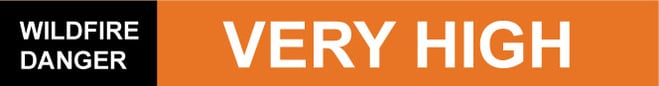
Wildfire danger
The wildfire danger in the Slave Lake Forest Area will continue to be VERY HIGH for tomorrow. Firefighters urge everyone to use caution when working or recreating outdoors, as under the hot and dry conditions, a fire will ignite easily and spread quickly.
On Alert
Report wildfires immediately by calling 310-FIRE (3473). Fire lookouts are watching for smoke and firefighters with helicopters, airtankers and heavy equipment are ready to respond to any new wildfires that start.

Weather
For Friday, the high will be 23-24 degrees and winds will be from west/northwest 15-20 kilometres per hour gusting up to 40. Thunderstorms may be expected in the northern portion of the forest area. Crossover conditions are expected as well. Crossover is the point at which the relative humidity is less than or equal to the temperature and this is an indicator of extreme burning.
Smoky conditions
Due to wildfire activity in northern Alberta, British Columbia and the Northwest Territories smoky conditions may persist in the Slave Lake Forest Area. Visit www.firesmoke.ca to see where the smoke is coming from. Anyone with health concerns should visit Alberta Health Services or call 811 for health advice from Alberta Health Link.
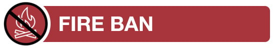
A fire ban is in effect for the entire Forest Protection Area of Alberta, including the Slave Lake Forest Area, due to hot and dry conditions.
Under this fire ban:
All fire permits are suspended or cancelled and no new fire permits will be issued. Some allowances can be made for essential agricultural and industrial burning, if approved by a forest officer.Prohibited:
-
All outdoor wood fires, including wood campfires on public land, private land, designated campgrounds, and backyard firepits
-
Barbeque charcoal briquettes
-
Fireworks and exploding targets
Allowed:
-
Propane/ natural gas-powered appliances
-
Indoor wood fires inside a structure (such as a facility, building, tent or RV) and contained within a device with a chimney and spark arrestor
-
Open flame oil devices (such as deep fryers and tiki torches). All devices must be CSA approved and used per manufacturer’s standards.
The fire ban will remain in effect until conditions improve. Firefighters appreciate your cooperation.
For more information view the Fire ban factsheet
The town of High Prairie, town of Slave Lake, and the Big Lakes County Fire Permit Area have also issued a fire ban. For specific fire ban information visit www.albertafirebans.ca
Current wildfire situation
Firefighters in helicopters and airtankers fought multiple holdover lightning wildfires in the northern portion of the Slave Lake Forest Area today. Of the 16 new wildfires, eight are classified as burning out of control, four are being held, one is under control and three have been extinguished.
SWF103 located approximately 36 kilometres southwest of Trout Lake is classified as burning out of control and is estimated to be 15 hectares in size.
SWF101 is located approximately 47 kilometres northwest of Red Earth Creek. It is estimated to be 50 hectares in size and is classified as burning out of control.

Photo: July 11, 2024 8:06 pm Airtankers made good progress on slowing the spread of the wildfire located northeast of Trout Lake.
SWF099 located approximately 2.4 kilometres northeast of Trout Lake is estimated to be eight hectares in size and is classified as burning out of control. Airtankers made good progress on slowing the wildfire spread and currently there are 16 firefighters with a helicopter working on the wildfire. At this time, the wildfire does not pose a risk to the community.
SWF096 and SWF098 are located approximately 33 kilometres north of Red Earth Creek. These wildfires are classified as burning out of control and are estimated to be 20 and 40 hectares in size. Airtankers continue to fight these wildfires and have reported that the spread has been reduced. Two groups of heavy equipment are currently building fire guard around these wildfires.
SWF095 is located approximately 70 kilometres north of Peerless Lake. It is estimated to be 200 hectares in size and is classified as burning out of control.
SWF092 and SW093 are located approximately 85 kilometres north of Red Earth Creek. The wildfires were last estimated to be two and three hectares in size and are classified as burning out of control. Firefighters with a helicopter are working on the wildfires.
SWF085 was detected on July 10th and is located approximately 9.4 kilometres southwest of Faust. SWF085 is classified as burning out of control and is five hectares in size. The wildfire did experience some increased activity due to the warm and windy conditions today. Firefighters utilized airtankers and two groups of heavy equipment are enroute to build fire guard.
Since January 1, 2024, 105 wildfires have been reported in the Slave Lake Forest Area, resulting in a total burned area of 716.67 hectares.
Since January 1, 2024, 726 wildfires have been reported in the Forest Protection Area of Alberta, resulting in a total burned area of 200,597.93 hectares.
To view wildfires on a map, download the AB Wildfire App or visit the Alberta Wildfire Status Dashboard
The Forest Protection Area is divided into 10 forest areas. Find the latest updates for each area here or subscribe to receive them in your inbox.

Prevent wildfires
67% of wildfires in Alberta are caused by people. Whether you are recreating or working outdoors, please do your part to prevent wildfires.
When riding your off-highway vehicle, stop frequently to remove any build-up of debris from your machine. Grass, muskeg, moss or other debris can begin to smoulder and drop to the ground as you're riding and spark a wildfire. Always carry firefighting equipment such as a shovel, extinguisher and bucket when you ride.
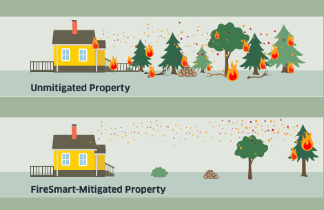
FireSmart Alberta
![]()
![]()
![]()
If you have any questions, please contact:
Wildfire Information Officer
Leah Lovequist
Mobile:780-849-0945
Leah.Lovequist@gov.ab.ca
RELATED INFORMATION
Forest Area Updates:
Websites: