

The wildfire danger is HIGH for the Grande Prairie Forest Area.
Lower temperatures and moderate relative humidity are expected for the next burning period. Winds are anticipated to be strong and gusty. Chance of light, scattered precipitation is expected with lightning holdovers possible in the coming days.
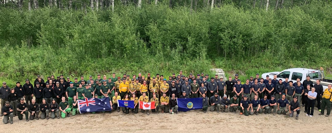
(Incident Management Team - Boone Lake Complex June 29, 2023)
Wildfire Situation
Since January 1, there have been 45 wildfires in the Grande Prairie Forest Area (GPFA) burning nearly 141,231 hectares.
There are 10 wildfires in the Grande Prairie Forest Area. Of these fires, one is classified as out of control (OC), six are under control (UC) and three are being held (BH). To see a map of the wildfires across the province please click here.
A fire restriction remains in effect for northern parts within the Grande Prairie Forest Protection Area.
Find wildfire forecasts, weather maps and information about how fire danger is monitored in Alberta alberta.ca/fire-weather-and-forecasts.aspx
GWF035 & GWF038 - Boone Lake Complex GCX002
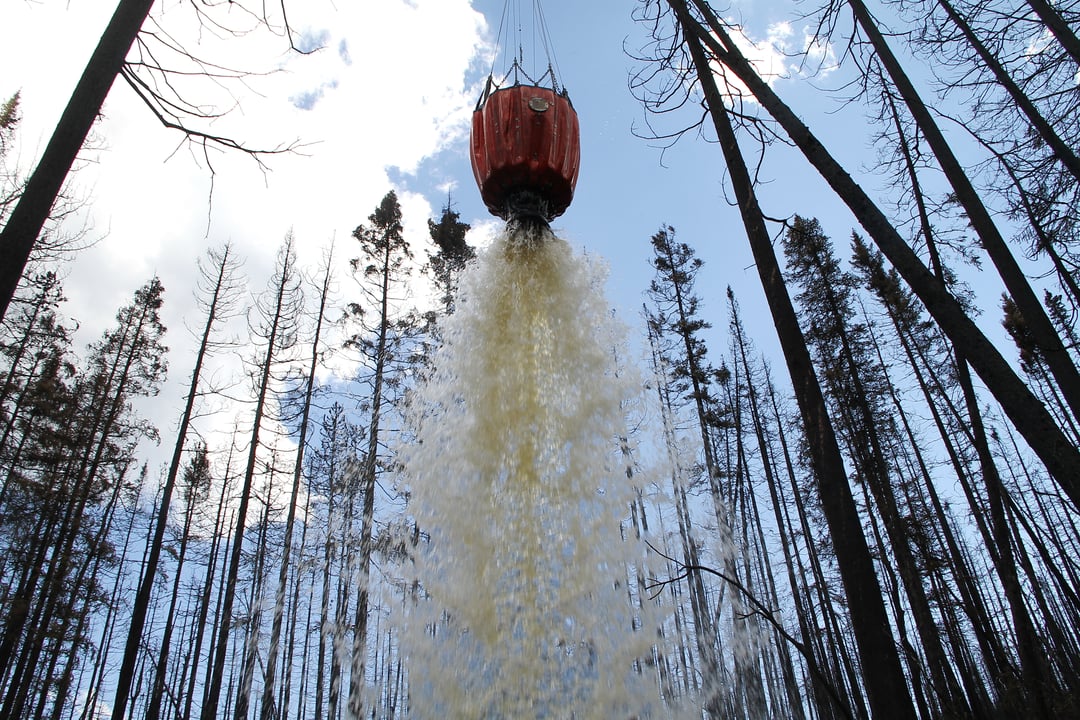
The Boone Lake Complex is made up of two fires and the total area involved is 8,985 hectares. The complex received very scattered rain in the past 24 hours and has seen moderate fire behavior.
Firefighters continue to complete dozer guard and contain the line inside the perimeter 100 feet in priority areas. Firefighters are monitoring for spot fires outside the perimeter.
Currently, 141 firefighters, 10 helicopters with buckets and 15 pieces of heavy equipment are working to contain these wildfires.
GWF035 is located 20 kilometers north of Valhalla Center near the northeast side of Boone Lake. This wildfire is now considered to be 100 percent contained with a guard and is estimated to be 872 hectares in size. This wildfire started June 4, 2023, and is classified as Being Held (BH). The south perimeter is held adjacent to Boone Lake and is being supported with a long-term retardant, helicopter bucketing and heavy equipment and ground resources.
GWF039 this lightning caused wildfire is classified as Under Control (UC) and is estimated to be 94 hectares in size. At this stage, suppression efforts have ensured the wildfire will not spread any further. Firefighters will continue to patrol and monitor the fire and extinguish hotspots when reported. GWF039 is located approximately 60 kilometers southwest of Grovedale.
GWF041 is now classified as being Under Control (UC). This wildfire is estimated to be 6.5 ha in size and located 7.5 kilometers northwest of Moonshine Lake Provincial Park. Firefighters will continue to patrol and monitor this fire and extinguish hotspots when reported.
GWF027 & GWF040 - Eagle Complex WCX001
GWF040 is listed as under control (UC) at 1.3 hectares.
GWF 027 is classified as being held (BH). It is estimated to be 55,000 hectares in size and is now part of the Eagle Complex, which is being managed by the Whitecourt Forest Area. For the most recent updates visit the Whitecourt Forest Area Update.
GWF017 & GWF023, GWF019 - Sturgeon Lake Complex GCX001
The Sturgeon Lake Complex is made up of three fires and the total area involved is 28,802 hectares.
The interior of active wildfires can flare up as previously unburnt vegetation catches fire. This is a normal occurrence. Firefighters are monitoring these active fires and are working to put out hot spots. There is no need to report flame or smoke in these areas.
As of June 1, 2023 the status of the wildfires within the Sturgeon Lake Complex has been updated to under control. Firefighters remain on alert for new wildfires and continue to monitor those under control.
GWF017 is estimated to be 5,752 hectares in size and classified as under control (UC).
GWF023 is estimated to be 3,889 hectares in size and classified as under control (UC).
GWF019 - Bald Mountain Fire is 19,435 hectares in size and classified as under control (UC). This fire is approximately 17 kilometers west of Highway 40. This wildfire has been determined to be caused by lightning.

A FIRE RESTRICTION remains in effect for the northern part of the Grande Prairie Forest Area, within the Forest Protection Area (FPA) of Alberta. Cities, towns, villages and summer villages as well as National Parks are exempt from this restriction.
Please visit albertafirebans.ca to view a map of the impacted area. This fire restriction will remain in effect until conditions improve across the province.
Prohibited:
- All outdoor wood fires in backcountry and random camping areas on public land
- Charcoal briquettes in backcountry and random camping areas on public land
- The use of fireworks and exploding targets
- Wood campfires on private land and in designated campgrounds
- Charcoal briquettes on private land and in designated campgrounds
- Propane/natural gas-powered appliances
- Open flame oil devices (e.g., turkey deep fryers, tiki torches)
- Indoor wood fires contained within a device with a chimney and spark arrestor
- All appliances must be CSA approved and used per manufacturer’s standards
.png?width=659&height=371&name=wildfire%20app%20(2).png)


