The wildfire danger for the Grande Prairie Forest Area is VERY HIGH
A weather system is pushing through Alberta bringing rain and thunderstorms. While any and all precipitation is welcome news, the quantity received on the provinces numerous wildfires will vary. Many areas have not received significant rain, causing the fire danger to remain VERY HIGH in the Grande Prairie Forest Area.
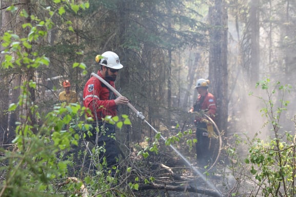
Sturgeon Lake Complex GCX001
Wildfire Situation | May 22, 2023
Since January 1, 2023, there have been 32 wildfires in the Grande Prairie Forest Area. At this time, nearly 24 317 hectares (ha) have burned. Of these fires, three are listed as out of control (OC), six are under control (UC), one is being held (BH), three have been turned over to the responsible party for extinguishment and 19 of these fires have been extinguished.
To see all wildfires on a map please click here.
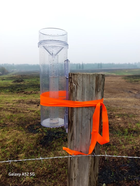
Sturgeon Lake Complex GCX001
Varying quantities have been recorded on different areas of the fire. The Fire Behaviour Analyst will continue to monitor the situation closely in the coming daysé
GWF031
GWF031 was reported last night. It is estimated to be 0.31 hectares in size and has been turned over to the responsible party. The fire was ignited by lightning that touched a wind row (a brush pile) during the passage of a thunderstorm. The fire is located northwest of New Fish Creek. The Valleyview Fire Department responded, along with the local landowner and a four-person crew of wildland firefighters. Crews worked on the fire through the night. An order to reduce and remove the fuels was issued to the landowner, who will now continue with suppression efforts.
GWF019 - Bald Mountain Fire
This fire is classified as out of control (OC) and was estimated to be 14,540 hectares in size. The fire is approximately 17 kilometres west of Highway 40. The fire has crossed the Bald Mountain Road to the east and is in proximity to the intersection of Odum Ridge Road and Bald Mountain Road to the south.
Forty-six firefighters along with five helicopters and 12 pieces of heavy equipment are assigned to the fire today. Visibility will determine if aircraft can be used today. When it will be possible to do so, a new assessment of the hectares affected will be conducted. Fire behaviour has been subdued over the past days and there has been minimal growth.
Crews continue to work on surrounding the two new excursions across Bald Mountain Road as well as the growth to the south where Weyerhauser Road meets the end of Bald Mountain Road with dozer guard. Firefighters are actioning these areas with water and hand tools. Crews are also working on the northwest flank, actioning hot spots along the fire line.
GWF018
This fire is currently classified as out of control (OC). For more information about this fire plase visit the Peace River Forest Area Update. For evacuation information, visit https://clearhillscounty.ab.ca/
GWF027- Eagle Complex WCX001
This fire is classified as out of control (OC) and is now part of the Eagle Complex which is being managed by the Whitecourt Forest Area. For the most recent updates visit the Whitecourt Forest Area Update
GWF017 & GWF023 - Sturgeon Lake Complex GCX001
The Sturgeon Lake Complex comprises two fires. GWF017 is estimated to be 5752 hectares in size and is out of control, while GWF023 is estimated to be 3869 hectares in size and is out of control. Today there are 133 firefighting personnel and 103 management and support staff on site. Eight helicopters and 27 pieces of heavy machinery are allotted to the two fires.
The change in types and numbers of resources in coming days will reflect the equipment needs of the crews in order to complete their objectives. Precipitation and higher relative humidity impacts how crews fight fire. In the coming days, less helibucketing will be required, whereas more direct ground attack will be employed. This means that firefighters will use hand tools to find hot spots, turn over the ground, and use hose to water them. Turning over hot spots in rainy weather also lets mother nature do her part. Firefighters will also be working with heavy machinery to remove dangerous trees in their path. Visibility will determine if aircraft can be used today. If flying is possible, the helicopters will be used to assess the fire from the air, better direct crews, create better mapping, and offer bucketing support should flare-ups occur. This work will be done along the fire line up to 100 feet inside the perimeter as well as around all structures at risk.
A second thermal scan was conducted last night, and several hundred more hot spots were identified. This information helps crews better focus their efforts. The majority of GWF017 was scanned in the last 48 hours. Rain gauges have recorded varying amounts of precipitation on different parts of the fire. Fire behaviour is predicted to be subdued today.
For Greenview Emergency Operations Centre check here
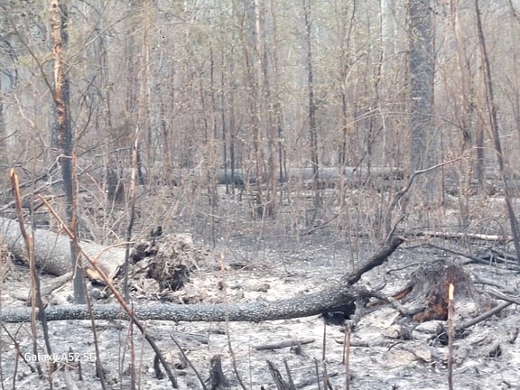
An important concern for firefighters today was the presence of dangerous trees in and around the fires. Many trees have little to no root systems left. When this happens, trees can fall with a slight gust of wind.
Volunteers, equipment owners/operators or firefighters looking to assist with these wildfires or any of the wildfires within the province, please contact EmergencySupportOffers@gov.ab.ca.
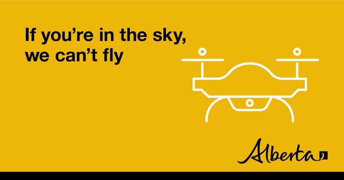
The use of recreational drones over wildfires in Alberta is dangerous, illegal and could result in a fine of up to $15,000* for putting aircraft and people at risk. Please give Alberta firefighters the space they need to do their jobs safely. *Transport Canada

Fire ban and OHV restriction in effect
A fire ban and OHV restriction is in effect within the Forest Protection Area due to extreme fire danger.
Under this fire ban:
- All existing Fire Permits are suspended (or cancelled)
- No new Fire Permits will be issued
- All outdoor wood fires are banned, including wood campfires on public lands, wood campfires on private land and provincial campgrounds.
- Backyard firepits
- BBQ charcoal briquettes
- The use of fireworks and exploding targets
- The recreational use of off-highway vehicles (OHV) on public lands, including designated OHV trails
Allowed:
- Propane/natural gas-powered appliances.
- Open flame oil devices (e.g., turkey deep fryers, tiki torches)
- Indoor wood fires contained within a device with a chimney and spark arrestor
- All appliances must be CSA approved and used per manufacturer’s standards

Due to extreme fire danger conditions, the province has enacted an Off-Highway Vehicle Restriction that prohibits the recreational use of off-highway vehicles (OHV)s on public lands, including designated OHV trails, until the wildfire danger lessens. This OHV restriction applies to the entire Forest Protection Area of Alberta.
Indigenous people when using an OHV for traditional purposes. Traditional purposes are hunting, fishing, and trapping – including the use of an OHV to travel to the location(s) for these purposes.
Essential industry-related activities requiring the use of OHVs - permission from a forest officer is required in the Grande Prairie Forest Area.
Off-highway vehicle use is still permitted on private lands.
If you see a wildfire, report it immediately by calling 310-FIRE.
The fire ban will remain in effect until conditions improve.
Melanie Morin, Information officer, on behalf of Kelly Burke
(819) 441-7006
Phone: 1-866-394-3473
- Alberta Wildfire
- Alberta Fire Bans
- FireSmart in Alberta
- Alberta Emergency Alerts
- Air Quality Health Index
- Wildfire Smoke and Your Health
- 511 Road Reports
- Emergency Preparation
Please subscribe to the Grande Prairie Forest Area wildfire update to receive an email when new information is posted.


