WHITECOURT FOREST AREA FIRE DANGER RATING

Stay away from active wildfire areas | For your safety and to ensure firefighters can do their job safely, please stay away from active wildfire areas. Your cooperation is essential.
Danger trees | Be extra cautious near burnt areas and avoid forested areas that have been recently affected by wildfires. Hazards remain from falling trees or branches, especially if conditions are windy, or if there are deep ash pits and burning peat.
Reporting wildfires | Firefighters continue to work on out of control wildfires and fire lookouts are watching for smoke. While we always appreciate people calling in to report wildfires, the large volume of calls we are currently receiving is diverting our resources away from fighting wildfires. As always, please still call 310-FIRE if you see smoke or flame that looks new and potentially unreported, but assume that large columns of smoke and burned over areas have already been detected and reported.
The interior of active wildfires can flare up as previously unburnt vegetation catches fire. This is a normal occurrence. Firefighters are monitoring these active fires and working to put out hot spots. There is no need to report flame or smoke in these areas.
Smoke | Lingering smoke may still be visible in some areas and in affected communities. Smoke inversions can trap air near the ground causing dangerous driving conditions and poor air quality. Please use extra caution when driving in smoky conditions, and take necessary precautions if you have smoke-related health concerns.
Drones | The use of recreational drones over wildfires in Alberta is dangerous, illegal and could result in a fine of up to $15,000* for putting aircraft and people at risk. Please give Alberta firefighters the space they need to do their jobs safely. *Transport Canada
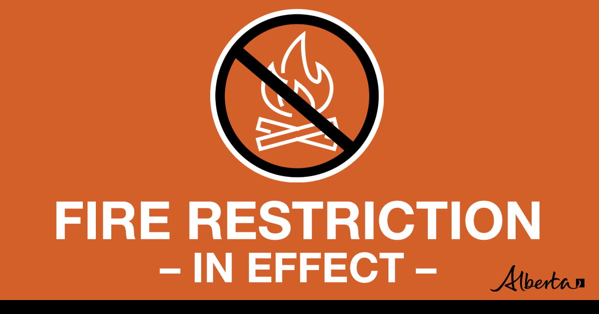
FIRE RESTRICTION
A FIRE RESTRICTION is in effect across the Whitecourt Forest Area.

Under this FIRE RESTRICTION:
Prohibited:
- All outdoor wood fires in backcountry and random camping areas on public land
- Charcoal briquettes in backcountry and random camping areas on public land
- The use of fireworks and exploding targets
Allowed:
- Wood campfires on private land and in designated campgrounds
- Charcoal briquettes on private land and in designated campgrounds
- Propane/natural gas-powered appliances
- Open flame oil devices (e.g., turkey deep fryers, tiki torches)
- Indoor wood fires contained within a device with a chimney and spark arrestor
- All appliances must be CSA approved and used per manufacturer’s standards
This fact sheet has further information on the fire restriction.
Please visit albertafirebans.ca to view a map of the impacted areas. This fire restriction will remain in effect until conditions improve across the province.
.png?width=659&height=345&name=WF_Social-images%20(9).png)
Warm weather and winds can quickly dry the fine fuels raising the danger levels. If you see smoke or flame in the forest, call 310-FIRE(2473).
WHITECOURT FOREST AREA UPDATE
Since January 1, 2023, there have been 43 wildfires in the Whitecourt Forest Area. A total of 66,571 ha has been burned by these wildfires.
Visit our website and click on the interactive map to view active wildfires and their stats on the wildfire dashboard.
ACTIVE WILDFIRES
Eagle Complex WCX-001 (WWF023, GWF027, GWF040)
This complex is approximately 121,769.3 ha. More than 195 firefighters and support personnel are allocated to this fire. Partners assisting Alberta on the complex include firefighters and an incident management team from Australia, two crews from B.C., and Idaho.
Ongoing crew activities include extending and strengthening fire containment guards for both GWF-027 and WWF-023. This is being completed by both ground crews and heavy machinery teams. Crews are also continuing to work along priority spots on the fire line for both fires (GWF-027 and WWF-023) extinguishing active fire and patrolling for hot spots. A crew will work on extinguishing GWF040. Air operations with buckets continue to support grounds crews, dependent on resource availability.
Overnight temperature low is forecast to be 7C with relative humidity peaking at 74 per cent. Daytime highs of 16C with relative humidity of 30 per cent. Winds are forecast to be westerly at 10 to 12 kilometers per hour, until turning north easterly at 10 kilometers per hour later this evening, and gusting to 40 kilometers per hour into the middle of the afternoon. A possibility of rain for Sunday and into next week.
WWF-023 detected on May 5, is listed as out of control at 66,443.00 ha. This wildfire was caused by lightning.
Crews continue to focus on identified hot spots along the fire perimeter, including from Iosegun Lake and back along Fishpond Rd to the highway. Heavy equipment will continue assisting with cutting more guard in the active areas of fire activity. Helicopters bucketed water on hotspots south of Raspberry Lake.
GWF-027 was detected on May 13 and is out of control at 55,197 ha. Cause for this wildfire is under investigation.
Dozer guards continue to be expanded and strengthened for reinforcement. Unit crews from both B.C. Sierras and Sarver contractors continue to work priority areas, including areas of activity in the south. This fire has been most active in the southwest. Increased visibility allowed for more targeted use of helicopters.
GWF-040 was on June 7 and is listed as under control at 1.3 ha.
Containment guard has been established by heavy equipment with support from a ground crew. Crews will be focusing on extinguishment of the wildfire.
WWF015 detected on April 29 is still Under Control at 47 ha. Crews are actively monitoring.
All wildfires in Alberta are investigated and these wildfires remain under investigation. To learn more about wildfire classifications, click here.
*Extinguished fires are not reported on this page. Refer to the Alberta Status Dashboard for information about these fires.
AREA ADJACENT WILDFIRES
Deep Creek Complex (EWF035, WCU001, WCU002)
EWF035, WCU001 & WCU002 are part of the Deep Creek Complex. For wildfire updates on this group of wildfires, please visit alberta.ca/edson-area-update.
Wildhay Complex (EWF037, EWF040)
For wildfire updates on this group of wildfires, please visit alberta.ca/edson-area-update, scrolling down to view information.
Grizzly Complex (SWF057, SWF063, SWF064)
For wildfire updates on this group of wildfires, please visit alberta.ca/slave-lake-area-update.
Volunteer Information
Volunteers, equipment owners/operators or firefighters looking to assist with these wildfires or any of the wildfires within the province, please contact EmergencySupportOffers@gov.ab.ca.
Albertans are always asked to use caution when working or recreating in the outdoors:
- Before you burn it, get your fire permit. Fire permits in Alberta.
- Clear debris from hot spots on your off-highway vehicle.
- Ensure your campfire is out - soak it, stir it, soak it again.
- Before heading out, please check albertafirebans.ca to determine whether there are any fire advisories, fire restrictions or fire bans in effect for your destination.
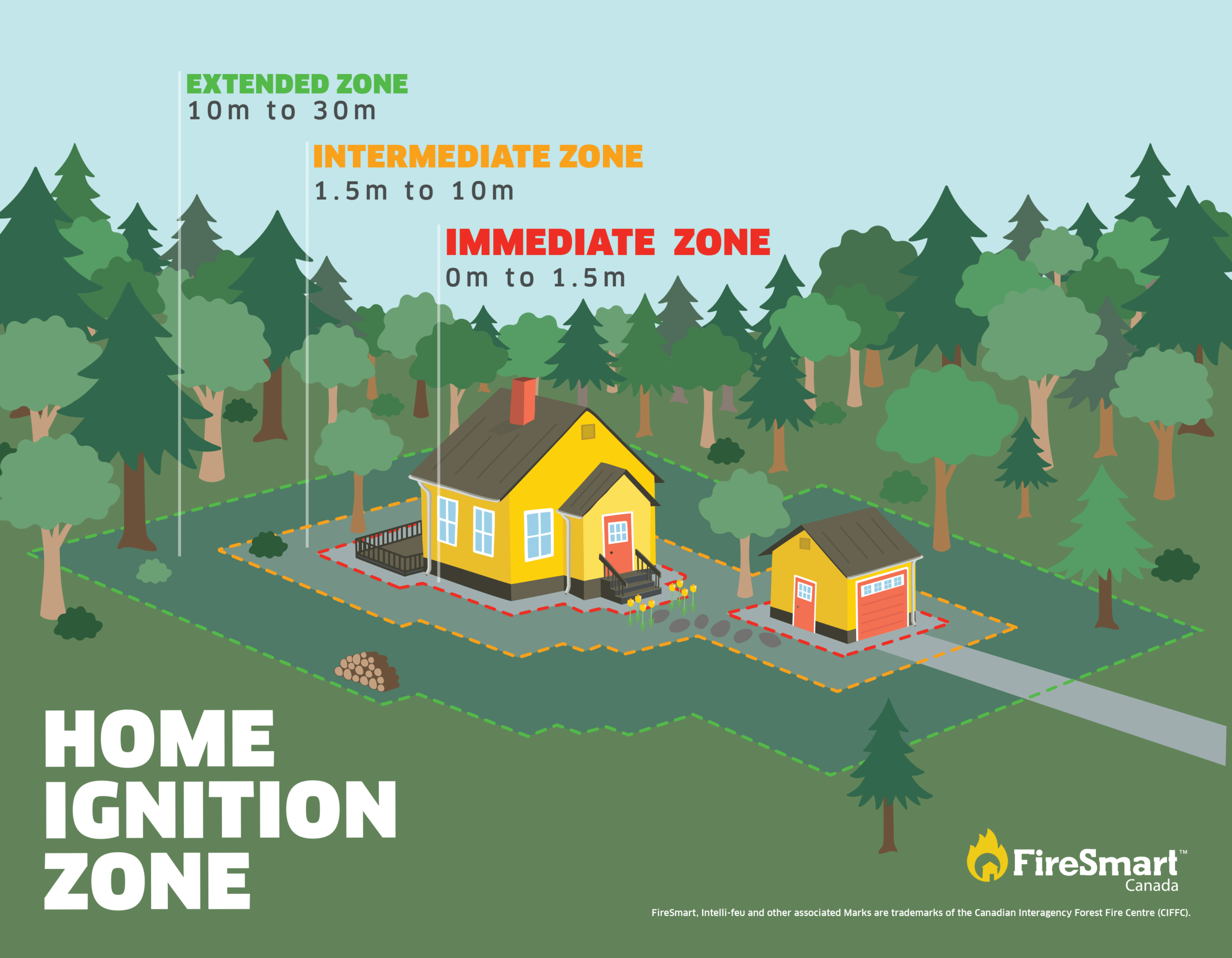
FIRESMART BEGINS AT HOME
Protecting your home starts with simple actions.
There are many factors that may impact your property's risk to wildfire. FireSmart Canada has great videos you can view on various topics and improve your fire preparedness. You can check out these videos by clicking here and viewing their videos on YouTube.

- For road closure information, please visit 511.alberta.ca
- The NASA FIRMS Fire Information website is a great resource to give an idea of the location of wildfires in the area, but it should be noted that this data is based on interpolation and often can make a wildfire appear larger than it actually is. Wildfire smoke is a tool used for the location of smoke firesmoke.ca
- Anyone with health concerns should visit Alberta Health Services or call 811 for health advice from Alberta Health Link.
- Please visit Alberta Emergency Alerts for your community webpage for more information.
Download the Alberta Wildfire app today and get access to accurate, real-time information on wildfires in your area. You can also find information on fire advisories, restrictions and bans across the province and much more all on your mobile device.
Available for Apple and Android.
Find wildfire forecasts, weather maps and information about how fire danger is monitored in Alberta please visit: alberta.ca/fire-weather-and-forecasts.aspx

780-778-7166 if this line is unavailable, please call 780-778-7153
General Information Related to Alberta Wildfire or Fire Bans, Restrictions, or Advisories
1-866-FYI-FIRE
General/Other Forestry Related Questions
780-778-7153
Websites for Further Information:
- Alberta Wildfire
- Alberta Fire Bans
- FireSmart in Alberta
- Alberta Emergency Alerts
- Air Quality Health Index
- Wildfire Smoke and Your Health
- 511 Road Reports
- Emergency Preparation
Social Media:

