

For today, the temperature is expected to be 19-20 degrees with relative humidity of 30 percent. The winds will be from the north/northwest at 15 kilometres per hour. There is a chance of isolated showers with lightning today.
Smoky conditions will persist in the Slave Lake Forest Area. Anyone with health concerns should visit Alberta Health Services or call 811 for health advice from Alberta Health Link. Visit www.firesmoke.ca to see where the smoke is coming from.

FIRE RESTRICTION IN EFFECT
A fire restriction is in effect within the Forest Protection Area of the Slave Lake Forest Area.
Under the fire restriction safe wood campfires are allowed in campgrounds and in backyards.

The use of recreational drones over wildfires in Alberta is dangerous, illegal and could result in a fine of up to $15,000* for putting aircraft and people at risk. Please give Alberta firefighters the space they need to do their jobs safely.
*according to Transport Canada
Attention Aircraft Pilots
Aircraft Pilots are reminded to check NOTAMs before flying into areas with active wildfires. Flying into a NOTAM area without prior authorization will cause disruption to aerial firefighting.
Wildfire Situation
There were no new wildfires yesterday.
Since January 1, 2023, in the Slave Lake Forest Area, there have been 102 wildfires which have burned 408,705.58 hectares.
Since January 1, 2023, in the Forest Protection Area of Alberta, there have been 656 wildfires which burned 1,439,634.54 hectares.
To view wildfires on a map, download the AB Wildfire App or visit the Alberta Wildfire Status Dashboard
NOTE: The wildfire perimeter is an estimate based on measurements such as GPS, aerial scanning and satellite imagery. This estimated perimeter can change as more accurate measurements become available. Areas within the fire perimeter may not have been affected by wildfire.
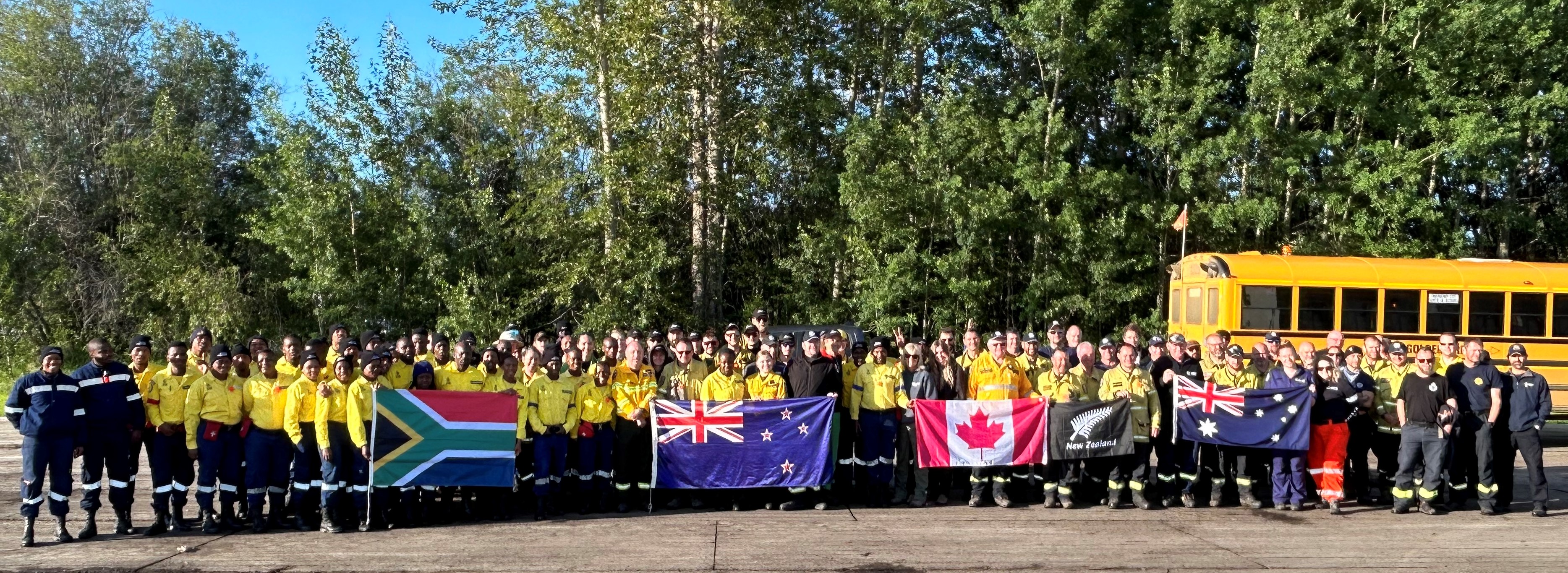
Photo: June 21, 2023 Firefighters from South Africa, New Zealand, Canada & Australia working on the Grizzly/Saulteaux Complex.
Grizzly/Saulteaux Complex
There are a total of 172 firefighters, 70 heavy equipment operators, 44 support staff, 21 aircraft and 75 pieces of heavy equipment working on the Grizzly/Saulteaux Complex wildfires.
If you have any questions about the wildfires in the Grizzly/Saulteaux Complex please contact Bianca Callinan by email wf.scx0012023-IOF.i@gov.ab.ca
Grizzly Complex (SWF057, SWF063, SWF064 and SWF095)
SWF-057 is located approximately 26 kilometers south of Kinuso and over 30 kilometers southwest of the Town of Slave Lake. The wildfire is classified as being held and has burned an estimated 16,728 hectares. On June 18th, an infrared scan to identify ground fires was conducted on SWF057. The locations of the ground fires were then passed onto firefighters who are working to extinguish them.
SWF-063 is located approximately seven kilometers south of High Prairie and sixteen kilometers northwest of Swan Hills. The wildfire is classified as burning out of control and has burned an estimated 123,670 hectares. On June 20th, an infrared scan to identify ground fires was conducted on the northern end of SWF063. Firefighters were given the locations of the ground fires and are working to extinguish them. Heavy equipment continues to build fire guards on the north flank around excursions.
SWF-064 is located over 40 kilometers northwest of Swan Hills. This wildfire is classified as burning out of control and is approximately 40,060 hectares. Firefighters are extinguishing ground fires on the southwest side of the wildfire.
SWF095 is located southeast of the hamlet of Sweathouse. This wildfire is classified as burning out of control and is approximately 8,500 hectares in size. Firefighters continue to focus firefighting efforts on the north and west side of the wildfire. Firefighters have established pump and hose set ups in these areas and are extinguishing ground fires. Heavy equipment continues to build fire guard on the east and west side of the wildfire.
With a reduction in fire activity and with firefighting efforts on SWF095, the Evacuation Order issued by the MD of Greenview continues to be a one hour Evacuation Advisory.
Map - Grizzly Complex
Saulteaux Complex – (SWF085, SWF086 and SWF087)
SWF085, SWF086 and SWF087 are located approximately five kilometres northwest of Smith and 30 kilometres east of the Town of Slave Lake. SWF085 is under control and SWF086 and SWF087 are being held. Being held means with the current weather conditions and resources, these wildfires are not anticipated to grow past expected boundaries. The sizes of these wildfires are as follows; SWF086 is 4,742 hectares, SWF085 is 39.4 hectares and SWF087 is 1,036 hectares. Firefighters continue to patrol for ground fires.
Map – Saulteaux Complex
SWF093 is located approximately 27 kilometres northeast of Little Buffalo. The wildfire is under control and has burned 23.9 hectares.
SWF068 is located approximately six kilometres northwest of Peavine Metis Settlement. Firefighting operations are being conducted by the Peace River Forest Area. For information on this wildfire visit the Peace River Wildfire Update. If you have any questions regarding SWF068 please contact Wildfire Information Officer Michelle Huley by calling 780-618-2081 or by email michelle.huley@gov.ab.ca
-jpeg.jpeg)
Photo: June 19th, 2023 Firefighters are transported by helicopter into SWF060 to extinguish ground fires.
SW060 is located 2.3 kilometres east of the border of the Whitefish Lake First Nation. This wildfire is being held and has burned approximately 43,981 hectares. Being held means with the current weather conditions and resources, the wildfire is not anticipated to grow past expected boundaries. Firefighters are patrolling and extinguishing ground fires. There are 30 firefighters and four helicopters working on this wildfire.

Learn about wildfires and what you can do to be prepared. Visit https://www.alberta.ca/wildfire-preparedness.aspx
Visit https://511.alberta.ca for the latest information on road closures.
Do your part and prevent wildfires
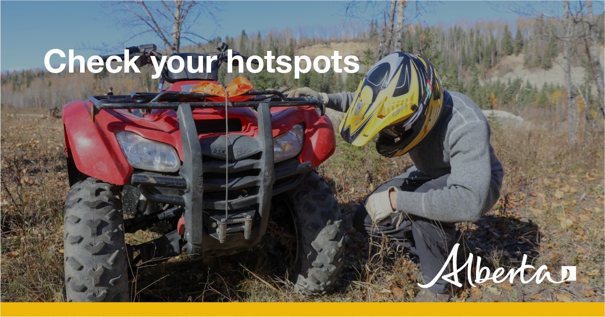
When riding your off-highway vehicle stop frequently to remove any build-up of debris from your machine. Grass, muskeg, moss or other debris can begin to smoulder and drop to the ground as you're riding and spark a wildfire. Always carry firefighting equipment - a shovel, extinguisher and bucket when you ride.
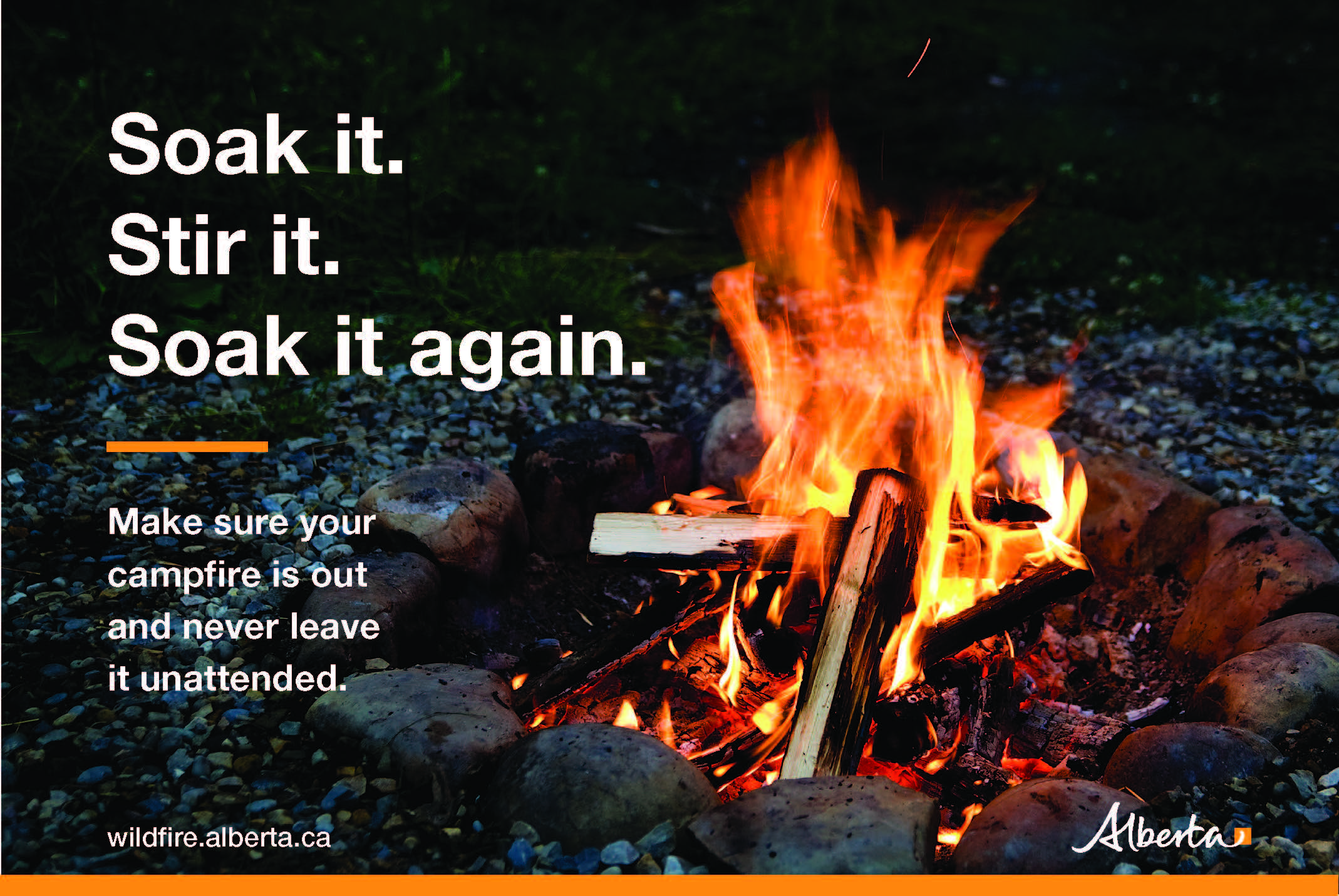
When having a campfire, keep it small, safe and always attended. When you are leaving your site or headed to bed, your campfire must be extinguished. Soak it, stir up the ashes, soak it again to ensure it is out.
.png?width=1200&name=wildfire%20app%20(2).png)
The wildfire dashboard provides up-to-date wildfire information at the click of a button. This interactive tool displays important statistics on the number of active wildfires in the province, sizes, locations, suspected causes and more. The dashboard builds on the former wildfire status map by displaying the most frequently accessed information in one convenient location.
Download the Alberta Wildfire app today and get access to accurate, real-time information on wildfires in your area. You can also find information on fire advisories, restrictions and bans across the province and much more all on your mobile device. Available for Apple and Android.
Subscribe to the Slave Lake Forest Area Wildfire Update to receive an email when new information is posted.
Join the conversation on Facebook, Twitter or Instagram. ![]()
![]()
![]()
If you have any questions please contact:
Leah Lovequist
Wildfire Information Officer
Mobile:780-849-0945
Email:Leah.Lovequist@gov.ab.ca
RELATED INFORMATION
Websites: