Always ensure you soak your campfire, stir it and soak it again until the ashes are cool to the touch. Never leave your campfire unattended.
The smoke settling over our forest area is not caused by local wildfires. To learn more about smoke and where it's coming from, visit FireSmoke.ca
If you see smoke or flame in the forest, call 310-FIRE.
Previous Edson Forest Area Updates - Click here
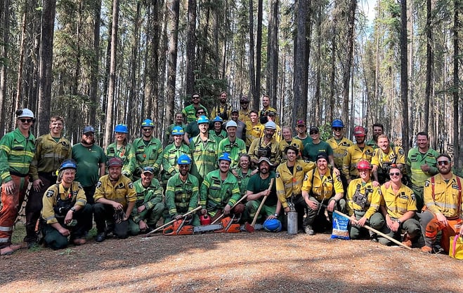 AB Wildfire and Australia firefighters took advantage of a slow week and helped get Wolf Lake Campground cleared of dead and dangerous trees last week. (July 8 2023).
EDSON FOREST AREA WILDFIRE UPDATE
The wildfire danger in the Edson Forest Area is LOW today. The cooler temperatures, higher relative humidity, partial cloud cover and no significant wind is helping keep wildfire activity down and is expected to continue in the coming days.
Since January 1, 2023, there have been 73 wildfires in the Edson Forest Area burning a total of 234,458 ha.
PROVINCIAL WILDFIRE UPDATE
Since January 1, 2023 in the Forest Protection Area, there have been 845 wildfires burning a total of 1,561,500 ha.
Last year, there were 577 wildfires by this date with a total of 113,389 ha burnt. The 5 year average is by this date is 698 wildfires with a total of 189,732 ha burnt.
Visit our website and click on the interactive map to view active wildfires and their stats on the wildfire dashboard.
**Bold indicates new or important information. This update is best viewed on a web browser or the AB Wildfire Status App.**
UNDERSTANDING WILDFIRE BEHAVIOUR
Alberta Wildfire shares important information with municipal fire departments and community leaders on a daily basis, we work together closely to ensure you are safe in your community. It can be difficult to explain the complexity of these wildfires to the public but we are committed to continue informing all communities about fire prevention, FireSmart and fire operations when there's a wildfire of significance in our area.
There are many factors that affect a wildfire and its growth, such as the wind, temperature and the forest fuel moisture conditions. You may have seen the Forestry fire danger signs that are posted around your communities, along highway 16 and the Edson Forestry warehouse. We set the fire danger based on a number of factors, including the Fire Weather Index (FWI). The FWI is derived from data collected daily at various weather and includes observations of temperature, relative humidity, wind speed, and 24-hour precipitation. The FWI is a system used across Canada to quantify the fire hazard based on forest fuel moisture, temperature, relative humidity and forecasted winds.
Wildfires generally smoulder on and in the ground with very little open flame on low to moderate fire activity days. Creeping surface fire with open flame and the occasional torching tree is typical fire behaviour on moderate days. The days where the fire "picked up" and "took off" were on days when the fire danger was very high to extreme.
Today, the fire danger is LOW in our forest area. This means that fire can ignite but would have difficulty spreading to deeper vegetation layers or larger fuels, such as trees. Creeping ground fires would not travel very fast as grass is now green and there's sufficient moisture in the fine fuels. You can view the provincial wildfire danger map and learn more about how to interpret fire danger by clicking here.
Follow the advice of your community leaders, be prepared and pay attention to the directions that are given. We do not anticipate wildfire growth until the fire danger reaches high or very high.
EDSON FOREST AREA | PEMBINA WILDFIRE COMPLEX | EWF031, EWF039
EWF031 was detected on May 4 and is classified as being held which means that under the current weather conditions and with the resources available, there will be no unexpected growth. However, firefighters anticipate the possibility of a small amount of spread which would be normal on a wildfire of this size. To learn more about wildfire classifications, click here. After an investigation was conducted, this wildfire was determined to be caused by lightning. To view actual locations of the wildfires, visit the wildfire dashboard.
There are now 59 firefighters, 11 support staff, 13 pieces of heavy equipment and four helicopters assigned to the Pembina Complex. Firefighters are actioning any hotspots that are identified through aerial heat scanning. Once they arrive in the area that was mapped, they set up a gird system and look, smell and feel around for any smoke or heat that could be in the ground. There aren't very many hotspots for a wildfire this size, however when conditions become hot, dry and windy, more hotspots could emerge.
Fickle Lake Area and Willmore Area | No active fire has been observed in the Willmore area. Some hotspots were being worked on by the firefighters. They will continue to monitor for any activity and will respond accordingly.
Carrot Creek Area | Crews have completed their objectives at both Wolf Lake and Minnow Lake. They've felled dangerous trees and cut them into firewood to help the re-opening of the recreational park. Firefighters continue to look for and extinguish hotspots found along the fires edge in this area. There are two dozers and two excavators assigned to EWF039, working towards reclamation of the containment lines.
East Side | The burn area is located approximately 18 km west of Cynthia. Little to no activity has been observed in this area. Firefighters continue to look for and extinguish hotspots when found along the fires edge in this area.
Firefighters have had a challenging season but we're glad to see them keep their spirits up. Local helitack 5 is letting off some steam and putting out hotspots on EWF031. *To view this video, open in the web browser or app (July 12, 2023).
ROCKY MOUNTAIN HOUSE FOREST AREA | PEMBINA WILDFIRE COMPLEX | RWF034, RWF040
For more information regarding the Rocky Mountain House Forest Area, visit their Wildfire Updates.
EDSON FOREST AREA | DEEP CREEK COMPLEX | WCU001, WCU002, EWF035
WCU001 was detected on April 29, and estimated to be 6,284 ha in size. WCU002 was detected on the evening of April 29 and estimated to be 2,478 ha in size. EWF035 was detected on May 5 and is 19,672 ha in size. All three of these wildfires are classified as UNDER CONTROL meaning that the wildfire is completely contained and not expected to grow. These wildfires are in the final stages before they're classified as extinguished. The cause remains under investigation. To view actual locations of the wildfires, visit the wildfire dashboard.
Many of the firefighters, heavy equipment and overhead members have demobilized from the complex this week. Our local firefighters such as our helitack, firetack and unit crew members remain in the area and will respond if conditions change.
We anticipate low fire behaviour for the coming days, meaning that there may be some fire activity but it would be mostly smouldering or creeping slowly. No fire activity has been observed. Residents may see some smoke coming from within the wildfire complex as conditions warm up and fuels dry up. This is expected and Alberta Wildfire firefighters will monitor and respond to any flare ups as needed.
Heavy equipment continue reclamation on these wildfires in areas where there is no longer a concern and the ground is dry enough, removing creek crossings, rolling back disturbed soil and spreading debris for a more natural setting. All disturbed containment lines will need to be reclaimed and this work is expected to continue into the fall and possibly into the winter months.
EDSON FOREST AREA | WILDHAY WILDFIRE COMPLEX | EWF037, EWF040
The Wildhay Complex is comprised of two wildfires, EWF037 and EWF040. They are both located south of the Little Smoky River, north of the Wild Hay River and east of Hwy 40 north. The complex is 63 km north of Hinton. Both of these wildfires were determined to be caused by lightning.
EWF040 is now classified as under control and is estimated to be 12,073 ha.
EWF037 continues to be classified as under control at 578 ha.
GENERAL INFORMATION ON WILDFIRES IN OUR AREA
WORK OR RECREATE NEAR WILDFIRE AREAS | We urge residents and members of the public to use extra caution near burnt areas. There are many hazards that may not be visible, like deep burning ash pits and falling trees. Burnt trees are a serious hazard, and trees that may look healthy with green needles or leaves could have burnt out roots under the ground and fall unexpectedly. Keep in mind that trees and powerlines could also fall on the road and block your vehicle. Do not approach powerlines as they could be energized.
DRONES | The use of recreational drones over wildfires in Alberta is dangerous, illegal and could result in a fine of up to $15,000* for putting aircraft and people at risk. Please give Alberta firefighters the space they need to do their jobs safely. *Transport Canada
TO SUBSCRIBE TO THE UPDATES | You can subscribe to these updates (or any other forest area's update) and they'll come directly to your email or as a notification on your phone. You can visit our website, enter your email address and click Instant then Subscribe. You can also download the AB Wildfire Status App, click the "i" at the bottom left, click the bell for notifications and toggle the Edson Forest Area Update.
UNDERSTANDING WILDFIRE CLASSIFICATIONS | When firefighters classify a wildfire as OUT OF CONTROL, it means that the wildfire is burning and is expected to continue to grow within and possibly outside of its present boundary. The classification of BEING HELD means that under the current weather conditions and the resources available, there will be no unexpected growth, however firefighters anticipate the possibility of a small amount of spread which would be normal on a wildfire of this size. To learn more about wildfire classifications, click here.
WILDFIRE PREPAREDNESS | Learn how you can prepare yourself for a wildfire by clicking here.
WILDFIRE INVESTIGATIONS | Wildfires in Alberta are either human-caused or caused by lightning. Every wildfire in Alberta is investigated.
WILDFIRE MAPS AND BOUNDARIES | Note that wildfire perimeter maps are an estimate based on measurements such as GPS, aerial scanning and satellite imagery. This estimated perimeter can change as more accurate measurements become available. Areas within the fire perimeter may not have been affected by wildfire. Visit our Wildfire Dashboard to view active wildfires and their stats on the wildfire dashboard. Click on "view interactive map". You can choose different basemaps by selecting the four squares icon, or layers by clicking on the three sheets of paper on the top right corner.
Albertans are always asked to use caution when working or recreating in the outdoors:
- Before you burn it, get your fire permit. Fire permits in Alberta.
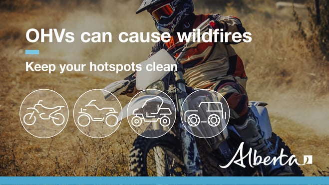
- Clear debris from hot spots on your off-highway vehicle.
- Ensure your campfire is out - soak it, stir it, soak it again.
- Before you head out this weekend, check out the albertafirebans.ca website or download the app to stay informed.
- For road closure information, please visit 511.alberta.ca
- For information regarding smoke in the area, you can visit firesmoke.ca
- NASA FIRMS Fire Information website is a great resource to give an idea of the location of wildfires in the area, but note that the data is based on interpolation and often can make the wildfire look larger then it actually is.
- To view the provincial wildfire danger map, click here.
ALBERTA WILDFIRE INFORMATION
- Subscribe to the Edson Forest Area wildfire update to receive an email when new information is posted.
- Download the Alberta Wildfire App for Apple and Android device.
- Join the conversation on Facebook, Twitter or Instagram.
For more information, please contact: