As warming and drying conditions continue this week, the public may notice smoke rising from active wildfire areas.
If you see smoke or flame that you suspect is not from an active wildfire area, contact 310-FIRE.
We urge residents and members of the public to use extra caution near burnt or flooded areas. There are many hazards that may not be visible, like deep burning ash pits, downed powerlines, falling trees and unstable river banks.
Previous Edson Forest Area Updates - Click here.
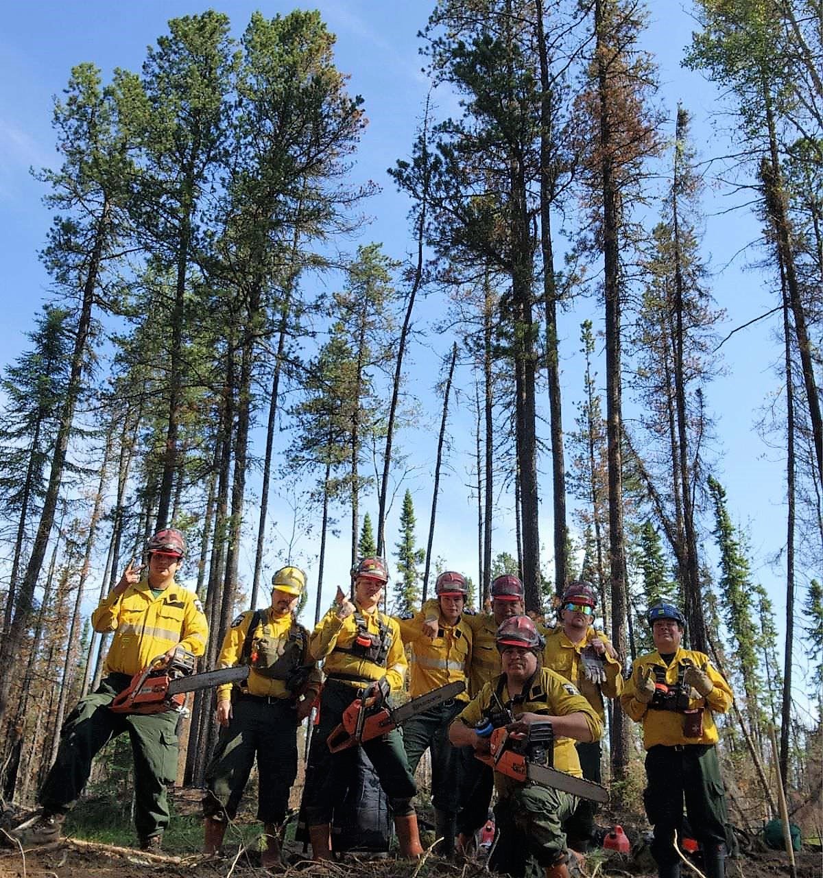 Alberta Wildfire firetack crews have been busy searching for and extinguishing hotspots. (June 24, 2023).
NEW WILDFIRE STARTS
Visit our wildfire dashboard to view active wildfires and their stats.
UNDERSTANDING WILDFIRE BEHAVIOUR
AB Wildfire shares important information with municipal fire departments and community leaders on a daily basis, we work together closely to ensure you are safe in your community. It can be difficult to explain the complexity of these wildfires to the public but we are committed to continue to informing all communities about fire prevention, FireSmart and fire operations when there's a wildfire of significance in our area.
There are many factors that affect a wildfire and its growth, such as the wind, temperature and the forest fuel moisture conditions. You may have seen the Forestry fire danger signs that are posted around your communities, along highway 16 and the Edson Forestry warehouse. We set the fire danger based on a number of factors, including the Fire Weather Index (FWI). The FWI is derived from data collected daily at various weather and includes observations of temperature, relative humidity, wind speed, and 24-hour precipitation. The FWI is a system used across Canada to quantify the fire hazard based on Forest Fuel moisture, temperature, relative humidity and forecasted winds.
Wildfires generally smoulder on and in the ground with very little open flame on low to moderate fire activity days. Creeping surface fire with open flame and the occasional torching tree is typical fire behaviour on moderate days. The days where the fire "picked up" and "took off" were on days when the fire danger was very high to extreme. Today, the fire danger is low in our forest area and is anticipated to stay low for the next 72 hours. That means that the fire will mostly smoulder in the ground and will have a hard time burning the available fuel on the forest floor. You may still see smoke and even steam from hotspots in the ground. You can view the provincial wildfire danger map and learn more about how to interpret fire danger by clicking here.
In the coming weeks, the fire danger will climb again and the wildfires in our area will become more active. Follow the advice of your community leaders, be prepared and pay attention to the directions that are given. We do not anticipate wildfire growth until the fire danger reaches high or very high.
EDSON FOREST AREA | PEMBINA WILDFIRE COMPLEX | EWF031, EWF039
**Bold indicates new or important information.
EWF031 was detected on May 4 and is located 18 km west of Lodgepole, 5 km northwest of Brazeau Dam and 1.5 km south of Edson. The fire is now classified as BEING HELD and is estimated to be 201, 885 ha in size (note that the wildfire size will change at times due to it being refined and remapped. It does not always mean that there was new growth). To view the wildfire boundary, visit the wildfire dashboard.
There are 244 firefighters and 38 support staff being shared between the Pembina Complex of fires. There are 27 pieces of heavy equipment, and 15 helicopters assigned to the complex. In addition, structure protection personnel from the Town of Edson and Yellowhead County have integrated with the complex as a structure protection branch to allow for seamless coordination between Alberta Wildfire and Yellowhead County.
Personnel from Australia, New Zealand, South Africa, United States, Alberta, and the Yukon are working together on this fire. An Incident Management Team from Australia is managing the Pembina Complex.
Goals at the Pembina Complex remain first responder and public safety. We are using the downturn in weather to make strong progress on goals and plan for future initial attack.
Fire Behaviour | Daytime pop-up showers and thunderstorms are expected each day this week, mainly from late morning until early/mid-evening. Northwest winds gusting to 30 km/h will diminish to light this evening. Light north-northwest winds Monday afternoon and Tuesday veer to the east south-east for Wednesday and Thursday. Todays fire danger is moderate. Under these conditions, we expect mostly smouldering ground fire and some low surface fire as the fuels become dryer.
Crews and personnel will access fireline today where conditions permit. Access and egress routes will be assessed to ensure conditions are safe before crews utilize these routes.
Fickle Lake Finger | The burn area is located approximately 2.5 km east of Fickle Lake and approximately 5 km south of Marlboro. Personnel are continuing to consolidate lines in this section of the fire. This work involves crews constructing containment line using hand tools and heavy machinery.
Willmore Park Finger | The burn area is located approximately 1.5 km south of Edson.
Containment line has been established ahead of the most northern edge of this finger to limit any further growth in this area. Crews have extinguished up to 100 feet into the fire perimeter around the fire that crossed over the McLeod River. Crews have been working to extinguish any hotspots in this area that have been identified. Crews have completed reclamation work in the park. Larger timber is felled and being coordinated for removal.
Carrot Creek Area | The burn area is located approximately 6 km south of Highway 16 and approximately 10 km southwest of Carrot Creek.
Crews and heavy equipment continue to work in this location to consolidate containment lines and to prevent the fire from spreading any further in this location.
East Side | The burn area is located approximately 18 km west of Cynthia.
Crews on this edge of the fire have been working long hours to extinguish hotspots, construct containment line and prevent the fire spreading any further to the east. Heavy machinery supported by aircraft and ground crews will be working north and south along this edge of the fire.
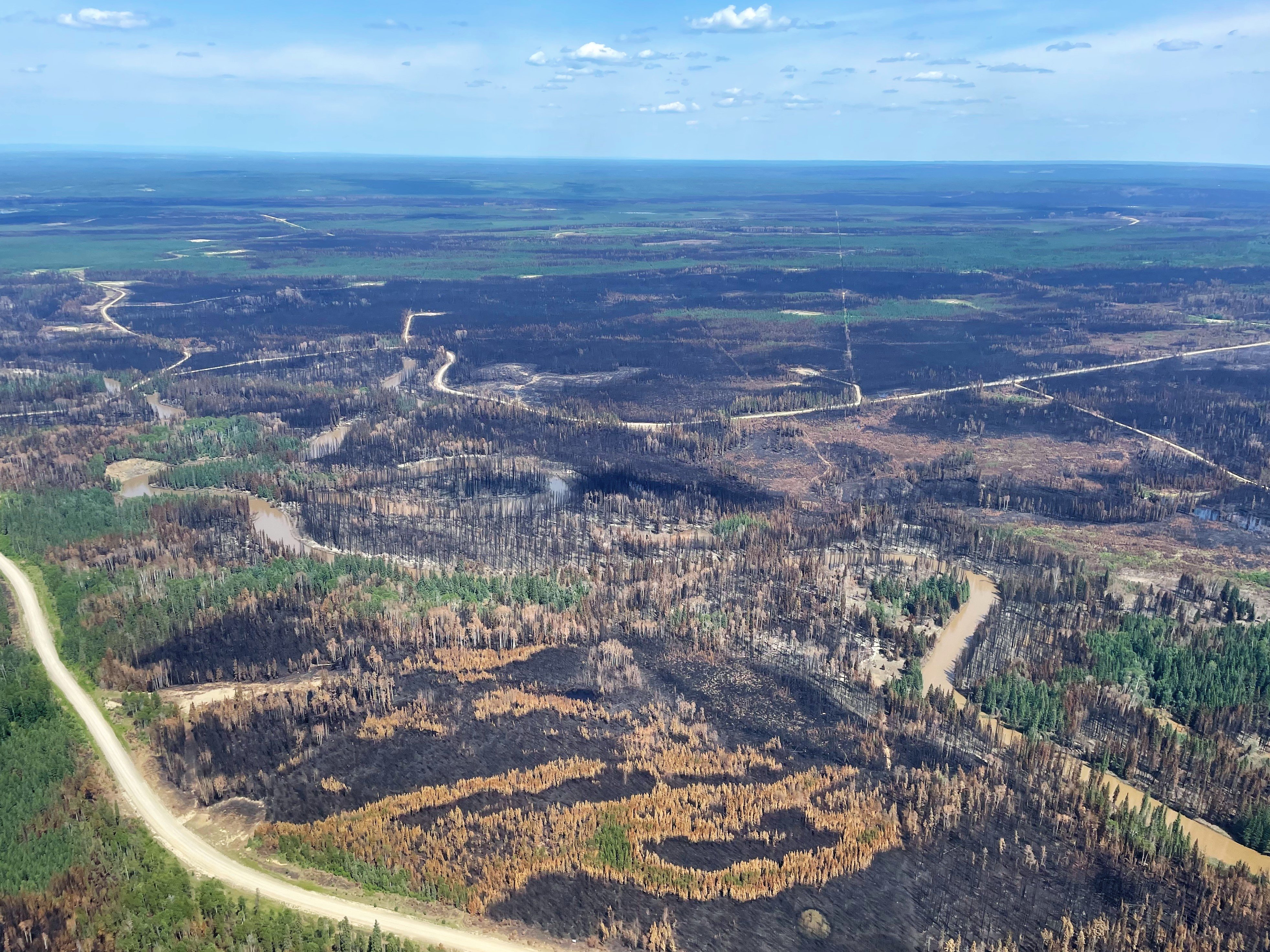
Little smoke can be seen over EWF031 today. Smoke may be noticed in the coming days as conditions warm up and dry the fuels on the ground (June 24, 2023).
ROCKY MOUNTAIN HOUSE FOERST AREA | PEMBINA WILDFIRE COMPLEX | RWF034, RWF040
RWF034 is located near the O'Chiese Reserve is now classified as BEING HELD. The fire is currently estimated at 87,492 ha in size.
Personnel and heavy equipment are continuing to monitor and extinguish hotspots. Crews are continuing to reinforce control lines within the perimeter and extinguish hotspots. Smoke may still be visible as surfaces dry. The perimeter on the west side of the Brazeau Reservoir has remained quiet.
RWF040 is being actively monitored by firefighters and support staff assigned to the complex who can respond if necessary. Personnel continue to work on putting out hotspots within the perimeter. The fire is currently estimated to be 5,089 ha in size and is now BEING HELD.
For more information regarding the Rocky Mountain House Forest Area, visit their Wildfire Updates.

By: Tara Stephens, Pembina Wildfire Complex. Wildfire Information Officer. Alberta Forestry and Parks. For information related to the Pembina Wildfire Complex please contact: 780-728-5843.
EDSON FOREST AREA | DEEP CREEK COMPLEX | WCU001, WCU002, EWF035
WCU001 was detected on April 29, and estimated to be 6,284 ha in size. WCU002 was detected on the evening of April 29 and estimated to be 2,478 ha in size. EWF035 was detected on May 5 and is 19,672 ha in size. To view actual locations of the wildfires, visit the wildfire dashboard.
All three of these wildfires are classified as UNDER CONTROL meaning that the wildfire is completely contained and not expected to grow. These wildfires are in their final stages before they're classified as extinguished.
There are 108 firefighters assigned to the Deep Creek Complex. There's also four helicopters, 26 pieces of heavy equipment, and 28 support staff who are part of the incident management team, equipment maintenance and crew supervision (to name a few positions). Additional helicopters and heavy equipment groups are available from the Pembina Complex should they be required on any of the fires within the Deep Creek Complex.
The wildfire complex is expected to see low to moderate fire behaviour in the next couple of days, meaning that very little fire activity will be observed. Residents may see some smoke coming from within the wildfire complex as conditions warm up and fuels dry up. This is expected and AB Wildfire firefighters will monitor and respond to any flare ups as needed. Fortunately we expect temperatures in the mid 20's, 30-40% relative humidity and very little wind which will help keep fire behaviour low.
The Alberta Wildfire firetack and Working on Wildfire South African firefighters will continue to extinguish hotspots throughout the upcoming days. They are working mostly on the west and southwest sections of EWF035. Wildfire crews will also be working on various sections of these wildfires to retrieve equipment and hose where areas are secure.
Heavy equipment continue reclamation on these wildfires in areas where there is no longer a concern, removing creek crossings, rolling back disturbed soil and spreading debris for a more natural setting. All disturbed containment lines will need to be reclaimed and this work is expected to continue into the fall and possibly into the winter months.
By Caroline Charbonneau, Deep Creek Wildfire Complex. Wildfire Information Officer, Alberta Forestry and Parks, Edson Forest Area. For information related to the Deep Creek Complex please contact: 780-740-1341.
EDSON FOREST AREA | WILD HAY WILDFIRE COMPLEX | EWF037, EWF040
The Wild Hay Complex is comprised of two wildfires, EWF037 and EWF040. They are both located south of the Little Smoky River, north of the Wild Hay River and east of Hwy 40 north. The complex is 63 km north of Hinton.
EWF040 is now classified as being held and is estimated to be 12,073 ha.
EWF037 continues to be classified as under control at 578 ha.
GENERAL INFORMATION ON WILDFIRES IN OUR AREA
WORK OR RECREATE NEAR WILDFIRE AREAS | We urge residents and members of the public to use extra caution near burnt areas. There are many hazards that may not be visible, like deep burning ash pits and falling trees. Burnt trees are a serious hazard, and trees that may look healthy that have green needles or leaves could have burnt out roots under the ground and fall unexpectedly. Keep in mind that trees and powerlines could also fall on the road and block your vehicle. Do not approach powerlines as they could be energized.
DRONES | The use of recreational drones over wildfires in Alberta is dangerous, illegal and could result in a fine of up to $15,000* for putting aircraft and people at risk. Please give Alberta firefighters the space they need to do their jobs safely. *Transport Canada
TO SUBSCRIBE TO THE UPDATES | You can subscribe to these updates (or any other forest area's update) and they'll come directly to your email or as a notification on your phone. You can visit our website, enter your email address and click Instant then Subscribe. You can also download the AB Wildfire Status App, click the "i" at the bottom left, click the bell for notifications and toggle the Edson Forest Area Update.
UNDERSTANDING WILDFIRE CLASSIFICATIONS | When firefighters classify a wildfire as OUT OF CONTROL, it means that the wildfire is burning and is expected to continue to grow within and possibly outside of its present boundary. The classification of BEING HELD means that under the current weather conditions and the resources available, there will be no unexpected growth, however firefighters anticipate the possibility of a small amount of spread which would be normal on a wildfire of this size. To learn more about wildfire classifications, click here.
WILDFIRE PREPARDNESS | Learn how you can prepare yourself for a wildfire by clicking here.
WILDFIRE INVESTIGATIONS | Wildfires in Alberta are either human-caused or caused by lightning. Every wildfire in Alberta is investigated and the wildfires mentioned remain under investigation.
WILDFIRE MAPS AND BOUNDARIES | Note that wildfire perimeter maps are an estimate based on measurements such as GPS, aerial scanning and satellite imagery. This estimated perimeter can change as more accurate measurements become available. Areas within the fire perimeter may not have been affected by wildfire. Visit our Wildfire Dashboard to view active wildfires and their stats on the wildfire dashboard. Click on "view interactive map". You can choose different basemaps by selecting the four squares icon, or layers by clicking on the three sheets of paper on the top right corner.
Albertans are always asked to use caution when working or recreating in the outdoors:
- Before you burn it, get your fire permit. Fire permits in Alberta.
- Clear debris from hot spots on your off-highway vehicle.
- Ensure your campfire is out - soak it, stir it, soak it again.
- Before you head out this weekend, check out the albertafirebans.ca website or download the app to stay informed.
- For road closure information, please visit 511.alberta.ca
- For information regarding smoke in the area, you can visit firesmoke.ca
- NASA FIRMS Fire Information website is a great resource to give an idea of the location of wildfires in the area, but note that the data is based on interpolation and often can make the wildfire look larger then it actually is.
- To view the provincial wildfire danger map, click here.

ALBERTA WILDFIRE INFORMATION
- Subscribe to the Edson Forest Area wildfire update to receive an email when new information is posted.
- Download the Alberta Wildfire App for Apple and Android device.
- Join the conversation on Facebook, Twitter or Instagram.
For more information, please contact: