

The fire danger in the Peace River Forest Area (PRFA) remains HIGH.
A wildfire southwest of Little Buffalo has become increasingly active this afternoon as winds have increased. Alberta Wildfire is responding with firefighters, heavy equipment and helicopters. The community of Little Buffalo has been evacuated by the Kee Tas Kee Now Tribal council. For information, residents can call Joe Auger at 780-625-1503.
Due to the return of hot temperatures, fires within the forest area are seeing increased fire activity. Please stay informed of the fire situation. Subscribe to the Peace River Forest Area updates to get an email notification every time a new update is posted. To report a wildfire, call 310-FIRE (3473).
A fire restriction is in effect for the PRFA. All outdoor wood fires are banned on public lands, including backcountry and random camping. The use of fireworks and exploding targets are also prohibited. Please visit AlbertaFiresbans.ca for more information. For further information and maps on smoke please go to Smoke Forecast - FireSmoke.ca
To see the forecasted fire danger, click here, updates daily at 3:00 PM
The northeast tip of Kimiwan wildfire SWF068 produces smoke as recent hot, dry weather has resulted in some increased fire activity.
Initial attack crews are put on standby to action any new wildfire starts, especially when the fire danger increases. Visit our Wildfire Dashboard to view active wildfires and their stats.
Wildfire Situation (as of 10 a.m., July 1)
Since January 1, there have been 85 wildfires in the Peace River Forest Area (PRFA) burning a total of 8806.54 hectares (ha).
PWF081 was discovered on June 30. It is approximately 0.36 hectares in size and is classified as being held. It is approximately 11 kilometers north of the clear prairie road, west of Worsley. Firefighters and helicopters are working to prevent the fire spread.
PWF082 was discovered on June 30. It is approximately 1,200 hectares in size and classified as out of control. It is located south of Chinchaga Wildland Provincial Park.
PWF083 was discovered June 30 and has been extinguished.
PWF084 was discovered June 30. It is approximately 1 hectare in size and is classified as being held. It is approximately 2 kilometers east of the East Haul road and Hwy 968 turn off. Firefighters from AB Wildfire and the local fire department are working to have the fire under control.
PWF079 was discovered June 29. It is approximately 3 hectares in size and currently classified as out of control. Two crews of firefighters and helicopters are working to contain the spread.
PWF074 was discovered June 28 and is approximately 40 hectares in size, and located approximately five kilometers northwest of Little Buffalo. It is classified as out of control. Crews, helicopters, air tankers and heavy equipment are working on this fire to maintain containment lines.
PWF067 is located 18 km from the Keg River highway at the 695 and highway 35 intersection. This fire is estimated to be 250 hectares in size and is classified as out of control. At this time, firefighters, helicopters, air tankers, and heavy equipment are working on this wildfire and containment lines are in place.
PWF070 is now extinguished.
GWF018 is currently classified as Being Held (BH). It is now estimated to be 49,327 ha in size. Firefighters and helicopters continue to action and monitor the area.
PWF034 is located approximately 21 kilometers east and northeast of Worsley and 21 kilometers North of Cleardale. It is classified as under control at 587 ha. Firefighters continue to patrol this wildfire and action any hotspots found.
Check out the Clear Hills County website for a map and additional information. These wildfires have been actioned by local fire departments with help from Alberta Wildfire.
Continue to stay informed by subscribing to Alberta Wildfire updates by entering your email. To view wildfires on a map, download the AB Wildfire App or visit the Wildfire Status page.
Caution is advised when travelling on area highways due to smoke conditions, especially in low lying areas. For road closures, visit 511 Alberta.
All wildfires in Alberta are investigated and these wildfires remain under investigation. To learn more about wildfire classifications, click here.
The Kimiwan Complex
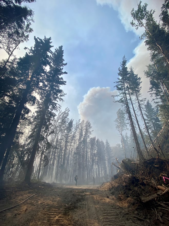 Firefighters on the guard line of SWF068 with a plume of smoke in the sky.
Fire behaviour on the Kimiwan Complex is expected to be HIGH today.
SWF068 is classified as Out of Control (OC) and is 132,018 hectares.
Forecast is for moderate temperatures up to 18C today and gusting south and westerly winds across the fire ground continues to dry out fuels. An approaching low pressure system is expected to bring wind gusts up to 30 kilometers per hour today and through the weekend.
Fire activity has increased over the past few days due to warm, dry weather, and will continue to be active as a low pressure system moves through the area over the next few days. Firefighters supported by heavy equipment and helicopters bucketing water continue to reinforce guard lines on northern tip of the fire in anticipation of gusty winds today and this weekend, and preventative structural protection is in place. Crews are continuing to secure containment lines on the northern and southern ends of the fire. The fire is approximately 75 per cent contained.
An American Incident Management Team (IMT) is now managing this wildfire. Crews from Peace River, Australia, Yukon and America continue to work alongside each other. There are 217 firefighters and support personnel assigned to SWF068.
The American IMT was brought to Alberta through the Northwest Compact, a fire protection agreement created in 1998 for the purpose of promoting effective prevention, presuppression, suppression and control of forest fires in the Northwest wildland region of the
United States and Western areas of Canada. Members are the states of Alaska, Washington, Montana, Idaho, and Oregon; the provinces of Alberta, Saskatchewan, and British Columbia, and the Yukon Territory and Northwest Territories.
PWF038 is classified as Under Control (UC) and is 6,534 hectares.
Reclamation work is continuing on the PWF 038 wildfire. Alberta Forestry and Parks, in its mandate to prevent and suppress wildfires within the province, is required to reclaim disturbed forest land caused by wildfire suppression operations. Wildfire reclamation is required to prevent or reduce the potential of soil erosion and ensure soil stabilization on or near the fire line.
A reminder to community members to please not drive on Seal Lake Road west of the intersection with Range Road 190.
Please do not report smoke or flame from within an active wildfire area. Firefighters are diverted from essential tasks to respond to fires reported by the public. You may see smoke or flame within the existing boundary of a wildfire; this is normal.
The Kimiwan Complex and Peace River Forest Area Information Officer is Michelle Huley. Call her at 780-652-2410, or email to michelle.huley@gov.ab.ca.
For more information about wildfire in or near municipalities impacted by SWF068, please go to Northern Sunrise County or the MD of Smoky River
The Long Lake Complex | HWF036, HWF058
Fires HWF036 and fire HWF058 are now being managed by two separate Incident Management Teams (IMT) and will no longer be called the Long Lake Complex. Fire HWF036 is named the Long Lake Fire and fire HWF058 is named the Basset Fire.
BC have also observed increased activity with their three fires on the border. There are three fires burning along the BC and Alberta border. They are in remote country with no community and are being monitored by air. For more information on these fires please go BC Wildfire Service gov.bc.ca
THE BASSET FIRE | HWF058 | JUNE 29, 2023 AS OF 8:30 PM
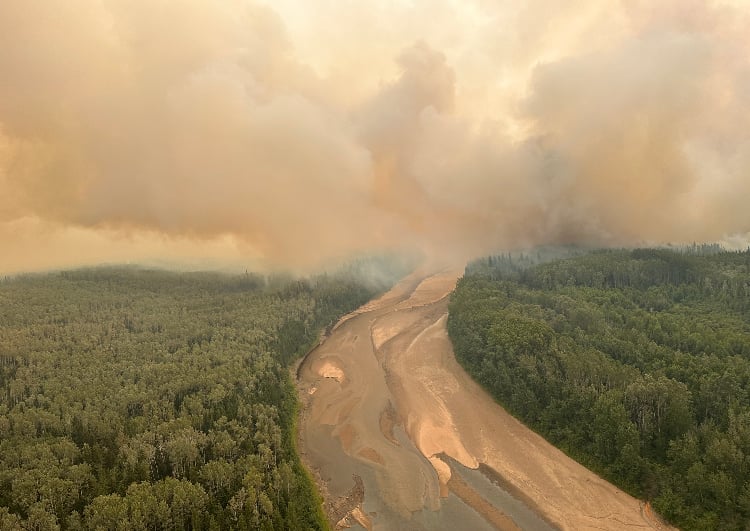
This fire is located approximately 13 km northwest of the of Paddle Prairie Metis Settlement boundary marker, where the Haig River meets the Chinchaga River. This fire is classified as out of control (OC) with a last recorded size of 29,809 hectares.
Firefighters and heavy equipment's control lines were challenged as there was an increase in activity again today. The fire has seen growth on the, east and southwest sides of the fire. The east side continued to grow towards the Chinchaga River today. This evening it has been confirmed the fire has crossed over to the east side. This area where the fire has crossed the river is approximately 18 km north of where the Haig River meets the Chinchaga River.
Firefighters, heavy equipment and aircraft are worked together to cool hotspots in priority areas and establish guards along the south and southeast side, to prevent spread towards the community of Paddle Prairie. In addition, heavy equipment has made good progress creating control lines on the south side of the fire. With the return in hot temperatures and crossover conditions, fire behaviour is expected to continue to challenge crews and aircraft again tomorrow.
Structural protection crews have established protection on structures along the Chinchaga River. There are 48 wildland and structural firefighters, 9 helicopters, support staff and heavy equipment working on this fire. Airtankers are available as needed.
The IMT continues to work closely with locals on understanding the local landscape and getting access to the fire ground as well as communicate with council as the fire situation changes.
Victoria Ostendorf | Wildfire Information Officer
High Level Forest Area
Forestry Division, Parks & Tourism
Office:780-926-5401
Cell:780-841-9387
For more information please visit the High Level Forest Area Update.
Stay away from active wildfire areas for your safety and to ensure firefighters can do their job safely, please stay away from active wildfire areas. Your cooperation is essential.
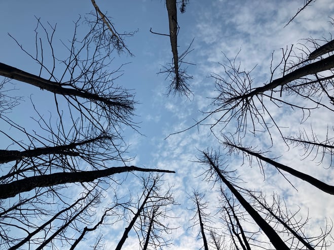
Dangerous trees Be extra cautious near burnt areas and avoid forested areas that have been recently affected by wildfire. Hazards remain from falling trees or branches, especially if windy, deep ash pits and burning peat.
Reporting wildfires Please do not report smoke or flame from within an active wildfire area. Firefighters are diverted from essential tasks to respond to fires reported by the public. You may see smoke or flame within the existing boundary of a wildfire, this is normal.
Smoke Lingering smoke may still be visible in some areas and in affected communities. Smoke inversions can trap air near the ground causing dangerous driving conditions and poor air quality. Please use extra caution when driving in smoky conditions, and take necessary precautions if you have smoke-related health concerns.
Drones The use of recreational drones over wildfires in Alberta is dangerous, illegal and could result in a fine of up to $15,000* for putting aircraft and people at risk. Please give Alberta firefighters the space they need to do their jobs safely.
Prohibited:
- All outdoor wood fires in backcountry and random camping areas on public land
- Charcoal briquettes in backcountry and random camping areas on public land
- The use of fireworks and exploding targets
Allowed:
- Wood campfires on private land and in designated campgrounds
- Charcoal briquettes on private land and in designated campgrounds
- Propane/natural gas-powered appliances
- Open flame oil devices (e.g., turkey deep fryers, tiki torches)
- Indoor wood fires contained within a device with a chimney and spark arrestor
- All appliances must be CSA approved and used per manufacturer’s standards
Be advised that Alberta Parks has it's own set of fire ban levels, please visit their website for more information.
![]()
Using FireSmart principles is becoming a way of life for many communities in North America. With so many neighborhoods threatened by wildfire each year, residents are taking action and reducing the risk to their homes, cabins and properties.
To learn more on how you can protect your home and structures from wildfire, visit firesmartcanada.ca or click here to watch videos.
For those that have farm or acreages, this publication may be helpful to keep you FireSmart. Click on the link for the Farm and Acreage FireSmart Magazine.
FOR MORE INFORMATION
- Bookmark the Peace River Wildfire Update and check for updates anytime or subscribe to have it emailed to you.
- You can also find us on Facebook, Twitter and Instagram or visit www.wildfire.alberta.ca
CONTACT
Michelle Huley
Wildfire Information Officer, Peace River Forest Area
780-618-2081
Michelle.huley@gov.ab.ca
HELPFUL LINKS
Alberta Wildfire StatusAlberta Fire Bans
Air Quality Health Index
Alberta Emergency Alerts
511 Road Reports
Emergency Preparation