

The fire danger in the Peace River Forest Area (PRFA) remains HIGH.
High winds are expected as a cold front passes through the Peace River forest area today. The potential for lightning will be high and widespread. Firefighters will be looking for lightning holdovers in the coming days as a return to high drying conditions are expected.
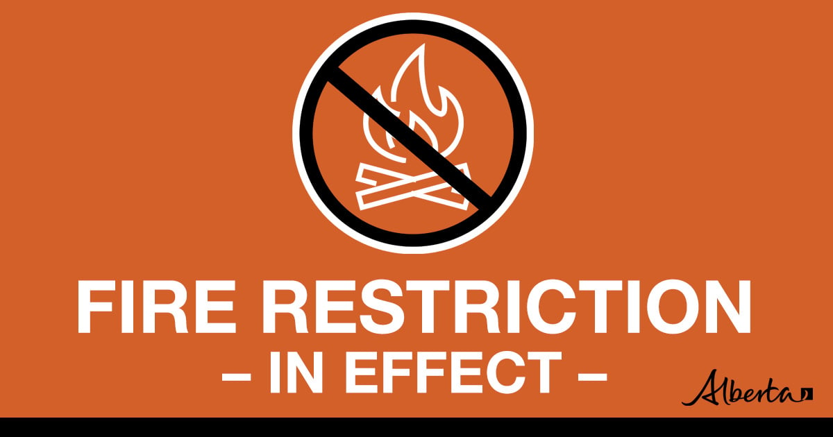
A fire restriction is in effect for the PRFA. All outdoor wood fires are banned on public lands, including backcountry and random camping. The use of fireworks and exploding targets are also prohibited. Please visit AlbertaFiresbans.ca for more information.
To see the forecasted fire danger, click here, updates daily at 3:00 PM
Initial attack crews are put on standby to action any new wildfire starts, especially when the fire danger increases. Visit our Wildfire Dashboard to view active wildfires and their stats.
Wildfire Situation
Since January 1, there have been 66 wildfires in the Peace River Forest Area (PRFA) burning a total of 7,218 hectares (ha).
PWF061 is located 75km southwest of Keg River. This fire is estimated to be 12 hectares in size and is classified as being held (BH). At this time, firefighters and a helicopter are working on this wildfire.
PWF065 is a lightning caused fire located 58km west of Manning. This fire is estimated to be 1.5 hectares in size. At this time, firefighters and a helicopter are assigned to this fire.
GWF018 is currently classified as Being Held (BH). It is now estimated to be 49,327 ha in size.
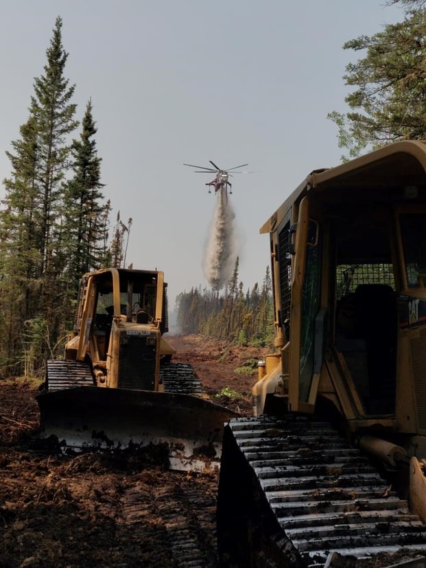
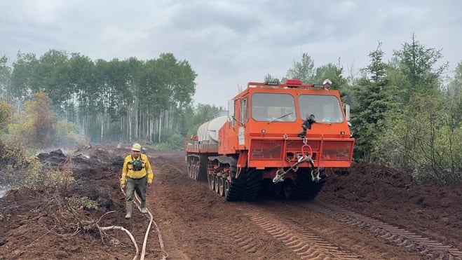
Wildland firefighters continue working to bring this wildfire under control. Today, 47 firefighters are using helicopters with buckets and water trucks as well as heavy equipment to maintain and hold containment lines.
PWF-034 is located approximately 21 kilometers east and northeast of Worsley, and 21 kilometers North of Cleardale. It is classified as being held at 587ha. Firefighters continue to patrol this wildfire and action any hotspots found.
Check out the Clear Hills county website for a map and additional information. These wildfire have been action by local fire departs with help from Alberta Wildfire.
Continue to stay informed by subscribing to Alberta Wildfire updates by entering your email. To view wildfires on a map, download the AB Wildfire App or visit the Wildfire Status page.
Caution is advised when travelling on area highways due to smoke conditions, especially in low lying areas. For road closures, visit 511 Alberta.
All wildfires in Alberta are investigated and these wildfires remain under investigation. To learn more about wildfire classifications, click here.
The Kimiwan Complex
Fire behaviour on the Kimiwan Complex is expected to be VERY HIGH today.
SWF068 is classified as Out of Control (OC) and is 132,315 hectares.
Today, with forecast 26 degrees, light south to south westerly winds and low relative humidity of 40%, fire crews will again be working in challenging conditions. An additional aircrane has been added to the fleet of one aircrane, five mediums and four intermediate helicopters to assist the Albertan, Yukon, Australian and American fire crews to monitor hotspots around the perimeter of the fire and suppress any fire activity.
PWF038 is classified as Under Control (UC) and is 6,534 hectares.
Reclamation work has begun on the PWF 038 wildfire. Alberta Forestry and Parks, in its mandate to prevent and suppress wildfires within the province is required to reclaim disturbed forest land caused by wildfire suppression operations. Wildfire reclamation is required to prevent or reduce the potential of soil erosion and ensure soil stabilization on or near the fire line.
A reminder to community members to please not drive on Seal Lake Road west of the intersection with Range Road 190.
The Kimiwan Complex Information Officer is Carmel Henderson at 780-652-2410.
For more information about wildfire in or near municipalities impacted by SWF068, please go to Northern Sunrise County or the MD of Smoky River
The Long Lake Complex
There are currently 313 personnel, 18 aircraft and 60 heavy equipment working across this complex of fires.
HWF036 this fire was detected on May 3, 2023, and is classified as Out of Control (OC) with a last recorded size of 168,614 hectares. This increase in size is due to internal pockets within the fire perimeter burning and updated mapping data from aerial intel. The increase is not as a result of any increased fire activity. Due to the great work of crews we now have 62% of the fire line contained and being held.
An aerial scan that was done yesterday has identified hot spots within the fire perimeter that firefighters will focus on today. The fire is still active on the western and northern border, moving towards the British Columbia border. Crews are burning out this area and working with dozers. Vegetation inside the fire perimeter continues to burn, we are still finding hot spots within the fire. Firefighters continue mop-up hot spots.
The northeast guard protecting the community of Chateh continues to hold with limited activity fire along this edge. Firefighters continue to monitor and strengthen containment lines. Cenovus has been working with the Incident Management Team to determine a safe return to work plan. The plant has completed their first phases of operations.
Industry requests are increasing. It remains a priority of the IMT to get industry partners to sites as it is safe to do so. Please coordinate all requests through the Industry Liaison, Kevin Kuhn k.kuhn@mistikenvironmental.com
HWF058 this fire was detected June 4, 2023. This fire is classified as out of control (OC) with an estimated size of 21,356 hectares.
This fire is located approximately 72 kilometers southwest of the Town of High Level and approximately 17 kilometers northwest of the of Paddle Prairie Metis Settlement boundary marker, where the Haig River meets the Chinchaga River. Evacuation trigger maps have been developed with the local community.
Dozers continue to work on the western edge of the fire along the easement and the southwest corner. Crews are also burning out the section in between the dozer guard and the edge of the fire. Evacuation trigger maps have been developed with the local community and todays increased fire activity does not see the fire hitting the 72-hour trigger line today.
We continue to work closely with locals on gain access and understanding the local environment. Equipment and dozers have been activated to access the fire from the north and south. A base camp for crews has been established at Keg River Camp, southwest of Paddle Prairie.
Contact:
Ellisa Bourne
Wildfire Information Officer - Long Lake Fire
Email – WF.HWF0362023-IOF.i@gov.ab.ca
For more information please visit the High Level Forest Area Update.
Stay away from active wildfire areas for your safety and to ensure firefighters can do their job safely, please stay away from active wildfire areas. Your cooperation is essential.
Dangerous trees Be extra cautious near burnt areas and avoid forested areas that have been recently affected by wildfire. Hazards remain from falling trees or branches, especially if windy, deep ash pits and burning peat.
Reporting wildfires Please do not report smoke or flame from within an active wildfire area. Firefighters are diverted from essential tasks to respond to fires reported by the public. You may see smoke or flame within the existing boundary of a wildfire, this is normal.
Smoke Lingering smoke may still be visible in some areas and in affected communities. Smoke inversions can trap air near the ground causing dangerous driving conditions and poor air quality. Please use extra caution when driving in smoky conditions, and take necessary precautions if you have smoke-related health concerns.
Drones The use of recreational drones over wildfires in Alberta is dangerous, illegal and could result in a fine of up to $15,000* for putting aircraft and people at risk. Please give Alberta firefighters the space they need to do their jobs safely.
Prohibited:
- All outdoor wood fires in backcountry and random camping areas on public land
- Charcoal briquettes in backcountry and random camping areas on public land
- The use of fireworks and exploding targets
Allowed:
- Wood campfires on private land and in designated campgrounds
- Charcoal briquettes on private land and in designated campgrounds
- Propane/natural gas-powered appliances
- Open flame oil devices (e.g., turkey deep fryers, tiki torches)
- Indoor wood fires contained within a device with a chimney and spark arrestor
- All appliances must be CSA approved and used per manufacturer’s standards
Be advised that Alberta Parks has it's own set of fire ban levels, please visit their website for more information.
A number of area municipalities have implemented emergency measures in response to wildfires.
For more information about Alberta Emergency Alerts, go to Alberta Emergency Alerts
FireSmart Begins at Home
![]()
Using FireSmart principles is becoming a way of life for many communities in North America. With so many neighborhoods threatened by wildfire each year, residents are taking action and reducing the risk to their homes, cabins and properties.
We strongly encourage those with homes, cabins and other structures to FireSmart their properties to limit the impacts of a potential wildfire reaching your door step. To learn more on how you can protect your home and structures from wildfire, visit firesmartcanada.ca or click here to watch videos. FireSmart Canada also has a FREE one-hour course for those who are getting started with FireSmart. Click here to learn more.
For those that have farm or acreages, this publication may be helpful to keep you FireSmart. Click on the link for the Farm and Acreage FireSmart Magazine.
FOR MORE INFORMATION
- Bookmark the Peace River Wildfire Update and check for updates anytime or subscribe to have it emailed to you.
- You can also find us on Facebook, Twitter and Instagram or visit www.wildfire.alberta.ca
CONTACT
Wildfire Information Officer Kelly Burke, on behalf of Michelle Huley
Phone: 1-866-394-3473
HELPFUL LINKS
Alberta Wildfire StatusAlberta Fire Bans
Air Quality Health Index
Alberta Emergency Alerts
511 Road Reports
Emergency Preparation