
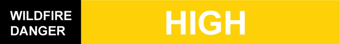
The fire danger is high in the High Level Forest Area and the Fire Restriction remains in effect. Please be cautious in areas of cured grass. Dry grass can ignite easily and spread quickly. To report a wildfire call 310-FIRE(3473).
STAY SAFE THIS HUNTING SEASON
Off Highway-Vehicle Safety - Exhaust systems heat up to temperatures in excess of 200°C. At these temperatures, built up materials and debris on your machine (such as grass, muskeg, moss) can heat up, smoulder and ignite. Hot debris can drop to the ground as you are riding, starting a wildfire. Keep watch while riding and extinguish small fires if you have water available. If you see a wildfire, report it immediately by calling 310-FIRE.
Active Wildfire Area - There a active wildfire operations ongoing in the High Level Forest Area. To see a map of wildfire locations download the AB Wildfire App or visit the Alberta Wildfire Status Dashboard. For your safety and to ensure firefighters can do their job safely, please stay away from active wildfire areas. Your cooperation is essential.
Campfires - The High Level Forest Area Has a Fire Restriction in place. Ensure you always check Albertafirebans.ca before recreating in the Forest Protection Area of Alberta.
Smoky Conditions - Smoke from near by wildfires is impacting air quality and road visibility. Drive safe and 511.alberta.ca. for road closure information.
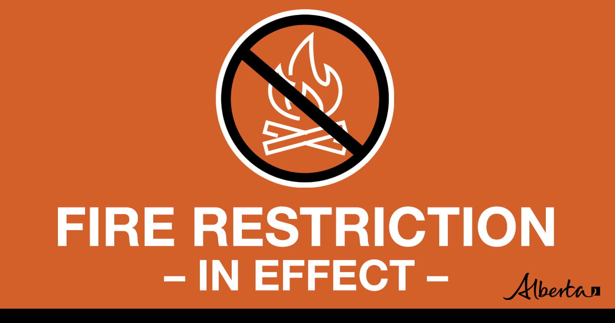
FIRE RESTRICTION IN EFFECT | SEPTEMBER 1, 2023
A fire restriction is in effect for the High Level Forest Area, due to warm, dry and windy conditions. The fire restriction will remain in effect until conditions improve.
Under this restriction:
- Requests for permits for light burning will be considered on a case by case basis.
Prohibited:
- All outdoor wood fires are banned on public lands, including backcountry and random camping areas.
- Fireworks and exploding targets.
Allowed:
- Safe wood campfires on private lands and in designated campgrounds.
- Backyard fire pits
- Charcoal briquette barbeques.
- Propane/ natural gas-powered appliances.
- Indoor wood fires contained within a device with a chimney and spark arrestor.
- Cooking, warming and lighting devices that are CSA approved and used as per manufacturer’s standards.
Never leave a campfire unattended. Soak it, stir it and soak it again until cool to the touch to ensure it is extinguished. If you see a wildfire, report it immediately by calling 310-FIRE.
WEATHER |
Today the forecasted temperature is 14 degrees, a relative humidity of 55 percent with winds northwest/west 10 km/h. Tomorrow the forecasted temperature is 15 degrees, a relative humidity of 50 percent with winds southeast 10-15 km/h.
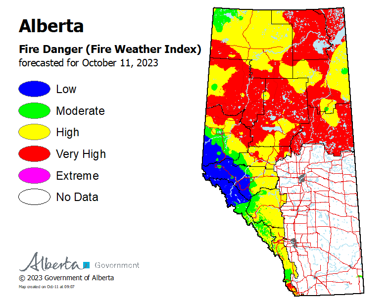
HIGH LEVEL FOREST AREA | WILDFIRE SITUATION | OCTOBER 11, 2023 AS OF 11:00 AM
There are 27 wildfires in the High Level Forest Area. Of these fires, 16 are classified as being held (BH) and 11 are under control (UC). To see a map of the wildfires in the High Level Forest Area and across the province please click here.
THE BASSET COMPLEX (HWF058, HWF036)| OCTOBER 11, 2023 AS OF 11:00 AM
An Incident Management Team (IMT) is managing these wildfires.
HWF058 | This wildfire is classified as being held with a last recorded size of 234,164 hectares. Being held means that given current weather conditions and resources, the wildfire is not anticipated to grow past expected boundaries.
This wildfire is approximately 20 km east of Chateh, 43km west of the Town of High Level, 30 km southwest of Meander, 15 km from the northwest corner boundary of the Paddle Prairie Metis Settlement, and 38 kilometers west of highway 35 south.
Fire behaviour has been reduced due to lighter winds and cooler temperatures therefore minimal growth has been reported. Heavy equipment, aircraft and wildland firefighters continue to work to suppress this wildfire. Crews and heavy equipment are making good progress on creating control lines on the west and east side of the fire, working off of highway 58.
HWF036 | This wildfire is classified as being held (BH) at 248,556 hectares. Being held means that given current weather conditions and resources, the wildfire is not anticipated to grow past expected boundaries.
The Town of Rainbow Lake in consultation with the Dene Tha' First Nation, Mackenzie County and Alberta Wildfire have restricted access to areas southwest and west of the Town of Rainbow Lake. There are barricades placed to restrict access both west and south of the Town of Rainbow Lake due to safety concerns. South of Baseline (Bivouac) Road up to the BC boarder, and south of the Town of Rainbow Lake including the lake itself including areas further south. The Town of Rainbow Lake is working closely with partners to monitor the situation and will inform the public once the area is safe to travel in again.
Stay away from active wildfire areas | For your safety and to ensure firefighters can do their job safely, please stay away from active wildfire areas. Your cooperation is essential.
Dangerous trees | Be extra cautious near burnt areas and avoid forested areas that have been recently affected by wildfire. Hazards remain from deep ash pits, burning peat and falling trees or branches, especially if windy.
Reporting wildfires | Please do not report smoke or flame from within an active wildfire area. Firefighters are diverted from essential tasks to respond to fires reported by the public. You may see smoke or flame within the existing boundary of a wildfire, this is normal.
Smoke | Lingering smoke may still be visible in some areas and in affected communities. Smoke inversions can trap air near the ground causing dangerous driving conditions and poor air quality. Please use extra caution when driving in smoky conditions, and take necessary precautions if you have smoke-related health concerns.
Drones | The use of recreational drones over wildfires in Alberta is dangerous, illegal and could result in a fine of up to $15,000* for putting aircraft and people at risk. Please give Alberta firefighters the space they need to do their jobs safely. *Transport Canada
.png?width=659&height=371&name=wildfire%20app%20(2).png)
WILDFIRE INFORMATION
Download the Alberta Wildfire app today and get access to accurate, real-time information on wildfires in your area. You can also find information on fire advisories, restrictions and bans across the province and much more all on your mobile device. Available for Apple and Android.
Before heading out, please check albertafirebans.ca to determine whether there are any fire advisories, fire restrictions or fire bans in effect for your destination.
Subscribe to the High Level Forest Area Update to receive an email when new information is posted. Join the conversation on Facebook, Twitter or Instagram.
WILDFIRE LINKS AND TOOLS
Volunteers, equipment owners/operators or firefighters looking to assist with these wildfires or any of the wildfires within the province can contact EmergencySupportOffers@gov.ab.ca.
There are multiple EVACUATION ORDERS & ALERTS in the Province. Please visit Alberta Emergency Alerts or your community webpage for more information.
To see all the wildfires burning in Alberta click here.
WILDFIRE PREPAREDNESS | Learn how you can prepare yourself for a wildfire by clicking here.