

Fire bans are effective in reducing the number of human-caused wildfires and helping firefighters focus on existing or new wildfires. We realize that this may change long-weekend holiday plans for some, but our first priority is the safety of Albertans and their communities. It is extremely important for Albertans to respect the fire ban and help reduce human-caused wildfires. Alberta Wildfire encourages all Albertans to celebrate responsibly this long weekend.
WILDFIRE DANGER
The wildfire danger is EXTREME in the High Level Forest Area.
We ask Albertans to be extremely cautious if they are spending time in the Forest Protection Area of Alberta. The hot and dry weather continues to increase the wildfire danger. In these conditions, a wildfire will ignite easily and spread quickly.
Alberta Wildfire uses a variety of tools to identify areas with a high wildfire danger, and strategically place resources where they are needed most to efficiently attack wildfires as they occur.
HIGH LEVEL FOREST AREA WILDFIRE UPDATE| MAY 18, 2023 AS OF 9:00 PM
There are currently five wildfires burning in the High Level Forest Area. Two of these wildfires are classified as Out of Control (OC) and three are Under Control (UC). Today firefighters responded to one new wildfire start that has since been extinguished. To see a map of the wildfires in the High Level Forest Area and across the province please click here.
Firefighters, aircraft, and heavy equipment have been working in conjunction with communities, county and municipal firefighting services as aggressively as possible to make progress on wildfires in the High Level Forest Area. Despite all of this hard work, there remains uncontained wildfire perimeter and fire behavior forecasts indicate that there will be continued growth on the wildfires throughout the region.
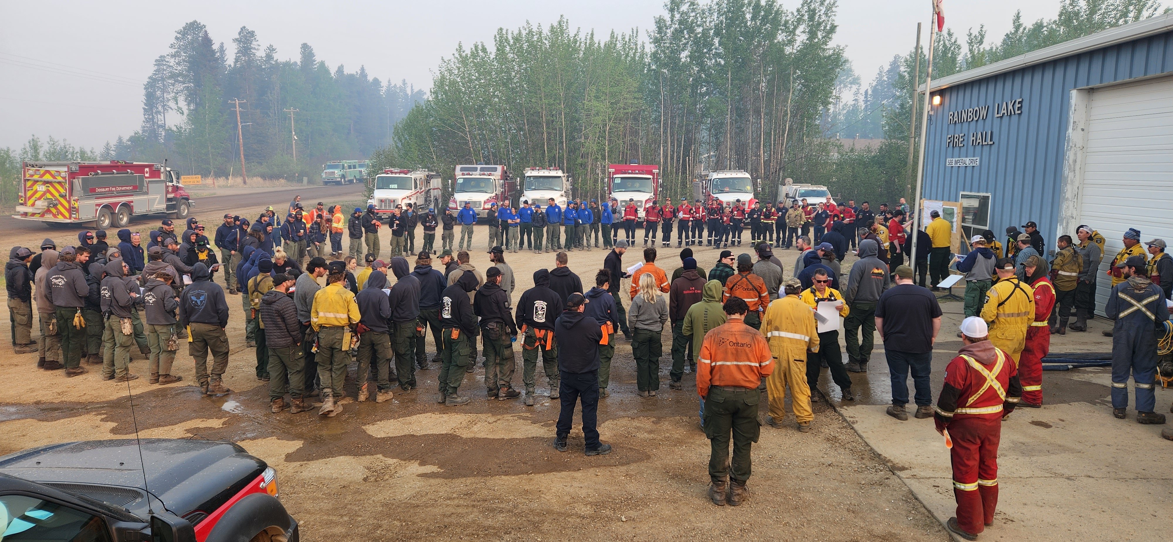
Firefighters gather at the Town of Rainbow Lake Fire Hall for their early morning safety briefing before heading out to work on the Long Lake wildfire. May 18, 2023.
THE LONG LAKE FIRE | HWF036 | MAY 18, 2023 AS OF 8:30 PM
This fire is located in the vicinity of the Town of Rainbow Lake. This wildfire is classified as out of control (OC) at 106,938 hectares. Today, firefighters observed fire activity and growth on the south side of the fire, moving away from the community of Chateh.
This wildfire remains approximately 13 km from the community of Chateh. Firefighters and heavy equipment are working hard on securing existing fire guards west of the community of Chateh.
Our top priority is the safety of the people in the Town of Rainbow Lake, the community of Chateh, and oil and gas and energy infrastructure. Wildland firefighter crews and wildland urban interface crews continue to ensure protection of the structures within the town and community. Firefighters will continue to action hotspots around the Town of Rainbow Lake and ensure all hotspots are fully extinguished.
The Incident Management Team (IMT) is providing the continued support for restoration of critical infrastructure and communications systems in the Town of Rainbow Lake. Damage was done to powerlines, resulting in a lack of power within the Town of Rainbow Lake, community of Chateh and the hamlet of Zama City. In addition, there are road closures in the area. Please visit 511 for the most updated travel information.
There are 111 firefighters, 10 helicopters and 15 pieces of heavy equipment working on the Long Lake Fire. Structural protection crews will continue protecting structures within the area as the wildfire situation evolves. These crews continue to patrol the Town of Rainbow Lake, throughout the day and night to spot any hotspots and excursions within the town. Wildland Urban Interface crews have deployed to the community of Chateh to work on structural protection operations, Firesmart work around homes and operationalize the defense plan.
The Town of Rainbow Lake has an evacuation order in place.
Dene Tha First Nation has an evacuation order in place for the community of Chateh.
Please stay informed by downloading the Alberta Emergency Alert mobile app or by visiting their website.
Weather Forecast | Long Lake Fire (HWF036)
The Incident Management Team has a dedicated Fire Behaviour Analyst and therefore the weather forecast will be fire area specific.
Today light winds from the southeast persisted throughout the day. Smoke coverage is variable from both the Long Lake fire, fires from central Alberta and eastern British Columbia. The overall trend is up until the weekend. Morning inversions are not expected to last beyond 8:00 a.m., and the overnight RH recovery for Thursday and Friday is not expected to exceed 60%.
Tomorrow the forecast is as follows; a temperature of 27 degrees, a relative humidity of 25 percent and winds northeast 15 km/h gusting 30 km/h. As a forecasted cold front passes on Saturday and Sunday winds are expected to shift from the east 10 km/h
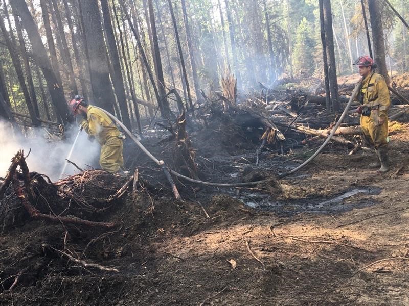 Crews work to extinguish hotspots along the Paskwa Fire perimeter, May 18, 2023
THE PASKWA FIRE | HWF030 | MAY 18, 2023 AS OF 8:30 PM
The Paskwa fire is located in the community of Fox Lake and was detected on May 2, 2023. This fire is classified as Out of Control (OC) and the last recorded size is 61,452 hectares. The fire is 1km inside the Wood Buffalo National Park boundary and is approximately 8km from the community of Garden River.
Today, crews began work to secure the northeast perimeter of the fire working along the retardant line on the flank closest to the community of Garden River. Members of the Incident Management Team were in the community to provide an update and answer question from residents about the status of the fire and to discuss conditions for the removal of the evacuation alert.
Members of the IMT also visited the community of Fort Vermillion to meet with evacuated residents of Fox Lake and provide information about the status of the fire and answer questions.
Work continues in the community of Fox Lake to create safe conditions to allow for re-entry, beginning with temporary access and escorted community visits. The Incident Management Team is working closely with the Little Red River Cree Nation to develop a timeline for when these visits may be able to occur. Access to the Little Red River cultural heritage site will also be facilitated once escorted visits to the community begin.
Today, a specialized tree-falling crew arrived and began to assess and remove dangerous trees in the community. Crews continue working to create an extinguished perimeter of approximately 30 metres around every structure, this objective will take time given the number of structures in the community.
Tonight a specialized drone equipped with infrared cameras will scan the community of Fox Lake and provide detailed locations of the remaining hot spots to help crews locate them for extinguishment. The drone will be requested again tomorrow evening to scan the southwest perimeter of the fire to identify any remaining hot spots along the control line.
ATCO crews are also working in the community to restore power and repair damaged lines.
There are 99 firefighters, 8 helicopters, and heavy equipment working on the Paskwa fire. Air tanker support is available as requested.
Little Red River Cree Nation has an evacuation order in place for the community of Fox Lake. The community of Garden River is on an evacuation alert. For information regarding the evacuation, please stay informed by visiting the Little Red River Cree Nation’s Facebook page.
Weather Forecast | Paskwa Fire (HWF030)
The Incident Management Team has a dedicated Fire Behaviour Analyst and therefore the weather briefing will be fire area specific. Hot and dry conditions continue with no significant rain in the forecast. Tomorrow the forecast is as follows, a temperature of 28 degrees and a relative humidity of 20 percent. Southeast wind in the morning that will switch to north wind of 20-35 km/h with gusts of 50 at midday due to a passing cold front.
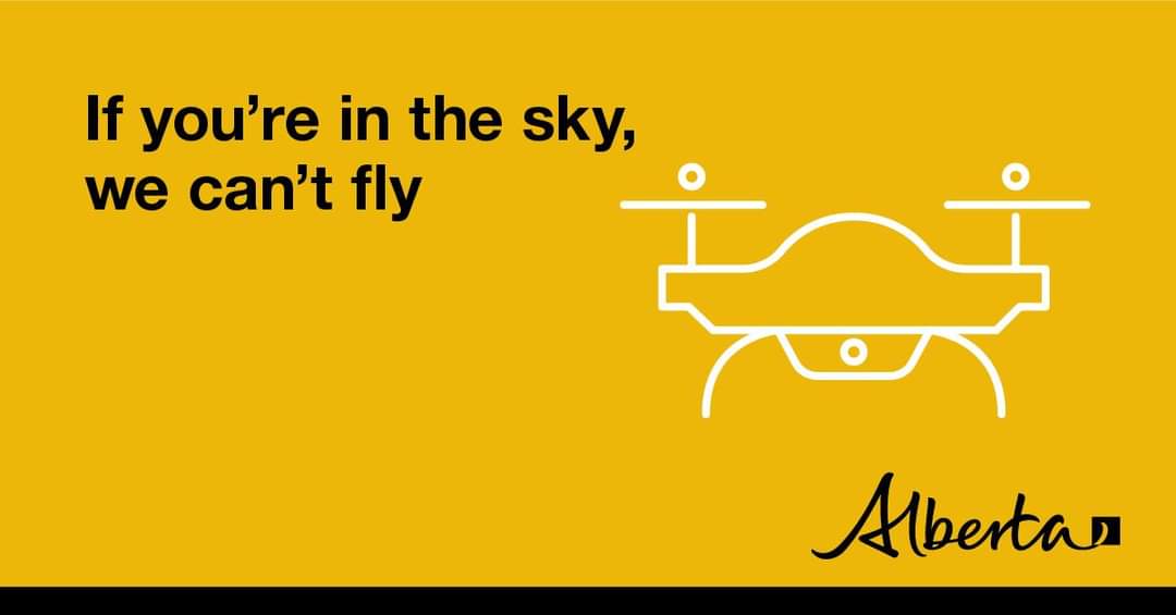
DO NOT FLY DRONES NEAR WILDFIRES!
The use of recreational drones over wildfires in Alberta is dangerous, illegal and could result in a fine of up to $15,000* for putting aircraft and people at risk. Please give Alberta firefighters the space they need to do their jobs safely.
*Transport Canada
ALBERTA STATE OF EMERGENCY
A provincial state of emergency has been declared. Albertans who require assistance can call 310-4455 for wildfire related information.


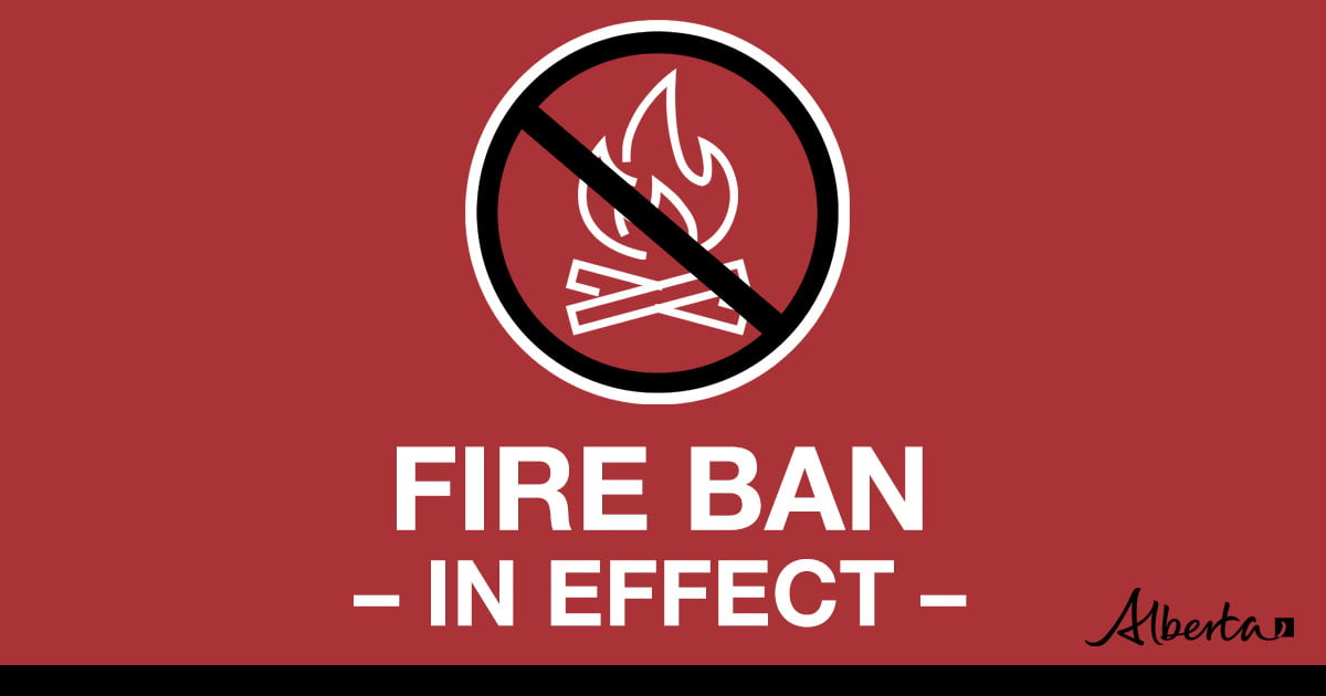
Under this fire ban:
•All existing Fire Permits are suspended (or cancelled)
•No new Fire Permits will be issued
Prohibited:
•All outdoor wood fires are banned, including wood campfires on public lands, wood campfires on private land and provincial campgrounds
•Backyard firepits
•BBQ charcoal briquettes
•The use of fireworks and exploding targets
•The recreational use of off-highway vehicles (OHV) on public lands, including designated OHV trails
Allowed:
•Propane/natural gas-powered appliances
•Open flame oil devices (e.g., turkey deep fryers, tiki torches)
•Indoor wood fires contained within a device with a chimney and spark arrestor
•All appliances must be CSA approved and used per manufacturer’s standards
•Indigenous people when using an OHV for traditional purposes. Traditional purposes are hunting, fishing, and trapping – including the use of an OHV to travel to the location(s) for these purposes.
•Essential industry-related activities requiring the use of OHVs.
•Off-highway vehicle use is still permitted on private lands.
WE URGE RESIDENTS AND RECREATIONALISTS TO USE EXTRA CAUTION
Due to the current dry grass, warm weather and possible windy conditions, there is an increased risk of wildfires in the Forest Area. We urge residents and visitors to exercise caution and take the following precautions:
- Do not start any fires or use open flames in areas that are susceptible to catching fire, such as near dry vegetation like grass or wooded areas.
- Dispose of cigarettes and other smoking materials properly, do not throw them on the ground.
- If you see a wildfire, immediately call 310-FIRE (3473) and report the location of the fire.
- Avoid using equipment that could generate sparks, friction or flames, such as power tools or lawn mowers, in areas with dry vegetation.
- Ensure grinders and welders are properly maintained and used in areas that are free from dry vegetation. Have sufficient water and tools on hand. Always keep watch of your surroundings and look around at regular intervals for smoke or flames that may have been accidently ignited.
We encourage everyone to stay informed about the current wildfire risk and to follow any guidance or orders from emergency personnel. By working together and taking proactive steps, we can help reduce the risk of wildfires in our community.
WILDFIRE INFORMATION
Download the Alberta Wildfire app today and get access to accurate, real-time information on wildfires in your area. You can also find information on fire advisories, restrictions and bans across the province and much more all on your mobile device. Available for Apple and Android.
Before heading out, please check albertafirebans.ca to determine whether there are any fire advisories, fire restrictions or fire bans in effect for your destination.
Subscribe to the High Level Forest Area Update to receive an email when new information is posted. Join the conversation on Facebook, Twitter or Instagram.
WILDFIRE LINKS AND TOOLS
Volunteers, equipment owners/operators or firefighters looking to assist with these wildfires or any of the wildfires within the province can contact EmergencySupportOffers@gov.ab.ca.
There are multiple EVACUATION ORDERS & ALERTS in the Province. Please visit Alberta Emergency Alerts or your community webpage for more information.
For road closure information, please visit: https://511.alberta.ca/#:Alerts
The NASA FIRMS Fire Information website is a great resource to give an idea of the location of wildfires in the area, but it should be noted that this data is based on interpolation and often can make a wildfire appear larger than it actually is.
Wildfire smoke is a tool used for the location of smoke firesmoke.ca
To see all the wildfires burning in Alberta click here.
.png?width=1200&name=wildfire%20app%20(2).png)
Victoria Ostendorf
Wildfire Information Officer
High Level Forest Area
Mobile: 780-841-9387
Email: victoria.ostendorf@gov.ab.ca
James Eastham (Paskwa Fire HWF-030)
Wildfire Information Officer
Email: james.eastham@pc.gc.ca
Mobile: 403-497-4839