

The wildfire danger is High in the High Level Forest Area. The Area received scattered rain showers which has helped with a reprieve in fire activity and has allowed firefighters to work safely however it was not wide spread nor a significant amount help the forest fuels long-term. The Fire Ban and OHV Restriction are still in effect until the Area receives a significant amount of rain.
Under this fire ban:
•All existing Fire Permits are suspended (or cancelled)
•No new Fire Permits will be issued
Prohibited:
•All outdoor wood fires are banned, including wood campfires on public lands, wood campfires on private land and provincial campgrounds
•Backyard firepits
•BBQ charcoal briquettes
•The use of fireworks and exploding targets
•The recreational use of off-highway vehicles (OHV) on public lands, including designated OHV trails
Allowed:
•Propane/natural gas-powered appliances
•Open flame oil devices (e.g., turkey deep fryers, tiki torches)
•Indoor wood fires contained within a device with a chimney and spark arrestor
•All appliances must be CSA approved and used per manufacturer’s standards
•Indigenous people when using an OHV for traditional purposes. Traditional purposes are hunting, fishing, and trapping – including the use of an OHV to travel to the location(s) for these purposes.
•Essential industry-related activities requiring the use of OHVs.
•Off-highway vehicle use is still permitted on private lands.
Stay away from active wildfire areas | For your safety and to ensure firefighters can do their job safely, please stay away from active wildfire areas. Your cooperation is essential.
Danger trees | Be extra cautious near burnt areas and avoid forested areas that have been recently affected by wildfire. Hazards remain from deep ash pits, burning peat and falling trees or branches, especially if windy.
Reporting wildfires | Please do not report smoke or flame from within an active wildfire area. Firefighters are diverted from essential tasks to respond to fires reported by the public. You may see smoke or flame within the existing boundary of a wildfire, this is normal.
Smoke | Lingering smoke may still be visible in some areas and in affected communities. Smoke inversions can trap air near the ground causing dangerous driving conditions and poor air quality. Please use extra caution when driving in smoky conditions, and take necessary precautions if you have smoke-related health concerns.
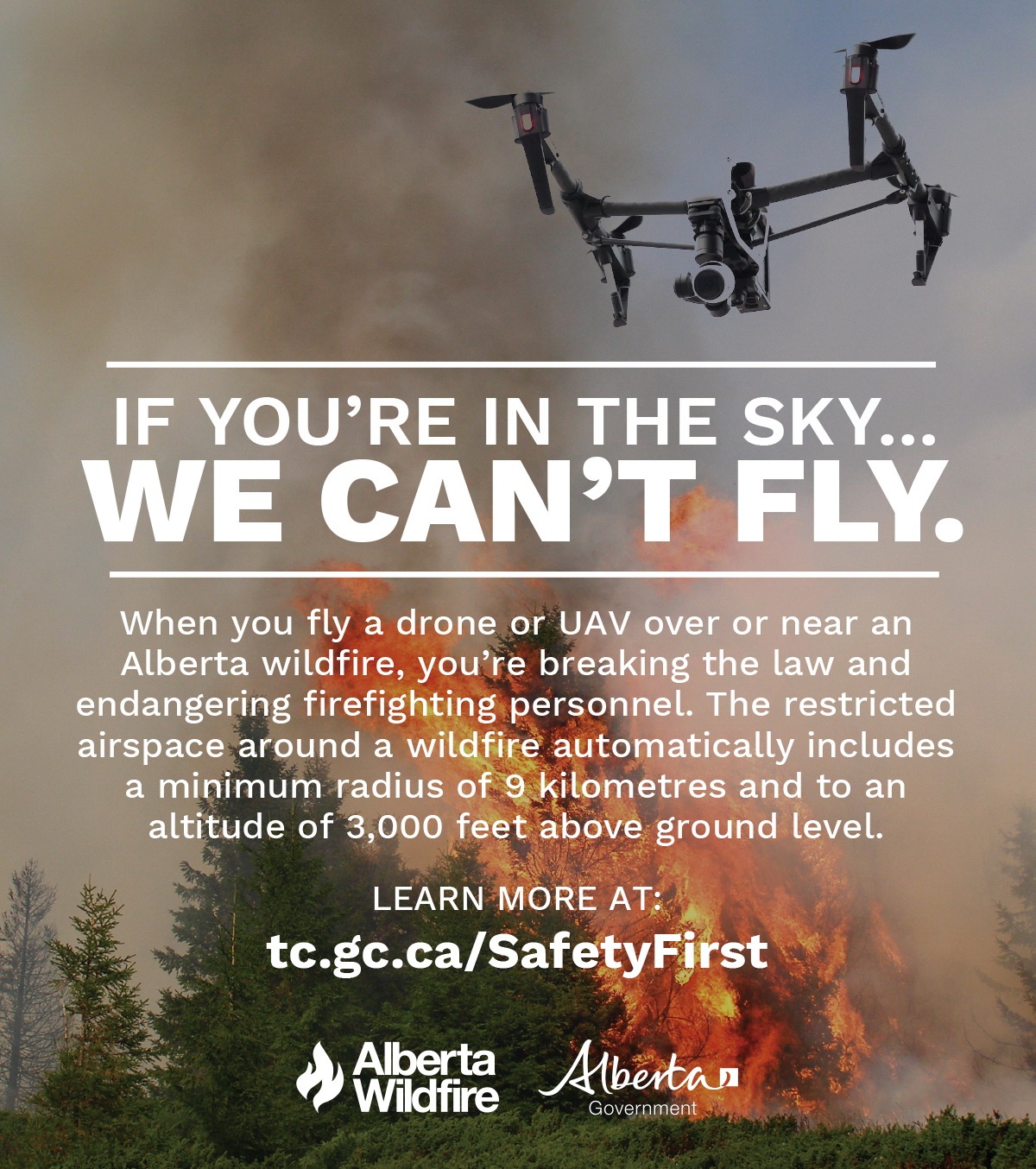
Drones | The use of recreational drones over wildfires in Alberta is dangerous, illegal and could result in a fine of up to $15,000* for putting aircraft and people at risk. Please give Alberta firefighters the space they need to do their jobs safely. *Transport Canada
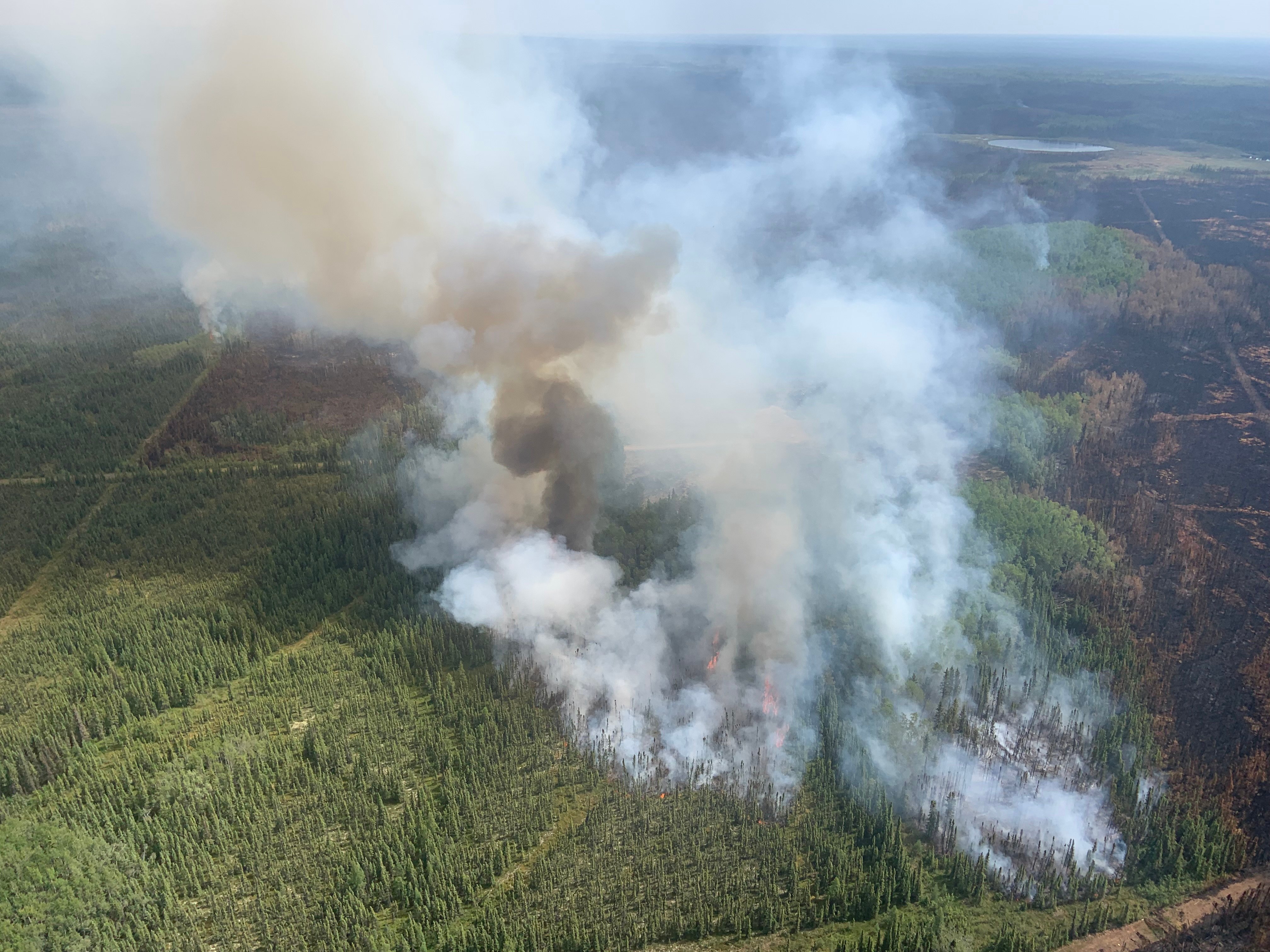
The Beach Road Fire, HWF064. This fire is classified as out of control (OC) at a last recorded size of 4,689 hectares. June 21, 2023.
There are 10 wildfires in the High Level Forest Area. Of these fires, five are classified as out of control (OC), and five are under control (UC). Firefighters responded to one new wildfire yesterday, fire HWF069. This fire is classified as under control (UC) at 0.1 hectares. Please see the updates below regarding information on the Paskwa Fire and the Long Lake Complex.
To see a map of the wildfires in the High Level Forest Area and across the province please click here.
THE BEACH ROAD FIRE | HWF064 | This fire was detected June 9th, 2023. This fire is classified as out of control (OC) with a last recorded size of 4,689 hectares. This fire is being managed by the High level Forest Area and there is an Incident Management Team now in place.
The fire is located approximately 10km northwest of Zama City. With the return in hot and windy conditions there was an excursion over the dozer guard on the south side yesterday afternoon however, crews, heavy equipment and helicopters were able to create new control lines and cool the area to prevent further spread. Alberta Wildfire and Mackenzie County continue to work together and monitor the situation closely.
Heavy equipment continues to create guards around the community. Structure protection units are in place in the community and are ready if needed. In addition, crews, heavy equipment and aircraft continue their work on the east and south sides of the fire.
THE LONG LAKE COMPLEX | HWF036, HWF058 and HBZ001 | JUNE 22, 2023 AS OF 12:00 PM
HWF036 | This fire was detected on May 3, 2023. This fire is classified as out of control (OC) with a last recorded size of 165,400 hectares. Firefighters, aircraft and heavy equipment have made great progress, therefore, 45 percent of the fire line is contained and being held.
Todays warmer weather is expected to bring a return in fire activity within the perimeter. The temperature will rise throughout the week and will hit high 20’s tomorrow.
The fire is still active on the western and northern border, moving towards the British Columbia border. Crews are monitoring the fire by air. If we see movement today due to the weather it will most likely be in this area.
The northeast guard protecting the community of Chateh continues to hold with limited activity fire along this edge. Firefighters continue to monitor and strengthen containment lines. Vegetation inside the fire perimeter continues to burn, we are still finding hot spots within the fire. Firefighters continue to black out and mop up hot spots as they arise.
Please be aware that there is still active fire burning in the area. Residents are reminded not to enter the fire area due to large number of firefighters, and equipment working. Burnt trees continue to fall which are dangerous.
HWF058 |This fire is located approximately 80 km southwest of the Town of High Level and approximately 17 km northwest of the of Paddle Prairie Metis Settlement boundary marker, where the Haig River meets the Chinchaga River. This fire is classified as out of control (OC) with an estimated size of 21,356 hectares.
Yesterday there was columns of smoke and increased activity, however there was no significant run of fire. Yesterday hot spots were bombed by airtankers and retardant was dropped on the eastern side of the fire to prevent further spread.
Crews are flying into the fire line daily as access is challenging. Dozers continue to work on the western edge of the fire along the power easement and the south west corner. Crews are also burning out the section in between the dozer guard and the edge of the fire.
The IMT continues to work closely with locals on understanding the local environment and getting access to the fire ground. A base camp for crews has been established at Keg River Camp, southwest of Paddle Prairie.
There are currently 320 personnel, 17 aircraft and 31 heavy equipment working across this complex of fires. The Incident Management Team continues to work closely with effected communities, First Nations and industry stakeholders.
BC have also observed increased activity with their three fires on the border. They are in remote country with no community and are being monitored by air. The Long Lake Fire complex Incident Management Team is in daily contact with the BC Wildfire Service. For more information on these fires please go BC Wildfire Service (gov.bc.ca)
Weather Forecast | Long Lake Complex
The forecast for today is as follows, a temperature of 25 degrees, a relative humidity of 25 percent with winds south/southwest 15 – 20km.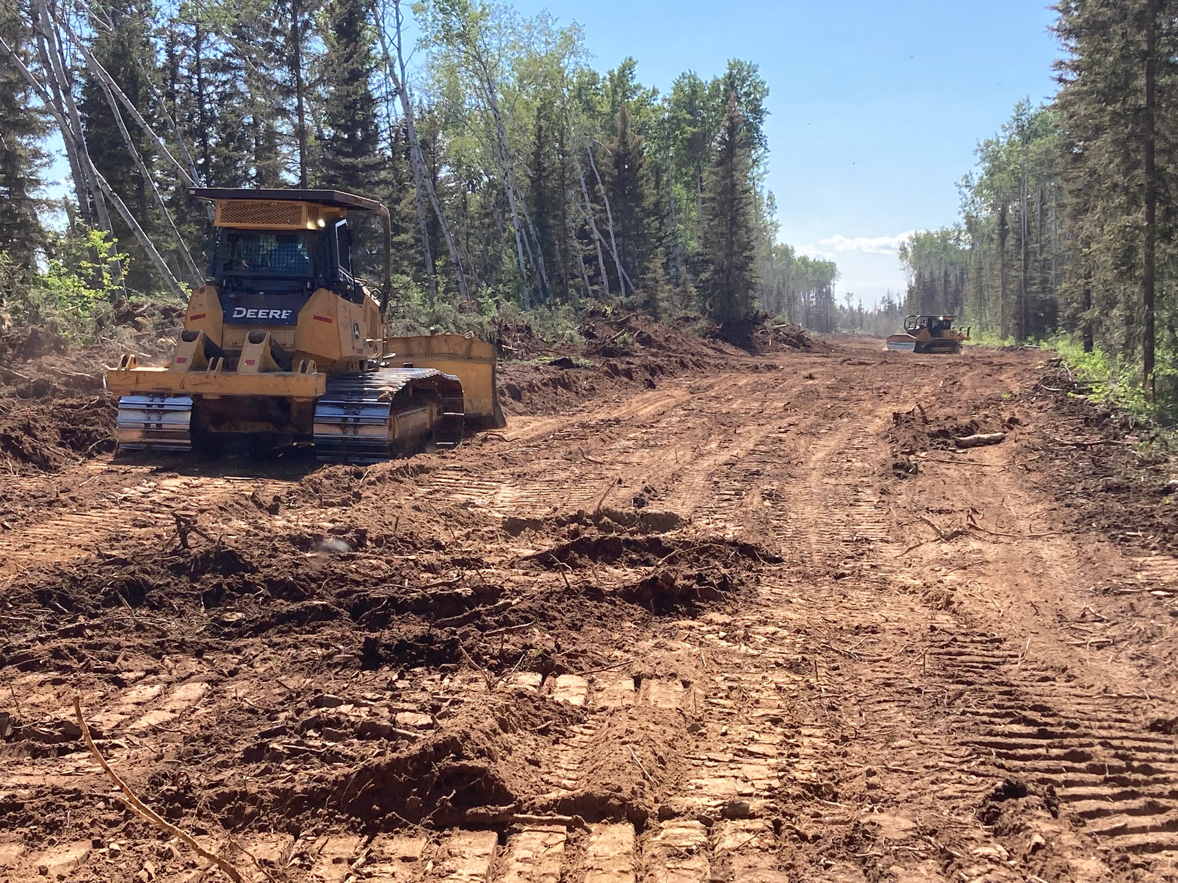
Heavy equipment creating guards on the Paskwa fire. June 22, 2023.
THE PASKWA FIRE | HWF030 | JUNE 22, 2023 AS OF 12:00 PM
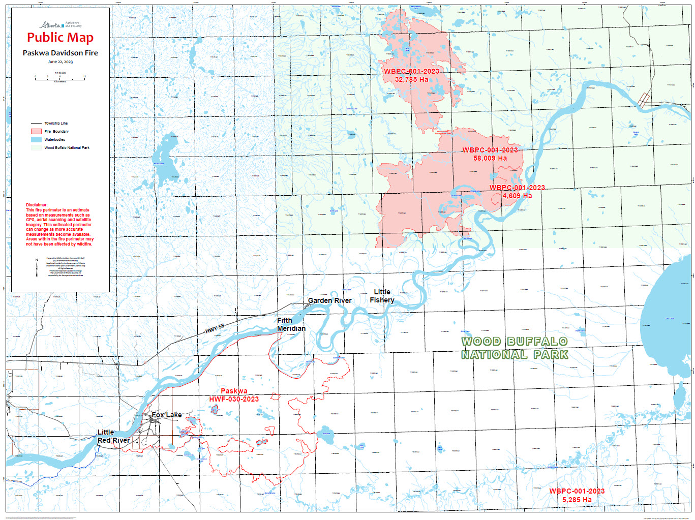
The Paskwa fire was detected on May 2, 2023. It extends along the south side of the Peace River from the community of Fox Lake into Wood Buffalo National Park and is approximately 8 km south of the community of Garden River. The wildfire is estimated at 96,582 hectares and this fire is classified as out of control (OC).
The top priorities for managing the Paskwa Fire are full extinguishment of fire in Fox Lake, protecting Garden River, and working toward securing the fire perimeter to prevent significant fire spread.
Smoke is lingering in the community of Fox Lake and ground crews are still working in the community actioning smokes with hand tools and water. Crews will continue to remove danger trees within the community as they’re spotted. These crews will be moved to action any surface fire if it arises in other areas of Fox Lake.
There are light-medium smokes surfacing in Fox Lake from within the burned-out fire perimeter as crews pile and burn off debris. This is a controlled and monitored practice to get rid of unwanted downed trees that have been piled to burn off and clean-up the wildfire zone. These burning piles are burning on bare mineral soil and are located away from any structures in town.
Now that work has been completed in Fox Lake to extinguish 75m (250 ft) perimeters around structures crews have moved to the roadways to extinguish hotspots 250 ft outwards. Heavy equipment is working around larger hotspot areas where there is still potential for fire spread when conditions are right.
The high-volume water system, water lines, and sprinkler systems on structures are in place in the community of Garden River and structural firefighters will be available as needed. These are proactive measures to ensure the community is prepared should the fires move closer to Garden River.
Parks Canada and Alberta Wildfire have come together in Unified Command, allowing these two agencies to work together closely and share resources to protect the community of Garden River.
Many aerial scans have been completed over the course of this wildfire event and will be ongoing. The information we receive from the data gives the operations team a better plan of action as to where the deep burning hotspots in the area.
There are 101 personnel supporting the Paskwa/Davidson fire response consisting of wildland and structural firefighters, incident management staff, and Paskwa Fire Base support staff. There are also 12 helicopters and 19 pieces of heavy equipment dedicated to the Paskwa/Davidson fire.
Evacuation Alerts and Information
Little Red River Cree Nation has an evacuation order in place for the community of Fox Lake. The community of Garden River remains on an evacuation alert. For information regarding the evacuation, please stay informed by visiting the Little Red River Cree Nation’s Facebook page.
Weather Forecast | Paskwa Fire (HWF030)
Today, a daytime temperature of 21 degrees with winds out of the east-southeast at 10-15 km/h. Relative humidity is 35 percent which is less moisture than what has been seen in the last few days. Firefighters are preparing to see an increase in fire behavior this afternoon and into the weekend as we start to see hot and dry conditions.
Davidson Lake fire (Wildfires 8, 9, 11, 13, 14) – Wood Buffalo National Park – June 21
Davidson Lake Fires were last estimated at 91,079 hectares and remains 6.2 km from the community.
After a combination of aerial assessment and satellite data, the fire size for the Davidson Lake Fires is currently estimated to be 97,230 hectares.
Chief Conroy Sewepagaham along with Councillor Leslie Joe Laboucan were up in the helicopter yesterday to gain situational awareness of both the Paskwa Fire and the Davidson Lakes Fires. It was an active day on the Davidson Lake Fires, particularly along the southern end of the fire. The fire has not moved towards Garden River and remains approximately 6.2km from the evacuation trigger.
The small spot fire near the south end of the fire around Trident Creek that was first observed on Sunday was secured by crews on the ground yesterday. It is currently contained and is boxed in by retardant; crews have a hose lay to the edge of the spot. Fire specialists will continue to monitor this area and it will continue to be actioned by crews on the ground. Bucketing operations continued along the head of the fire to limit spread, and this work will continue as needed today to address hotspots along the perimeter.
A new section of dozer line was established yesterday, running south along the edge of the fire from the old Peace Point Road to a wet area. It connects with the existing north dozer guard and will help keep that section of the fire from moving any further west. Heavy equipment will begin walking up towards the east flank of the fire over the next few days in order to create access for crews to respond with direct suppression, to keep the fire from hooking in towards Garden River from the north.
Crews are continuing to check on cabins in the vicinity of the fire and have been running sprinklers to keep the areas around them wetted down.
The community dozer guard north of Garden River is now complete, crews will work on cleaning this up today and then continue to widen the guard.
The update above has been provided by the Parks Canada Information Officer working on the Davidson Lake fire. For more information regarding fires burning within the Wood Buffalo National Park, please click here.
DO NOT FLY DRONES NEAR WILDFIRES!
The use of recreational drones over wildfires in Alberta is dangerous, illegal and could result in a fine of up to $15,000* for putting aircraft and people at risk. Please give Alberta firefighters the space they need to do their jobs safely. *Transport Canada
WILDFIRE INFORMATION
Download the Alberta Wildfire app today and get access to accurate, real-time information on wildfires in your area. You can also find information on fire advisories, restrictions and bans across the province and much more all on your mobile device. Available for Apple and Android.
Before heading out, please check albertafirebans.ca to determine whether there are any fire advisories, fire restrictions or fire bans in effect for your destination.
Subscribe to the High Level Forest Area Update to receive an email when new information is posted. Join the conversation on Facebook, Twitter or Instagram.
WILDFIRE LINKS AND TOOLS
Volunteers, equipment owners/operators or firefighters looking to assist with these wildfires or any of the wildfires within the province can contact EmergencySupportOffers@gov.ab.ca.
There are multiple EVACUATION ORDERS & ALERTS in the Province. Please visit Alberta Emergency Alerts or your community webpage for more information.
For road closure information, please visit: 511.alberta.ca
Wildfire smoke is a tool used for the location of smoke firesmoke.ca
To see all the wildfires burning in Alberta click here.
WILDFIRE PREPARDNESS | Learn how you can prepare yourself for a wildfire by clicking here.
.png?width=1200&name=wildfire%20app%20(2).png)
Victoria Ostendorf
Wildfire Information Officer
High Level Forest Area
Mobile: 780-841-9387
Email: victoria.ostendorf@gov.ab.ca