

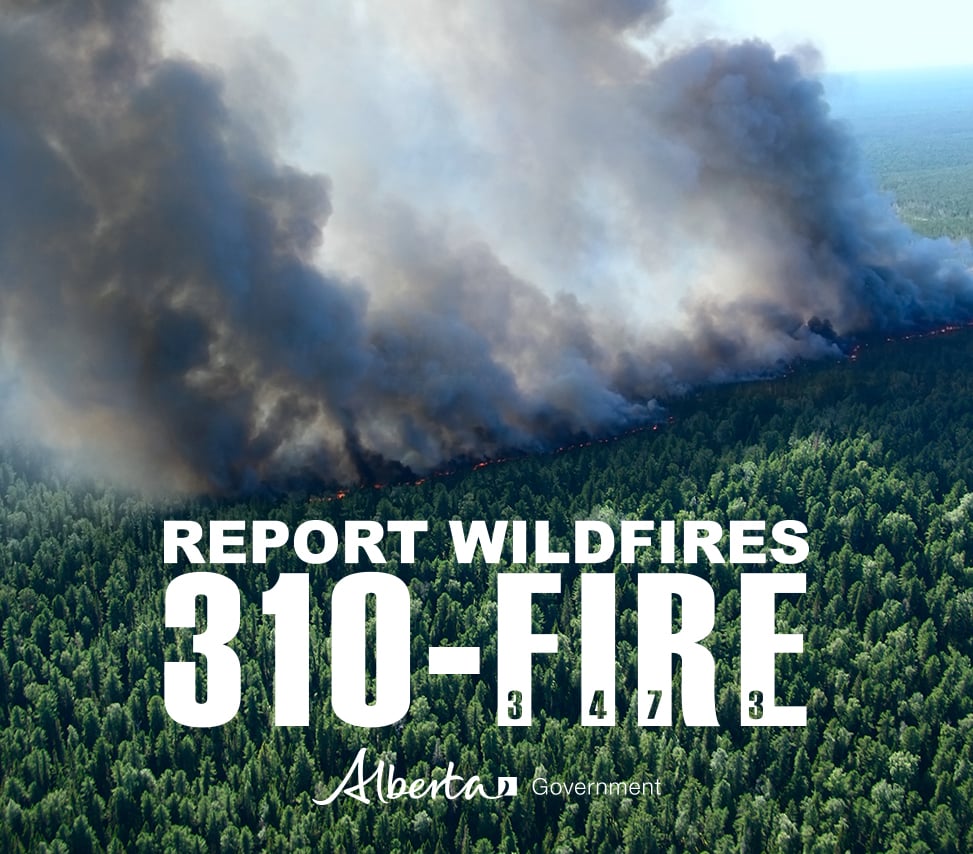
The wildfire danger is very high in the High Level Forest Area. The fire ban and off-highway vehicle restriction remain in effect. To report a wildfire please call 310-FIRE(3473).
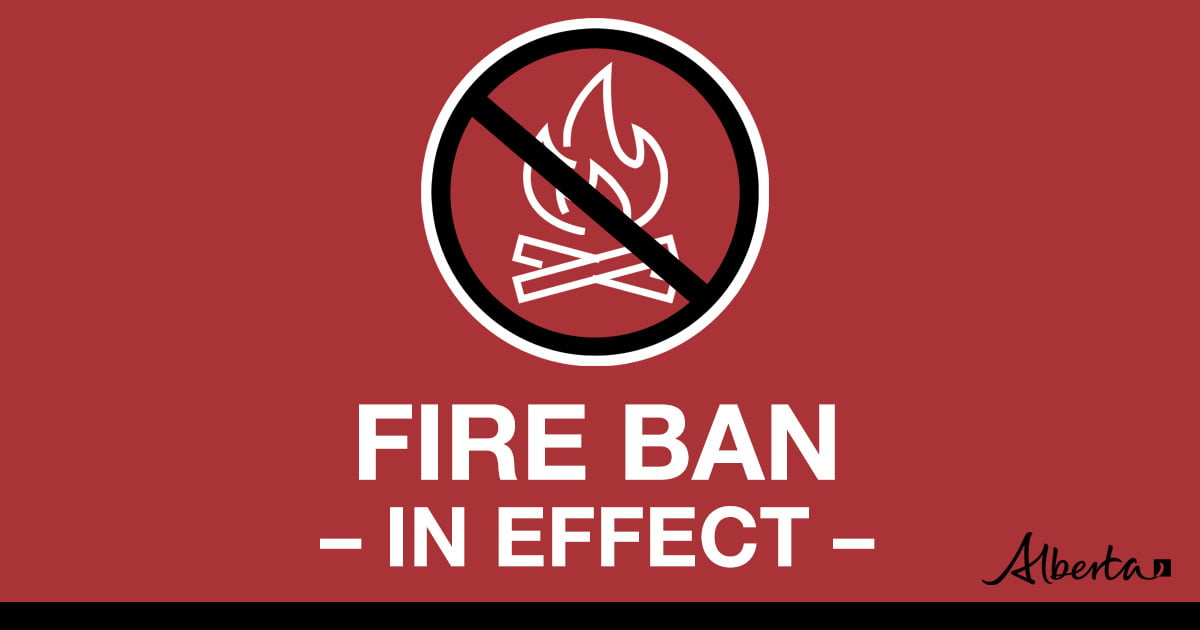

Under this fire ban:
•All existing Fire Permits are suspended (or cancelled)
•No new Fire Permits will be issued
Prohibited:
•All outdoor wood fires are banned, including wood campfires on public lands, wood campfires on private land and provincial campgrounds
•Backyard firepits
•BBQ charcoal briquettes
•The use of fireworks and exploding targets
•The recreational use of off-highway vehicles (OHV) on public lands, including designated OHV trails
Allowed:
•Propane/natural gas-powered appliances
•Open flame oil devices (e.g., turkey deep fryers, tiki torches)
•Indoor wood fires contained within a device with a chimney and spark arrestor
•All appliances must be CSA approved and used per manufacturer’s standards
•Indigenous people when using an OHV for traditional purposes. Traditional purposes are hunting, fishing, and trapping – including the use of an OHV to travel to the location(s) for these purposes.
•Essential industry-related activities requiring the use of OHVs.
•Off-highway vehicle use is still permitted on private lands.
Stay away from active wildfire areas | For your safety and to ensure firefighters can do their job safely, please stay away from active wildfire areas. Your cooperation is essential.
Danger trees | Be extra cautious near burnt areas and avoid forested areas that have been recently affected by wildfire. Hazards remain from deep ash pits, burning peat and falling trees or branches, especially if windy.
Reporting wildfires | Please do not report smoke or flame from within an active wildfire area. Firefighters are diverted from essential tasks to respond to fires reported by the public. You may see smoke or flame within the existing boundary of a wildfire, this is normal.
Smoke | Lingering smoke may still be visible in some areas and in affected communities. Smoke inversions can trap air near the ground causing dangerous driving conditions and poor air quality. Please use extra caution when driving in smoky conditions, and take necessary precautions if you have smoke-related health concerns.
Drones | The use of recreational drones over wildfires in Alberta is dangerous, illegal and could result in a fine of up to $15,000* for putting aircraft and people at risk. Please give Alberta firefighters the space they need to do their jobs safely. *Transport Canada
There are eight wildfires in the High Level Forest Area. Of these fires, three are classified as out of control (OC), one is being held and four are under control (UC). Due to the thunderstorm that passed through last night, firefighters responded to three new wildfires. To see a map of the wildfires in the High Level Forest Area and across the province please click here.
THE LONG LAKE FIRE | HWF036 | JUNE 5, 2023 AS OF 2:30 PM
The Long Lake fire (HWF036) was detected on May 3, 2023. This fire is classified as Out of Control (OC). The fire is currently 152,559 hectares in size. There was heavy smoke in Rainbow Lake this morning and visibility is limited.
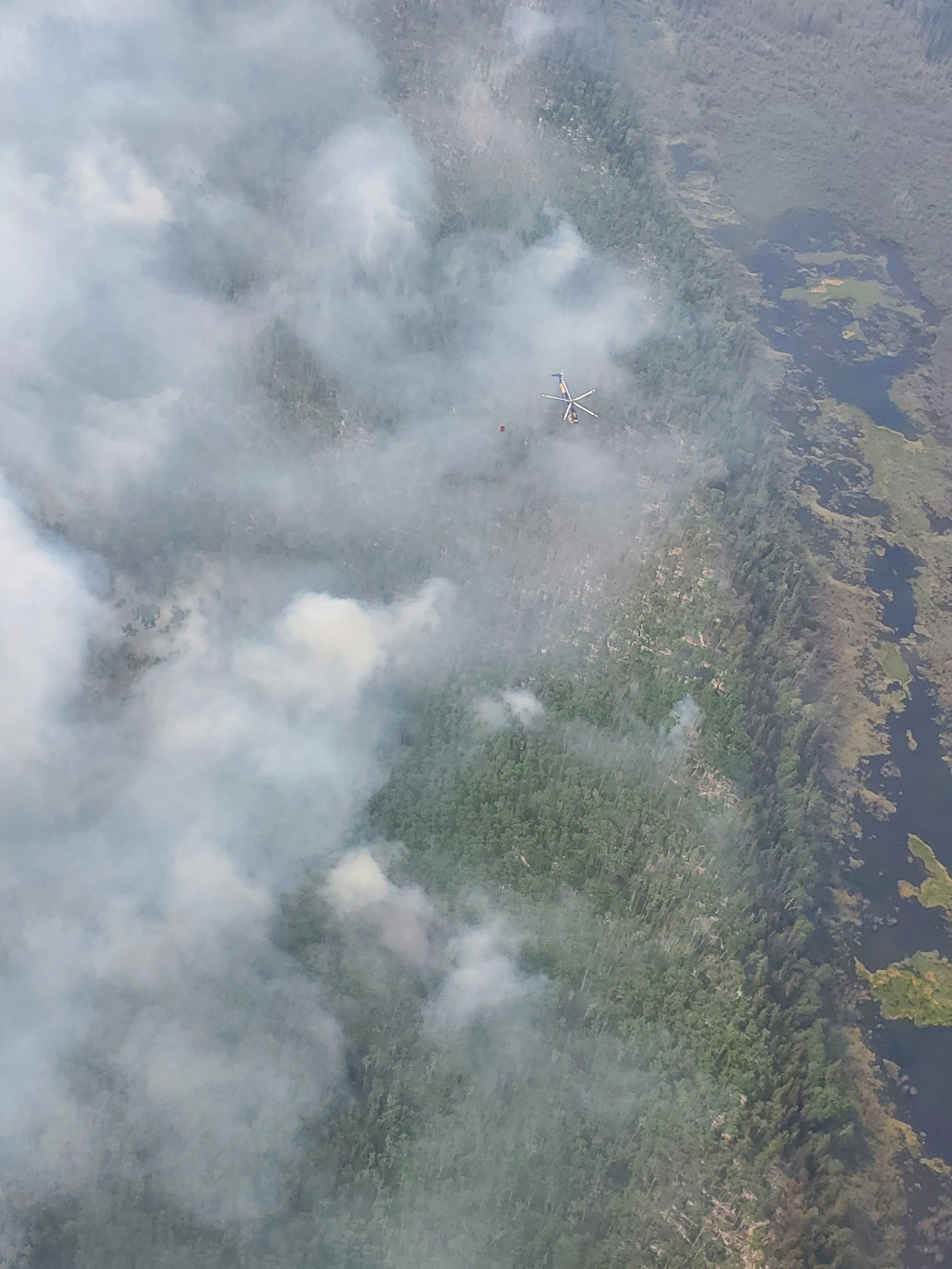
This fire continues to be active on the southwest side around the Baseline road area. Crews continue to monitor this section of the fire from aircraft. If conditions allow, crews will use hand ignition along Baseline Road to tidy up the fire edge and burn any unburnt vegetation.
There was increased fire activity south of the Cenovus gas plant towards the powerline. Fire reached within 2-3 kilometers of the powerlines on Friday but firefighters continue to actively monitor and control this by utilizing helicopters for bucketing and dozers. Large airtankers have also dropped retardant to provide extra protection. The fire hasn’t crossed the retardant line into the powerline at this stage.
The fire is also active west of the Town of Rainbow Lake moving towards the British Columbia border. The Incident Management Team at Rainbow Lake has been in daily contact with the team in Fort Nelson to develop a plan.
The northeast guard protecting the community of Chateh continues to hold with limited active fire along this edge. ATCO has restored power to the community of Rainbow Lake and Chateh. Re-entry to Chateh is planned for today, Monday June 5th.
Please be aware that there is still active fire burning in the area. Residents are reminded not to enter the fire area due to large number of firefighters, and equipment working. Burnt trees continue to fall which are dangerous.
Incident Management Teams from Canada, America and Australia and a number of helicopters are currently working at the Incident Command Post located at the Town of Rainbow Lake airport to support this fire. Please keep out of this area to allow firefighters to continue to do their job.
There are currently 192 personnel supporting the Long Lake Fire. Including wildland and structural firefighters, incident management staff and heavy equipment operators. There are also 9 helicopters and various pieces of heavy equipment dedicated to this fire.
Weather Forecast | Long Lake Fire
Today's forecast is as follow, a temperature of 19 degrees, a relative humidity of 25-30 percent, and winds southwest 10-15 km/h.
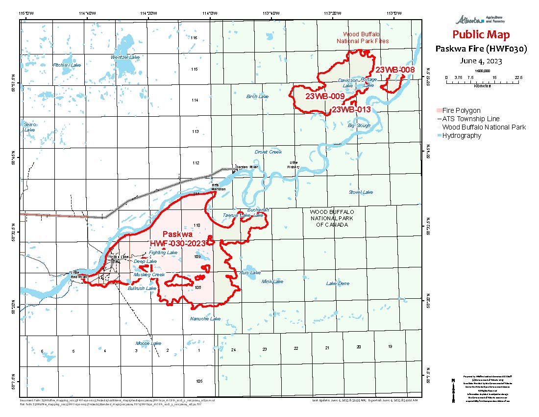
THE PASKWA FIRE | HWF030 | JUNE 5, 2023 AS OF 2:30 PM
The Paskwa fire is located in the community of Fox Lake and was detected on May 2, 2023. This fire is classified as Out of Control (OC) and the last recorded size is 95,389 hectares.
The top priorities for managing the Paskwa Fire are full extinguishment of fire in Fox Lake, protecting Garden River, and working toward securing the fire perimeter to prevent significant fire spread.
Winds were calmer yesterday than originally forecast, and good overnight recovery (low temperatures, and high humidity) kept fire activity low. Weather forecasts for today look good to get crews on the ground in key areas along the perimeter.
Fire crews will work near 5th Meridian to extinguish remaining hot spots in the fireguard along the northeast fire perimeter. Sprinklers are in place around 5th Meridian and hose line laid along the perimeter in that area. Helicopters will continue bucketing in the northeast to support this work. The fireguard is in place to prevent fire spread north of the Peace River and to protect the community of Garden River.
Work continues along the entire north-northeast perimeter to remove remaining forest fuels and extinguish hot spots, keeping the fire south of the Peace River.
On Saturday, to prevent fire spread to the south, four fixed-wing aircraft were dispatched to drop a line of fire retardant about 2km north of Nanuche Lake on the southeastern fire perimeter near the Wood Buffalo National Park boundary. Helicopters continue bucketing along the southeast perimeter, and fire crews will be on the ground today in the area east of Un’sko’wask’wuh Lake.
Work on the southwest perimeter is almost complete with only a few hot spots remaining along the 30m (100 foot) wide fireguard. Today, crews will be extinguishing these and other areas along the southern perimeter, to secure the fire perimeter from Little Red River to Muskeg Creek.
The high-volume water system, water lines, and sprinkler systems on structures are in place in the community of Garden River, and structural firefighters remain on standby. These are proactive measures to ensure the community is prepared should the fires move closer to Garden River.
Work continues in Fox Lake to extinguish 75m (250 ft) perimeters around structures and remove danger trees. Heavy equipment continues to clear around some of the larger fire areas to remove forest fuels helping the fire crews to extinguish these hot spots.
There are currently 184 personnel supporting the Paskwa Fire response including wildland and structural firefighters, incident management staff, heavy equipment operators, and Paskwa Fire Base support staff, as well as 12 helicopters dedicated to the Paskwa fire. Three additional heavy helicopters have been supporting fire operations over the last week.
Evacuation Information and Alerts
Little Red River Cree Nation has an evacuation order in place for the community of Fox Lake. The community of Garden River remains on an evacuation alert. For information regarding the evacuation, please stay informed by visiting the Little Red River Cree Nation’s Facebook page.
The community of Garden River is under an evacuation alert.
Weather Forecast | Paskwa Fire
Today the forecast is as follows, a temperature of 21 degrees, a relative humidity of 35-40 percent, and winds west to southwest 15-20 km/h.
Wood Buffalo National Park Fire Update| Davidson Complex
Davidson Complex consists of four fires (Fires 8, 9, 13 and 14) in the Davidson Lake area of Wood Buffalo National Park. Combined, the fires are around 28,615 ha (286.15km2) in size. The Davidson Complex is approximately 25km east of the community of Garden River. The fires do not currently pose a risk to the community. Parks Canada fire specialists have assessed the fires and are discussing potential containment options with members of the Little Red River Cree Emergency Management Team in Garden River. Sprinkler systems have been installed on at-risk cabins in the area, and crews continue to maintain these systems as conditions allow.
For more information regarding fires burning within the Wood Buffalo National Park, please click here.
DO NOT FLY DRONES NEAR WILDFIRES!
The use of recreational drones over wildfires in Alberta is dangerous, illegal and could result in a fine of up to $15,000* for putting aircraft and people at risk. Please give Alberta firefighters the space they need to do their jobs safely.
*Transport Canada
ALBERTA STATE OF EMERGENCY
A provincial state of emergency has been declared. Albertans who require assistance can call 310-4455 for wildfire related information.
WILDFIRE INFORMATION
Download the Alberta Wildfire app today and get access to accurate, real-time information on wildfires in your area. You can also find information on fire advisories, restrictions and bans across the province and much more all on your mobile device. Available for Apple and Android.
Before heading out, please check albertafirebans.ca to determine whether there are any fire advisories, fire restrictions or fire bans in effect for your destination.
Subscribe to the High Level Forest Area Update to receive an email when new information is posted. Join the conversation on Facebook, Twitter or Instagram.
WILDFIRE LINKS AND TOOLS
Volunteers, equipment owners/operators or firefighters looking to assist with these wildfires or any of the wildfires within the province can contact EmergencySupportOffers@gov.ab.ca.
There are multiple EVACUATION ORDERS & ALERTS in the Province. Please visit Alberta Emergency Alerts or your community webpage for more information.
For road closure information, please visit: 511.alberta.ca
Wildfire smoke is a tool used for the location of smoke firesmoke.ca
To see all the wildfires burning in Alberta click here.
.png?width=1200&name=wildfire%20app%20(2).png)
Victoria Ostendorf
Wildfire Information Officer
High Level Forest Area
Mobile: 780-841-9387
Email: victoria.ostendorf@gov.ab.ca