

If you see smoke or flame and suspect it's a wildfire, call 310-FIRE (3473).
Are you interested in being a wildland firefighter or crew leader/sub-leader for the 2025 season? Apply soon — more information below.
Firearms and fire suppression are not a good mix — see maps below for areas that hunters must avoid. Please also check the live interactive map ("Dashboard") before going into the backcountry.
Farmers and others are encouraged to get their burn and harvest permits now, while conditions are more conducive to safe burning — more information below.
This update is best viewed on a web browser or the AB Wildfire Status App | View previous High Level Forest Area Updates. Bold indicates new or important information.

HUNTERS AND OTHERS — PLEASE AVOID THESE AREAS
Please stay away from areas where we are still working to control and extinguish wildfires. Frontline firefighters and heavy equipment operators continue their work on the ground and their safety — and yours — is a top priority.
There are many hazards that may not be visible in burnt areas, such as deep burning ash pits and falling trees. Burnt trees are a serious hazard, and trees that may look healthy, which have green needles or leaves, could have burnt-out roots under the ground and fall unexpectedly onto you or the road and block your vehicle.
Never leave your cooking or warming fire unattended, and always ensure you fully extinguish it. Soak the ashes, stir them, and soak them again until they're cool to the touch.

Please stay away from areas where we are still actively working to control and extinguish wildfires: HWF072, which is approximately 150 km northwest of the Town of High Level, and north of Rainbow Lake along the B.C. border; and the five wildfires of the Semo Complex, which are approximately 120 km east of the Town of High Level, north of Highway 58 and the communities of John D'Or Prairie and Fox Lake, and northwest of the community of Garden River — towards the border with Wood Buffalo National Park.

This more detailed map of HWF072 (above) shows the area hunters and others are asked to stay well clear of. HWF072 is BEING HELD and is located approximately 150 km northwest of the Town of High Level and north of Rainbow Lake — along the Alberta-B.C. border.
HIGH LEVEL FOREST AREA | WILDFIRE SITUATION
There are currently 15 wildfires burning in the High Level Forest Area. Of these, 5 are being held and 10 are classified as under control. There is also one wildfire along the Alberta-N.W.T. border.
Since January 1, 2024, there have been 185 wildfires in the High Level Forest Area, burning a total of 326,627 hectares (ha).
HWF072, which is BEING HELD, is located 45 km west of Zama City and 60 km northwest of Chateh. This wildfire is estimated to be 35,914 ha in size. There are currently 81 firefighting personnel, 6 helicopters and 21 pieces of heavy equipment assigned to this wildfire. Heavy equipment operators continue working to establish and enhance containment lines — with a focus on the eastern perimeter and fully establishing 100-foot control lines along the southern perimeter of HWF061 — while firefighters and helicopters with buckets work on hotspots. With ongoing scans, as required, hotspots are being identified and those areas prioritized for firefighters. The investigation found that this wildfire was caused by lightning.
HTZ001 (bordering on the N.W.T. to the north) is UNDER CONTROL and being monitored. Please see NWT Wildfire Update Map and the South Slave SS009-24 Update for more information on the status of this and other fires on the N.W.T. side of the border.
HCX001 – Semo Complex (HWF061, HWF081, HWF083, HWF136, HWF141)
The Semo Wildfire Complex is located west of Garden River, and north of Fox Lake and John D'Or Prairie.
There are currently approximately 60 firefighters and support personnel, 5 helicopters and 15 pieces of heavy equipment associated to the Semo Wildfire Complex. Due to the progress made in controlling these wildfires, there is no longer be an on-scene incident management team assigned to this complex, which is now being managed from Fort Vermilion.
All remaining wildfires in the Semo Complex are under control — meaning they are completely contained and will be extinguished.
HWF061, the largest of the complex's wildfires (105,871 ha), was previously threatening the Little Red River Cree Nation communities of John D'Or Prairie and Fox Lake. This wildfire is located approximately 8.8 km northeast of the community boundary line of John D'Or Prairie, 10.7 km north of the community boundary line of Fox Lake, and 1.7 km north of Highway 58. This wildfire was determined to have been caused by lightning.
As we continue to make steady progress towards eventually extinguishing all wildfires in the complex, the number of resources (firefighting personnel, aircraft and equipment) continues to be gradually reduced. Adequate resources will be maintained to continue searching for and extinguishing remaining hotspots, reclamation, and monitoring of the entire complex.
Reclamation has begun on HWF061 and HWF136. This process, which is being done in close consultation with the Little Red River Cree Nation, involves turning the topsoil back over the containment lines, which were built by heavy equipment in areas that are no longer threatened by wildfire. Rolling back the topsoil will allow for new growth and re-generation of vegetation.
Heat scanning by rotor-wing aircraft continues, as required. These scans help firefighters locate hotspots, while positioning resources in priority areas to assist in controlling wildfires.
*You can view the location and statistics of these wildfires on our interactive map by following the active wildfire link. Visit our website to learn more about wildfire classifications.
COMMUNITY ENGAGEMENT - "NIGHT MARKET", OPEN HOUSE

-jpeg.jpeg?width=2000&height=1500&name=IMG_0260%20(002)-jpeg.jpeg)
Alberta Wildfire supported the Town of High Level's "Night Market" event at Jubilee Park (Oct. 5, 2024) — see above — providing attendees with information on campfire safety, safe burning of debris, and burn permits, while also facilitating the making of smores (marshmallows, chocolate and cookies combined) for about 200 adults and children.

Firefighters demonstrate the dangers of fire behaviour in homes and other structures (Sept. 30, 2024). Alberta Wildfire supported the La Crete fire department's open house, which was focused on fire safety.
IF YOU PLAN TO HARVEST IT, GET YOUR PERMIT
Personal Use Forest Products Permits are for small-scale personal use only (no resale) for Christmas trees, firewood or transplants. These free permits are available online or in person at your nearest forestry office. The PUFPP entitles individuals to:
- Cut up to three Christmas trees under 2.5 m (approximately 8 feet in height and no more than 15 cm in diameter at the stump).
- Transplant up to 20 trees less than 2.5 m in height.
- Cut up to 5 cubic metres (5 m3) of firewood. The number of trees cut depends on tree species and size and is approximately:
- 5 to 7 large coniferous trees (generally trees with needles), or
- 4 to 6 deciduous trees (generally trees with leaves), or
- 5 m3 is approximately 1.5 cords (approximately 3 level 1/2 ton pickup truck boxes). - Cut up to 5 m3 of roundwood timber (fence posts or poles).
PUFPPs authorize Albertans to cut and removed timber from designated Crown land only. The area-specific PUFPP document must be with you at all times while cutting or transporting trees from Crown land. In one 30-day period, a person can hold up to 4 permits – up to one permit each for:
- firewood
- Christmas trees
- roundwood
- transplants
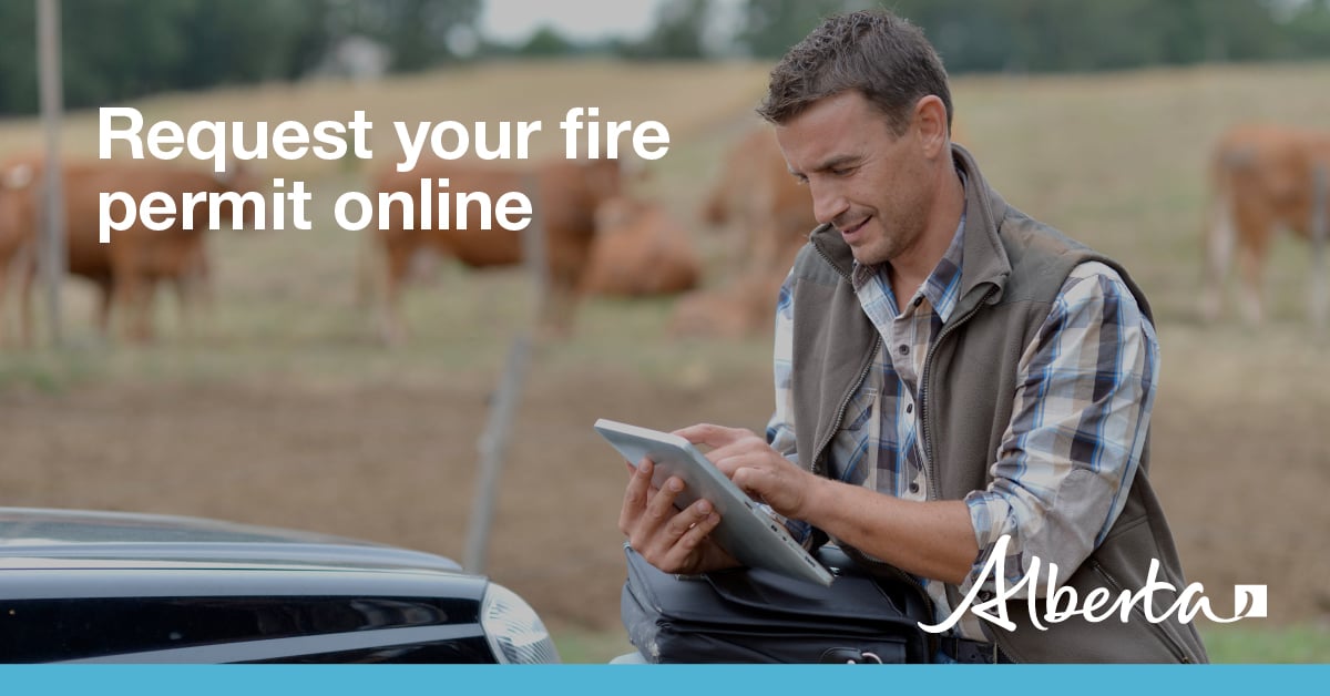
IF YOU PLAN TO BURN IT, GET YOUR PERMIT
Fire permits are now required for any outdoor burning with the exception of campfires.
Fire permits are free and can be requested online. Visit firepermits.alberta.ca to request your fire permit online. You may also request your fire permit by calling your local Forestry Office.
High Level Forest Area | Permit Line: 780-926-5407.
Stay informed of fire restrictions and fire bans in your area by checking Alberta Firebans.
WILDFIRE SAFETY MESSAGES
DANGEROUS TREES | Be extra cautious near burnt areas and avoid forested areas that have been recently affected by wildfire. Hazards remain from deep ash pits, burning peat and falling trees or branches, especially if windy.
SMOKE | Lingering smoke may still be visible in some areas and in affected communities. Smoke inversions can trap air near the ground causing dangerous driving conditions and poor air quality. Please use extra caution when driving in smoky conditions. To see forecasted smoke, please visit FireSmoke.ca. If you have smoke related health concerns, please visit or contact Alberta 811.
ALBERTA HEALTH WILDFIRE RESOURCES | You can visit Alberta Health Services for information on how you or your loved ones can access resources related to wildfire impacts and smoke concerns.
DRONES | The use of recreational drones over wildfires in Alberta is dangerous, illegal and could result in a fine of up to $15,000* for putting aircraft and people at risk. Please give firefighters the space they need to do their jobs safely. *Transport Canada.
WILDFIRE INFORMATION
- Visit firesmoke.ca to view smoke drifts in the area
- Call 811 for smoke-related health concerns
- For evacuation information, please visit https://www.alberta.ca/alberta-emergency-alert.aspx
- Download the Alberta Wildfire app today and get access to accurate, real-time information on wildfires in your area. You can also find information on fire advisories, restrictions and bans across the province and much more all on your mobile device. Available for Apple and Android.
- Before heading out, check the fire bans website or download the app to determine if there are any fire advisories, fire restrictions or fire bans in effect for your destination.
- Subscribe to the High Level Forest Area Update to receive an email when new information is posted. Join the conversation on Facebook, Twitter or Instagram.
- Missed an issue of the High Level Forest area Wildfire Update? You can find previous updates on our website.
- For evacuation orders and alerts in the Province visit Alberta Emergency Alerts or your community webpage for more information.
- For road closure information, visit Alberta 511 or download the app.
- To see all the wildfires burning in Alberta click here.
- Learn how you can prepare yourself for a wildfire with some tips and tricks on wildfire preparedness
