A fire ban remains in effect for the forest protection area of Alberta, including the High Level Forest Area.
The forest area may experience heavy smoke over communities at times. Contact 811 for wildfire and smoke-related health concerns.
If you see smoke or flame and suspect it's a wildfire, call 310-FIRE (3473).
This update is best viewed on a web browser or the AB Wildfire Status App | View previous High Level Forest Area Updates. Bold indicates new or important information.

Firefighters are busy searching for and extinguishing hotspots on many wildfires in our forest area. This takes time and energy. At times digging into the ground feeling for heat and dousing it with water. (July 24, 2024)
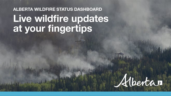
HIGH LEVEL FOREST AREA | WILDFIRE SITUATION
The wildfire danger in the High Level Forest Area is EXTREME. This means that forest fuels are extremely dry and pose a serious fire risk. Fast-spreading, high-intensity fires are likely, which are very difficult to contain and control.
There are currently 38 wildfires burning in the High Level Forest Area. Of these, 13 are out of control, 12 are being held, and 13 are classified as under control. Two of these wildfires are carry-over fires from the 2023 season. There are also two wildfires along borders: one shared with B.C. and one with the N.W.T.
Since January 1, 2024, there have been 151 wildfires in the High Level Forest Area, burning a total of 264,645 hectares (ha).
NASA FIRMS Fire Information website is a great resource to give an approximate location of hotspots in an area, but cannot always be used to determine specifically where a wildfire is burning. The heat from smoke columns, reflections from water and other heat signatures will appear on the map. It's important to note that the data is based on a mathematical estimate (interpolation) and can often make a wildfire appear larger than it actually is.
You can view the location and statistics of these wildfires on our interactive map by following the active wildfire link. Visit our website to learn more about wildfire classifications.
HIGH LEVEL FOREST AREA | ACTIVE WILDFIRES OF INTEREST
WEATHER FORECAST
Tomorrow, a high of 24C is expected, along with a relative humidity (RH) of 35 percent and winds from the northeast 15-20 km/h. There is a possibility of some precipitation.
HCX001 – SEMO COMPLEX (HWF053, HWF061, HWF081, HWF083, HWF136, HWF141)
The Semo Wildfire Complex is located north of John D'Or Prairie, Garden River and Fox Lake. A few of the wildfires in this complex are located within Caribou Mountains Provincial Park. An Incident Management Team is in place on this wildfire complex, and response efforts are being aided by firefighters from as far away as Alaska and Australia. Additional resources are en-route to replace fire crews and personnel who will be timing out in the coming days.
There are currently 396 firefighters and support personnel, 14 helicopters and 51 pieces of heavy equipment currently working on the Semo Wildfire Complex.
HWF061 is a lightning-caused wildfire currently burning OUT OF CONTROL and was last estimated to be 96,181 hectares (ha). This wildfire is approximately 19 km northeast of the community of John D'Or Prairie and approximately 15 km north of the community of Fox Lake.
HWF136 is currently burning OUT OF CONTROL at approximately 5,469 ha in size. This wildfire is now located adjacent to Highway 58, due to successful ignition operations on July 21. It remains north of Highway 58 and is an estimated 13 km northwest of Garden River.
HWF053 is currently burning OUT OF CONTROL. This wildfire is located directly above HWF061 and is estimated to be 709 ha in size. This wildfire is currently being monitored.
Other fires on this complex are within or nearby Caribou Mountain Wildland Provincial Park. Most of these wildfires have been determined to be caused by lightning, but the newer ones’ causes remain under investigation. These fires will be monitored by fire personnel, with aircraft and further support as required. These wildfires include: HWF141, which is currently burning OUT OF CONTROL north of HWF061 and east of HWF081, covering approximately 2,038 ha; HWF081, which is OUT OF CONTROL and last estimated at 48,190 ha; and HWF083, which is OUT OF CONTROL at 32,840 ha.
WILDFIRE OPERATIONS
Helicopters were able to fly late morning today, as visibility cleared. Air operations will occur until last light tonight, with helicopters bucketing water on more active areas of HWF061’s southern perimeter. Three air tanker groups were requested and laid long-term retardant down near the southern perimeter of the wildfire in key areas, with the goal of limiting southerly spread toward Highway 58. The use of night-vision helicopters has been ordered and their work will likely be targeting the southern perimeter as well.
Crews are keeping up the good work they’ve been doing on-the-ground. There are crews working west and east along HWF061’s perimeter from Foggy Tower Road, supported by heavy equipment pushing in containment lines (guards) ahead of them. Over on HWF136, Little Red River Cree Nation and other firefighters continued their work at extinguishing hot spots 100 feet into the fire’s perimeter, along Highway 58 and the containment access line. Further east on HWF136, a 20-person fire crew worked along the southeastern perimeter, following behind a heavy equipment group that is tight-lining the fire’s eastern edge. Tight-lining is when heavy equipment operators create containment lines as close to the fire’s edge as possible.
Heavy equipment operators were successful today at completing the full length of the eastern extension to the wider 20-km community containment line adjacent to Highway 58. The new line runs up to HWF136’s easternmost perimeter. With that mission complete, heavy equipment operators have started opening up access routes into additional areas of HWF061 along the southern perimeter and will work on that overnight.
Low-level, heat-scanning drones will fly the southwestern edge of HWF061 by Foggy Tower Road tonight. Fire personnel will use the information from the scans to inform containment strategies for both HWF061 and HWF136.
The structure protection unit (SPU) continues to assess and set up sprinkler systems and do FireSmart work throughout John D’or Prairie. Overnight, SPU teams will patrol Highway 58 for ember spread or spot fires. Tonight, three Little Red River Cree Nation fire trucks from John D’or, Fox Lake and Garden River will join the night watch.
WEATHER FORECAST | SEMO COMPLEX
Overnight, there’s an anticipated low of just 13C and a relative humidity (RH) of 80. Tomorrow, the temperature will be 18C, with a RH of 50. There will be winds stronger than we’ve seen on this wildfire complex for a few weeks with high gusting expected. These predominantly north winds, reaching gusts of up to 60 km/hr by tomorrow at midnight and extending into Friday may challenge the work that’s been done on these fires. There is a chance for precipitation starting tomorrow afternoon and continuing through until Friday. If we get precipitation, it will assist in firefighting efforts and should help with visibility issues, but in these extremely dry conditions, it is not enough sustained precipitation to make a large impact on wildfires.
EVACUATION ALERTS AND ORDERS
EVACUATION ORDERS are now in effect for all three LRRCN communities: John D'Or Prairie, Fox Lake and Garden River (July 20).
The Alberta Emergency Management Agency (AEMA) advises that Garden River is under an evacuation order, as of July 10. The communities of John D'Or Prairie and Fox Lake are now also under an evacuation order (effective July 20). For more details, please visit Alberta Emergency Alert.
You can also follow Little Red River Cree Nation’s (LRRCN) Facebook page for updates at https://www.facebook.com/lrrcn or their website at https://lrrcn.ab.ca/.

Expand (click) to view the full public map of the Semo wildfire complex.
HCX003 - MELVIN RIVER COMPLEX* | BISTCHO LAKE (part of HTZ001), HWF030, HWF047, HWF065, HWF072, HWF075 and HWF091
*The Amber River Complex (HCX002) has been blended into the Melvin River Complex.
An incident management team is responsible for the personnel and resources assigned to the Melvin River Complex and its eight wildfires: Bistcho Lake (HTZ001), HWF030, HWF047, HWF065, HWF072, HWF074, HWF075 and HWF091). There are currently 135 personnel, 20 helicopters and six pieces of heavy equipment working on the wildfires within this complex. The wildfires in this complex do not currently threaten any communities.
No growth was observed overnight on any of the wildfires in this complex (some rain has helped).
Our GIS mapping specialists have very recently completed a close reassessment of wildfire sizes across the High Level Forest Area, which accounts for the recent increases noted in the number of hectares burned on some of the wildfires in this complex.
As smoke has cleared overnight and into this morning, visibility has improved considerably, allowing for air operations and improved access for ground operations
HTZ001 is a mutual aid wildfire that originated in the border zone with the Northwest Territories (N.W.T.) in 2023. The BISTCHO LAKE section of HTZ001, which is estimated to cover an area of 95,000 ha, is actively burning on the NE and SE sides of Bistcho Lake, and its is currently burning OUT OF CONTROL. Some reassessments of structural protection are ongoing.
Please see NWT Wildfire Update Map and the South Slave SS009-24 Update for more information on their activities and wildfire status in the N.W.T. area.
HWF092 is located approximately 55 km north of the Town of High Level, is BEING HELD and is estimated to cover an area of 49 ha. With smoke clearing, the much-improved visibility has allowed access by air and heli-bucketing is expected today.
HWF091 is located NW of HWF065, is BEING HELD and is estimated to cover an area 3,492 ha. Monitoring of this wildfire is ongoing.
HWF072 is approximately 60 km northwest of Chateh, is burning OUT OF CONTROL and is estimated to cover an area 18,170 ha in size. Heli-bucketing is being conducted on the west side of this wildfire, as conditions and visibility permit.
HWF065 is currently BEING HELD and is estimated to cover an area 36,067 ha in size. This wildfire is about 2 km southwest of Bistcho Lake and was determined to have been caused by lightning.
HWF047 is burning OUT OF CONTROL and is now estimated to cover an area of 1,707 ha in size, after some growth was observed on the east side. This wildfire was determined to have been caused by lightning. Much-improved visibility has allowed access by air and some heli-bucketing is expected today.
HWF030 is BEING HELD and is estimated to cover an area 3,221 ha in size. The cause of this fire is under investigation. Heavy equipment work continues on perimeter areas of this wildfire. Much-improved visibility has allowed easier ground access. Fire crews are working on expanding containment lines to 100 feet, which is aimed at moving areas from containment to controlled, as conditions permit.
OTHER WILDFIRES IN THE HIGH LEVEL FOREST AREA
None of these other wildfires in the area (below) currently threaten any communities.
HWF147, which is now BEING HELD, is located 51 km west-southwest of Rainbow Lake and 85 km west-northwest of High Level. It is estimated to be 0.9 ha in size. There are four firefighters and two helicopters associated to this wildfire.
HWF146 is burning OUT OF CONTROL located 25 km east-southeast of Zama City. It is estimated to be 35 ha in size. There are 12 firefighters, two helicopters and two dozers associated to this wildfire.
HWF145 is burning OUT OF CONTROL located 24 km east-southeast of Zama City. It is estimated to be 26 ha in size. There are eight firefighters, one helicopter and two dozers associated to this wildfire.
HWF133 is burning OUT OF CONTROL and estimated to be 336 ha in size. The cause of this fire is under investigation.
HWF121 is burning OUT OF CONTROL and estimated to be 6,790 ha in size. The cause of this fire is under investigation.
HWF115 is classified as BEING HELD, which means that given current weather conditions and resources, the wildfire is not anticipated to grow past expected boundaries. It's now estimated to be 15 ha in size.
HWF102 is being held and estimated to be 6,958 ha in size. The fire was determined to have been caused by lightning.
To view these and other wildfires in the province, view our interactive map by following the active wildfire link.
PROVINCIAL WILDFIRE SITUATION (as of 10 a.m., July 24)
The fire danger is very high to extreme in the Fort McMurray and Lac La Biche Forest Areas. The northwest side of the province is mainly high to low. The southern parts of the province and agricultural zone remain extreme.
Since January 1, 2024 in the Forest Protection Area of Alberta, there have been 957 wildfires burning a total of 539,416 hectares (ha).
Last year, on this date, there were 912 wildfires that burnt a total of 2,178,074 ha. In the past five years on this date, an average of 761 wildfires had burnt an average of 628,241 ha.

Cities, towns, villages and summer villages, as well as federal lands (such as national parks), are exempt from this ban. These jurisdictions have the authority to issue their own bans and may have complementary bans in place.
Visit Alberta Fire Bans to see if a fire ban or restriction is in place in your area and learn what is prohibited and allowed under this ban.
The fire ban will remain in effect until conditions improve.
FIRE PERMITS REQUIRED
At this time, the High Level Forest Area is not issuing any permits. All existing permits are currently suspended.
High Level Forest Area | Permit Line: 780-926-5407. Stay informed of fire restrictions and fire bans in your area by checking Alberta Fire Bans.
DANGEROUS TREES | Be extra cautious near burnt areas and avoid forested areas that have been recently affected by wildfire. Hazards remain from deep ash pits, burning peat and falling trees or branches, especially if windy.
SMOKE | Lingering smoke may still be visible in some areas and in affected communities. Smoke inversions can trap air near the ground causing dangerous driving conditions and poor air quality. Please use extra caution when driving in smoky conditions. To see forecasted smoke, please visit FireSmoke.ca. If you have smoke related health concerns, please visit or contact Alberta 811.
ALBERTA HEALTH WILDFIRE RESOURCES | You can visit Alberta Health Services for information on how you or your loved ones can access resources related to wildfire impacts and smoke concerns.
DRONES | The use of recreational drones over wildfires in Alberta is dangerous, illegal and could result in a fine of up to $15,000* for putting aircraft and people at risk. Please give firefighters the space they need to do their jobs safely. *Transport Canada.
FireSmart is a national program that helps Canadians increase their resilience to wildfire. Whether you are a homeowner, resident, business, local government, or Indigenous community, you can take small steps with lasting impacts.
Vegetation management is the modification of wildland fuels for the purpose of mitigating the potential intensities and impact of wildfire. Vegetation management as a strategy for reducing wildfire hazard makes a lot of sense: wildfire requires fuel, in the form of vegetation, to burn. If we can change the fuel, we can change the wildfire's behaviour. For suggestions on landscaping tips, you can view the FireSmart Guide to Landscaping.
To learn more on how you can protect your home, visit FireSmart Alberta. For farm or acreages, you can download the Farm and Acreage FireSmart magazine.
WILDFIRE INFORMATION
- Visit firesmoke.ca to view smoke drifts in the area
- Call 811 for smoke related health concerns
- For evacuation information please visit https://www.alberta.ca/alberta-emergency-alert.aspx
- Download the Alberta Wildfire app today and get access to accurate, real-time information on wildfires in your area. You can also find information on fire advisories, restrictions and bans across the province and much more all on your mobile device. Available for Apple and Android.
- Before heading out, check the fire bans website or download the app to determine if there are any fire advisories, fire restrictions or fire bans in effect for your destination.
- Subscribe to the High Level Forest Area Update to receive an email when new information is posted. Join the conversation on Facebook, Twitter or Instagram.
- Missed an issue of the High Level Forest area Wildfire Update? You can find previous updates on our website.
- For evacuation orders and alerts in the Province visit Alberta Emergency Alerts or your community webpage for more information.
- For road closure information, visit Alberta 511 or download the app.
- To see all the wildfires burning in Alberta click here.
- Learn how you can prepare yourself for a wildfire with some tips and tricks on wildfire preparedness.