

The wildfire danger in the High Level Forest Area is VERY HIGH.
Mackenzie County has issued an evacuation notice (alert) for Zama. For more info, please visit the county's website or Facebook page.
PLEASE AVOID THE AREA AND DO NOT USE DRONES IN THE VICINITY OF ZAMA CITY. See details on this fire (HWF030), and fire suppression efforts, below under "Active Wildfires of Interest".

Effective June 25, a fire advisory is now in effect for the High Level Forest Area. Under this advisory:
- Existing fire permits are valid but extension requests may not be granted. Permit holders must follow the safe burning conditions outlined on the fire permit; and
- New fire permits will be issued on a case-by-case basis, for essential burning only.
Permitted:
- Safe wood campfires
- Backyard fire pits
- Portable propane fire pits
- Gas or propane stoves and barbecues
- Catalytic or infrared style heaters
Prohibited:
- Any burning without a valid fire permit, other than a campfire, is prohibited.
To learn more about the Alberta Fire Ban System, check out our video or visit AlbertaFireBans.ca.

HWF030 continues to burn approximately 8.5 km SW of Zama City (June 25 at 1:30 p.m.) — see below
HIGH LEVEL FOREST AREA WILDFIRE SITUATION
Active Wildfires of Interest
HWF030 - Amber River Fire (near Zama)
Alberta Wildfire personnel, aircraft and equipment operators are continuing to respond to this wildfire, which is currently out of control — meaning the wildfire is burning and is expected to continue growing — although there does not appear to have been any significant growth today. The fire remains approximately 8.5 km southwest of Zama City and is estimated to cover about 3,200 hectares (ha). The cause of this wildfire remains under investigation.
The evacuation notice (alert) for Zama, issued by MacKenzie County, remains in effect. For more information, please visit the county's website or Facebook page.
There are now 218 firefighting personnel on scene, along with nine helicopters (primarily for heli-bucketing) and heavy equipment operators that are actively engaged. Air tankers and other heavy aircraft remain on stand-by — for use as required, and as opportunities arise. We expect some additional firefighters and resources to arrive today.
The incident management team, which coordinates frontline operations and supporting resources, remains established in the Zama area.
Structural protection in key areas remains installed and ready to go, should it be required.
Two dozer groups have consolidated on the west side, while one dozer group is working from the north, and another from the south — all are focused on securing the perimeter areas that are accessible by heavy equipment, which we expect will be achieved by Wednesday morning. The work of fire crews on the SE, east and NE flanks continues to hold — and crews continue their work to more fully secure portions of the perimeter line (flanks) where we were not able to wrap with dozer guard. We estimate that 65 percent of the fire is now contained by dozer guard with further progress expected.Today, we expect to reach a high of 26 C, with a relative humidity (RH) between 20-30 percent and variable winds — shifting from E-SE at 5-10 km/h and NE-E at 5-10 km/h. Tomorrow (Thursday), we expected to reach a high of 24 C, with an RH of 20-25 and winds from the NE at 15-20 km/h — gusting to 35 km/h.

HWF044 is burning about 40 km NE of the Town of High Level (June 24 at 5:40 p.m.).
HWF044
Alberta Wildfire personnel continue to respond to this wildfire, which is approximately 40 km NE of the Town of High Level (near Ponton). This wildfire is considered to be out of control (OC), meaning the wildfire is burning and is expected to continue growing. The cause of this fire remains under investigation.
This wildfire is still estimated to be 40-percent contained and cover an area of approximately 115 ha.
There are still 33 firefighters on scene and four helicopters are being used for heli-bucketing in targeted locations, and to transport firefighters. Airtankers remain on stand-by ready to engage, as required.
Night-vision-equipped (NVIS) helicopters, using infrared technology, will again be used tonight to monitor fire behavior and support operational planning with its assessments, as we continue our efforts to contain and control this wildfire.
General Situation
There are currently seven fires burning in the High Level Forest Area — two are out of control (HWF030 and HWF044 — see above) and five are classified as under control. Two of these wildfires are carry-over fires from the 2023 season. Additionally, there are two wildfires along borders: one shared with B.C. and one with the N.W.T. (HTZ001, see below).
Since January 1, 2024, there have been 44 wildfires in the High Level Forest Area, burning a total of 4,014 ha (these numbers do not include the two border fires noted above).
Paskwa wildfire now extinguished
After extensive work over the winter and into the spring, including numerous infrared scans to identify hot spots — along with recent precipitation received — we are confident in changing the status of the Paskwa wildfire to extinguished (EX), effective June 10. This fire was referred to as HWF-030-2023 on the Alberta Wildfire app and webpage.
The Paskwa wildfire was a 2023 carry-over fire, which burned in the vicinity of several Little Red River Cree Nation communities, including Fox Lake, and caused significant damage to homes, infrastructure and the environment last year — impacting the lives of many in the area.
Our success in extinguishing the Paskwa wildfire is a result of a close working relationship and communication between Alberta Wildfire and the Little Red River Cree Nation. The support and cooperation of the nation chief and council, along with community members, have been very much appreciated.
Alberta Wildfire will continue to work closely with the Little Red River Cree Nation and its leaders — and surrounding communities within the High Level Forest Area and beyond — to enhance awareness and prevention efforts, thereby reducing the likelihood of significant wildfires, such as the Paskwa fire, impacting lives and livelihoods in the future.
CLASSIFICATIONS | Learn more about wildfire classifications.
LOCATIONS | View this wildfire on our interactive map by following the active wildfire link.
PROVINCIAL WILDFIRE SITUATION (as of 10 a.m., June 26)
The fire danger is very high in the northern part of the province. It is low to moderate for the central boreal and very high to extreme in the agricultural zone. The fire danger in the Rockies is high to very high.
Since January 1, there have been 479 wildfires recorded in the Forest Protection Area that have burned at least 31,318 hectares (ha). Last year, on this date, there were 703 wildfires that had burned 1,802,965 ha across the province. The five-year average — from January 1 to this date — is 559 wildfires, which had burned 529,868 ha across the province.
CLASSIFICATIONS | Learn more about wildfire classifications.
LOCATIONS | View this wildfire on our interactive map by following the active wildfire link.

Alberta Wildfire (Forestry and Parks) monitors all under control fires to locate and extinguish hot spots that may be found. Some of the remaining firefighters (above) assigned to the Cameron Hills wildfire (HTZ001), adjacent to the NWT border, work to extinguish hot spots in mid-June.
______________________________________________________________________________________
HTZ001 (Cameron Hills wildfire) is a mutual aid wildfire that originated in the border zone with the Northwest Territories (N.W.T.) in 2023. The Alberta portion of this fire, south of the border, is now classified as BEING HELD, which means that the wildfire is not expected to grow past its current boundaries — based on the resources available and weather forecasts.
On the Alberta side, this wildfire (HTZ001) is located near Indian Cabins, just south of the N.W.T. border. This recent burn within the High Level Forest Area covers an estimated 30,526 hectares (ha).
Given our success in managing this wildfire to date, the assigned Alberta Wildfire incident management team (IMT), which had been in place for about a month, has departed — leaving a reduced number of firefighters, support staff and aircraft on scene (along with some heavy equipment), as we continue to monitor this wildfire, extinguishing any hot spots found along the perimeters.
The aim of protecting critical infrastructure along Highway 35, including utilities and Indian Cabins, remains, and we will continue to work closely with our industry partners and N.W.T. counterparts to contain and control this wildfire (HTZ001).
Please see NWT Wildfire Update Map and the South Slave SS009-24 Update for more information on their activities and wildfire status in the N.W.T. area.
There remains the possibility of Highway 35 and surrounding roads being impacted. We urge all motorists to check Alberta 511 before travelling in the area — allowing extra time in case of road closures. For up-to-date information on highway closures, visit Alberta 511 or download the app.

A firefighter (above) works to extinguish a hot spot at the Cameron Hills wildfire (HTZ001) in June.
CARRY OVER WILDFIRES | There are three carry-over wildfires from the 2023 wildfire season. These fires are classified as under control (UC). High-level infrared scanning is being conducted by aircraft to determine if there are any other active spots in the forest area. The wildfires remaining on the landscape are being monitored for fire activity, and resources are being deployed to extinguish hotspots as they are discovered.
DANGEROUS TREES | Be extra cautious near burnt areas and avoid forested areas that have been recently affected by wildfire. Hazards remain from deep ash pits, burning peat and falling trees or branches, especially if windy.
SMOKE | Lingering smoke may still be visible in some areas and in affected communities. Smoke inversions can trap air near the ground causing dangerous driving conditions and poor air quality. Please use extra caution when driving in smoky conditions. To see forecasted smoke, please visit FireSmoke.ca. If you have smoke related health concerns, please visit or contact Alberta 811.
DRONES | The use of recreational drones over wildfires in Alberta is dangerous, illegal and could result in a fine of up to $15,000* for putting aircraft and people at risk. Please give firefighters the space they need to do their jobs safely. *Transport Canada.

COMMUNITY ENGAGEMENT
CANADA DAY (July 1)
Alberta Wildfire wishes everyone a very Happy Canada Day on July 1.

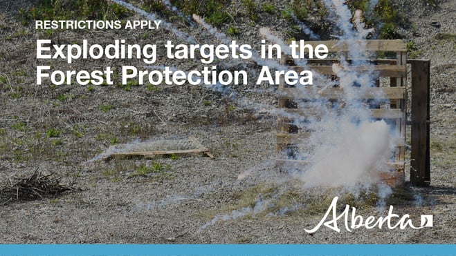
FIREWORKS
As the July long weekend approaches, many Albertans are preparing to celebrate with fireworks. While these displays can be thrilling, it’s crucial to remember that fireworks and exploding targets can pose a significant wildfire risk. The hot debris generated by these explosions can ignite dry grass and other forest fuels, leading to unintended wildfires. To prevent wildfires, the use of fireworks and exploding targets in the Forest Protection Area of Alberta requires written permission from a forest officer.
Please make your request at least three days before the long weekend to allow time for a necessary site inspection.
High Level Forest Area: 780-926-5407
For those celebrating outside the Forest Protection Area, different rules apply depending on your location:
- Town of High Level: Fireworks are allowed only for special town-sponsored events.
- Town of Rainbow Lake: Permit required; call the town office at 780-956-3934
By following these guidelines and obtaining the necessary permissions, you can help ensure a safe and enjoyable celebration for everyone.
FIRE PERMITS REQUIRED
All burning within the Forest Protection Area of Alberta requires a burn permit, with the exception of a campfire. At this time, the High Level Forest Area is issuing burn permits on a case-by-case basis.
High Level Forest Area | Permit Line: 780-926-5407. Stay informed of fire restrictions and fire bans in your area by checking Alberta Firebans.
SAFE CAMPFIRES
As the weather gets better and more of us head into the woods for some rest and relaxation please make sure you NEVER LEAVE A CAMPFIRE UNATTENDED.
Here are a few tips that will help ensure a safe campfire:
- Never leave your campfire unattended. Before you leave your campfire, ensure you fully extinguish it by soaking the ashes, stirring them and soaking them again until they are cool to the touch.
- Choose a safe site that is out of the wind and on bare mineral ground. Ensure that sparks can't fly into nearby dry fuels or grass. A spark will fly farther then you think.
- Ensure you have sufficient firefighting equipment including water near by. Don't take chances. A spark in dry grass will ignite easily and spread very quickly if the wind is present.
- Remember to visit albertafirebans.ca before heading out to find the latest information about fire bans across the province.
FireSmart is more than a collection of best-practices, programs, resources, and tools. FireSmart is a way of living with and managing the risk of wildfire. It is a shared responsibility between government, community leaders, neighbourhoods, and residents. Together, we can build a wildfire resilient Alberta. A FireSmart Alberta.
Your actions today can minimize wildfire damage to your home and property tomorrow. Flames aren’t the only threat. An estimated 90% of homes damaged or destroyed by wildfire are ignited by embers. By taking proactive FireSmart measures around your house and yard, you can increase your properties’ resistance to wildfire.
To learn more on how you can protect your home, visit FireSmart Alberta. For farm or acreages, you can download the Farm and Acreage FireSmart magazine.
WILDFIRE INFORMATION
Download the Alberta Wildfire app today and get access to accurate, real-time information on wildfires in your area. You can also find information on fire advisories, restrictions and bans across the province and much more all on your mobile device. Available for Apple and Android.
Before heading out, please check albertafirebans.ca to determine whether there are any fire advisories, fire restrictions or fire bans in effect for your destination.
Subscribe to the High Level Forest Area Update to receive an email when new information is posted. Join the conversation on Facebook, Twitter or Instagram.
-jpg-1.jpeg?width=70&height=70&name=Pic%20in%20helicopter%20in%20PR%20(April%202024)-jpg-1.jpeg)