

Please use caution when working or recreating outdoors and keep watch of your surroundings. Any spark, friction or hot exhaust could start a wildfire. If you see smoke or flame in the forest and suspect it's a wildfire, call 310-FIRE.
This update is best viewed on a web browser or the AB Wildfire Status App | To view previous High Level Forest Area Updates - Click here. Bold indicates new or important information.
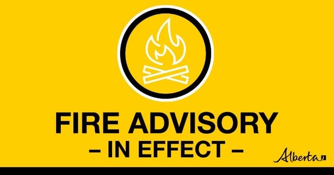
A fire advisory is in effect for the High Level Forest Area.
- Existing fire permits remain valid, but extension requests may not be granted.
- New permits will be issued on a case-by-case basis, for essential burning only.
- Campfires are allowed in both designated campgrounds and random camping areas.
- Fireworks and exploding targets are prohibited.
If you see a wildfire, report it immediately by calling 310-FIRE.
To learn more about the Alberta Fire Ban System, check out our video or visit AlbertaFireBans.ca.

HTZ001 (Cameron Hills): Islands of unburned vegetation burning within the perimeter yesterday, May 29, 2024.

HTZ001 (Cameron Hills): Islands of unburned vegetation burning within the perimeter yesterday, May 29, 2024.
HIGH LEVEL FOREST AREA | WILDFIRE SITUATION | MAY 30, 2024
There are currently 11 fires burning in the High Level Forest Area (HLFA). Of those wildfires, ten are classified as under control and one is classified as being held. Six of these under control wildfires are carry-over fires from the 2023 season. Additionally, there are three fires along borders: two shared with B.C. and one with the N.W.T.
Since January 1, 2024, there have been 40 wildfires in the HLFA, burning a total of 537 hectares (ha).
HTZ001 (Cameron Hills wildfire) is a mutual aid wildfire that originated in the border zone with the Northwest Territories (N.W.T.) in 2023. It is currently located near Indian Cabins, just south of the N.W.T. border. Crews worked on it into the fall and winter and the fire carried over into 2024. On May 10, the fire crossed Highway 35, near Indian Cabins and the Hay River, and on May 23 it spread north, crossing the border back into the N.W.T. It is estimated that since May 10, 30,046 hectares have burned, and the fire is now considered out of control. Please note that this affected area (30,046 ha) is not included in the total number of hectares indicated in the HLFA, as it is a mutual-aid wildfire with shared jurisdiction with the N.W.T.
As of 6 pm last night, a new Incident Management Team assumed command of this fire. They are deployed at the Steen River Incident Command Post. This is a regular practice where a fresh and rested team comes in to relieve their counterparts after approximately 14 days of deployment.
Yesterday, smoky conditions slowed the processes of getting crews out to the fire line, but everyone made it out to work on their assignments throughout the day. Much of the fire line is only accessible by helicopter and therefore transportation is weather dependent. The overcast skies and cooler conditions did benefit fire behaviour and containment lines built by firefighters and heavy machinery held. Crews continue to have success with various tactics including building dozer guard, laying hose line, finding, and extinguishing hot spots along the perimeter and using helibuckets. As winds picked up in midafternoon, columns of smoke could be observed within the fire’s perimeter. Islands of unburned vegetation were being consumed within the current boundaries of the fire and did not pose any threat to the highway or infrastructure. 182 firefighters and staff, 17 helicopters and 21 pieces of heavy equipment remain assigned to the incident.
All suppression efforts along the N.W.T. border are coordinated with the N.W.T. government. Please see https://www.gov.nt.ca/ecc/en/services/wildfire-update for more information on their activities.
Cooler temperatures and higher relative humidity are forecasted but the strong winds will challenge suppression efforts along the containment lines. Today, a high of 14 C is expected along with a low relative humidity of 35% to 40%, north to northwest winds at 25-30 km/h, but gusting to 45 km/h one to five millimetres of precipitation.
Highway 35 and surrounding roads may be impacted. We urge all motorists to check Alberta 511 before travelling in the area—allowing extra time in case of road closures. For up-to-date information on highway closures, visit Alberta 511 or download the app.
We ask that the public stay away from the area as firefighters and aircraft continue their work containing the spread of the wildfire. DO NOT use drones in the surrounding area of the wildfire. If you're in the sky, we can't fly.
HWF021 is classified as being held, estimated to be 378 ha in size and now a part of MCX001 wildfire complex with the Fort McMurray Forest Area. There are no threats to infrastructure or communities at this time. This wildfire is being actioned by firefighters and will be extinguished.
CLASSIFICATIONS | To learn more about wildfire classifications, click here.
LOCATIONS | To view this wildfire on our interactive map, click here and follow the active wildfire link.
CARRY OVER WILDFIRES | There are seven carry over wildfires from the 2023 wildfire season. These fires are classified as under control (UC). High-level infrared scanning is being conducted by aircraft to determine if there are any other active spots in the forest area. The wildfires remaining on the landscape are being monitored for fire activity, and resources are being deployed to extinguish hotspots as they are discovered.
SMOKE CONCERNS | Smoke may be visible in the High Level Forest Area. To see forecasted smoke, you can visit FireSmoke.ca. If you have smoke related health concerns, please contact Alberta 811.
.png?width=1200&height=676&name=wildfire%20app%20(2).png)
FIRE PERMITS REQUIRED
All burning within the Forest Protection Area of Alberta requires a burn permit, with the exception of campfire. At this time, the High Level Forest Area is not issuing any new burn permits and all existing permits have been suspended or cancelled.
High Level Forest Area | Permit Line - 780-926-5407. Stay informed of fire restrictions and fire bans in your area by checking Alberta Firebans.
More so than ever before, Canadians are feeling the direct and indirect impacts of wildfire. There is a growing need for FireSmart education. FireSmart Canada has developed a FREE one-hour course for those who are getting started with FireSmart and want to learn more. Follow the link by clicking here.
- Plan your high risk operations early in the morning when dew and humidity is higher in the dead grass and dry vegetation. Keep in mind that peak burning periods in our forest area are roughly between 1 p.m. and 7 p.m.
- Start from your headland (outer edge of the field) and work your way in. In the event a rock is struck and a spark is produced, the wildfire will be less likely to have vegetation to consume and easier to slow the spread.
- Ensure you clear all combustible materials away from points of ignition. Near heat shields, exhausts and wheel wells.
- Keep watch of your surroundings when working, you could accidently start a wildfire. Carry sufficient firefighting equipment and have a water source nearby.
To learn more on how you can protect your farm or acreage, you can also download the Farm and Acreage FireSmart magazine.
WILDFIRE INFORMATION
Download the Alberta Wildfire app today and get access to accurate, real-time information on wildfires in your area. You can also find information on fire advisories, restrictions and bans across the province and much more all on your mobile device. Available for Apple and Android.
Before heading out, please check albertafirebans.ca to determine whether there are any fire advisories, fire restrictions or fire bans in effect for your destination.
Subscribe to the High Level Forest Area Update to receive an email when new information is posted. Join the conversation on Facebook, Twitter or Instagram.
For more information, please contact:
Wildfire Information Officer