

A fire restriction remains in effect for the High Level Forest Area.
The wildfire danger in the High Level Forest Area remains EXTREME. This means that forest fuels are extremely dry and pose a very serious fire risk. Fast-spreading, high-intensity fires are likely, which are very difficult to control.
Tomorrow, strong gusty winds are expected. Please use caution when working or recreating outdoors and keep watch of your surroundings. Any spark, friction or hot exhaust could start a wildfire. If you see smoke or flame in the forest and suspect it's a wildfire, call 310-FIRE.
This update is best viewed on a web browser or the AB Wildfire Status App | To view previous High Level Forest Area Updates - Click here. Bold indicates new or important information.
 HTZ001 is experiencing intense fire behaviour and thick smoke this evening. Monitor Alberta 511 before travelling on highway 35 near the Northwest Territories border and surrounding area. (May 13, 2024 at 8:00 p.m.).
HIGH LEVEL FOREST AREA | WILDFIRE SITUATION | MAY 13, 2024
Since January 1, 2024, there have been 35 wildfires in the High Level Forest Area burning a total of 528 hectares (ha). Of these wildfires, five are classified as under control (UC).
HTZ001 is a mutual aid wildfire located near Indian Cabins that originated from the Northwest Territories in 2023. The fire crossed highway 35 near Indian Cabins and the Hay River on May 10. It continues to burn in the area.
Tomorrow, 48 firefighters will be assisted by six helicopters and 16 pieces of heavy equipment to build a containment line around infrastructure and prevent the spread of the fire. Heavy equipment are working both day and night, they've completed the dozer guard from the Hay River to the highway. They're now concentrating on the southwest side of the wildfire, anticipating growth in the coming days due to the winds. Firefighters are busy searching for and extinguishing hotspots in key areas on the perimeter to prevent it from spreading further.
This wildfire received small amounts of rain this morning and experienced a weather inversion until early this afternoon. Inversions cause the smoke to hover low to the ground. These conditions aren't great for aircraft, but allow firefighters more flexibly to work near the fire because the smoke keeps fire behaviour low.
At this time, the winds and dry conditions are creating intense fire behaviour and pushing the wildfire towards the Northwest Territories border. Highway 35 may be impacted this evening and into the night. We urge all motorists to check Alberta 511 before travelling in that direction.
Tomorrow, temperatures are expected to reach 16 degrees with 25 per cent relative humidity. Winds are anticipated to be from the west 15-20 km/h switching from the north later in the afternoon. This means that the wildfire is likely to grow towards the east, eventually moving towards the south later in the day.
There's a slight chance of precipitation expected in the coming days.
At this time, highway 35 remains open but conditions could change at a moments notice. Allow for additional time, expect delays and closures. For up-to-date information on highway closures, visit Alberta 511 or download the app.
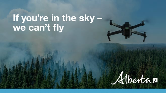
We kindly ask that the public stay away from the area as firefighters and aircraft work on containing the spread of the wildfire. DO NOT use drones in the surrounding area of the wildfire. If you're in the sky, we can't fly.
Additional information on this wildfire will be available tomorrow unless conditions change.
HWF021 is classified as being held, estimated to be 378 ha in size and now a part of MCX001 wildfire complex with the Fort McMurray's Forest Area. There are no threats to infrastructure or communities at this time. The wildfire is being actioned by firefighters and will be extinguished.
CLASSIFICATIONS | To learn more about wildfire classifications, click here.
LOCATIONS | To view this wildfire on our interactive map, click here and follow the active wildfire link.
CARRY OVER WILDFIRES | There are eight carry over wildfires from the 2023 wildfire season. These fires are classified as under control (UC). High level infrared scanning conducted by aircraft is being conducted to determine if there are any other active spots in the forest area. The wildfires remaining on the landscape are being monitored for fire activity and resources are being deployed to extinguish hotspots as they are discovered.
SMOKE CONCERNS | Smoke may be visible in the High Level Forest Area. To see forecasted smoke, you can visit FireSmoke.ca. If you have smoke related health concerns, please contact Alberta 811.

FIRE RESTRICTION IN EFFECT
Human-caused wildfires are entirely preventable. Use extreme caution if you are doing any work that will produce a spark, friction or hot exhaust. A fire will quickly spread in dry and dead grass. If you’re using your OHV, remember to stop often, cool down your machine and check your hotspots. Grass can get stuck in the hot areas of your OHV, heat up and start a wildfire when it falls to the ground.
Under this restriction:
- Existing fire permits are restricted, suspended or cancelled and no new fire permits will be issued.
- Safe wood campfires within fire rings in campgrounds are allowed.
Prohibited on public lands, including backcountry and random camping areas:
- All outdoor wood fires.
- Fires fueled exclusively by charcoal briquettes.
- The use of fireworks and exploding targets.
Allowed in designated campgrounds on private and public land, designated day use areas and on privately owned land:
- Safe wood campfires.
- Backyard fire pits, charcoal briquette barbeques.
- Propane/ natural gas-powered appliances CSA approved or UL certified
The fire restriction will remain in effect until conditions improve. To view restriction boundaries, visit AlbertaFireBans.ca.
To learn more about the Alberta Fire Ban System, check out our video.
SAFE CAMPFIRES
While it may feel like summer isn't here yet, the chance of a wildfire is very real. Wildfires can start anytime of year if the conditions are right. Note that during a fire restriction, no campfires are allowed on public lands. See fire restriction information.
Here are a few tips that will help ensure a safe campfire:
- Never leave your campfire unattended. Before you leave your campfire, ensure you fully extinguish it by soaking the ashes, stirring them and soaking them again until they are cool to the touch.
- Choose a safe site that is out of the wind and on bare mineral ground. Ensure that sparks can't fly into nearby dry fuels or grass. A spark will fly farther then you think.
- Ensure you have sufficient firefighting equipment including water near by. Don't take chances. A spark in dry grass will ignite easily and spread very quickly if the wind is present.
- Remember to visit albertafirebans.ca before heading out to find the latest information about fire bans across the province.
Alberta Wildfire typically sees an increase in human-caused wildfires during the spring and long weekends so do your part and prevent wildfires.
FIRE PERMITS REQUIRED
All burning within the Forest Protection Area of Alberta requires a burn permit, with the exception of campfire. At this time, the High Level Forest Area is not issuing any new burn permits and all existing permits have been suspended or cancelled.
High Level Forest Area | Permit Line - 780-926-5407. Stay informed of fire restrictions and fire bans in your area by checking Alberta Firebans.
More so than ever before, Canadians are feeling the direct and indirect impacts of wildfire. There is a growing need for FireSmart education. FireSmart Canada has developed a FREE one-hour course for those who are getting started with FireSmart and want to learn more. Follow the link by clicking here.
- Plan your high risk operations early in the morning when dew and humidity is higher in the dead grass and dry vegetation. Keep in mind that peak burning periods in our forest area are roughly between 1 p.m. and 7 p.m.
- Start from your headland (outer edge of the field) and work your way in. In the event a rock is struck and a spark is produced, the wildfire will be less likely to have vegetation to consume and easier to slow the spread.
- Ensure you clear all combustible materials away from points of ignition. Near heat shields, exhausts and wheel wells.
- Keep watch of your surroundings when working, you could accidently start a wildfire. Carry sufficient firefighting equipment and have a water source nearby.
To learn more on how you can protect your farm or acreage, you can also download the Farm and Acreage FireSmart magazine.
WILDFIRE INFORMATION
Download the Alberta Wildfire app today and get access to accurate, real-time information on wildfires in your area. You can also find information on fire advisories, restrictions and bans across the province and much more all on your mobile device. Available for Apple and Android.
Before heading out, please check albertafirebans.ca to determine whether there are any fire advisories, fire restrictions or fire bans in effect for your destination.
Subscribe to the High Level Forest Area Update to receive an email when new information is posted. Join the conversation on Facebook, Twitter or Instagram.
For more information, please contact:
