

The High Level Forest Area fire danger remains moderate despite the cooler temperatures and higher relative humidity due to very dry forest fuels. These dry conditions will not improve until the area receives significant rainfall.
If you see smoke or flame in the forest and suspect it's a wildfire, call 310-FIRE.

- New heavy fuel fire permits may be requested and will be evaluated on a case-by-case basis.
- Burn barrel permits can be requested and burn barrel permits that were issued in 2023 are active again.
- Backyard fire pits
- Portable propane fire pits
- Gas or propane stoves and barbecues
- Catalytic or infrared-style heaters
Stay away from active wildfire areas | For your safety and to ensure firefighters can do their job safely, please stay away from active wildfire areas. Your cooperation is essential.
Dangerous trees | Be extra cautious near burnt areas and avoid forested areas that have been recently affected by wildfire. Hazards remain from deep ash pits, burning peat and falling trees or branches, especially if windy.
Reporting wildfires | Please do not report smoke or flame from within an active wildfire area. Firefighters are diverted from essential tasks to respond to fires reported by the public. You may see smoke or flame within the existing boundary of a wildfire, this is normal.
Smoke | Lingering smoke may still be visible in some areas and in affected communities. Smoke inversions can trap air near the ground causing dangerous driving conditions and poor air quality. Please use extra caution when driving in smoky conditions, and take necessary precautions if you have smoke-related health concerns.
Drones | The use of recreational drones over wildfires in Alberta is dangerous, illegal and could result in a fine of up to $15,000* for putting aircraft and people at risk. Please give Alberta firefighters the space they need to do their jobs safely. *Transport Canada
WEATHER
The forecasted temperature today is 21 degrees, a relative humidity of 45 percent with west winds 15-20 km/h. There's a slight chance of rain showers for most of the forest area, with a possibility of lightning.
There is no special air quality statement issued for High Level. For more information please visit weather.gc.ca
HIGH LEVEL FOREST AREA | WILDFIRE SITUATION | AUGUST 12, 2023 AS OF 12:00 PM
There are 21 wildfires in the High Level Forest Area. Of these fires, one is classified as out of control (OC), 13 are being held (BH) and seven are under control (UC). To see a map of the wildfires in the High Level Forest Area and across the province please click here.
WILDFIRES OF INTEREST
HWF112 | This fire is located approximately 32 km north of highway 58, east of Wentzel Lake. This fire is classified as being held (BH) at a last recorded size of 32,158 hectares. This fire is being monitored by firefighters. There are no communities at risk at this time.
HWF102 | This is located approximately 18 km north of highway 58. The wildfire is classified as under control (UC) at a last recorded size of 1,166 hectares. There are 21 firefighters, two helicopters and heavy equipment working on this fire. Crews are working to establish and strengthen control lines on the west and east sides of the fire, working towards the south. There are no communities at risk at this time.
HWF064 | This fire was detected June 9, 2023. This fire is classified as under control (UC) with a last recorded size of 6,175 hectares. The fire is located approximately 10 km northwest of Zama City. Firefighters are monitoring this wildfire and will respond as needed.
HWF030 | THE PASKWA FIRE
The Paskwa fire was detected on May 2, 2023. It extends along the south side of the Peace River from the community of Fox Lake into Wood Buffalo National Park and is approximately 8 km south of the community of Garden River. The wildfire is 96,582 hectares in size and is classified as being held (BH). Being held means given current weather conditions and resources, the wildfire is not anticipated to grow past predetermined boundaries.
Crews continue their work in Fox Lake going house to house to extinguish 250 feet around each structure and 250 feet along roadways. The crews are currently concentrating on the east side of the Paskwa field and the other areas that were identified during an infrared scan.
There are areas within the community where the fire is burning deep in peat moss. Extinguishing peat fires causes additional challenges. These fires burn deep into the ground and often need to be dug out and drowned in water. If they aren't properly extinguished, peat fires can burn under ground for weeks and even through the winter months. They can creep underground and resurface later, in new locations.
There are 16 firefighters and four water trucks searching for and extinguishing hotspots near the community. They're assisted by other heavy equipment and two helicopters.
THE OWL COMPLEX | AUGUST 12, 2023 AS OF 12:00 PM
The High Level Forest Area is managing wildfires HWF072, HWF138, HWF083, HWF087, HWF092, and HWF142.
HWF072 | This fire is classified as under control (UC) at 30,123 hectares. The fire is approximately 14 km southwest of the South Tall Cree boundary at highway 88. Very little activity was observed on the wildfire and firefighters expect the low fire behaviour to continue as cooler temperatures and possible rain showers are in the forecast.
This week, crews will continue to search for and extinguish hotspots near Waldin Lake and the northern perimeter of the wildfire. Reclamation of dozer guards in areas where there's no concern for re-ignition is being planned and will begin in the coming weeks.
HWF083 | This fire is classified as being held (BH) at 13,700 hectares. It is located approximately 34 km southeast of the South Tall Cree boundary at the Wabasca River. No communities are currently at risk. Firefighters are monitoring this fire.
HWF087 | This fire is classified as being held (BH) at 12,508 hectares. This fire is located approximately 3 km south of Harper Creek. No communities are currently at risk. Firefighters are monitoring this fire.
HWF142 | This fire is classified as under control (UC) at 15 hectares. No communities are currently at risk. Firefighters will continue to monitor this fire.
Resources
There are 41 firefighters, four helicopters and heavy equipment working on this complex. Airtankers are available as needed.
THE BASSET COMPLEX | AUGUST 12, 2023 AS OF 12:00 PM
An Incident Management Team (IMT) is managing wildfires HWF058 and HWF138 within the High Level Forest Area, as well as wildfires PWF067, PWF079, and PWF114 within the Peace River Forest Area.
HWF058 | This wildfire is located about 12 km northwest of the Paddle Prairie Metis Settlement boundary marker, where the Haig River meets the Chinchaga River. It is classified as out of control (OC) at 39,324 hectares.
This wildfire did not receive significant enough rainfall to improve the dry forest fuels and firefighters anticipate increased fire behaviour in the next several days as warming and drying conditions continue into the weekend.
The south and southeastern part of the wildfire remains quiet but firefighters continue to monitor and extinguish hotspots in this area when they're identified.
Firefighters continue to build containment line from the northwest to the southeast point to prevent unburnt fuel in the "bowl" on the northern portion of the wildfire to spread outside of the boundary. Good progress is being made by crews on the southeast side where they're putting out hotspots.
Low to moderate fire behaviour was observed again yesterday on the western edge of the wildfire. Firefighters are finding the terrain challenging due to very wet areas.
The area of the fire that crossed to the east side of the Chinchaga River is about 15 km north of where the Haig River meets the Chinchaga River. This area is secured and contained.
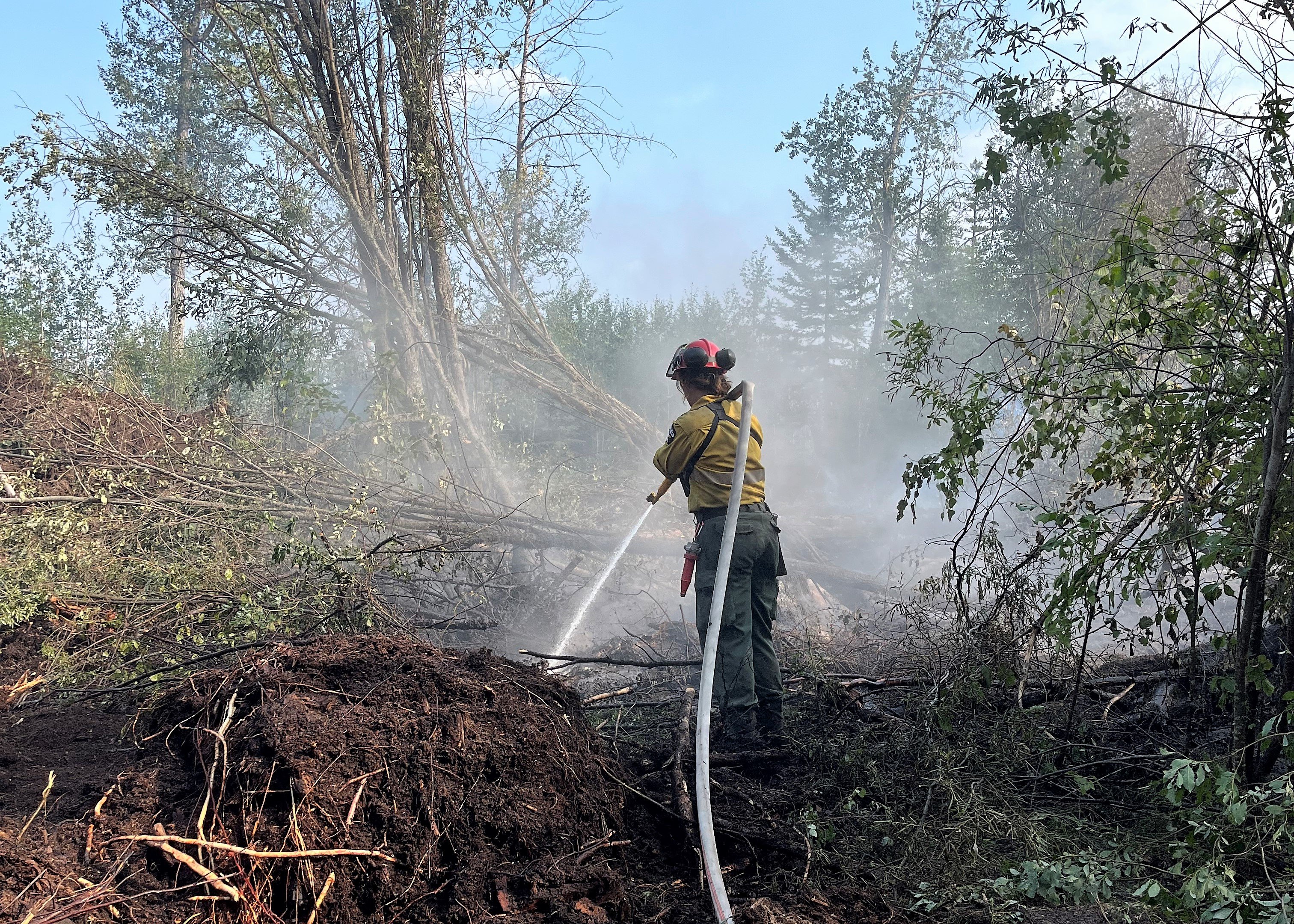
A unit crew member is searching for and extinguishing hotspots which is called "hotspotting". This is a very crucial part of fighting wildfire and takes a lot of time and handwork. Firefighters must find the hotspots, often down on hands and knees feeling around with their bare hands. Hotspots that aren't extinguished properly could re-ignite and continue to burn later on. (Unit crew member on HWF058 August 11, 2023).
PWF067 | This wildfire is located 9 kilometers west of highway 35 and 10 km south of the Keg River. It is classified as being held (BH) at 5,248 hectares. Hotspots are still being found on this wildfire and firefighters assisted with helicopters will be returning to extinguish them. The wildfire will be monitored closely as drying, warming and windy conditions are expected through the weekend.
PWF079 | This wildfire is classified as under control (UC) at 3 hectares. Firefighters continue to monitor this wildfire.
Resources
There are 94 firefighters and support staff working on the Basset Complex with 12 helicopters and heavy equipment. Firefighters from Australia, New Zealand, United States, South Africa and Alberta are currently working on this wildfire.
Weather
Today the forecasted temperature is 23 degrees, a relative humidity of 35 percent with west winds 15-20 km/h, gusting up to 40 km/h and no chance of rain showers.
THE LONG LAKE FIRE | AUGUST 12, 2023 AS OF 12:00 PM
An Incident Management Team (IMT) is managing fires HWF036 and HBZ003.
HWF036 | This wildfire is classified as being held (BH) at 185,528 hectares. Being held means that given current weather conditions and resources, the wildfire is not anticipated to grow past expected boundaries.
Firefighters and heavy equipment continue to strengthen and extend the containment lines in key areas to prevent the spread of the wildfire. Helicopters and crews continue to work to protect critical infrastructure on the west side. The northeast guard protecting the community of Chateh continues to hold.
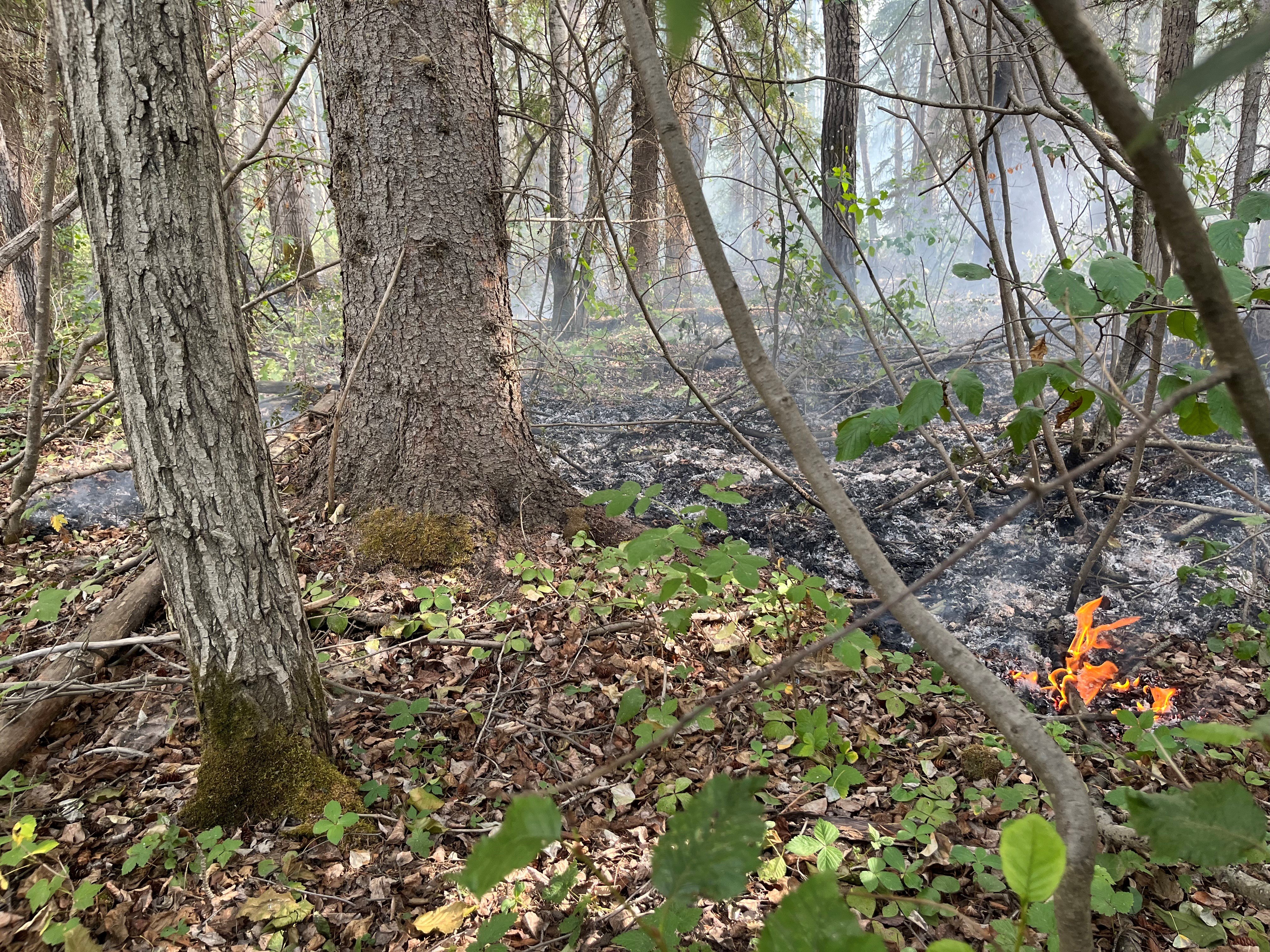
Low to moderate fire behaviour was observed yesterday. The northwest corner was most active, producing significant smoke back onto the fire. The fire continues to creep and smoulder in the ground and despite cooler temperatures and recent rain, firefighters are still seeing some flaring trees on the western edges. The forest fuels, like needles and branches, are still dry and significant rain will be required to change these conditions. firefighters expect increasing fire behaviour in the coming days as relative humidity is expected to decrease and winds increase over the weekend.
Firefighters were building helicopter pads by clearing trees to allow for easier access to the fireline yesterday. They also continue to search for and extinguish hotspots along the south and southeast edges of the wildfire.
They were also busy clearing downed trees on the some of the impacted roadways. The wildfire did cross the Hay River in a small section but firefighters are going to continue monitoring this area and respond if needed.
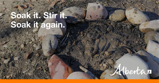
We are asking the public, residents and industry to use extra caution around areas impacted by wildfire and to not walk near or into burnt areas. There are many hazards that are difficult to see, like deep burning ash pits, unstable trees that can fall because their roots have been burnt away, as well as other unknown dangers. Fallen trees on various roads have been reported. If travelling along these burnt areas, be aware and prepared in case these trees fall onto the road, as your vehicle could become entrapped.
The majority of HWF036 showed very little fire behaviour yesterday expect for the western side where trees were seen flaring (August 11, 2023).
HBZ003 | This fire continues to be active on the east and northeast sides. Helicopters have been working the northeast side to slow the spread towards critical infrastructure in the area.
Resources
There are 40 firefighters and support staff working on this wildfire from Australia, the United States and Alberta. Nine helicopters and heavy equipment are also supporting these operations. Additional heavy helicopters and airtankers are available if required.
Weather
Today the forecasted temperature is 24 degrees, a relative humidity of 35 percent with winds west/southwest 15 km/h gusting to 35 km/h with no chance of rain showers.
Creeping ground fire was present on HWF036 yesterday and firefighters anticipate increased fire behaviour in the coming days as temperature and wind increases and relative humidity decreases (August 11, 2023).
DO NOT FLY DRONES NEAR WILDFIRES!
The use of recreational drones over wildfires in Alberta is dangerous, illegal and could result in a fine of up to $15,000* for putting aircraft and people at risk. Please give Alberta firefighters the space they need to do their jobs safely. *Transport Canada
WILDFIRE INFORMATION
Download the Alberta Wildfire app today and get access to accurate, real-time information on wildfires in your area. You can also find information on fire advisories, restrictions and bans across the province and much more all on your mobile device. Available for Apple and Android.
Before heading out, please check albertafirebans.ca to determine whether there are any fire advisories, fire restrictions or fire bans in effect for your destination.
Subscribe to the High Level Forest Area Update to receive an email when new information is posted. Join the conversation on Facebook, Twitter or Instagram.
WILDFIRE LINKS AND TOOLS
Volunteers, equipment owners/operators or firefighters looking to assist with these wildfires or any of the wildfires within the province can contact EmergencySupportOffers@gov.ab.ca.
There are multiple EVACUATION ORDERS & ALERTS in the Province. Please visit Alberta Emergency Alerts or your community webpage for more information.
For road closure information, please visit: 511.alberta.ca
Wildfire smoke is a tool used for the location of smoke firesmoke.ca
To see all the wildfires burning in Alberta click here.
WILDFIRE PREPAREDNESS | Learn how you can prepare yourself for a wildfire by clicking here.
Acting Information Officer - High Level Forest Area