

WILDFIRE DANGER
The wildfire danger is EXTREME north of Lake Athabasca and VERY HIGH south of Lake Athabasca within the Fort McMurray Forest Area. Firefighters urge everyone to continue to use caution as a wildfire will ignite easily and spread quickly.
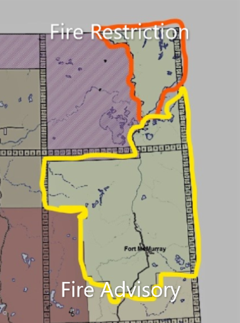
A FIRE RESTRICTION is in effect for the Fort McMurray Forest Area north of Lake Athabasca to the Northwest Territories border within Fire Control Zone 39.
A FIRE ADVISORY is in effect for the Fort McMurray Forest Area south of Lake Athabasca, visit Alberta Fire Bans for more information.
To view a map of Fire Restrictions and Bans across the Forest Protection Area, click here.
Report wildfires immediately by calling 310-FIRE (3473).
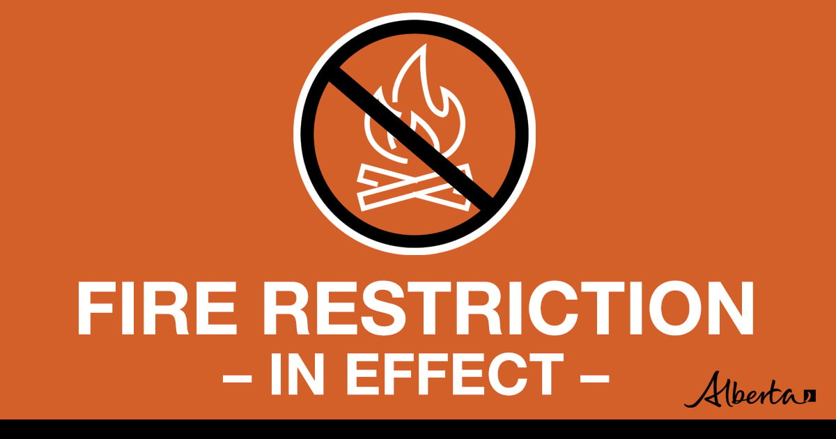
FIRE RESTRICTION IN EFFECT
A Fire Restriction remains in effect for the Fort McMurray Forest Area north of Lake Athabasca to the Northwest Territories border within Fire Control Zone 39.
Under this restriction:
- Existing fire permits are restricted, suspended or cancelled and no new fire permits will be issued.
- Safe wood campfires within fire rings in campgrounds are allowed.
Prohibited:
- All outdoor wood fires are banned on public lands, including backcountry and random camping areas.
- The use of fireworks and exploding targets is also prohibited.
Allowed:
- Safe wood campfires on private lands and in provincial campgrounds.
- Backyard fire pits, charcoal briquette barbeques.
- Propane/ natural gas-powered appliances.
- Indoor wood fires contained within a device with a chimney and spark arrestor.
- Cooking, warming and lighting devices – all devices must be CSA approved and used as per manufacturer’s standards.
Click here, for the Fire Restriction factsheet.
If you see a wildfire, report it immediately by calling 310-FIRE.
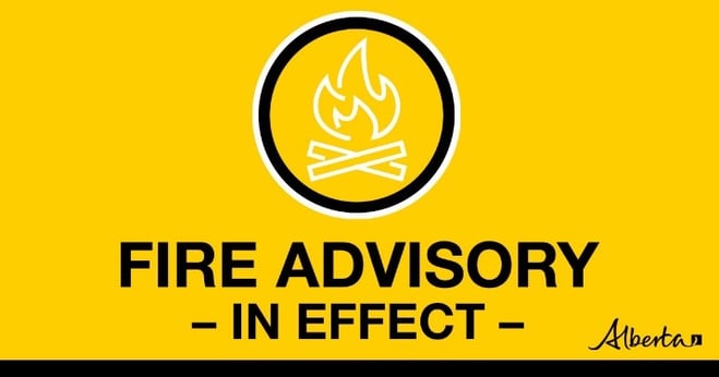
FIRE ADVISORY IN EFFECT
A Fire Advisory is in effect for the Fort McMurray Forest Area south of Lake Athabasca.
Due to current and forecasted weather conditions, no new permits will be issued. All existing permits remain valid but renewals will be considered on a case-by-case basis.
Prohibited:
- Burning without a valid fire permit, other than a campfire, is prohibited.
Allowed:
- Safe wood campfires
- Backyard fire pits
- Portable propane fire pits
- Gas or propane stoves and barbecues
- Catalytic or infrared-style heaters
Municipalities, Parks and protected areas may have additional fire safety requirements.
Never leave a campfire unattended. Soak it, stir it and soak it again until cool to the touch to ensure it is extinguished.
Please visit albertafirebans.ca to see a map of the exact area covered under this Fire Advisory.
The Fire Advisory will remain in effect until conditions improve.
Click here, for the Fire Advisory factsheet.
If you see a wildfire, report it immediately by calling 310-FIRE.
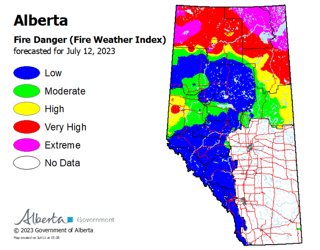
To see the forecasted fire danger click here, updates daily at 3:00 PM.
ON ALERT
Fire lookouts are on high alert constantly watching for smoke and firefighters in helicopters are assessing potential sightings of wildfires, ready to respond to any new wildfires that may start.
Wildland firefighters urge everyone to be extremely cautious when out in the Forest Protection Area. Check your winter burns, and comply with fire bans and OHV restrictions.
SMOKY CONDITIONS
Due to the numerous wildfires in Alberta and other parts of Canada, smoky conditions will continue. Anyone with health concerns should visit Alberta Health Services or call 811 for health advice from Alberta Health Link. Before travelling check www.511.Alberta.ca for information the latest road conditions or closures. Visit www.firesmoke.ca to see where the smoke is coming from and to view wildfires on a map, download the AB Wildfire App or visit the Alberta Wildfire Status Dashboard.
FORT MCMURRAY WILDFIRE UPDATE
Since January 1, 2023 there have been 50 wildfires in the Fort McMurray Forest Area, burning a total of approximately 189,267 hectares (ha).
SWF081 was detected on May 14 and is located near Chipewyan Lakes. This wildfire is classified as being held and is estimated to be 33,138 hectares in size. This wildfire was caused by lightning.
MWF021 was detected on May 27 and is located near Birch Mountains Wildland Provincial Park. This wildfire is classified as being held and is 14,760 ha in size. This wildfire was caused by lightning.
MWF023 was detected May 28 and is located near Birch Mountains Wildland Provincial Park. This wildfire is classified as being held and is 54,639 ha in size. This wildfire was caused by lightning.
MWF024 was detected May 28 and is located east of Marguerite River Wildland Provincial Park. This wildfire is classified as being held and is approximately 28,204 ha in size. This wildfire was caused by lightning.
Yesterday, MWF024 flared up, resulting in fire growth on the south-southwest side of the perimeter. A smoke column was visible from Fort McMurray but continues to be monitored by wildfire crews.
MWF025 was detected May 28 and is located approximately 7 km north of Fort Chipewyan. This wildfire is classified as being held and is approximately 73,690 ha in size. This wildfire was caused by lightning.
This wildfire no longer poses a threat to the community of Fort Chipewyan, Allison Bay, Dog Head, or the Fort Chipewyan airport. 80 per cent of the entire wildfire perimeter is controlled, which includes the entire south perimeter.
Anyone with smoke related health concerns should visit Alberta Health Services or call 811 for health advice from Alberta Health Link.
For the most recent map of MWF025, click here.
MWF026 was detected May 28 and is located northeast of Marguerite River Wildland Provincial Park. This wildfire is classified as being held and is approximately 1,705 ha in size. This wildfire was caused by lightning.
MWF030 was detected on June 4 and is located near La Butte Creek. This wildfire is classified as being held and is 7.4 ha in size. This wildfire was caused by lightning.
MWF034 was detected on June 24 and is classified as under control at 15 hectares. This wildfire was caused by lightning.
MWF035 was detected on June 24 and is classified as under control at 4.5 hectares. This wildfire was caused by lightning.
MWF043 was detected on June 30 and is approximately 25 km southeast of Fort Fitzgerald. This wildfire is classified as being held and is approximately 5,700 ha in size. This wildfire was caused by lightning.
MWF050 was detected today and is located approximately 20 km east of SWF081 and approximately 28 km south of Birch Mountains Wildland Provincial Park. This wildfire is classified as out of control and is approximately 60.80 ha in size. This wildfire was caused by lightning.
Mutual-aid wildfires:
MSZ001 is located on the Alberta/Saskatchewan border, just south of Lake Athabasca. This wildfire is classified as being held and is approximately 75 ha in size.
MNZ001 is located on the south edge of the Alberta/Wood Buffalo National Park border. This wildfire is classified as being held and is approximately 2,595 ha.
To view active wildfires across Alberta, click here.
PROVINCIAL WILDFIRE UPDATE
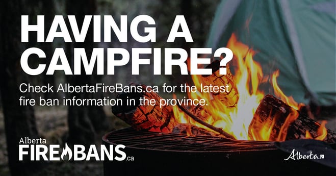
CAMPFIRE SAFETY
Remember to check www.albertafirebans.ca for fire advisories, bans or restrictions in your area or destination. If you are camping in a provincial or national park, check the rules and guidelines and be sure to follow them for your safety and the safety of other campers.
Safe wood campfires - should be within a metal, brick, or rock fire ring.
They are required to:
- be on rock, gravel, sand, or another non-combustible surface that extends at least one metre around the fire
- have a responsible person in attendance to keep fire under control at all times and extinguish before leaving
- have enough water on hand to extinguish the fire. Safe wood campfires on private lands include private land campgrounds and private land recreation areas.
Always let the fire burn down before you plan to extinguish it. Spread the embers within the fire pit, then add water or loose dirt and stir. Repeat until your campfire is cool to the touch. You should not be able to feel any heat from the ashes.
OHV SAFETY
If you plan on riding OHVs in the Forest Protection Area of Alberta, you can reduce the risk of your vehicle causing a wildfire by following these simple steps:
- Before you ride, clean out hot spots and remove debris from your machine.
- After riding through muskeg or tall grass, stop and remove any build-up from your machine.
- Carry firefighting equipment such as a small shovel, collapsible pail or fire extinguisher.
- Wash your OHV and keep it clean; do not wash in streams and creeks.
- Make sure your muffler and spark arrestor are working properly.
- Stop frequently. Take the time to knock debris from your machine’s hot spots. If the debris is smouldering, soak it, stir it, and soak it again to make sure it is extinguished.
For more information, see Off-highway vehicles: Wildfire prevention tips.
EXPLODING TARGETS AND FIREWORKS
The Forest and Prairie Protection Act and associated regulations applies to the shooting, ignition or detonation of exploding targets and fireworks on public lands and private lands located within the FPA.
A Forest Officer from the local forest area office may grant written permission to shoot, ignite or detonate exploding targets or fireworks in the FPA. Written permission of exploding targets and fireworks is based on current wildfire danger and managed on a case-by-case basis.
A fire advisory, restriction, ban or forest closure may prohibit or limit use of exploding targets and fireworks during high wildfire hazard situations within the FPA. Check Alberta Fire Bans or the mobile phone app for the latest information.
WILDFIRE DASHBOARD
The wildfire dashboard provides up-to-date wildfire information at the click of a button. This interactive tool displays important statistics on the number of active wildfires in the Forest Protection Area of Alberta, sizes, locations, suspected causes and more.
The dashboard builds on the former wildfire status map by displaying the most frequently accessed information in one convenient location.
CONTACT
Websites:
Alberta Wildfire, Alberta Fire Bans, FireSmart in Alberta, Alberta Emergency Alerts, Air Quality Health Index
Wildfire Smoke and Your Health, 511 Road Reports, and Emergency Preparation.
Social Media:
Join the conversation on
![]()
![]()
![]()
Apps:
Alberta Wildfire App for Apple or Android and Alberta Fire Bans App for Apple or Android.