

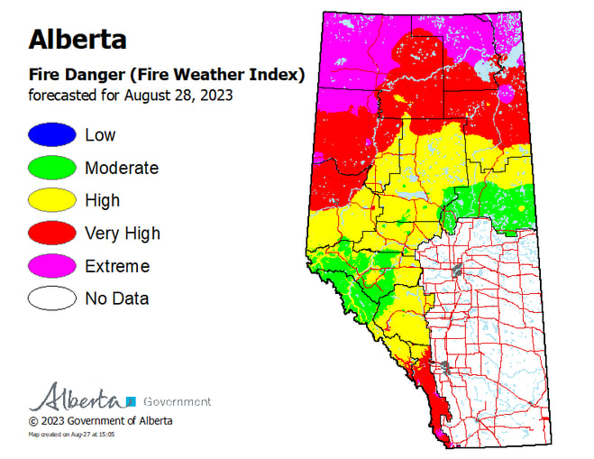
WILDFIRE DANGER
The wildfire danger is VERY HIGH for south of Lake Athabasca and EXTREME for north of Lake Athabasca within the Fort McMurray Forest Area. Fort Smith's fire danger is considered EXTREME.
A Fire Advisory remains in effect for the Fort McMurray Forest Area. See details below.
Please be very cautious when recreating outdoors as we are entering a drying trend where wildfires can ignite easily and spread quickly.
Report wildfires immediately by calling 310-FIRE (3473).
EVACUATION ORDERS
Highway 5 is currently closed due to wildfire activity. Click here, for more highway closure information.
The Regional Municipality of Wood Buffalo (RMWB) has declared a state of local emergency and issued an evacuation order for the community of Fort Fitzgerald. Click here for more information.
The Chief and Council of Smith's Landing First Nation has declared a state of local emergency and issued an evacuation order. Click here, for more information.
The Town of Fort Smith has declared a state of local emergency and issued an evacuation order for residents within the municipality and surrounding areas. Click here, for more information.
For information on Northwest Territories evacuations click here.
For more information and related links, please see MNZ003 below.
SMOKY CONDITIONS
Due to the numerous wildfires in Alberta and other parts of Canada, smoky conditions will continue. Anyone with health concerns should visit Alberta Health Services or call 811 for health advice from Alberta Health Link. Before travelling check www.511.Alberta.ca for information the latest road conditions or closures. Visit www.firesmoke.ca to see where the smoke is coming from and to view wildfires on a map, download the AB Wildfire App or visit the Alberta Wildfire Status Dashboard.
WILDFIRE OF NOTE
Wood Buffalo Complex (previously Parks Canada Fire 7, Alberta Wildfire MNZ003, and NWT SS069):
Structure protection is established and maintained by firefighting crews in the event that the wildfire approaches the community (August 27, 2023).
For the most recent map, click here.
The Wood Buffalo Complex is estimated to be 472,656 hectares in size and classified as OUT OF CONTROL, which means that the fire is still burning and is expected to grow in size. This wildfire was detected on May 28 in Wood Buffalo National Park and was determined to be caused by lightning. The Wood Buffalo Complex is being managed under unified command by the Government of Northwest Territories, Parks Canada, and Alberta Wildfire from the incident command post in Fort Smith.
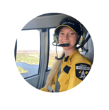
There are currently 377 personnel which include 87 pieces of heavy equipment, 24 helicopters and 136 firefighters and structure protection personnel responding to the Wood Buffalo Complex. Firefighters continue to work in priority areas, assisted by helicopters and heavy equipment to prevent the spread towards communities. These numbers will fluctuate as personnel leave the incident for much needed rest and new personnel and resources arrive.
Firefighters observed increased fire behaviour during the “peak burning period” yesterday but no significant growth was recorded. Peak burning normally occurs mid to late afternoon when temperatures are hottest and relative humidity drops. Fortunately, the smoke lingered for most of the day which kept the fire behaviour less active then expected. Firefighters believe that there would have been more growth if smoke wasn’t present, which shaded the wildfire from the sun.
Today we anticipate 30C and with relative humidity of 30 per cent with winds from the southeast 10 km/h, gusting up to 25 km/h. Tomorrow, the forecasted high is 30C and a relative humidity of 30 per cent with winds from the southeast 10 km/h, gusting to 15 km/h. These weather conditions could allow for extreme fire behaviour, especially if smoke isn’t present over the wildfire.
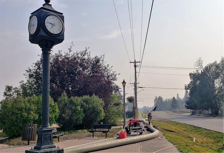
Structure protection will continue to be maintained and repositioned as needed by firefighters. The structure protection, like sprinklers and water bladders, help to create a wet area to prevent the wildfire from burning near residences and other buildings. When fire activity increases near residences, crews will turn on some of the structure protection as a precautionary measure. Extensive work has also been done around Fort Smith and surrounding communities, removing vegetation following FireSmart practices. For more information on these efforts, see the Fort Smith Protective Services Facebook page or visit FireSmartCanada.ca.
Wildfire specialists continue to look for opportunities to conduct planned controlled burns in key areas. Controlled burns are a great tool that firefighters use to remove the available fuel, bringing the wildfire to a containment line like a dozer guard or natural break like a river or a road. This removes the likelihood of the wildfire spreading further, especially if weather conditions allow for extreme fire behaviour.
There was no significant growth on much of the fire yesterday. More active areas continue to be in the northern area of the fire, closest to Thebacha. The distances from the fire to communities did not change yesterday except for in the Thebacha area: the fire is now 2.4 km from Thebacha.
Today, crews will be working to extinguish some spot fires observed just off Connie’s Road and a small area off Foxholes Road. They’ll be supported as needed with helicopter bucketing if visibility permits.
Structure protection work continues in Thebacha, Bell Rock, Fort Smith, Fort Fitzgerald and other areas, and the systems are run as needed based on active areas of the fire. Crews did FireSmarting in the Queen Elizabeth campground area yesterday and continue this work in other areas.
While visibility permitted in the morning, helicopters bucketed active areas of the fire yesterday including an area on the fire perimeter closest to Fort Smith. Smoke created visibility challenges and grounded aircraft for most of the afternoon, but helicopters were able to fly again around 4:00 p.m.
Yesterday, dozers finished working on a containment line using dozers east of Pine Lake Road to tie it to a water feature. Crews worked on two spot fires along the perimeter of the fire in this area as well.
Hard work paid off yesterday as crews completed work to contain spot fires that occurred a week ago just past the most southerly containment line in the Fort Fitzgerald area. Fire personnel are planning to directly attack the east edge of the fire near Hay Camp Road, as fire activity and visibility permit.
Nine pieces of heavy equipment completed the Fort Smith community containment line yesterday – this line is 100 metres wide and extends from Highway 5 to just south of Bordertown, along Pine Lake Road.
There were infrared scans conducted last night. These scans provide critical information to fire personnel showing where heat and hot spots are within the fire perimeter. Knowing this information guides strategic planning and allows fire crews to zero in on specific areas.
For distances to each community, please see attached map.
Distance Disclaimer* Firefighters use multiple tools to measure distances depending on visibility, smoke and availability of aircraft and drones. These tools have various accuracies to measure distance and are subject to change.
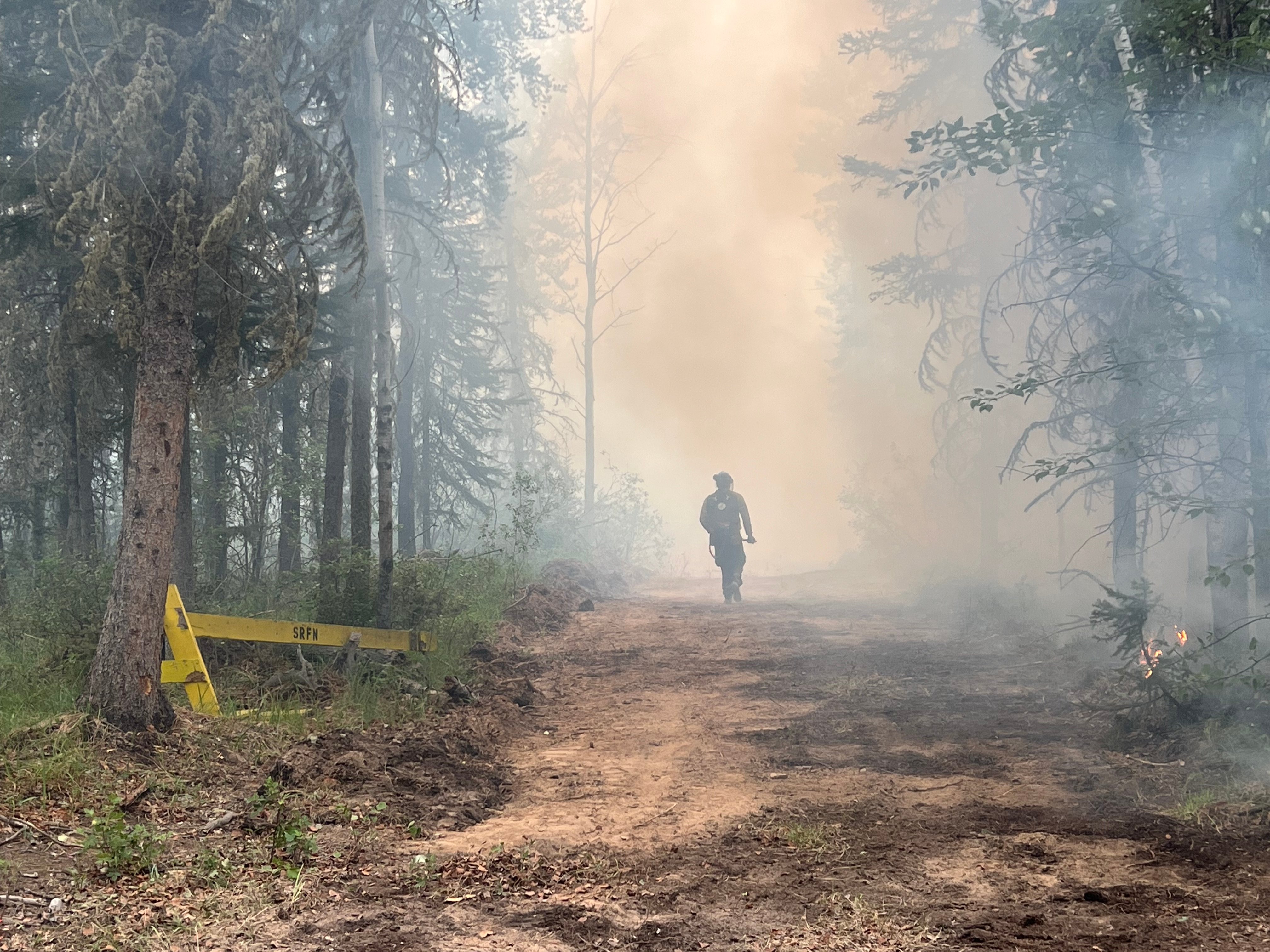
Firefighters continue to work on searching for and extinguishing hotspots along key areas on the Wood Buffalo Wildfire Complex (August 27, 2023).
Message from your communities and other departments
The Town of Fort Smith and Fort Fitzgerald have declared a STATE OF LOCAL EMERGENCY and it remains under an EVACUATION ORDER. The ORDER has been issued for public safety. If you have evacuated, please do not return. This is an active wildfire operation area and is dangerous for residents and first responders. You can also visit the Town of Fort Smith webpage for additional information.
Highway 5 is currently closed from Hay River to Fort Smith due to safety concerns and limited visibility. Click here for highway closure information.
Pine Lake Road from Bordertown to Peace Point remains CLOSED due to fire behaviour and active fire operations in the area.
Additional wildfire information
All other wildfires in Wood Buffalo National Park are being actively monitored and do not pose a risk to public safety at this time. Parks Canada will continue to monitor and action these wildfires as required. For more information visit Wood Buffalo National Park wildfire updates.
For information on other wildfires visit the respective webpages:
Wood Buffalo National Park wildfire updates
Northwest Territories fire information
Alberta Wildfire Status Dashboard
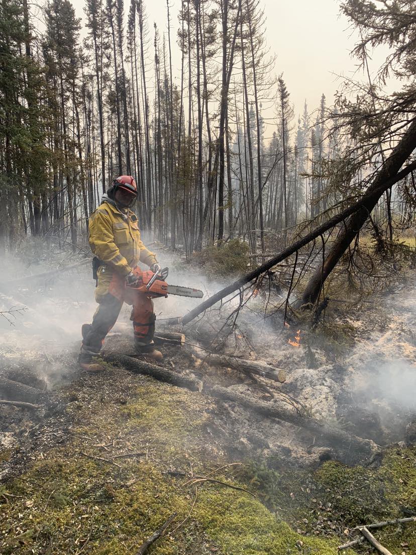
Firefighters from Alberta, Northwest Territories, Parks Canada and New Zealand are supporting fire operations on Wood Buffalo Wildfire Complex (August 27, 2023).
Report any wildfires or suspicious smoke in Alberta to 310-FIRE, in Northwest Territories to 1-877-NWTFIRE, and in Wood Buffalo National Park to 867-621-0136.

FIRE ADVISORY IN EFFECT
A fire advisory is in effect for the entire Fort McMurray Forest Area due to continued hot and dry conditions which will increase the fire behaviour potential.
Under this advisory:
- Existing fire permits are still valid but may be suspended or cancelled if warm, dry weather continues
- The issuing or suspension of new permits is left to the discretion of a forest officer until conditions change
- Permits for the use of fireworks and exploding targets will not be issued.
Prohibited
Any burning without a valid fire permit, other than a campfire.
Allowed
- Safe wood campfires (including charcoal briquettes) in backcountry or random camping areas
- Safe wood campfires (including charcoal briquettes) on private lands and in provincial campgrounds
- Backyard fire pits
- Charcoal briquette barbeques
- Gas and liquid powered appliances (stoves and lanterns)
- Open flame oil devices (e.g., turkey deep fryers, tiki torches)
- Catalytic or infrared-style heaters
- Indoor wood fires
Remember to check the hot spots on your Off-Highway Vehicle (OHV) and remove debris before and after use.
Never leave a campfire unattended. Soak it, stir it and soak it again until cool to the touch to ensure it is extinguished.
If you see a wildfire, report it immediately by calling 310-FIRE.
The fire advisory will remain in effect until conditions improve.
FORT MCMURRAY WILDFIRE UPDATE
Since January 1, 2023 there have been 58 wildfires in the Fort McMurray Forest Area, burning a total of approximately 327,492 hectares (ha).
MWF021 was detected on May 27 and is located approximately 38 km south of Wood Buffalo National Park. This wildfire is classified as under control (UC) and is 14,760 ha in size. This wildfire was caused by lightning.
MWF023 was detected May 28 and is located near Birch Mountains Wildland Provincial Park. This wildfire is classified as under control (UC) and is 54,639 ha in size. This wildfire was caused by lightning.
MWF024 was detected May 28 and is located east of Marguerite River Wildland Provincial Park. This wildfire is classified as under control (UC) and is approximately 28,454 ha in size. This wildfire was caused by lightning.
MWF025 was detected May 28 and is located approximately 7 km north of Fort Chipewyan. This wildfire is classified as being held and is approximately 95,491 ha in size. This wildfire was caused by lightning.
This wildfire no longer poses a threat to the community of Fort Chipewyan, Allison Bay, Dog Head, or the Fort Chipewyan airport. Eighty per cent of the entire wildfire perimeter is controlled, which includes the entire south perimeter.
MWF038 was detected on June 29 and is located approximately 6 km north of the Slave Lake/Fort McMurray Forest Area border. This wildfire is classified as under control (UC) and is approximately 569 ha in size. This wildfire was caused by lightning.
MWF039 was detected on June 29 and is located within Birch Mountains Wildland Provincial Park but has crossed over into the Slave Lake Forest Area. This wildfire is classified as under control (UC) and is approximately 15,200 ha in size. This wildfire was caused by lightning.
MWF043 was detected on June 30 and is approximately 20 km southeast of Fort Fitzgerald. This wildfire is classified as being held and is approximately 108,555 ha in size. This wildfire was caused by lightning. To view actual locations of the wildfire, visit the wildfire dashboard.
This wildfire is experiencing decreased fire growth and is not currently moving any closer to Fort Smith or Fort Fitzgerald.
Mutual-aid wildfires:
MNZ001 is located on the south edge of the Alberta/Wood Buffalo National Park border. This wildfire is classified as being held and is approximately 2,595 ha.
PROVINCIAL WILDFIRE UPDATE
ON ALERT
Fire lookouts are on high alert constantly watching for smoke and firefighters in helicopters are assessing potential sightings of wildfires, ready to respond to any new wildfires that may start.
Wildland firefighters urge everyone to be extremely cautious when out in the Forest Protection Area. Check your winter burns, and comply with fire bans and OHV restrictions.
.png?width=658&height=345&name=WF_Social-images%20(3).png)
CAMPFIRE SAFETY
Remember to check www.albertafirebans.ca for fire advisories, bans or restrictions in your area or destination. If you are camping in a provincial or national park, check the rules and guidelines and be sure to follow them for your safety and the safety of other campers.
Safe wood campfires - should be within a metal, brick, or rock fire ring.
They are required to:
- be on rock, gravel, sand, or another non-combustible surface that extends at least one metre around the fire
- have a responsible person in attendance to keep fire under control at all times and extinguish before leaving
- have enough water on hand to extinguish the fire. Safe wood campfires on private lands include private land campgrounds and private land recreation areas.
Always let the fire burn down before you plan to extinguish it. Spread the embers within the fire pit, then add water or loose dirt and stir. Repeat until your campfire is cool to the touch. You should not be able to feel any heat from the ashes.
OHV SAFETY
If you plan on riding OHVs in the Forest Protection Area of Alberta, you can reduce the risk of your vehicle causing a wildfire by following these simple steps:
- Before you ride, clean out hot spots and remove debris from your machine.
- After riding through muskeg or tall grass, stop and remove any build-up from your machine.
- Carry firefighting equipment such as a small shovel, collapsible pail or fire extinguisher.
- Wash your OHV and keep it clean; do not wash in streams and creeks.
- Make sure your muffler and spark arrestor are working properly.
- Stop frequently. Take the time to knock debris from your machine’s hot spots. If the debris is smouldering, soak it, stir it, and soak it again to make sure it is extinguished.
For more information, see Off-highway vehicles: Wildfire prevention tips.
EXPLODING TARGETS AND FIREWORKS
The Forest and Prairie Protection Act and associated regulations applies to the shooting, ignition or detonation of exploding targets and fireworks on public lands and private lands located within the FPA.
A Forest Officer from the local forest area office may grant written permission to shoot, ignite or detonate exploding targets or fireworks in the FPA. Written permission of exploding targets and fireworks is based on current wildfire danger and managed on a case-by-case basis.
A fire advisory, restriction, ban or forest closure may prohibit or limit use of exploding targets and fireworks during high wildfire hazard situations within the FPA. Check Alberta Fire Bans or the mobile phone app for the latest information.
WILDFIRE DASHBOARD
The wildfire dashboard provides up-to-date wildfire information at the click of a button. This interactive tool displays important statistics on the number of active wildfires in the Forest Protection Area of Alberta, sizes, locations, suspected causes and more.
The dashboard builds on the former wildfire status map by displaying the most frequently accessed information in one convenient location.
CONTACT
Websites:
Alberta Wildfire, Alberta Fire Bans, FireSmart in Alberta, Alberta Emergency Alerts, Air Quality Health Index
Wildfire Smoke and Your Health, 511 Road Reports, and Emergency Preparation.
Social Media:
Join the conversation on
![]()
![]()
![]()
Apps:
Alberta Wildfire App for Apple or Android and Alberta Fire Bans App for Apple or Android.