

An evacuation order has been issued for Jasper National Park and the Town of Jasper. There is no threat to communities in Yellowhead County, the Town of Hinton or the Town of Edson.
The smoke settling over Yellowhead County, Town of Hinton and Town of Edson is not produced by a wildfire in our forest area. See below for further details.
If you see smoke or flame in the forest and suspect it's a wildfire, call 310-FIRE (3473) to report it.
This update is best viewed on a web browser or the AB Wildfire Status App | View previous Edson Forest Area Updates. Bold indicates new or important information.

Smoke from wildfires in Jasper drifts and settles across the Rocky Mountains. The photo was taken at 2:00 p.m. from Grave Flats Tower looking northwest from the cupula (July 23, 2024).
WILDFIRES OUTSIDE OF THE EDSON FOREST AREA
The smoke settling over Yellowhead County, Town of Hinton and Town of Edson is not produced by a wildfire in our forest area.
The wildfire located north of Jasper along highway 16 is currently 39 km south-southwest of Brule and 61 km south-southwest of Hinton.
The wildfire located south of Jasper along highway 93 is currently 45 km southwest of Cadomin.
You can view smoke drifts from the FireSmoke.ca website.
NASA FIRMS Fire Information website is a great resource to give an approximate location of hotspots in an area, but cannot always be used to determine specifically where a wildfire is burning. The heat from smoke columns, reflections from water and other heat signatures will appear on the map. It's important to note that the data is based on a mathematical estimate (interpolation) and can often make a wildfire appear larger than it actually is.
EDSON FOREST AREA WILDFIRE UPDATE
The wildfire danger in the Edson Forest Area is EXTREME. This means that forest fuels are extremely dry and pose a very serious fire risk. Fast-spreading, high-intensity fires are likely, which may be very difficult to control.
Fire danger is a relative index depicting forest environment conditions, how a fire will behave and how much damage a fire could do. View the forecasted fire danger map.
Since January 1, 2024, there have been 88 wildfires in the Edson Forest Area burning a total of 270 ha. All wildfires are investigated in Alberta.
ACTIVE WILDFIRES IN THE EDSON FOREST AREA
WEATHER FORECAST Today, a high of 26C with 20% relative humidity is expected. Winds from the west 20-25 km/h with gusts up to 35 km/h, shifting from the northeast 15 km/h. Crossover conditions are expected again, meaning that the temperature will be greater then the relative humidity and could allow for increased fire activity.
Tomorrow, a high 26C with 25% relative humidity. Winds from the northeast 15-20 km/h with a chance of thunderstorms.
The forest area has initial attack crews prepositioned across the area to respond to new wildfire detections. Airtankers are available when there are opportunities for effective use. Alberta Wildfire has prepositioned aircraft and heavy equipment near the Jasper National Park boarder to assist and respond, if required.
EWF088 is currently burning OUT OF CONTROL 14 km southwest of Cynthia. It's estimated to be 1 ha in size. Airtankers are currently on site. The cause of the wildfire is under investigation.
EBZ001 is a mutual aid wildfire on the boarder of British Columbia and the Edson Forest Area, within Willmore Wilderness Park. It's currently burning OUT OF CONTROL 56 km southwest of Grande Cache, 98 km west of Rock Lake and 147 km west-northwest of Hinton. It is estimated to be 340 ha in size. .
EWF086 is currently burning OUT OF CONTROL 11 km northeast of Cynthia and 30 km south of Chip Lake It's estimated to be 1 ha in size. There are four firefighters, three helicopters and dozers associated with this fire. Airtankers are supporting firefighting activities. This wildfire was determined to be caused by lightning.
EWF083 is currently burning OUT OF CONTROL 37 km northeast of Hinton, 87 km southwest of Fox Creek and 110 km east-southeast of Grande Cache. It is estimated to be 0.62 ha in size. There are 22 firefighters, two helicopters and one piece of heavy equipment associated to the wildfire. This wildfire was determined to be caused by lightning.
EWF081 is currently burning OUT OF CONTROL 37 km southwest of Edson, 25 km northeast of Robb and 66 km southeast of Hinton. This fire is located beside EWF075 and EWF077. It's estimated to be 9.2 ha in size. There are eight firefighters, one helicopter and three pieces of heavy equipment actioning the wildfire.
EWF080 is currently burning OUT OF CONTROL. This wildfire is located in Willmore Wilderness Park, 50 km south-southeast of Grande Cache and 80 km west of Hinton. It's estimated to be 70 ha in size.
EWF078 is now BEING HELD, which means that given current weather conditions and resources, the wildfire is not anticipated to grow past expected boundaries. The wildfire is located 53 km south-southwest of Edson and 33 km southeast of Robb. The fire is estimated to be 0.56 ha in size. The wildfire was determined to have been caused by lightning.
EWF076 is currently burning OUT OF CONTROL approximately 24 km south-southwest from Hinton, 7 km south-southeast of Folding Mountain Village and 6 km northeast of Miette Hotsprings. The wildfire is estimated to be 1 ha in size. The wildfire is located on top of a mountain ridge, making it difficult for firefighters to access.
EWF074 is now classified as UNDER CONTROL. It's located 45 km northwest of Edson, 55 km northeast of Hinton and 25 km north of Obed. The fire is estimated to be 8.6 ha in size. The wildfire was determined to be caused by lightning. The wildfire will be monitored for wildfire activity and actioned if required.
EWF072 is now UNDER CONTROL . It is located 56 km northwest of Edson, 60 km northeast of Hinton and 37 km north of Obed. The fire is estimated to be 12.6 ha in size. Currently, 17 firefighters and four pieces of heavy equipment continue to reinforce the containment lines. They'll be working from the perimeter, searching for and extinguishing hotspots. The wildfire was determined to be caused by lightning.
No communities are threatened by these wildfires at this time.
Learn more about wildfire classifications. View active wildfires, their locations and stats on the interactive map on our Wildfire Status page.

Airtankers have been supporting firefighting activity on EWF078 is listed as being held (July 23, 2024).
ACTIVE WILDFIRES IN JASPER NATIONAL PARK
An evacuation order has been issued for Jasper National Park and the Town of Jasper.
Update from Parks Canada (below), as of July 23, 2024 at 11:00 a.m.
The Town of Jasper and Parks Canada’s priority is the safety of our staff, residents and visitors. We acknowledge this is a stressful time and appreciate patience as this is an evolving and complex situation. We are doing our best to provide you with accurate and timely information. Please rely on official information sources from Municipality of Jasper, Parks Canada, and Alberta Emergency Alert.
Thank you to the thousands of residents and visitors who evacuated during the night last night. Your patience and efforts to get out safely made a measurable difference in the response.
Current situation | There are multiple wildfires in Jasper National Park. Parks Canada had aircraft out assessing the wildfires at first light to get eyes on wildfire activity and behavior, identify impacted infrastructure and set firefighting objectives for the day.
Parks Canada has mobilized resources to arrive today and in coming days, including a Parks Canada Incident Management Team and additional firefighting resources and aircraft. Parks Canada and Alberta Wildfire are partners in wildfire response and Alberta Wildfire is supporting Jasper National Park. Alberta Emergency Management Agency (AEMA) arrived in Jasper early this morning to assist.
Our priority is to protect the town and community of Jasper, limiting wildfire growth towards town, Highway 16 and critical infrastructure. Critical structural protection is being managed by fire teams from across the region.
Evacuation | Evacuation of the Town of Jasper and Jasper National Park is ongoing. Evacuees need to travel west on Highway 16 to larger centers. Fuel is available at the Shell gas station.
The Town of Valemount has limited services and cannot accommodate more evacuees at this time. Evacuees should continue on Highway 16 through B.C. and select a route back to Alberta.
Anyone requiring a reception centre is directed to Shouldice Arena in Calgary or Bonnets Energy Centre, 10017 99 Ave, in Grande Prairie, AB, opening at 9:00 am on Tuesday, July 23.
RCMP have been out this morning going door-to-door ensuring all residents have evacuated. 35 RCMP officers are on site to ensure safety and assist with the evacuation process. All seniors' living facilities and the hospital have been evacuated to Hinton.
If you are still in Jasper and need help evacuating, please go to the Jasper Activity Centre at 303 Bonhomme St. If you need help getting to the Jasper Activity Centre, please call 780-852-6543.
Backcountry evacuations are in progress. If you have a way of contacting those in the backcountry, they should reach a trailhead and are directed to evacuate and check in with Parks Canada Dispatch at 780-852-6155 as soon as they have cell service.
Check Alberta Emergency Alerts for up-to-date information on evacuation alerts and orders.
Check Alberta 511 on their website or download the app for road conditions and closures. We will provide an update as soon as new information is available.
Additional information will be available on the Jasper National Park facebook page and Municipality of Jasper page for updates.

A fire ban is in effect as of July 10 in the entire Forest Protection Area of Alberta, including the EDSON FOREST AREA, due to hot and dry conditions.
Cities, towns, villages and summer villages, as well as federal lands (such as national parks), are exempt from this ban. These jurisdictions have the authority to issue their own bans and may have complementary bans in place.
Visit Alberta Fire Bans to see if a fire ban or restriction is in place in your area and learn what is prohibited and allowed under this ban.
The fire ban will remain in effect until conditions improve.
PROVINCIAL WILDFIRE UPDATE
As of 10:00 a.m. on July 23, 2024.
The fire danger is extreme throughout all of the province except for along the BC border, where it is low to high.
Since January 1, 2024 in the Forest Protection Area of Alberta, there have been 940 wildfires burning a total of 535,082 hectares (ha).
Last year, on this date, there were 905 wildfires that burnt a total of 2,160,074 ha. In the past five years on this date, an average of 756 wildfires had burnt an average of 628,223 ha.
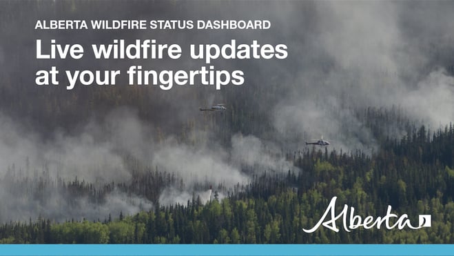
For the most up-to-date wildfire information, visit the Alberta Wildfire Status Dashboard.
FIRE PERMITS ARE REQUIRED
Under a FIRE BAN, all permits are cancelled or suspended and no new permits will be issued. To learn more, visit albertafirebans.ca.
DRONES - IF YOU'RE IN THE SKY, WE CAN'T FLY!
There have been reports of drones being flown in and around restricted air space. If there are drones in areas where aircraft or airtankers are being used for wildfire suppression, we are unable to continue those flights until the space is cleared. A drone could strike an aircraft, causing damage to aircraft and severe injuries or fatality of pilots and firefighters. WE WILL NOT RISK LIVES FOR YOUR DRONES.
Before you fly your drone make sure you understand the rules that apply and follow them.
For more information, please visit: Safety for drones and firefighting aircraft or Transport Canada’s legal requirements.
FIRESMART YOUR HOME
FireSmart is a national program that helps Canadians increase their resilience to wildfire. Whether you are a homeowner, resident, business, local government, or Indigenous community, you can take small steps with lasting impacts.
Homes and buildings ignite because of the materials, condition, and everything that surrounds them. The area within 30m of the home is called the Home Ignition Zone (HIZ). Within it are three priority areas, each requiring specific actions. Start by reducing your risk in the Immediate Zone and work your way outward.
To learn more on how you can protect your home, visit FireSmart Alberta. For farm or acreages, you can download the Farm and Acreage FireSmart magazine.
WILDFIRE PREVENTION TIPS & TOOLS
Albertans are always asked to use caution when working or recreating in the outdoors:
- Before you burn it, get your fire permit. Fire permits in Alberta.
- Clear debris from hot spots on your off-highway vehicle.
- Ensure your campfire is out - soak it, stir it, soak it again.
- Before you head out this weekend, check out the albertafirebans.ca website or download the app to stay informed.
- If you are working within the Forest Protection of Alberta, you must carry sufficient firefighting equipment as per the Forest Prairie and Protection Act.
- For road closure information, please visit 511.alberta.ca
- For information regarding smoke in the area, you can visit firesmoke.ca
- NASA FIRMS Fire Information website is a great resource to give an idea of the location of wildfires in the area, but note that the data is based on interpolation and often can make the wildfire look larger then it actually is.
ALBERTA WILDFIRE INFORMATION
- Subscribe to the Edson Forest Area wildfire update to receive an email when new information is posted.
- Download the Alberta Wildfire App for Apple and Android device.
- Join the conversation on Facebook, Twitter or Instagram.
For more information, please contact:

