
Due to very hot and dry conditions, there is increased wildfire activity on many wildfires in our area. Community leaders are advising residents to BE PREPARED AND PAY ATTENTION.
EVACUATION ORDERS AND ALERTS ARE IN EFFECT WITHIN THE EDSON FOREST AREA. VISIT YOUR COMMUNITY WEBPAGE AND ALBERTA EMERGENCY ALERT FOR MORE INFORMATION.
If you see smoke or flame outside of an active fire area, report it to 310-FIRE. If you or your property is in immediate danger, call 911.
Previous Edson Forest Area Updates - Click here
UPDATE FROM TOWN OF EDSON (11:00 p.m.) - we are seeing live embers and fire in Willmore Park. The fire has crossed the river. If you haven't evacuated yet, now is the time. Emergency crews are taxed with fire operations and will not be able to respond if you require assistance.
BE PREPARED & PAY ATTENTION
MESSAGE FROM YOUR COMMUNITIES
For information on evacuation alerts and orders, please visit Alberta Emergency Alert or visit www.edson.ca and www.yhcounty.ca and their social media pages for updates. All residents are encouraged to download the Alberta Emergency Alert app. For evacuation information, contact the info line: 1-833-334-4630.
EVACUATION ORDER - Yellowhead County and Town of Edson have issued an Evacuation Order for the Town of Edson and parts of Yellowhead County.
Due to increased fire activity, fires are becoming increasingly unpredictable. These fires are moving closer to more populated areas including the Town of Edson. Fires have jumped fire guards. There could be impacts to roads and highways as the fire crosses blocking off points of egress for evacuation. The reception centre is the Edmonton Expo Centre.
For those affected, evacuate immediately. For those with no transportation call 1-833-334-4630 for assistance.
Wildfire prep checklist www.alberta.ca/emergency-preparedness.aspx
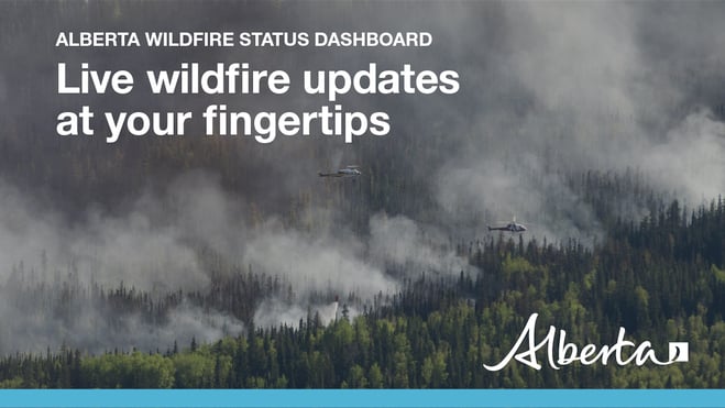
Visit our wildfire dashboard to view active wildfires and their stats.
PEMBINA WILDFIRE COMPLEX | EWF031, EWF039, RWF034, RWF040
UPDATED- JUNE 9, 2023 at 10:00 p.m.
EWF031 was detected on May 4 and is located 25 km west of Lodgepole, 20 km northwest of Brazeau Dam and 14 km southeast of Edson. The fire is classified as out of control and is estimated to be 130,762 ha in size.
There are 238 firefighters and support staff being shared between the Pembina Complex. There are 65 pieces of heavy equipment, and 21 helicopters assigned to the complex. An airtanker group is available and will be utilized if visibility in the area improves. In addition, a 20 person Australian crew has arrived at camp and will be to joining operations on the fireline immediately.
Today on the Pembina Complex, fire behaviour on EWF031 increased significantly as a result of steady and sustained winds from the southeast, pushing the fire in a northwest direction. Rank 6 fire behaviour is being observed, meaning an organized crown fire front with long-range spotting and independent spot fire growth. Fire observed on the north and west flank was displaying organized flame front up into tree canopies. Firefighting under these conditions is extremely dangerous and crews were pulled from the line in multiple areas due to safety concerns.
Activity along the north flank was extreme today and is expected to continue tomorrow. Significant growth has occurred due to excursions that have crossed guard in three different locations along the north flank. The most northern finger of the north flank is just south of the McLeod river. Heavy equipment night operations have commenced this evening and will continue throughout the night to build containment line along a pre-existing fuel break.
Today, a unit crew from Australia arrived on-site and this evening they will be working through the night in the community of Ansell to apply structure protection apparatuses.
The west side of the fire grew by nearly 21 km today to the west and to the northwest. Around 1900 this evening the west flank of the fire crossed the Sundance Road contingency line, just east of Erith River. As of 2200, operational staff have confirmed that the active flame front of the west flank has grown beyond and crossed Highway 47. This area of the fire is burning in predominantly spruce, which under these extreme conditions spreads upwards of 35 metres per minute. Overnight relative humidities are not expected to reduce significantly however the rate of spread will diminish as temperature decreases.
On the east side of the fire, a number of excursions have occurred varying in 100 ha each. Fire behaviour is very active all the way along this flank of the fire which continues to challenge crews.
On the southeast corner, an excursion occurred that is approximately 50 ha and has crossed the Elk River Road. This area is just north of the Brazeau Reservoir.
Tomorrow, the biggest anticipated challenge for personnel will be reduced visibility in the surrounding area, as well as the anticipated wind shift expected tomorrow evening around 1900. The cold front is anticipated to bring sustained extreme wildfire behaviour driven by erratic and strong winds from the northwest to the west. This wind shift will likely challenge containment lines along the east flank.
Resources will continue to be reassigned to areas of the fire where they can safely work. Crews are unable to work in areas that are displaying organized flames fronts due to significant safety risk.
EWF039 located near Carrot Creek, is currently being held. The fire is currently estimated to be 165 ha. The fire is fully wrapped in containment line and is a kilometer away from the Carrot Creek lookout tower. The Lookout staff will keep watch over the area.
RWF034 is located near the O'Chiese Reserve and classified as out of control. The fire is currently estimated at 87,108 ha in size.
An excursion occurred today on the east side of the Brazeau Reservoir in between the Sunchild road. It is currently estimated to be 150 ha and it currently no threat to values and received aviation support. A couple areas were producing smoke up near the northwest tip and will be reassessed by crews tomorrow when safe.
RWF040 The fire is actively monitored by firefighters and support staff assigned to the complex who can respond if necessary. The fire is currently estimated to be 5,089 ha in size and remains classified as out of control. An infrared scan was completed over this fire yesterday to identify any hotspots in the area. Crews will continue to targets any remaining hotspots for this fire.
The onsite Incident Management Team is continuing to collaborate with all partners and communities within the vicinity of this wildfire to ensure public safety.
New information on this complex will be available tomorrow afternoon. To view previous Edson Forest Area Updates - Click here.
By: Sarah Hall, Pembina Complex. Wildfire Information Officer, BC Wildfire Service.

DEEP CREEK WILDFIRE COMPLEX | EWF035, WCU001, WCU002
AS OF JUNE 9, 2023 - 7:00 p.m.
WCU001 was detected on April 29 and remains classified as out of control. The wildfire is estimated to be 6,284 hectares, no new growth has been recorded outside the fire perimeter. The wildfire zone is located southeast of Entwistle and west over the Pembina River where it spread north and travelled over Highway 16. The wildfire is parallel with Highway 16 and moved further west where it spread just north of Wildwood and now rests at Chip Lake.
WCU002 was detected on the evening of April 29 and is a mutual aid wildfire located on both sides of Highway 22, north of Highway 16. The wildfire’s status remains out of control. It is estimated to be 2,478 hectares.
Work continues to be done north of Wildwood west of highway 22 to flood heavily peated areas on fires WCU002. A high-volume pump is set up at the Cattle Farm on the west side of highway 22, working to flood peat areas. Firefighters are working in conjunction with the high-volume pump using 1.5” hose to nozzle water deep into the peat as they work with handtools, pumps and hose at this location. Fire crews and heavy equipment are also working near Range Road 91 on WCU001. They began working on the north end of Range Road 91 earlier this week and are now moving southward, making good progress.
A reminder that deep ash pits and burning peat are dangerous. We continue to ask residents to be extra cautious near burnt areas.
We also ask residents to avoid venturing into forested areas that have been recently affected by wildfire as they can present other hazards such as falling trees, as a result of root systems being compromised by fire.
EWF035 was detected on May 5. The northern portion of the fire is located 2 km east of Shining Bank Lake, reaching north and east across Township Road 560 and as far south as approximately 2 km north of the Niton Junction railway.
This wildfire is classified as out of control and has been remapped by GIS at 18,864 ha. The wildfire is south of Township Road 570, has burnt down to the south and continues to a site two kilometers north of the railroad track in Niton Junction. The fire moved across the Range Road 123 and burnt up to the Lobstick River.
Moderate to high winds with significant gusts were pushing smoke and fire spread generally towards the northwest for most of the day. The skies are smoky once again tonight over the Deep Creek Complex.
Windy, hot and dry weather in the Edson Forest Management Area of the Deep Creek Complex fires are leading to high fire activity on EWF035. Columns of smoke were visible this afternoon near the west flank south of the Township Road 560, and near the east flank, though less prominent. Moderate to high winds with significant gusts were pushing smoke and fire spread generally towards the northwest for most of the day. The skies are smoky once again tonight over the Deep Creek Complex.
Fire suppression aircraft were on the site of EWF035 this morning dropping long term retardant around the areas of the fire that were the most active yesterday (on the western flank south of Township Road 560). Among the were 802’s, an Electra and a Q400.
Hot dry weather is expected to continue into tomorrow with temperatures forecasted to reach 30 degrees. A cold front will be moving into the area Saturday evening. We are expecting a wind shift from southeast to northwest as a result. There is no precipitation in the forecast until late Saturday evening.
As a precautionary measure, Yellowhead County Fire Department with Alberta Wildfire continue to triage residences with regard to the need for structural protection and are continuing to install sprinklers on some residences north of Niton.
Firefighters continue to actively work on areas of the fire that are seeing increased activity while helicopters can be seen dropping water where smoke and flames are most prominent.
Fire behaviour typically increases during the “peak burning period”. This is normally mid-afternoon, when temperatures are hottest and relative humidity drops. Fire activity tends to slow down in the morning and late evenings when temperatures are cooler and humidity levels are higher.
There are 110 firefighters assigned to the Deep Creek Complex, six helicopters, 40 pieces of heavy equipment and 36 overhead staff that are part of the incident management team and crew supervision. An incident management team from Ontario with members from Alberta is working alongside overhead staff and firefighters from Prince Edward Island, Australia, British Columbia, South Africa and dedicated Alberta Wildfire staff on the Deep Creek Complex.
New information will be available again tomorrow afternoon. Previous Edson Forest Area Updates - Click here.
By: Isabelle Chenard. Wildfire Information Officer, Ontario Ministry of Natural Resources and Forestry. Contact: 780-728-5843.

WILD HAY WILDFIRE COMPLEX | EWF037 and EWF040
The Wild Hay Complex is comprised of two wildfires, EWF037 and EWF040. They are both located south of the Little Smoky River, north of the Wild Hay River and east of Hwy 40 north. The complex is 63 km north of Hinton. EWF040 is producing a lot of smoke that can be seen from far away, including from Hinton.
EWF040 is now out of control and now estimated to be 2,389 ha and growing, it escaped its wildfire boundary on June 7 and is burning mostly to north-northwest from its original area and has crossed the the Berland River and is now burning in both our forest area and the Whitecourt Forest Area.
EWF037 continues to be classified as being held at 578 ha.
GENERAL INFORMATION ON WILDFIRES IN OUR AREA
AREA CHALLENGES | This has been an unprecedented wildfire season; one that has resulted in many challenges for wildfire staff across the province. In response Alberta has been working with our partners to meet the demands for personnel and equipment needed to fight the numerous wildfires we have seen this spring. In the Edson Forest Area we currently have crews and support staff from all over Canada and the world, including U.S.A., Australia, New Zealand and South Africa, B.C., P.E.I., Newfoundland and Ontario.
WORK OR RECREATE NEAR WILDFIRE AREAS | We urge residents and members of the public to use extra caution near burnt areas. There are many hazards that may not be visible, like deep burning ash pits and falling trees. Burnt trees are a serious hazard, and trees that may look healthy that have green needles or leaves could have burnt out roots under the ground and fall unexpectedly. Keep in mind that trees and powerlines could also fall on the road and block your vehicle. Do not approach powerlines as they could be energized.
SMOKE | Lingering smoke can still be visible in some areas and in affected communities. Smoke inversions can trap air near the ground causing dangerous driving conditions and impacting nearby communities. If you have smoke related health concerns, please contact Alberta 811 or visit Alberta Health Services . Visit firesmoke.ca for current and forecasted smoke.
REPORTING WILDFIRES | We always appreciate people calling in to report wildfires but the large volume of calls we are receiving could be diverting our resources away from other essential tasks. As always, call 310-FIRE if you see smoke or flame that looks new and potentially unreported, but assume that large columns of smoke and burned over areas have already been detected and reported. If you or your property are in immediate danger, call 911.
AIRCRAFT NEAR WATER | Depending on the location of a wildfire, firefighting aircraft may need to use water from nearby lakes as a source of water to help fight wildfires. Often, these aircraft arrive without advanced warning. If you are in the water and see an aircraft coming in to collect water, please move within 30 m from the shore so these aircraft can safely resume firefighting efforts. Aircraft are large and require space to collect water, without interference from people and boats. Help us by staying out of the way when aircraft are around. Click here to learn more.
DRONES | The use of recreational drones over wildfires in Alberta is dangerous, illegal and could result in a fine of up to $15,000* for putting aircraft and people at risk. Please give Alberta firefighters the space they need to do their jobs safely. *Transport Canada
WILDFIRE PREPARDNESS | Learn how you can prepare yourself for a wildfire by clicking here.
WILDFIRE INVESTIGATIONS | Wildfires in Alberta are either human-caused or caused by lightning. Every wildfire in Alberta is investigated and the wildfires mentioned remain under investigation.
WILDFIRE CLASSIFICATIONS | To learn more about wildfire classifications, click here.
WILDFIRE MAPS AND BOUNDARIES | Note that wildfire perimeter maps are an estimate based on measurements such as GPS, aerial scanning and satellite imagery. This estimated perimeter can change as more accurate measurements become available. Areas within the fire perimeter may not have been affected by wildfire. Visit our Wildfire Dashboard to view active wildfires and their stats on the wildfire dashboard. Click on "view interactive map". You can choose different basemaps by selecting the four squares icon, or layers by clicking on the three sheets of paper on the top right corner.
**Bold indicates new or important information.

We encourage the public and industry to download the AB Fire Bans app or visit the website to learn more about prohibited and allowed actives under this restriction. If you are looking for information regarding crown land, click on the area you plan to visit and not the nearest town. Be advised that Alberta Parks has it's own set of fire ban levels, please visit their website for more information.
The fire restriction will remain in effect until conditions improve. To view the Alberta Wildfire Fire Ban video, click here.
Albertans are always asked to use caution when working or recreating in the outdoors:
- Before you burn it, get your fire permit. Fire permits in Alberta.
- Clear debris from hot spots on your off-highway vehicle.
- Ensure your campfire is out - soak it, stir it, soak it again.
- Before you head out this weekend, check out the albertafirebans.ca website or download the app to stay informed.
- For road closure information, please visit 511.alberta.ca
- For information regarding smoke in the area, you can visit firesmoke.ca
- NASA FIRMS Fire Information website is a great resource to give an idea of the location of wildfires in the area, but note that the data is based on interpolation and often can make the wildfire look larger then it actually is.
ALBERTA WILDFIRE INFORMATION
- Subscribe to the Edson Forest Area wildfire update to receive an email when new information is posted.
- Download the Alberta Wildfire App for Apple and Android device.
- Join the conversation on Facebook, Twitter or Instagram.
For more information, please contact: