
Please do not report smoke or flame from within an active wildfire area. Firefighters are being diverted from essential tasks when responding to existing fires reported by the public. You may see smoke or flame within the existing boundary of a wildfire, this is normal.
If you see smoke or flame outside of an active fire area, report it to 310-FIRE. If you or your property is in immediate danger, call 911.
Previous Edson Forest Area Updates - Click here
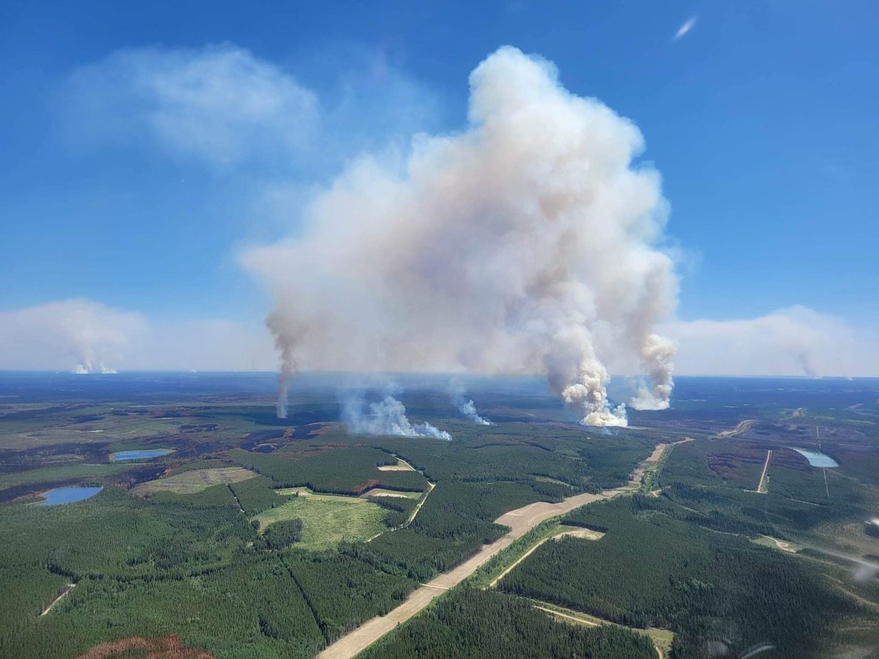 Large columns of smoke are seen from within existing wildfire perimeters. Firefighters are monitoring the movement and responding where needed. Please do not report existing wildfires (June 7, 2023 at 5:00 p.m.)
NEW WILDFIRE DETECTIONS
There are currently no new wildfires detected however firefighters are responding to multiple 310-FIRE calls, assessing if any are new wildfires.
Visit our wildfire dashboard to view active wildfires and their stats.
PEMBINA WILDFIRE COMPLEX | EWF031, EWF039, RWF034, RWF040
Today on the Pembina Complex, multiple columns were visible from nearby communities and travelers. The reason these columns were visible is because of hot and dry weather in the region is igniting unburned fuels within the fire perimeter. The locations of the increased activity is on the northwest flank for the fire 34 (approximately over 40 kms away from the town of Edson) and the northeast and east of fire 30 (approximately 35 kilometers away). Some smoke was also visible near the Moose Creek Road within the fire perimeter. These fuels will continue to burn, and smoke will be highly visible as temperatures increase and relative humidities drop for the next couple of days.
Today, as unburned fuels within the fire perimeter ignited, the fire’s interior naturally cleaned itself up by removing available fuel within the fire perimeter.
Personnel are conducting planned ignition operations on areas of the fire that are presenting favourable conditions to strengthen containment lines. When unburned pockets of fuel remain within the fire perimeter they pose a risk for potential spotting beyond containment lines. By utilizing planned ignition operations, aerial and ground support resources are able to take advantage of conditions that allow them to remove available fuel adjacent to existing containment line. Should these unburned fuels ignite naturally under adverse wind conditions, ground resources may be challenged.
Ground ignitions and potential aerial ignitions will take place at the south flank of 34, northeast and east of 31 when favourable. All other opportunities to clean up unburned fuels and increase suppression efforts ahead of the forecast cold front expected this Saturday. Unburned fuels are being burned out by ground crews in order to bring the fire’s edge to control lines where crews can effectively work the fire’s edge to improve containment.
New information regarding the Deep Creek Complex will be available tomorrow evening unless conditions change. To view previous Edson Forest Area Updates - Click here.
By: Sarah Hall, Pembina Complex. Wildfire Information Officer, BC Wildfire Service.

DEEP CREEK WILDFIRE COMPLEX | EWF035, WCU001, WCU002
WCU001 was detected on April 29 and remains classified as out of control. The wildfire is estimated to be 6,284 hectares, no new growth has been recorded outside the fire perimeter. The wildfire zone is located southeast of Entwistle and west over the Pembina River where it spread north and travelled over Highway 16. The wildfire is parallel with Highway 16 and moved further west where it spread just north of Wildwood and now rests at Chip Lake.
WCU002 was detected on the evening of April 29 and is a mutual aid wildfire located on both sides of Highway 22, north of Highway 16. The wildfire’s status remains out of control. It is estimated to be 2,478 hectares.
Increased fire activity within the interior of the fires of the Deep Creek Complex was seen this afternoon. Smoke and flames have been noted by members of the public and reported to Alberta Wildfire. Firefighters are working on the areas that are exhibiting more fire activity. These consist of unburned areas within the fire perimeter that have not yet burned. Fires burn more readily in areas where there are more conifer-type trees (spruce and pine for example) or where the fire is burning deep into the peat.
Heavy equipment is working on reinforcing containment lines in key areas. Helicopters continue to bucket water onto flames or smoke where required.
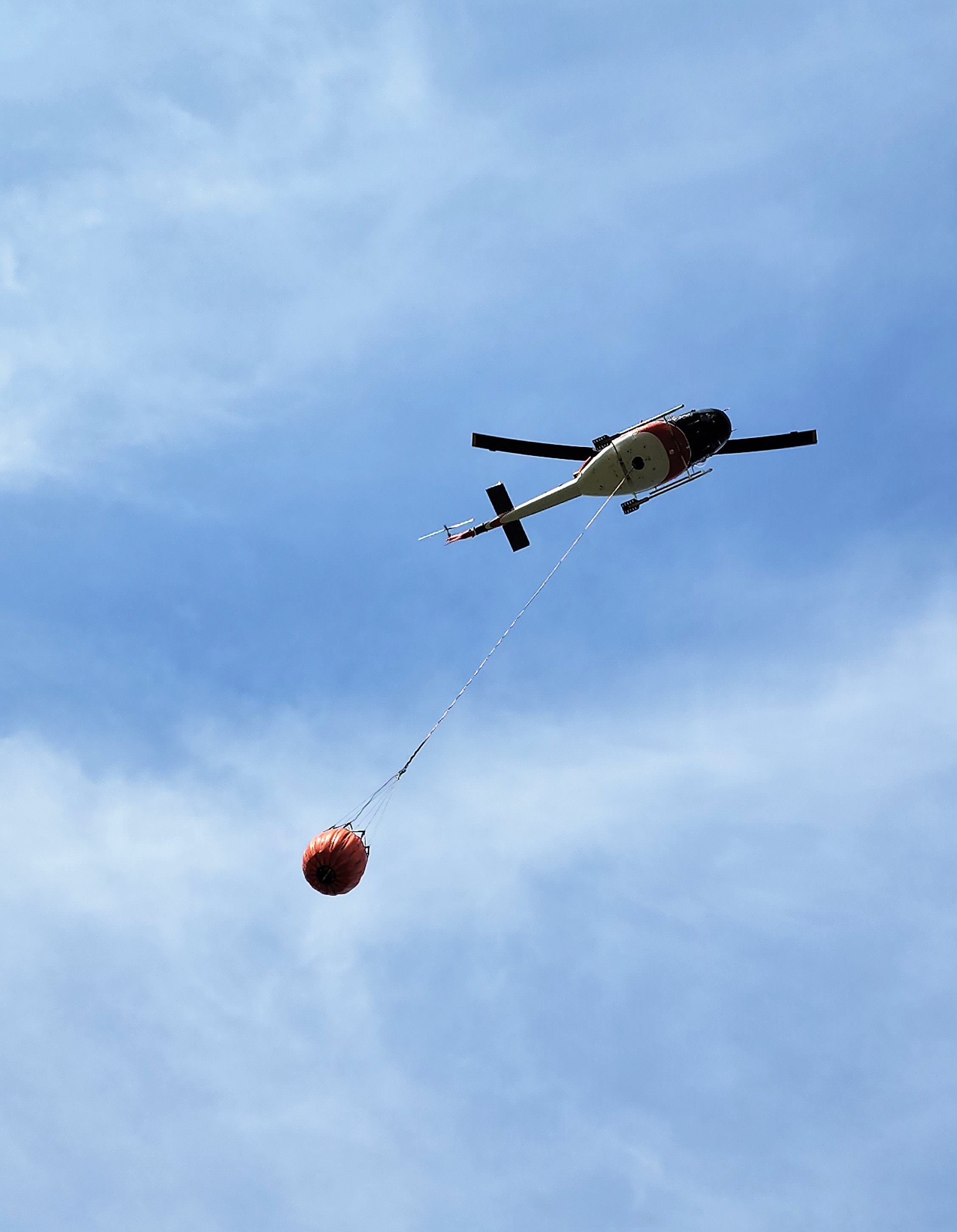 One of the helicopters of the Deep Creek Complex leaves a water source after filling its bucket to douse a hot spot on WCU001 this afternoon. (June 7, 2023)
There is a high likelihood that the fires of the Deep Creek Complex will be more active this week with temperatures expected to reach the high 20’s by Friday, and may reach 30 degrees by Saturday. There is no rain in the forecast for the next few days.
Work continues to be done north of Wildwood west of highway 22 to flood heavily peated areas. The high-volume pump now set up at the Cattle Farm on the west side of highway 22, working to flood peat areas on WCU002. Firefighters are working with hose connected to the high-volume pump to nozzle water under roots and into the soil. They are also working with hand tools to help the water seep deeper into the peat. Fire crews and heavy equipment are also working near Range Road 91 on WCU001.
Deep ash pits and burning peat are dangerous. We ask residents to be extra cautious near burnt areas.
We also ask residents to avoid venturing into forested areas that have been recently affected by wildfire as they can present other hazards such as falling trees, as a result of root systems being compromised by fire.
EWF035 was detected on May 5. The northern portion of the fire is located 2 km east of Shining Bank Lake, reaching north and east across Township Road 560 and as far south as approximately 2 km north of the Niton Junction railway.
This wildfire is classified as out of control and is estimated to be 19,567 ha. The wildfire is south of Township Road 570, has burnt down to the south and continues to a site two kilometers north of the railroad track in Niton Junction. The fire moved across the Range Road 123 and burnt up to the Lobstick River.
Hot and windy conditions increased fire activity in a few spots within the interior of the fire this afternoon. This is expected to continue throughout the week as temperatures rise and the relative humidity drops. Significant smoke was visible mid-afternoon but has dissipated as the flames consumed previously unburned vegetation within the interior of the fire.
Wildland firefighters continue to work with heavy equipment to contain the wildfire on the south and north sections of the fire (the latter closer to Township Road 560 in the interior). South African firefighters have arrived at the Deep Creek Complex. The have received their assignments and are working alongside firefighters from Alberta, BC, Ontario, US and Australia.
Firefighters continue to work on the east-south-east side of the fire where hotspots are prevalent today. Another crew of firefighters continues to work on the southwest side of this fire, continuing to establish containment line along the perimeter. British Columbia crews are working on the southern portion of the interior of the fire, south of Township Road 560 and on the northeastern-most side of the fire. Heavy equipment and firefighters are working in the central portion of the fire south of Township Road 560.
A reclamation specialist continues to assess areas of the fire that can be actioned.
Fire behaviour typically increases during the “peak burning period”. This is normally mid-afternoon, when temperatures are hottest and relative humidity drops. Fire activity tends to slow down in the morning and late evenings when temperatures are cooler and humidity levels are higher.
As a precautionary measure, Yellowhead County and AB Wildfire are triaging certain residences with structural protection units and has put sprinklers on several homes north of Niton Junction along the East Bank Road near Township Road 560. Firefighters will be in the area evaluating the current conditions and monitoring for increased fire activity.
There are 79 firefighters assigned to the Deep Creek Complex, six helicopters, 39 pieces of heavy equipment and 35 overhead staff that are part of the incident management team and crew supervision. An incident management team from Ontario with members from Alberta is working alongside overhead staff and firefighters from Prince Edward Island, Australia, British Columbia, the United States, South Africa and dedicated Alberta Wildfire staff on the Deep Creek Complex.
New information regarding the Deep Creek Complex will be available tomorrow evening unless conditions change. To view previous Edson Forest Area Updates - Click here.
By: Isabelle Chenard. Wildfire Information Officer, Ontario Ministry of Natural Resources and Forestry. Contact: 780-728-5843.

WILD HAY WILDFIRE COMPLEX | EWF037 and EWF040
The Wild Hay Complex is comprised of two wildfires, EWF037 and EWF040. They are both located south of the Little Smoky River, north of the Wild Hay River and east of Hwy 40 north. The complex is 63 km north of Hinton.
EWF040 is now out of control and now estimated to be 944 ha, it escaped its wildfire boundary this afternoon and is burning north of its original burnt area and south of the Berland River. Four firefighters, two medium helicopters and one heavy helicopter is actioning the wildfire.
EWF037 continues to be classified as being held at 578 ha.
GENERAL INFORMATION ON WILDFIRES IN OUR AREA
AREA CHALLENGES | This has been an unprecedented wildfire season; one that has resulted in many challenges for wildfire staff across the province. In response Alberta has been working with our partners to meet the demands for personnel and equipment needed to fight the numerous wildfires we have seen this spring. In the Edson Forest Area we currently have crews and support staff from all over Canada and the world, including U.S.A., Australia, New Zealand and South Africa, B.C., P.E.I., Newfoundland and Ontario.
WORK OR RECREATE NEAR WILDFIRE AREAS | We urge residents and members of the public to use extra caution near burnt areas. There are many hazards that may not be visible, like deep burning ash pits and falling trees. Burnt trees are a serious hazard, and trees that may look healthy that have green needles or leaves could have burnt out roots under the ground and fall unexpectedly. Keep in mind that trees and powerlines could also fall on the road and block your vehicle. Do not approach powerlines as they could be energized.
SMOKE | Lingering smoke can still be visible in some areas and in affected communities. Smoke inversions can trap air near the ground causing dangerous driving conditions and impacting nearby communities. If you have smoke related health concerns, please contact Alberta 811 or visit Alberta Health Services . Visit firesmoke.ca for current and forecasted smoke.
REPORTING WILDFIRES | We always appreciate people calling in to report wildfires but the large volume of calls we are receiving could be diverting our resources away from other essential tasks. As always, call 310-FIRE if you see smoke or flame that looks new and potentially unreported, but assume that large columns of smoke and burned over areas have already been detected and reported. If you or your property are in immediate danger, call 911.
AIRCRAFT NEAR WATER | Depending on the location of a wildfire, firefighting aircraft may need to use water from nearby lakes as a source of water to help fight wildfires. Often, these aircraft arrive without advanced warning. If you are in the water and see an aircraft coming in to collect water, please move within 30 m from the shore so these aircraft can safely resume firefighting efforts. Aircraft are large and require space to collect water, without interference from people and boats. Help us by staying out of the way when aircraft are around. Click here to learn more.
DRONES | The use of recreational drones over wildfires in Alberta is dangerous, illegal and could result in a fine of up to $15,000* for putting aircraft and people at risk. Please give Alberta firefighters the space they need to do their jobs safely. *Transport Canada
WILDFIRE PREPARDNESS | Learn how you can prepare yourself for a wildfire by clicking here.
WILDFIRE INVESTIGATIONS | Wildfires in Alberta are either human-caused or caused by lightning. Every wildfire in Alberta is investigated and the wildfires mentioned remain under investigation.
WILDFIRE CLASSIFICATIONS | To learn more about wildfire classifications, click here.
WILDFIRE MAPS AND BOUNDARIES | Note that wildfire perimeter maps are an estimate based on measurements such as GPS, aerial scanning and satellite imagery. This estimated perimeter can change as more accurate measurements become available. Areas within the fire perimeter may not have been affected by wildfire. Visit our Wildfire Dashboard to view active wildfires and their stats on the wildfire dashboard. Click on "view interactive map". You can choose different basemaps by selecting the four squares icon, or layers by clicking on the three sheets of paper on the top right corner.
**Bold indicates new or important information.

We encourage the public and industry to download the AB Fire Bans app or visit the website to learn more about prohibited and allowed actives under this restriction. If you are looking for information regarding crown land, click on the area you plan to visit and not the nearest town. Be advised that Alberta Parks has it's own set of fire ban levels, please visit their website for more information.
The fire restriction will remain in effect until conditions improve. To view the Alberta Wildfire Fire Ban video, click here.
Albertans are always asked to use caution when working or recreating in the outdoors:
- Before you burn it, get your fire permit. Fire permits in Alberta.
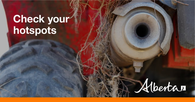
- Clear debris from hot spots on your off-highway vehicle.
- Ensure your campfire is out - soak it, stir it, soak it again.
- Before you head out this weekend, check out the albertafirebans.ca website or download the app to stay informed.
- For road closure information, please visit 511.alberta.ca
- For information regarding smoke in the area, you can visit firesmoke.ca
- NASA FIRMS Fire Information website is a great resource to give an idea of the location of wildfires in the area, but note that the data is based on interpolation and often can make the wildfire look larger then it actually is.
ALBERTA WILDFIRE INFORMATION
- Subscribe to the Edson Forest Area wildfire update to receive an email when new information is posted.
- Download the Alberta Wildfire App for Apple and Android device.
- Join the conversation on Facebook, Twitter or Instagram.
For more information, please contact: