
Please do not report smoke or flame from within an active wildfire area. Firefighters are being diverted from essential tasks when responding to existing fires reported by the public. You may see smoke or flame within the existing boundary of a wildfire, this is normal.
If you see smoke or flame outside of an active fire area, report it to 310-FIRE. If you or your property is in immediate danger, call 911.
Previous Edson Forest Area Updates - Click here
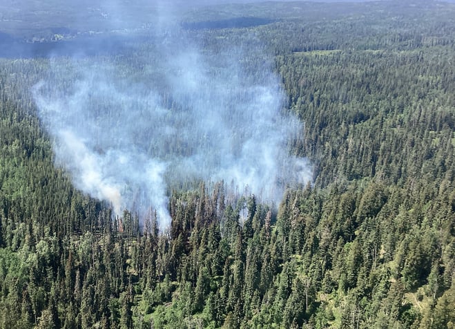 EWF054 was detected today and being actioned by eight firefighters and one helicopter (June 3, 2023).
NEW WILDFIRE STARTS
EWF054 was detected this afternoon and is located 38 km northwest of Edson, 5 km north of the Emerson road and estimated to be 0.9 ha in size. The fire is currently classified as out of control. An airtanker actioned the wildfire and eight firefighters and one helicopter are on scene working to extinguish the wildfire.
GENERAL INFORMATION ON WILDFIRES IN OUR AREA
**Bold indicates new or important information.
The area continues to have limited resources due to these exceptional times. We're sharing valuable resources with many other wildfires in the province but continue to work on and monitor the following wildfires in our area: WCU001, WCU002, EWF035, EWF031, EWF039, EWF037, EWF40 and new starts that are detected.
Firefighters, aircraft, and heavy equipment have been working in conjunction with county and municipal firefighting services as aggressively as possible to make progress on these wildfires while the conditions have been favorable. Despite all of this hard work, there are still hundreds of kilometers of uncontained wildfire perimeter and fire behaviour forecasts indicate that there may be growth on some of the wildfires throughout the Edson Forest Area.
Lingering smoke can still be visible in some areas and in affected communities. Smoke inversions can trap air near the ground causing dangerous driving conditions and impacting nearby communities. Please use EXTRA CAUTION WHEN DRIVING IN SMOKY CONDITIONS!
While we always appreciate people calling in to report wildfires, the large volume of calls we are currently receiving is diverting our resources away from other essential tasks. As always, please call 310-FIRE if you see smoke or flame that looks new and potentially unreported, but assume that large columns of smoke and burned over areas have already been detected and reported.
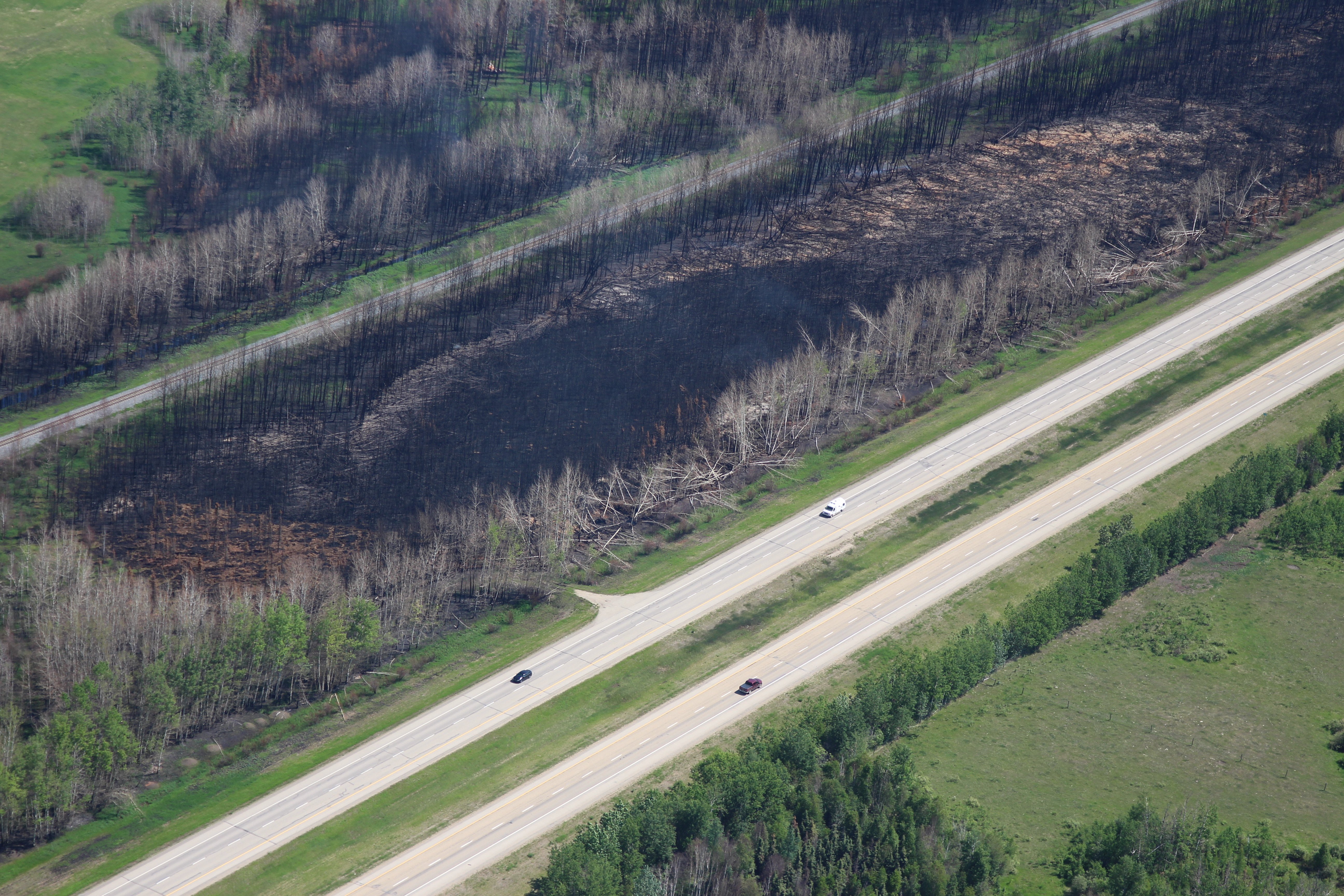
We ask residents to be extra cautious near burnt areas and to avoid venturing into forested areas that have been recently affected by wildfire as they can present other hazards such as falling trees, as a result of root systems being compromised by fire. Deep ash pits and burning peat are also dangerous.
Visit our Wildfire Dashboard to view active wildfires and their stats on the wildfire dashboard.
All wildfires in Alberta are investigated and these wildfires remain under investigation. To learn more about wildfire classifications, click here.
PEMBINA WILDFIRE COMPLEX | EWF031, EWF039, RWF034, RWF040
Today, there are 113 firefighters and incident management team members and support staff being shared between all fires on the Complex. There are 97 pieces of heavy equipment, and 23 helicopters assigned to the complex. An airtanker group is available to respond if necessary.
Crews took advantage of the minimal fire behavior to make good progress with their assignments. Dozers continued guard construction on both the northern and southern edges of the Wildfire Complex. In the north area they secured completed guard on the perimeter of the EWF031 excursion while south of RWF034 and RWF040, dozers and crews are expanding the guard in that area. After new dozer guard is constructed, crews follow behind securing with water systems, extinguishing hotspots, mopping up, removing or “demobing” the water systems when the fire threat is mitigated, then progress on to the next area needing attention. It is a long process and essential to containing the fire.
Fire behavior was minimal throughout the early part of the day with cooler temperatures and higher relative humidity suppressing fire activity. Smoldering fire with minimal low rates of spread were observed and ground fire is still present. In the afternoon, increased temperatures and winds resulted in potential fire spread on the surface with intermittent individual tree torching and crowning. It was a good day for fighting fire and noticeable progress was made.
EWF031 was detected on May 4 and is located 25 km west of Lodgepole, 20 km northwest of Brazeau Dam and 14 km southeast of Edson. The fire is classified as out of control and is estimated to be 130,762 ha in size. There was minimal fire growth today and that was well within fire contingency lines.
Yesterday wildfire firefighters and and heavy equipment were successful in placing dozer and hand guard around the entire excursion located on the northeast portion of EWF031- (Sub Section 1 of Section 1 in T50 R13 W5). The dozer guard on the perimeter of the excursion is being secured by crews completing the installation of water hose and the addition of supplemental dozer guard where needed. Helicopters will continue bucket drops and stand by to assist crews on the ground.
There is a containment line on the north side of the fire working downwards towards 6 Mile Road as well as a containment line previously completed and located south from Dora’s Corner. Both lines will have continued air support as visibility allows, and it is safe for aviation resources to operate to perform water drops if necessary.
EWF039 located near Carrot Creek, is currently being held. The fire is currently estimated to be 165 ha. The fire is fully wrapped in containment line and is a kilometer away from the Carrot Creek lookout tower. The one smoke detected days ago is well into the fire perimeter was in a burnt tree stump and is no longer showing any activity. The Lookout staff will keep watch over the area.
RWF034 is located near the O'Chiese Reserve and classified as out of control. The fire is currently estimated at 87,108 ha in size.
On the south side of RWF034 along the Brazeau River, dozer guard construction was completed today. Crews are supporting the guard and monitoring conditions.
RWF034 and RWF040 have connected and will be managed as one fire although they will be tracked individually for the time being.
RWF040 The fire is actively monitored by firefighters and support staff assigned to the complex who can respond if necessary. The fire is currently estimated to be 5,089 ha in size. Dozer guard was completed a couple of days ago around the east, south, and west sides of RWF040. Crews are actively supporting the guard with the installation of water systems which includes hose and pumps. An infrared scan completed a few days ago indicated that there were several hotspots within the fire perimeter. Crews are individually checking the hotspots for any potential issues and extinguishing any threats.
Some smoke is observed within the fire line which is to be expected with the trend of warming and drying conditions. Past growth occurred mostly to the west. The Blackstone Lookout Tower in the area is currently not at risk.
This will be the final day of the two-week assignment for the NW Compact IMT from the United States that has been managing the fire along with Alberta Fire. The incoming IMT is from British Columbia and will start actively managing the fire this evening. Taking over the role of sharing information with the community is Sarah Hall, Liaison and Information Officer for British Columbia Incident Management Team 3. Sarah was here in the same role working with the BC IMT that preceded us.
Tomorrow, we begin the long journey back to the United States. It has been an honor to serve you and your communities.
By: Kent Romney, Pembina Complex. Wildfire Information Officer, Oregon Department of Forestry.

DEEP CREEK WILDFIRE COMPLEX | EWF035, WCU001, WCU002
WCU001 was detected on April 29 and remains classified as out of control. The wildfire is estimated to be 6,281 ha in size, no new growth has been recorded outside the fire perimeter. The wildfire zone is located southeast of Entwistle and west over the Pembina River where it spread north and travelled over Highway 16. The wildfire is parallel with Highway 16 and moved further west where it spread just north of Wildwood and now rests at Chip Lake.
Smoke from WCU001 is visible from the highway 16 between Hansonville and Evansburg as hotspots continue to produce smoke from within the interior of this fire, this is normal and expected. As weather continues to be hot and dry, smoke will continue to be seen over the weekend. (June 2, 2023)
WCU002 was detected on the evening of April 29 and is a mutual aid wildfire located on both sides of Highway 22, north of Highway 16. The wildfire’s status remains out of control. It is estimated to be 2,477 ha in size.
There has been no new growth outside of the fire perimeter of either of these wildfires and observed fire behavior continues to be relatively low with some areas generating smoke this afternoon in the interior as warmer weather has returned to the area. Firefighters continue to make good progress on containing the wildfire and "mopping up", meaning that they are putting out hotspots.
Work continues to be done north of Wildwood west of highway 22 to flood heavily peated areas. Helicopters are bucketing onto hotspots as needed. A high-volume pump is working alongside heavy equipment near highway 22.
An overview of WCU001 on June 2, 2023. Chip Lake can be seen in the background. *To view the video, open the update in the app or website.
Smoke may continue to be seen as flare-ups occur on the interior. This is expected to persist in the peat areas where the fire is burning deep, smouldering under the layers of peat and burning roots and other organic matter.
Deep ash pits and burning peat are dangerous. We ask residents to be extra cautious near burnt areas. We also ask residents to avoid venturing into forested areas that have been recently affected by wildfire as they can present other hazards such as falling trees, as a result of root systems being compromised by fire.
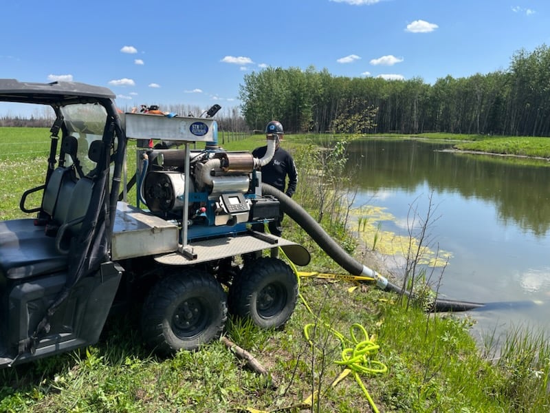 High-volume pump working on WCU002 near Highway 22. (June 3, 2023)
EWF035 was detected on May 5. The northern portion of the fire is located 2 km east of Shining Bank Lake, reaching north and east across Township Road 560 and as far south as approximately 2 km north of the Niton Junction railway.
This wildfire is classified as out of control and is estimated to be 19,592 ha in size. The wildfire is south of Township Road 570, has burnt down to the south and continues to a site two kilometers north of the railroad track in Niton Junction. The fire moved across the Range Road 123 and burnt up to the Lobstick River.
Wildland firefighters continue to work with heavy equipment to contain the wildfire on the south sections of the fire. The hotshot crews from the U.S. continue to work on the east-south-east side of the fire where hotspots were prevalent. Helicopters with water buckets continue to assist the firefighters with their efforts. They have wrapped up their work around Sunset Lake and have moved further south down the fireline to continue working on fire suppression efforts. British Columbia crews who arrived yesterday afternoon received their assignments. They are also working south of Township Road 560.
The perimeter from the northeast of the fire towards the northwest was cool again today with little to no fire activity. Firefighters are confident that the whole north and west boundary of the wildfire, down East Bank Road (Range Road 133A) is now contained and expect that the containment line wouldn't be challenged if the winds pushed the wildfire towards that direction again.
Fire behaviour typically increases during the “peak burning period”. This is normally mid-afternoon, when temperatures are hottest and relative humidity drops. Fire activity tends to slow down in the morning and late evenings when temperatures are cooler and humidity levels are higher.
Tomorrow will be a warm day with temperature rising to the upper 20’s. Early in the day, winds are expected to be southeasterly to northeasterly at 15-20 km/h, shifting to northwesterly and increasing in speed throughout the afternoon and evening. Windier conditions will be noted as of the early evening on Sunday and into the overnight period when 20 km/h sustained winds with gusts of up to 35 km/h are expected. Minimal precipitation is in the forecast and the temperature will cool down on Monday - 20 degrees Celsius is forecast. Sustained winds are expected to remain moderate to start the week with westerly winds at 25-30 km/h. These may be accompanied by gusts of up to 45 km/h. Residents can expect to note fire activity within the perimeters of the Deep Creek Complex fires, more notably at “peak burn” in the coming days as.
There are 63 firefighters assigned to the Deep Creek Complex, seven helicopters, 43 pieces of heavy equipment and 49 overhead staff that are part of the incident management team and crew supervision. An incident management team from Ontario with members from Alberta is working alongside overhead staff and firefighters from Prince Edward Island, Newfoundland, Australia, British Columbia, the United States and dedicated Alberta Wildfire staff on the Deep Creek Complex. Additional resources are expected to arrive in the coming days.
By: Isabelle Chenard. Wildfire Information Officer, Ontario Ministry of Natural Resources and Forestry. Contact: 780-728-5843.

WILD HAY WILDFIRE COMPLEX | EWF037 and EWF040
EWF037 is being held at 578 ha and EWF040 is being held at 684 ha. There are multiple wildfires located south of the Little Smoky River, north of the Wild Hay River and east of Hwy 40 north. These also include the areas near the Willow Haul Road and the Jack Wright Road north of Hinton.
There has been no perimeter growth on this complex is several days. Smoke and flame may still be observed within the interior of both EWF037 and EWF040. This complex is now being patrolled and monitored.
PUBLIC WILDFIRE MAPS
Visit our Wildfire Dashboard to view active wildfires and their stats on the wildfire dashboard.
Deep Creek Wildfire Complex (EWF035, WCU002 and WCU001) May 29, 2023 - public map - Click here.
Pembina Wildfire Complex (EWF031, EWF039, RWF034, RWF040) May 23 , 2023 - public map - Click here. *this map does not show other existing wildfires nearby.
Note: The wildfire perimeter map is an estimate based on measurements such as GPS, aerial scanning and satellite imagery. This estimated perimeter can change as more accurate measurements become available. Areas within the fire perimeter may not have been affected by wildfire.

Prohibited:
- All outdoor wood fires in backcountry and random camping areas on public land
- Charcoal briquettes in backcountry and random camping areas on public land
- The use of fireworks and exploding targets
Allowed:
- Wood campfires on private land and in designated campgrounds
- Charcoal briquettes on private land and in designated campgrounds
- Propane/natural gas-powered appliances
- Open flame oil devices (e.g., turkey deep fryers, tiki torches)
- Indoor wood fires contained within a device with a chimney and spark arrestor
- All appliances must be CSA approved and used per manufacturer’s standards
We encourage the public and industry to download the AB Fire Bans app or visit www.albertafirebans.ca to learn more about prohibited and allowed actives under this restriction. If you are looking for information regarding crown land, click on the area you plan to visit and not the nearest town.
Be advised that Alberta Parks has it's own set of fire ban levels, please visit their website for more information.
DO NOT FLY DRONES NEAR WILDFIRES!
The use of recreational drones over wildfires in Alberta is dangerous, illegal and could result in a fine of up to $15,000* for putting aircraft and people at risk. Please give Alberta firefighters the space they need to do their jobs safely. *Transport Canada
Albertans are always asked to use caution when working or recreating in the outdoors:
- Before you burn it, get your fire permit. Fire permits in Alberta.
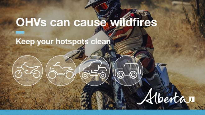
- Clear debris from hot spots on your off-highway vehicle.
- Ensure your campfire is out - soak it, stir it, soak it again.
- Before you head out this weekend, check out the albertafirebans.ca website or download the app to stay informed.
- For road closure information, please visit 511.alberta.ca
- For information regarding smoke in the area, you can visit firesmoke.ca
- NASA FIRMS Fire Information website is a great resource to give an idea of the location of wildfires in the area, but note that the data is based on interpolation and often can make the wildfire look larger then it actually is.
ALBERTA WILDFIRE INFORMATION
- Subscribe to the Edson Forest Area wildfire update to receive an email when new information is posted.
- Download the Alberta Wildfire App for Apple and Android device.
- Join the conversation on Facebook, Twitter or Instagram.
For more information, please contact: