
Please do not report smoke or flame from within an active wildfire area. Firefighters are being diverted from essential tasks when responding to existing fires reported by the public. You may see smoke or flame within the existing boundary of a wildfire, this is normal.
If you see smoke or flame outside of an active fire area, report it to 310-FIRE. If you or your property is in immediate danger, call 911.
Previous Edson Forest Area Updates - Click here
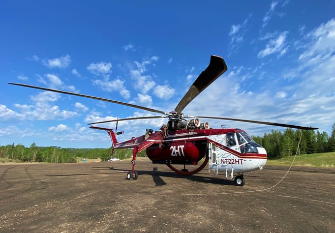 Sikorski CH-54B Air Cranes from Albany, Oregon arrived to the Edson Forest Area from the USA yesterday. They will be in service sometime today. (May 29, 2023)
Firefighters continue to consider controlled burn operations on some of the wildfires in the area. These can include ground and aerial ignition operations. These operations can only occur if the conditions are suitable. Firefighters monitor and evaluate those conditions throughout the day.
The goal of this operation is to remove the available fuel between the fire’s edge and the containment line. This strategy helps to slow down and limit the spread of the wildfire by decreasing the amount of fire perimeter that must be managed by firefighters. In preparation for these operations, fire suppression equipment and firefighters will be in position to extinguish any flame that may be near the containment line.
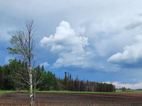
Note that increased smoke from this wildfire will be visible from surrounding communities.


A fire ban remains in place for Fire Control Zones 13, 14, and 16 FACTSHEET | MAP in the Edson Forest Area. All other areas within the Edson Forest Area are currently under a fire restriction FACTSHEET | MAP, which does permit campfires within designated campgrounds on private and public lands in designated day use areas, but not campfires in backcountry or random camping areas.
An OHV restriction remains in place for Fire Control Zones 13, 14 and 16 - FACTSHEET | MAP.

Screenshot from the Albertafirebans.ca website. The orange section indicates a fire restriction which means you can only have a campfire on private land or in a designated campground, if a fire ban isn't in effect. The red section indicates a fire ban which means you cannot have a campfire in either private or public land (back country). The red also indicates an OHV restriction. ** Please see factsheets above for more information regarding fire restrictions, bans and OHV restrictions. (May 27, 2023).
Be advised that Alberta Parks has it's own set of fire ban levels, please visit their website for more information.
FIRESMART BEGINS AT HOME
Protecting your home starts with simple actions.
There are many factors that may impact your property's risk to wildfire. FireSmart Canada has great videos that you can view on various topics. You can check out these videos by clicking here and viewing their videos on YouTube.
![]()
GENERAL INFORMATION ON WILDFIRES IN OUR AREA
**Bold indicates new or important information.
The area continues to have limited resources due to these exceptional times. We're sharing valuable resources with many other wildfires in the province but continue to work on and monitor the following wildfires in our area: WCU001, WCU002, EWF035, EWF031, EWF039, EWF037, EWF40 and new starts that are detected.
Firefighters, aircraft, and heavy equipment have been working in conjunction with county and municipal firefighting services as aggressively as possible to make progress on these wildfires while the conditions have been favorable. Despite all of this hard work, there are still hundreds of kilometers of uncontained wildfire perimeter and fire behaviour forecasts indicate that there may be growth on some of the wildfires throughout the Edson Forest Area.
Lingering smoke can still be visible in some areas and in affected communities. Smoke inversions can trap air near the ground causing dangerous driving conditions and impacting nearby communities. Please use EXTRA CAUTION WHEN DRIVING IN SMOKY CONDITIONS!
While we always appreciate people calling in to report wildfires, the large volume of calls we are currently receiving is diverting our resources away from other essential tasks. As always, please still call 310-FIRE if you see smoke or flame that looks new and potentially unreported, but assume that large columns of smoke and burned over areas have already been detected and reported.
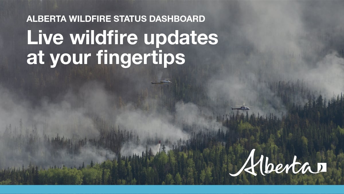
Visit our Wildfire Dashboard to view active wildfires and their stats on the wildfire dashboard.
All wildfires in Alberta are investigated and these wildfires remain under investigation. To learn more about wildfire classifications, click here.
PEMBINA WILDFIRE COMPLEX - EWF031/039, RWF034/040
Today, there were 117 firefighters and IMT support staff being shared between all fires on the Complex. There were 81 pieces of heavy equipment, and 24 helicopters assigned to the complex. An airtanker group is available to respond if necessary.
The crews made great progress with their assignments today: Dozers were creating containment line on both the northern and southern sides of the Wildfire Complex. In the north area, crews completed and secured the perimeter of the EWF031 excursion while to the south of RWF034 and RWF040, dozers and crews were expanding the containment line.
Today the fire behavior was mild to moderate throughout the morning with stable temperatures and moderate relative humidity. Rain showers and thunderstorms moved into some areas of the of the wildfire complex this afternoon and some parts of the fires received precipitation. Surface fire with low rates of spread were observed earlier in the day followed by slightly increased activity in the afternoon including intermittent crowning and spread.
EWF031 was detected on May 4 and is located 25 km west of Lodgepole, 20 km northwest of Brazeau Dam and 14 km southeast of Edson. The fire is classified as out of control and is estimated to be 130,762 ha in size. This number changed due to more accurate mapping with an infrared scan conducted the past few days ago in addition to increased fire behavior. Any fire growth today was well within fire contingency lines. An updated map will be available in the coming days.
Today firefighters continued to focus attention and resources on the excursion located on the northeast portion of the fire. The excursion’s progress to the north, east and west was stopped by the secured containment line established by dozers and crews today and on previous days. The team had most of its air resources on the excursion all day. This was a big success!
There is a containment line on the north side of the fire working downwards towards 6 Mile Road as well as a containment line previously completed and located south from Dora’s Corner. Both lines will have continued air support as visibility allows, and it is safe for aviation resources to operate to perform water drop if necessary.
EWF039 located near Carrot Creek, is currently being held. The fire is currently estimated to be 165 ha. The fire is fully wrapped in containment line and is a kilometer away from the Carrot Creek lookout tower.
RWF034 is located near the O'Chiese Reserve and classified as out of control. The fire is currently estimated at 87,108 ha in size.
On the southeast side of RWF034, an additional containment line continues to be constructed from the highway to the corner of the reservoir. It continues south from the reservoir and west to tie in with the Brazeau River. It then continues along the south bank of the river extending west around the southwest side of RWF040. From there it heads north on the east side of RWF040. Good progress was made on this containment line. This work will continue tomorrow and should be completed in the next couple of days.
Effective May 23, 2023, around 16:00hrs, the evacuation order for the O’Chiese FN was lifted and there are no alerts in place.
RWF034 and RWF040 have connected and will be managed as one fire although they will be tracked individually for the time being.
RWF040 The fire is actively monitored by firefighters and support staff assigned to the complex who can respond if necessary. The fire is currently estimated to be 5,089 ha in size. Some smoke was observed within the fire line which is to be expected with the trend of warming and drying conditions. Past growth occurred mostly to the west. The Blackstone Lookout Tower in the area is currently not at risk.
By: Kent Romney, Pembina Complex. Wildfire Information Officer, Oregon Department of Forestry.

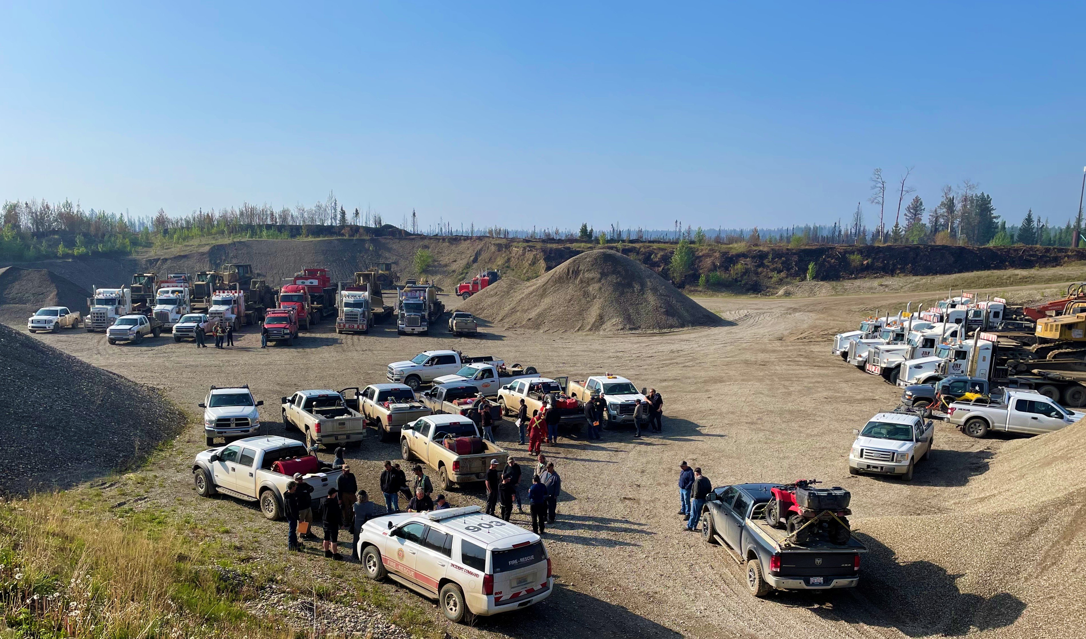
Heavy equipment staging site. Heavy equipment continued working on the EWF031 excursion today. (May 30, 2023)
DEEP CREEK WILDFIRE COMPLEX – EWF035, WCU001 & WCU002
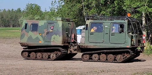
USA Hotshot crews heading out to the fireline on the Deep Creek Complex. (May 30, 2023)
WCU001 was detected on April 29 and remains classified as out of control. The wildfire is estimated to be 6,281 ha in size, no new growth has been recorded outside the fire perimeter. The wildfire zone is located southeast of Entwistle and west over the Pembina River where it spread north and travelled over Highway 16. The wildfire is parallel with Highway 16 and moved further west where it spread just north of Wildwood and now rests at Chip Lake.
WCU002 was detected on the evening of April 29 and is a mutual aid wildfire located on both sides of Highway 22, north of Highway 16. The wildfire’s status remains out of control. It is estimated to be 2,477 ha in size.
There has been no new growth outside of the fire perimeter of either of these wildfires and observed fire behavior continues to be low. Firefighters continue to make good progress on containing the wildfire and "mopping up", meaning their putting out hotspots.
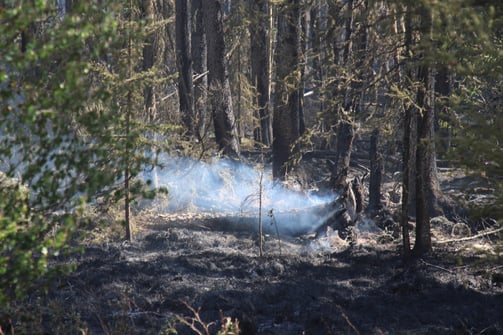
Smoke may continue to be seen coming from the interior of the fires . (May 30, 2023)
Smoke may continue to be seen as flare-ups occur on the interior. This is expected to persist in the peat areas where the fire is burning deep, smouldering under the layers of peat and burning roots and other organic matter. The presence of bucketing helicopters is expected to continue as they work on fire suppression.
Deep ash pits and burning peat are dangerous. We ask residents to be extra cautious near burnt areas.
.png?width=342&height=456&name=MicrosoftTeams-image%20(1).png)
Deep, hot ash pits around burnt tree roots on the Deep Creek Complex . (May 30, 2023)
We also ask residents to avoid venturing into forested areas that have been recently affected by wildfire as they can present other hazards such as falling trees, as a result of root systems being compromised by fire.
Thunderstorm in the Edson Forest Area today today. (May 30, 2023)
Isolated thunderstorms brought rain and lightning through some parts of the Deep Creek Complex this afternoon. The potential exists for holdover lightning fires to be discovered over the coming days. Even in instances when lightning is accompanied by rain, it can strike a tree or start a fire under the forest floor, and once the weather dries up, winds pick up and temperatures rebound those holdover lightning fires can appear on the landscape. Sometimes up to about a week later. Fire management staff will be on the lookout for hold-over lightning fires over the next few days as a result.
EWF035 was detected on May 5. The wildfire was detected 4.3 km north of Twp Rd 560, 7.5 km east of East Bank Road, and 6 km south of Twp Rd 570. We invite anyone who would like to see the exact location on a map to visit our dashboard by clicking here.
This wildfire is classified as out of control and is estimated to be 19,592 ha in size. The wildfire is south of Township Road 570, has burnt down to the south and continues to a site two kilometers north of the railroad track in Niton Junction. The fire moved across the Range Road 123 and burnt up to the Lobstick River.
Wildland firefighters continue to work with heavy equipment to contain the wildfire on the south sections of the fire. The hotshot crews from the U.S. continue to work on the east-south-east side of the fire where hotspots were prevalent. Helicopters with water buckets continue to assist the firefighters with their efforts. They have been focusing on an area near Sunset Lake and other areas around the east side of the fire.
The perimeter from the northeast of the fire towards the northwest was cool again today with little to no fire activity. Firefighters are confident that the whole north and west boundary of the wildfire, down East Bank Road (Range Road 133A) is now contained and expect that the containment line wouldn't be challenged if the winds pushed the wildfire towards that direction again.
Fire behaviour typically increases during the “peak burning period”. This is normally mid-afternoon, when temperatures are hottest and relative humidity drops. Fire activity tends to slow down in the morning and late evenings when temperatures are cooler and humidity levels are higher.
We expect temperatures in the high teens tomorrow and Thursday with relative humidity values in the 35 to 50% range. Northwesterly winds at 15 km/h are forecasted for Wednesday, shifting to North-easterly later in the day with a 70 percent chance of minimal precipitation (in the 3-6 mm range). North-north-easterly winds are expected to be lighter on Thursday as dryer conditions return leading up to the weekend. As a result, fire activity is expected to be low on the complex for Wednesday during non-peak burning times. As conditions rebound on Thursday, residents can expect to note fire activity within the perimeters of the Deep Creek Complex fires, more notably at “peak burn”.
The Deep Creek Complex has 72 wildland firefighters, six helicopters, 37 pieces of heavy equipment and 38 overhead staff that are part of the incident management team and crew supervision. An incident management team from Ontario with staff from Alberta is working alongside overhead staff and firefighters from Prince Edward Island, Newfoundland, Australia, New Zealand, the United States and dedicated Alberta Wildfire crews on the Deep Creek Complex. Additional resources are expected to arrive in the coming days.
By: Isabelle Chenard. Wildfire Information Officer, Ontario Ministry of Natural Resources and Forestry. Contact: 780-728-5843.

WILD HAY WILDFIRE COMPLEX - EWF037 and EWF040
EWF037 is being held at 578 ha and EWF040 is being held at 684 ha. There are multiple wildfires located south of the Little Smoky River, north of the Wild Hay River and east of Hwy 40 north. These also include the areas near the Willow Haul Road and the Jack Wright Road north of Hinton. These wildfires were formerly reported as five separate fires, but due to more accurate GPS measuring, have been determined to be two larger fires.
There has been no perimeter growth on this complex is several days. Smoke and flame may still be observed within the interior of both EWF037 and EWF040. This complex is now being patrolled and monitored.
PUBLIC WILDFIRE MAPS
Visit our Wildfire Dashboard to view active wildfires and their stats on the wildfire dashboard.
Deep Creek Wildfire Complex (EWF035, WCU002 and WCU001) May 29, 2023 - public map - Click here.
Pembina Wildfire Complex (EWF031, EWF039, RWF034, RWF040) May 23 , 2023 - public map - Click here. *this map does not show other wildfire nearby.
Edson Forest Area Fires May 23, 2023 - public map - Click here.
Note: The wildfire perimeter map is an estimate based on measurements such as GPS, aerial scanning and satellite imagery. This estimated perimeter can change as more accurate measurements become available. Areas within the fire perimeter may not have been affected by wildfire.
WILDFIRE LINKS AND TOOLS
There are multiple EVACUATION ORDERS & ALERTS in the Province. Please visit Alberta Emergency Alerts or your community webpage for more information.
For road closure information, please visit: 511.alberta.ca
The NASA FIRMS Fire Information website is a great resource to give an idea of the location of wildfires in the area, but it should be noted that this data is based on interpolation and often can make a wildfire appear larger than it actually is.
Wildfire smoke is a tool used for the location of smoke firesmoke.ca
DO NOT FLY DRONES NEAR WILDFIRES!
The use of recreational drones over wildfires in Alberta is dangerous, illegal and could result in a fine of up to $15,000* for putting aircraft and people at risk. Please give Alberta firefighters the space they need to do their jobs safely. *Transport Canada
COMMUNITY EMERGENCY INFORMATION | EVACUATIONS
A MESSAGE FROM THE MUNICIPALITIES
If you are evacuating, gather important documents, medication, and enough food and water to be away from home for at least 3 days. Take pets with you.
For updates from Yellowhead County and Town of Edson, please visit their Facebook page: https://www.facebook.com/yellowheadcounty or www.yhcounty.ca for updates. Evacuees can call 1-833-334-4630 for more information.
For updates from Parkland County, please visit their Facebook page: https://www.facebook.com/ParklandCountyAB. Residents in the affected areas can contact the Emergency Information Line at 1-780-968-8888.
For residents with health concerns related to smoke you can find the air quality map here: https://www.alberta.ca/about-the-air-quality-health-index.aspx. If you have smoke related health concerns, please contact AB 811 and click here for more information.
Albertans are always asked to use caution when working or recreating in the outdoors:
- Before you burn it, get your fire permit. Fire permits in Alberta.
- Clear debris from hot spots on your off-highway vehicle.
- Ensure your campfire is out - soak it, stir it, soak it again.
- Before you head out this weekend, check out the albertafirebans.ca website or download the app to stay informed.
ALBERTA WILDFIRE INFORMATION
- Subscribe to the Edson Forest Area wildfire update to receive an email when new information is posted.
- Download the Alberta Wildfire App for Apple and Android device.
- Join the conversation on Facebook, Twitter or Instagram.
For more information, please contact: