
We urge residents and members of the public to use extra caution near burnt areas. There are many hazards that may not be visible, like deep burning ash pits and falling trees. Burnt trees and powerlines could fall on the road and block your vehicle. Do not approach powerlines as they could be energized.
A drone in the sky means we can't fly. Keep our pilots and firefighters safe, a drone can cause serious injury and even death.
Previous Edson Forest Area Updates - Click here
 Firefighters did not observe very much fire activity today, thanks to the higher relative humidity, cooler temperatures and precipitation. (May 22, 2023)
GENERAL INFORMATION ON WILDFIRES IN OUR AREA
**Bold indicates new or important information.
The area continues to have limited resources due to these exceptional times. We're sharing valuable resources with many other wildfires in the province but continue to work on and monitor the following wildfires in our area: WCU001, WCU002, EWF035, EWF031, EWF039, EWF037, EWF040 and new starts that are detected.
Firefighters, aircraft, and heavy equipment have been working in conjunction with county and municipal firefighting services as aggressively as possible to make progress on these wildfires while the conditions have been favorable. Despite all of this hard work, there are still hundreds of kilometers of uncontained wildfire perimeter and fire behaviour forecasts indicate that there may be growth on some of the wildfires throughout the Edson Forest Area.
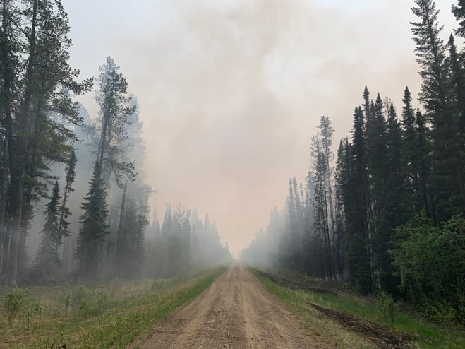
Smoke will be heavy again today in the Edson Forest Area. Lingering smoke will be visible in multiple areas and in affected communities following the cold front passage. Smoke inversions can also trap air near the ground causing dangerous driving conditions and impacting nearby communities. Please use EXTRA CAUTION WHEN DRIVING IN SMOKY CONDITIONS!
While we always appreciate people calling in to report wildfires, the large volume of calls we are currently receiving is diverting our resources away from other essential tasks. As always, please still call 310-FIRE if you see smoke or flame that looks new and potentially unreported, but assume that large columns of smoke and burned over areas have already been detected and reported. Thank you!
All wildfires in Alberta are investigated and these wildfires remain under investigation. To learn more about wildfire classifications, click here.
ACTIVE WILDFIRES
PEMBINA WILDFIRE COMPLEX - EWF031/039, RWF034/040
EWF031 was detected on May 4 and is located 25 km west of Lodgepole, 20 km northwest of Brazeau Dam and 14 km southeast of Edson. The fire is classified as out of control and is estimated to be 113,244 in size. The increased size is attributed to growth that has been observed over the last couple of days and due to more accurate mapping. Containment line is established on the northwest tip of the fire.
There were 82 firefighters and support staff being shared between this fire and EWF039. There were 20 pieces of heavy equipment, and nine helicopters assigned to the complex. An airtanker group remained available to respond if necessary. The Incident Management Team from the United States shadowed the outgoing team yesterday and assumed command of the Pembina Complex today, May 22, 2023.
Today, aircraft were able to complete two reconnaissance flights over the complex showing that the current fire activity is holding and being moderated by the current weather system, although scattered, precipitation occurred directly on the fire.
Aerial ignition operations were not conducted today but will be reassessed when conditions in the area improve. As was the case yesterday, crews continued working on hotspots south of the Svedberg Road and an additional crew worked along the excursion that occurred at 4km south of the Svedberg Road. Both hotspots continue to be estimated to be 1 ha in size and will need multiple days of sustain action by crews and equipment.
There is a containment line on the north side of the fire working downwards towards 6 Mile Road as well as a containment line located south from Dora’s Corner (completed two days ago). Both lines will now need continued air support when visibility improves, and it is safe for aviation to operate to perform bucketing.
Today, the downturn in weather occurred as forecasted. Rain and thunderstorms are forecasted for tomorrow.
EWF039 located near Carrot Creek, is currently being held. The fire is currently estimated to be 165 ha. The decrease in size is due to more accurate mapping of the fire. The fire is fully wrapped in containment line and is a kilometer away from the Carrot Creek lookout tower. Crews have successfully left the area and will be repositioned on fire EWF031. Personnel are continuing to monitor the area available to respond if necessary.
RWF034 is located near the O'Chiese Reserve and classified as out of control. The fire is currently estimated at 82,869 ha in size. The increased size is attributed to growth that has been observed over the last couple of days and due to more accurate mapping. There were 55 firefighters and support staff working on this fire. There were three helicopters assigned to the fire and four additional helicopters assigned to the complex. In addition, there were 22 pieces of heavy equipment.
Visibility issues from smoke hampered air operations again today. Ground crews will be assessing strategic locations on the southside of the fire for future operations. Crews continue to hold and mop up in the northern part of the southwest side of the fire.
RWF040 The fire is being monitored by firefighters and support staff assigned to the complex and are able to respond if necessary. The fire is currently estimated to be 4,544 ha in size. Growth has occurred mostly to the west. The Blackstone Lookout Tower in the area is currently not at risk.
If you have any questions or concerns about the PEMBINA COMPLEX please call the Acting Area Wildfire Information Officer Mélissa Lamadeleine 780-728-5618.
DEEP CREEK WILDFIRE COMPLEX – EWF035, WCU001 & WCU002
WCU001 was detected on April 29 and is classified as out of control. The wildfire remains at 7,281 ha in size, no new growth was recorded outside the fire perimeter. The wildfire zone is located southeast of Entwistle and west over the Pembina River where it spread north and travelled over Highway 16. The wildfire is parallel with Highway 16 and moved further west where the wildfire spread just north of Wildwood and now rests at Chip Lake.
WCU002 was detected on the evening of April 29 and is a mutual aid wildfire located on both sides of Highway 22, north of Highway 16. The wildfire is currently burning out of control. The wildfire is estimated to be 2,400 ha in size.
There was no new growth outside on either of these wildfires and very little fire activity was observed. Patches of unburned fuel within the boundaries may flare up, helicopter will be available to assist with bucketing operations if able to fly. Helicopters were able to assist firefighters with their activities today.
Patches of unburned vegetation may continue to burn inside the perimeter. Firefighters will often use an indirect attack approach to these challenging wildfires, letting them burn up to a natural break such as a road or a river. This ensures that the remaining vegetation within doesn’t continue to burn later in the season. Residents may see smouldering and flare ups at times within the perimeter. This is a normal occurrence until firefighters contain the fire perimeter to ensure it doesn’t grow, then work their way from the outside edge inwards. Firefighters will need to search for these hotspots, sometimes digging into the ground with their hands and feeling for heat. They use hand tools to dig the spots out and water to extinguish them. Simply putting water on a fire does not extinguish it. This process can take a long time and residents can expect that the fire will remain "out of control" until firefighters are confident that the fire is contained. At that time, the status will be changed to "being held" while they work towards extinguishment.
Deep ash pits and burning peat are dangerous. We ask residents to be extra cautious when near burnt areas.
Smoke will continue be very visible to residents in the area. It is being produced from the interior of the fire. The smoke can be a benefit, dampening the wildfire behaviour but can also cause health concerns. If you're experiencing smoke related health concerns, you can contact 811.
EWF035 was detected on May 5 and is located 3 km east of Shining Bank. This wildfire is classified as out of control and estimated to be 20,996 ha in size. The fire boundary was re-assessed with a helicopter and the size was changed to reflect the new boundary. The wildfire is now south of Township Road 570, burnt down to the south, two kilometers north of the railroad track in Niton Junction. The fire moved across the Rge Rd 123 and burnt up to the Lobstick River.
Firefighters did not observe very much fire activity again today, thanks to the higher relative humidity, cooler temperatures and more precipitation. The precipitation received wasn’t significant enough to change the dry conditions but did allow firefighters to continue working on containing the wildfire. The fire had a few flare ups in the interior, but mostly smouldered on the southern edge where the newest activity was happening.
We expect similar conditions tomorrow, with cool temperatures and much more rain.
Today firefighters continued to establishing new containment lines and building onto existing ones on the southern boundary of the fire. A guard was completed from East Bank Road to Rge Rd 130. Helicopters assisted firefighters on the southwest side, bucketing hotspots. They also worked on hot areas near the south-southeast and plan to return tomorrow.
Helicopters were available today to assist on the fire and our aircraft were able to fly today.
Wildfire firefighters continue to work with heavy equipment containing the fire on the western and northwestern side of the fire. A completed containment line made up of dozer guard, natural breaks and hand ignition burning is in place on the east side of East Bank Road.
Firefighters will continue to patrol the boundaries and extinguish hotspots on the edge. Residents will notice hotspots within the interior and this is very common for larger wildfires. Fire specialists must be confident that the fire is contained and once that’s established, they’ll start to work from the edges out and work their way in, searching for hotspots by looking and smelling for smoke, and feeling with their bare hands for heat. Once found, they must dig it up with hand tools and put them out with water. This process can take a very long time, simply putting water on a wildfire does not extinguish it as fires can burn deep into the ground and re-surface later when the conditions are favorable to burn.
The northeast of the fire was patrolled again today, and no heat was found along the edges of the wildfire. Firefighters were successful in establishing a containment line that runs from the 570 down to the 560 on the east side of the wildfire earlier this week. Their hand ignition burn operations were also successful, removing as much fuel as possible in the area.
The complex has 66 wildland firefighters, 26 pieces of heavy equipment and eight helicopters. There is also 25 overhead staff that are part of the incident management team. These personnel consist of heavy equipment coordinators, aircraft supervisors, task force leaders who work with the crews in the field, information officers who share information with the public and other key stakeholders such as industry. It also consists of logistics, facilities and equipment managers who ensure that firefighters are fed, lodged and have hot showers and tools to do their job. A large team like this also requires a finance team to ensure they track costs and payments. The camp is also prepared to receive many more firefighters in the coming weeks and can support up to 153 personnel. There are three other similar camps supporting the two complexes in our forest area.
We are asking the public to use extra caution around wildfire operations and not walk into the burnt areas. There are many hazards that are difficult to see, like deep burning ash pits, unstable trees that can fall because their roots have been burnt away, as well as other unknown dangers. Firefighters are highly trained individuals who wear special gear when working near wildfire. Fallen trees on various roads have been reported. If travelling along these burnt areas, be advised that trees could also fall onto the road and you may become entrapped.
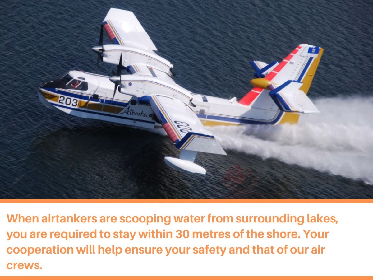
If you see aircraft in the area, we ask that you move away from the area to allow them space to work. You may be unintentionally impeding their operations, please give our firefighters the room and time they need to complete their tasks.
By: Caroline Charbonneau.
If you have any questions or concerns about the DEEP CREEK COMPLEX please call the Wildfire Information Officer - Caroline Charbonneau at 780-740-1341.
The Alpine hotshot crew from Colorado arrives at the Deep Creek Complex fire base camp for the evening after a long day on the fire line. (May 22, 2023) ** to view the video, open in the app or website.
WILD HAY WILDFIRE COMPLEX - EWF037 and EWF040
There are multiple wildfires located south of the Little Smoky River, north of the Wild Hay River and east of Hwy 40 north. These also include the areas near the Willow Haul Road and the Jack Wright Road north of Hinton. These wildfires were formerly reported as five separate fires, but due to more accurate GPS measuring, have been determined to be two larger fires.
EWF037 is being held at 578 ha and EWF040 is now being held at 684 ha.
There was no perimeter growth on the complex again today. The containment lines around the fires have withheld. Smoke and flame may still be observed within the interior of both EWF-037 and EWF-040.
This complex is now being patrolled and monitored.
PUBLIC WILDFIRE MAPS
Deep Creek Wildfire Complex (EWF-035, WCU002 and WCU001) May 20, 2023 - public map - Click here. *New map will be available at a later date to reflect new boundary.
Pembina Wildfire Complex (EWF031, EWF039, RWF034, RWF040) May 21 , 2023 - public map - Click here. *this map does not show other wildfire nearby.
EWF031 Wildfire May 21, 2023 - public map - Click here. * this map does not show other wildfire nearby.
Note: The wildfire perimeter map is an estimate based on measurements such as GPS, aerial scanning and satellite imagery. This estimated perimeter can change as more accurate measurements become available. Areas within the fire perimeter may not have been affected by wildfire.
WILDFIRE LINKS AND TOOLS
Visit our Wildfire Dashboard to view active wildfires and their stats on the wildfire dashboard.
There are multiple EVACUATION ORDERS & ALERTS in the Province. Please visit Alberta Emergency Alerts or your community webpage for more information.
For road closure information, please visit: 511.alberta.ca
The NASA FIRMS Fire Information website is a great resource to give an idea of the location of wildfires in the area, but it should be noted that this data is based on interpolation and often can make a wildfire appear larger than it actually is.
Wildfire smoke is a tool used for the location of smoke firesmoke.ca
DO NOT FLY DRONES NEAR WILDFIRES!
The use of recreational drones over wildfires in Alberta is dangerous, illegal and could result in a fine of up to $15,000* for putting aircraft and people at risk. Please give Alberta firefighters the space they need to do their jobs safely. *Transport Canada
COMMUNITY EMERGENCY INFORMATION | EVACUATIONS
A MESSAGE FROM THE MUNICIPALITIES
If you are evacuating, gather important documents, medication, and enough food and water to be away from home for at least 3 days. Take pets with you.
For updates from Yellowhead County and Town of Edson, please visit their Facebook page: https://www.facebook.com/yellowheadcounty or www.yhcounty.ca for updates. Evacuees can call 1-833-334-4630 for more information.
For updates from Parkland County, please visit their Facebook page: https://www.facebook.com/ParklandCountyAB. Residents in the affected areas can contact the Emergency Information Line at 1-780-968-8888.
For residents with health concerns related to smoke you can find the air quality map here: https://www.alberta.ca/about-the-air-quality-health-index.aspx. If you have smoke related health concerns, please contact AB 811 and click here for more information.


WILDFIRE PREVENTION TIPS
Albertans are always asked to use caution when working or recreating in the outdoors:
- Before you burn it, get your fire permit. Fire permits in Alberta.
- Clear debris from hot spots on your off-highway vehicle.
- Ensure your campfire is out - soak it, stir it, soak it again.
- Before you head out this weekend, check out the albertafirebans.ca website or download the app to stay informed.
ALBERTA WILDFIRE INFORMATION
- Subscribe to the Edson Forest Area wildfire update to receive an email when new information is posted.
- Download the Alberta Wildfire App for Apple and Android device.
- Join the conversation on Facebook, Twitter or Instagram.
For more information, please contact: