
A DRONE IN THE SKY MEANS WE CAN'T FLY!
Information Stations | Deep Creek Complex | May 20 & 21
Due to the current dry grass, warm weather and possible windy conditions, there is an increased risk of wildfires in the Edson Forest Area. We urge residents and visitors to exercise extra caution when working and recreating.
Previous Edson Forest Area Updates - Click here
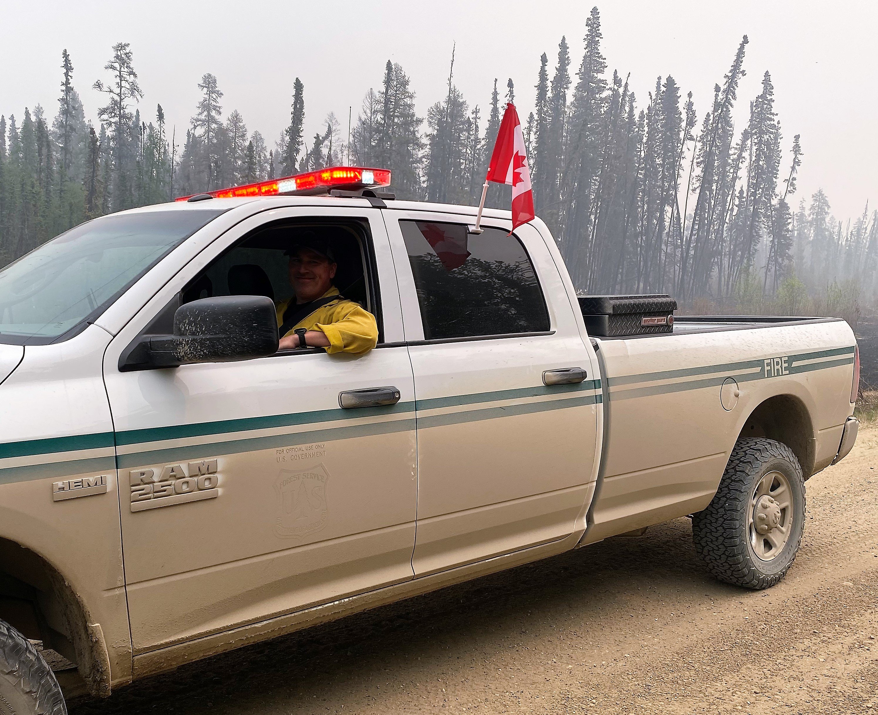 Our American firefighters appreciate the positive feedback and small gestures from residents. Operations is rocking the Canada flag on his U.S Forest Service truck (May 20, 2022).
DEEP CREEK COMPLEX INFORMATION STATION
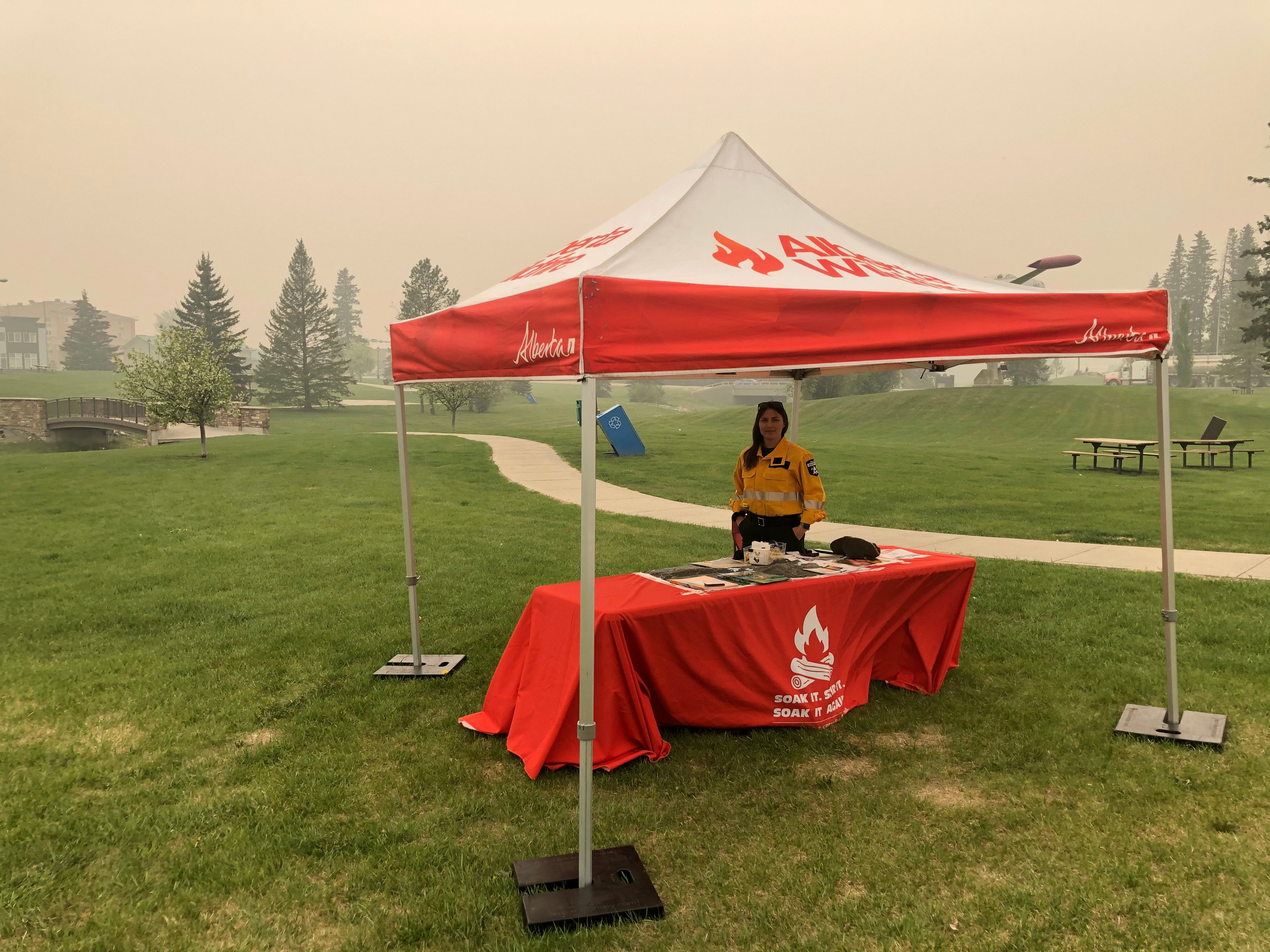
Tara will be hosting an information station today and tomorrow, look for the orange wildfire tent at the following locations (the station may be cancelled if smoke becomes too thick):
SUNDAY MAY 21, 2023
Wildwood Fire Hall (across street) | 11:00 a.m. - 1:00 p.m.
Peers Fire Hall | 2:00 p.m. - 4:00 p.m.
Edson Centennial Park (east side along Hwy 16) | 5:00 p.m. - 7:00 p.m.
GENERAL INFORMATION ON WILDFIRES IN OUR AREA
**Bold indicates new or important information.
The area continues to have limited resources due to these exceptional times. We're sharing valuable resources with many other wildfires in the province but continue to work on and monitor the following wildfires in our area: WCU001, WCU002, EWF035, EWF031, EWF039, EWF037, EWF040 and new starts that are detected.
Firefighters, aircraft, and heavy equipment have been working in conjunction with county and municipal firefighting services as aggressively as possible to make progress on these wildfires while the conditions have been favorable. Despite all of this hard work, there are still hundreds of kilometers of uncontained wildfire perimeter and fire behaviour forecasts indicate that there will be growth on many of the wildfires throughout the Edson Forest Area.
Smoke will be heavy again today and tomorrow in the areas of Wildwood, Lobstick, Hansonville, Evansburg and Entwistle. Lingering smoke will be seen along highway 16 and highway 22 and in affected communities. A smoke inversion happens when cooler air is trapped near the ground by a layer of warmer air above it and the inversion will keep smoke close the ground level. Smoke inversions can cause dangerous driving conditions and impact nearby communities. Please use EXTRA CAUTION WHEN DRIVING IN SMOKY CONDITIONS!
While we always appreciate people calling in to report wildfires, the large volume of calls we are currently receiving is diverting our resources away from other essential tasks. As always, please still call 310-FIRE if you see smoke or flame that looks new and potentially unreported, but assume that large columns of smoke and burned over areas have already been detected and reported. Thank you!
All wildfires in Alberta are investigated and these wildfires remain under investigation. To learn more about wildfire classifications, click here.
ACTIVE WILDFIRES
PEMBINA WILDFIRE COMPLEX - EWF031/039, RWF034/040
EWF031 was detected on May 4 and is located 25 km west of Lodgepole, 20 km northwest of Brazeau Dam and 14 km southeast of Edson. The fire is classified as out of control and is estimated to be 113,244 in size. The increased size is attributed to growth that has been observed over the last couple of days and due to more accurate mapping. Containment line is established on the northwest tip of the fire.
There were 76 firefighters and support staff being shared between this fire and EWF039. There were 23 pieces of heavy equipment, and seven helicopters assigned to the complex. An airtanker group was available to respond if necessary.
Fire activity on the south side of the northwest corner increased today and made operations challenging. Due to limited visibility from heavy smoke in the area, crews had to be pulled from the fireline until it was safe to return.
Due to visibility issues, planned ignition operations were not conducted. The operations will be reassessed when conditions improve. The containment line south from Dora’s Corner was completed today, as well as containment line from the north side of the fire down to 6 Mile Road. Air operations will be working on bucketing along those containment lines once visibility improves.
Isolated or scattered rain and thundershowers were forecasted for today and tomorrow. Moderate to strong north/northwest winds will develop late Sunday into Monday and Tuesday. Periods of rain will develop Monday and Tuesday.
EWF039 located near Carrot Creek, is currently being held. The fire is currently estimated to be 165 ha. The decrease in size is due to more accurate mapping of the fire. The fire is fully wrapped in containment line and is a kilometer away from the Carrot Creek lookout tower. Crews have successfully left the area and will be repositioned on fire EWF031. Personnel are continuing to monitor the area available to respond if necessary.
RWF034 is located near the O'Chiese Reserve and classified as out of control. The fire is currently estimated at 82,869 ha in size. The increased size is attributed to growth that has been observed over the last couple of days and due to more accurate mapping. There were 49 firefighters and support staff working on this fire. There were five helicopters assigned to the fire and four additional helicopters assigned to the complex. In addition, there were 23 pieces of heavy equipment.
RWF040 is located 6 km northeast of the Forestry Trunk Road and Brown Creek Provincial Recreational Area and is classified as out of control. The fire continued to be monitored by firefighters and support staff assigned to the complex. The fire is currently estimated to be 4,544 ha in size. Most of the growth has occurred to the west. The Blackstone Lookout Tower in the area is currently not at risk.
If you have any questions or concerns about the PEMBINA COMPLEX please call the Wildfire Information Officer Sarah Hall at 250-318-8375.
Low visibility on EWF-031 due to heavy smoke (May 20, 2022).
DEEP CREEK WILDFIRE COMPLEX – EWF035, WCU001 & WCU002
An incident management team from the U.S Forest Service along with many of their firefighters have arrived on May 14 to assist our area with one of the three wildfire complexes in the area. We want to thank our American friends for coming to assist us. A special arrangement has been in place for many years between Canada, the U.S, Australia and other countries that have similar firefighting training standards. We take safety and training very seriously and always seek to improve our operations.
WCU001 was detected on April 29 and is classified as out of control. The wildfire remains at 7,281 ha in size, no new growth was recorded outside the fire perimeter. The wildfire zone is located southeast of Entwistle and west over the Pembina River where it spread north and travelled over Highway 16. The wildfire is parallel with Highway 16 and moved further west where the wildfire spread just north of Wildwood and now rests at Chip Lake.
Patches of unburned vegetation may burn inside the perimeter of the fire and large smoke columns may be seen coming from within the fire perimeter. Helicopters will action these flare-ups as required throughout the day using bucketing operations.
Wildfire crews continue working in areas of deep peat south of WCU001 that are within the fire perimeter. Highway 16 will experience smoke from the active wildfire zone due to the hotspots near the highway.
WCU002 was detected on the evening of April 29 and is a mutual aid wildfire located on both sides of Highway 22, north of Highway 16. The wildfire is currently burning out of control. The wildfire is estimated to be 2,400 ha in size. There was no new growth outside of the fire perimeter detected. Patches of unburned fuel within the boundaries flared up again and were actioned with helicopter bucketing operations.
Smoke will continue be very visible to residents in the area which is being produced from the interior of the fire. These areas of unburnt fuel are surrounded by burned out areas and are within the perimeter boundary. The smoke can be a benefit, dampening the wildfire behaviour but can cause health concerns. If you're experiencing smoke related health concerns, you can contact AB 811. Smoke will linger along Highway 16 as crews work to extinguish hotspots. The wildfire has stayed south of Township Road 550 and east of Range Road 92 and west of Range Road 75. Alberta Wildfire and Yellowhead County are actioning this wildfire.
There wasn't a lot of fire activity observed on WCU001 & WCU002 again today.
EWF035 was detected on May 5 and is located 3 km east of Shining Bank. This wildfire is classified as out of control and estimated to be 18,608 ha in size. The fire doubled in size yesterday, but did not increase to the northeast or northwest. The wildfire is now south of Township Road 570, burnt down to the south, two kilometers north of the railroad track in Niton Juntion. The fire moved across the Rge Rd 123 and burnt along the Lobstick River. A new boundary map has been generated and is available below under Deep Creek Complex.
There was significant growth yesterday. The fire burnt towards the southeast and then towards the south later in the day. The fire moved extremely fast. Today, firefighters didn't record very much fire activity thanks to quiet winds and smoke which is smothering the wildfire. The fire was flaming in a few places in single stands but was mostly smouldering.
Weather tomorrow will be more favorable for wildfire firefighters. Temperatures will be in the mid to high 20s but the relative humidity is expected to be near 30% with some precipitation.
Monday, we expect slightly lower temperatures and higher humidity with winds from the northwest. More rain is forecasted, however we'll need significant precipitation to improve these hot and dry conditions.
SOUTHEAST OF EWF035
Yesterday, the fire intensity was increasing quickly near 11:00 a.m. and progressed to extreme fire behaviour by noon. The fire spread quickly to the south-southeast through spruce stands and as of 5:00 p.m. the fire moved directly towards the south.
Medium helicopters were bucketing around structures where conditions permitted but had to move away from the wildfire as winds and smoke made it difficult to bucket safely and effectively. Heavy helicopters were also present yesterday, bucketing on structures and around homes, attempting to cool the conditions near the community. The heavy (large) helicopters were available today to assist on the fire but none of our aircraft could take off today due to smoky conditions and poor visibility.
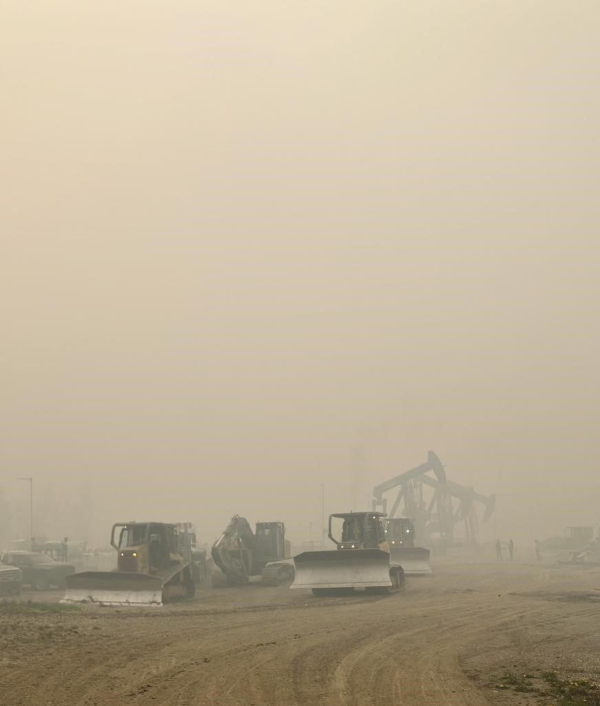
Today, seven pieces of heavy equipment were re-positioned and tasked with new line while the fire activity is favorable for them to work near.
On Thursday, airtankers had built a containment line with retardant on the southwest side of the fire. The fire burnt over it very quickly yesterday. Under these extreme fire behaviour conditions, helicopter water buckets, water skimmers and airtankers with retardant are often not effective due to the heat. Firefighters reported seeing 150 ft high flames from the trees and estimate that the fire moved approximately 60 meters per minute. They are effective under certain conditions and not always the best tool for the job. The fire also can spot ahead of itself and over containment lines of any type, especially under these rates of spread. Firefighters could see spotting from the wildfire up to 500 meters ahead of itself, making these conditions very challenging for firefighters.
NORTHWEST OF EWF035
Dozer operators and land owners were assisting with a dozer line to help contain the fire from the 560 moving south along East Bank Road, on the east side of the road. Although we appreciate the help from the public where possible, this is a special situation where the land owners are able to work closely with industry in ensuring the safety of the pipelines and the operators.
Today, firefighters continued to reinforce the containment line they've built with hand ignition burning operation from East Bank Road and moved into the interior of the fire. This burn will add protection to nearby properties, removing available fuel for the fire later on, if the winds change direction. The operation is successful, the winds were in favor for firefighters yesterday and continue to be for them today. The fire did spot across the river into agricultural land in a few places and fortunately the landowner was able to put out the hotspots on their land. Firefighters are also patrolling along the East Bank Road extinguishing hotspots on the west side of the road.
NORTHEAST OF EWF035
Firefighters successfully established a containment line that runs from the 570 down to the 560 on the east side of the wildfire. They nearly completed the hand ignition burn operation, removing as much fuel as possible in the area. Firefighters had to cease their operations as relative humidity and the vegetation was too wet to burn.
We are asking the public to use extra caution around wildfire operations and not walk into the burnt areas. There are unseen hazards, like deep burning ash pits, falling trees because their roots have been burnt away and aren't stable as well as other unknown dangers. Firefighters are highly trained individuals who wear special gear when working near wildfire. We understand that these are stressful times and we assure you we are doing what we can to chase this evermoving wildfire shifting from one side to another on a daily basis.
If you see aircraft in the area, we ask that you move away from the area. They cannot do their job effectively. You may be unintentionally impeding our operations, please give our firefighters the room and time they need to complete their tasks.
By: Caroline Charbonneau.
If you have any questions or concerns about the DEEP CREEK COMPLEX please call the Wildfire Information Officer - Caroline Charbonneau at 780-740-1341.
WILD HAY WILDFIRE COMPLEX - EWF037 and EWF040
There are multiple wildfires located south of the Little Smoky River, north of the Wild Hay River and east of Hwy 40 north. These also include the areas near the Willow Haul Road and the Jack Wright Road north of Hinton. These wildfires were formerly reported as five separate fires, but due to more accurate GPS measuring, have been determined to be two larger fires. EWF037 is out of control at 578 ha and EWF040 is out of control at 684 ha.
Yesterday crews successfully completed the containment line around EWF040. Medium helicopters were bucketing on hotspots adjacent to the containment lines today.
EWF-037 is now being held as of 1:17 this afternoon.
There was no perimeter growth on the complex again today. The containment lines around the fires have withheld. Smoke and flame may still be observed within the interior of both EWF-037 and EWF-040.
There were three helicopters, six pieces of heavy equipment and four wildfire personnel working on this complex today.
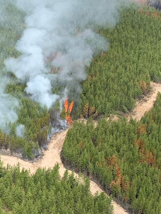
Smoke and flame may still be visible in the interior of EWF-037 & EWF-040 (May 20, 2022).
PUBLIC WILDFIRE MAPS
Deep Creek Wildfire Complex (EWF-035, WCU002 and WCU001) May 17, 2023 - public map - Click here.
Pembina Wildfire Complex (EWF031, EWF039, RWF034, RWF040) May 17, 2023 - public map - Click here.
EWF031 Wildfire May 17, 2023 - public map - Click here.
Note: The wildfire perimeter map is an estimate based on measurements such as GPS, aerial scanning and satellite imagery. This estimated perimeter can change as more accurate measurements become available. Areas within the fire perimeter may not have been affected by wildfire.
WILDFIRE LINKS AND TOOLS
Visit our Wildfire Dashboard to view active wildfires and their stats on the wildfire dashboard.
There are multiple EVACUATION ORDERS & ALERTS in the Province. Please visit Alberta Emergency Alerts or your community webpage for more information.
For road closure information, please visit: https://511.alberta.ca/#:Alerts
The NASA FIRMS Fire Information website is a great resource to give an idea of the location of wildfires in the area, but it should be noted that this data is based on interpolation and often can make a wildfire appear larger than it actually is.
Wildfire smoke is a tool used for the location of smoke firesmoke.ca
PROVINCIAL STATE OF EMERGENCY
Hot, dry conditions continue in most areas of the province resulting in numerous wildfires. A provincial state of emergency has been declared. Albertans who require assistance can call 310-4455 for wildfire related information - Click here.
DO NOT FLY DRONES NEAR WILDFIRES!
The use of recreational drones over wildfires in Alberta is dangerous, illegal and could result in a fine of up to $15,000* for putting aircraft and people at risk. Please give Alberta firefighters the space they need to do their jobs safely.
*Transport Canada
VOLUNTEER INFORMATION
Volunteers, equipment owners/operators or firefighters looking to assist with these wildfires or any of the wildfires within the province, please contact EmergencySupportOffers@gov.ab.ca. Please do not contact Edson Forest Area logistics directly, as they are extremely busy supporting the wildfire situation in the area. Thank you.
COMMUNITY EMERGENCY INFORMATION | EVACUATIONS
A MESSAGE FROM THE MUNICIPALITIES
If you are evacuating, gather important documents, medication, and enough food and water to be away from home for at least 3 days. Take pets with you.
For updates from Yellowhead County and Town of Edson, please visit their Facebook page: https://www.facebook.com/yellowheadcounty or www.yhcounty.ca for updates. Evacuees can call 1-833-334-4630 for more information.
For updates from Parkland County, please visit their Facebook page: https://www.facebook.com/ParklandCountyAB. Residents in the affected areas can contact the Emergency Information Line at 1-780-968-8888.
For residents with health concerns related to smoke you can find the air quality map here: https://www.alberta.ca/about-the-air-quality-health-index.aspx. If you have smoke related health concerns, please contact AB 811 and click here for more information.


WILDFIRE PREVENTION TIPS
Albertans are always asked to use caution when working or recreating in the outdoors:
- Before you burn it, get your fire permit. Fire permits in Alberta.
- Clear debris from hot spots on your off-highway vehicle.
- Ensure your campfire is out - soak it, stir it, soak it again.
- Before you head out this weekend, check out the albertafirebans.ca website or download the app to stay informed.
ALBERTA WILDFIRE INFORMATION
- Subscribe to the Edson Forest Area wildfire update to receive an email when new information is posted.
- Download the Alberta Wildfire App for Apple and Android device.
- Join the conversation on Facebook, Twitter or Instagram.
For more information, please contact: