

A DRONE IN THE SKY MEANS WE CAN'T FLY!
INFORMATION STATIONS | DEEP CREEK COMPLEX | May 18 & 19 (SEE BELOW)
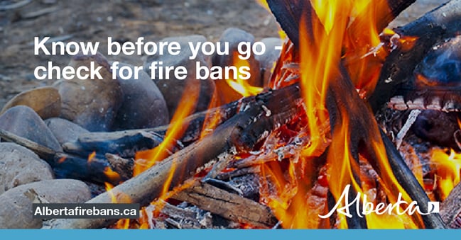
A FIRE BAN and OFF-HIGHWAY VEHICLE RESTRICTION is in effect for the Forest Protection Area of Alberta, including the Edson Forest Area.
For previous Edson Forest Area Updates - Click here
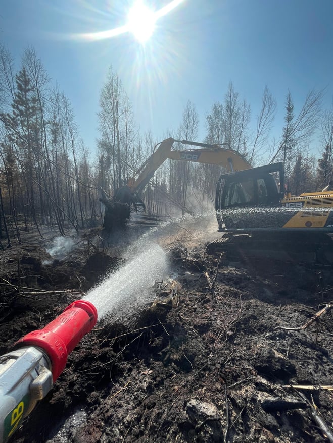
You may not see them close to the road, but there are over 100 wildland firefighters plus heavy equipment and helicopters working deep in the forest, building containment lines, digging up deep ash pits and soaking down hotspots all around the Edson Forest Area. (May 18, 2023)
DEEP CREEK COMPLEX INFORMATION STATION
Tara will be hosting an information station tomorrow, look for the orange wildfire tent at the following locations:
THURSDAY MAY 18 & FRIDAY MAY 19, 2023
Evansburg Provincial Building - 4921 50 Street | 11:00 a.m. - 1:00 p.m.
Wildwood Fire Hall (across street) | 2:00 p.m. - 4:00 p.m.
Niton Junction Gas Stations (Hwy 16) | 5:00 p.m. - 7:00 p.m.
GENERAL INFORMATION ON WILDFIRES IN OUR AREA
The area continues to have limited resources due to these exceptional times. We're sharing valuable resources with many other wildfires in the province but continue to work on and monitor the following wildfires in our area: WCU001, WCU002, EWF035, EWF031, EWF039, EWF037, EWF040 and new starts that are detected.
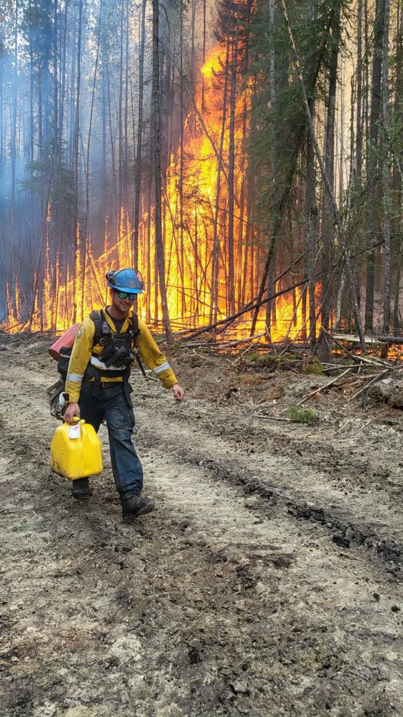
Firefighters, aircraft, and heavy equipment have been working in conjunction with county and municipal firefighting services as aggressively as possible to make progress on these wildfires while the conditions have been favorable. Despite all of this hard work, there are still hundreds of kilometers of uncontained wildfire perimeter and fire behaviour forecasts indicate that there will be growth on many of the wildfires throughout the Edson Forest Area.
Smoke will be heavy again today and tomorrow in the areas of Wildwood, Lobstick, Hansonville, Evansburg and Entwistle. Lingering smoke will be seen along highway 16 and highway 22 and in affected communities. A smoke inversion happens when cooler air is trapped near the ground by a layer of warmer air above it and the inversion will keep smoke close the ground level. Smoke inversions can cause dangerous driving conditions and impact nearby communities. Please use EXTRA CAUTION WHEN DRIVING IN SMOKY CONDITIONS!
While we always appreciate people calling in to report wildfires, the large volume of calls we are currently receiving is diverting our resources away from other essential tasks. As always, please still call 310-FIRE if you see smoke or flame that looks new and potentially unreported, but assume that large columns of smoke and burned over areas have already been detected and reported. Thank you!
These wildfires remain under investigation. To learn more about wildfire classifications, click here.
ACTIVE WILDFIRES
PEMBINA WILDFIRE COMPLEX - EWF031/039, RWF034/040
EWF031 was detected on May 4 and is located 25 km west of Lodgepole, 20 km northwest of Brazeau Dam and 14 km southeast of Edson. The fire is classified as out of control and is estimated to be 82,666 ha in size. No significant growth has been observed since May 7, 2023 and containment line is established on the northwest tip of the fire.
There are 77 firefighters and support staff being shared between this fire and EWF039. There are 34 pieces of heavy equipment, and eight helicopters assigned to the complex. An airtanker group is still assigned to this fire. This group is composed of one birddog and five skimmers.
The aerial ignition opportunity around Minnow Lake was not conducted yesterday. This operation will be reevaluated today and will only occur if favourable conditions are available. Ground crews will be conducting small scale ground ignitions on the north flank today. The purpose of these ignitions is to remove remaining fuel in between the fire perimeter and the planned containment lines in a controlled manner. In the northwest, from Repsol Road to the Trans Canada Pipeline, crews will be demobilizing the fireline today. Heavy equipment has completed the containment line from Wolf Creek Road to Minnow Lake East Road and Delmar Road south towards Dora’s Corner. Today, operations continue around Minow Lake for containment line will be built where conditions support heavy equipment operations.
Today, smoke has remained in the area and is providing a smoke screen throughout the complex, allowing temperatures to be cool and relative humidity to increase. A cold front will drop down from the north on Friday, crossing the area of the complex around noon. There is a chance of showers and a slight thundershower risk near the front as winds rapidly shift to the northwest behind it.
EWF039 located near Carrot Creek, is currently being held. The fire is currently estimated to be 216 ha. The fire is fully wrapped in containment line and is a kilometer away from the Carrot Creek lookout tower. Crews have successfully left the area and will be repositioned on fire EWF031. Personnel are continuing to monitor the area available to respond if necessary.
RWF034 is located near the O'Chiese Reserve and classified as out of control. The fire is currently estimated at 67,042 ha in size. There are 57 firefighters and support staff working on this fire. There are three helicopters assigned to the fire and three additional helicopters assigned to the complex. In addition, there are 23 pieces of heavy equipment.
The perimeter has not grown significantly on the south side of the fire and containment lines held. The priority for this fire continues to be on the south flank on established containment line. Direct attack is still being used when safe and smoldering ground fire was observed early this morning. The fire behaviour subdued due to lower temperatures, higher relative humidity and the smoke in the air acting as a screen. Crews are hot spotting and gridding to detect any remaining activity in this area in order to establish containment lines.
Today, smoke has remained in the area and is providing a smoke screen throughout the complex, allowing temperatures to be cool and relative humidity to increase. There will be fair and stable conditions today as high pressure builds to the east of the province. A cold front will drop down from the north on Friday, crossing the site around noon. There is a chance of showers and a slight thundershower risk near the front as winds rapidly shift to the northwest behind it.
Ground ignition operations on EWF031 yesterday (May 17, 2023)
DEEP CREEK WILDFIRE COMPLEX – EWF035, WCU001 & WCU002
An incident management team from the U.S Forest Service along with many of their firefighters have arrived on May 14 to assist our area with one of the three wildfire complexes in the area. We want to thank our American friends for coming to assist us. A special arrangement has been in place for many years between Canada, the U.S, Australia and other countries that have similar firefighting training standards. We take safety and training very seriously and always seek to improve our operations.
Fire behavior is expected to increase again today and tomorrow, warmer temperatures and lower relative humidity may cause crossover conditions, meaning the vegetation the fire consumes will burn more easily.
WCU001 was detected on April 29 and is classified as out of control. The wildfire remains at 7,281 ha in size, no new growth was recorded outside the fire perimeter. The wildfire zone is located southeast of Entwistle and west over the Pembina River where it spread north and travelled over Highway 16. The wildfire is parallel with Highway 16 and moved further west where the wildfire spread just north of Wildwood and now rests at Chip Lake.
Patches of unburned vegetation may burn inside the perimeter of the fire and large smoke columns may be seen coming from within the fire perimeter. Helicopters will action these flare-ups as required throughout the day using bucketing operations.
Wildfire crews continue working in areas of deep peat south of WCU001 that are within the fire perimeter. Highway 16 will experience smoke from the active wildfire zone due to the hotspots near the highway.
WCU002 was detected on the evening of April 29 and is a mutual aid wildfire located on both sides of Highway 22, north of Highway 16. The wildfire is currently burning out of control. The wildfire is estimated to be 2,400 ha in size. There was no new growth outside of the fire perimeter detected. Patches of unburned fuel within the boundaries flared up again and were actioned with helicopter bucketing operations.
Smoke will continue be very visible to residents in the area which is being produced from the interior of the fire. These areas of unburnt fuel are surrounded by burned out areas and are within the perimeter boundary. The smoke can be a benefit, dampening the wildfire behaviour but can cause health concerns. If you're experiencing smoke related health concerns, you can contact AB 811. Smoke will linger along Highway 16 as crews work to extinguish hotspots. The wildfire has stayed south of Township Road 550 and east of Range Road 92 and west of Range Road 75. Alberta Wildfire and Yellowhead County are actioning this wildfire.
EWF035 was detected on May 5 and is located 3 km east of Shining Bank. This wildfire is classified as out of control and estimated to be 5,951 ha in size. The wildfire is south of Township Road 570, west of Range Road 123, north and a small southern section of Township Road 560, and east of Shining Bank Lake.
There was new growth on the south perimeter again yesterday and continues to creep towards the west as the winds come out of the east-southeast. Firefighters expect the burn back within its perimeter as winds shift from the southwest tomorrow. This can be both challenging and a benefit to firefighters. Priorities need to be maintained as they establish main containment lines in the area to protect properties surrounding the fire.
The priorities on EWF035 are to monitor and extinguish hotspots on the north side of the wildfire, to mitigate the spread northwards towards properties and beyond.
They’ve established a large dozer on guard on the east side of the wildfire from 560 north to 570 and will bring this line to the fire, removing the unburnt fuel and ensure that there’s no fuel there for the fire to get into and take off again. This will prevent the fire from moving towards the east and into farmland if the winds were to change again in the coming days.
Firefighters were also successful in taking the fire down to the 560, removing that fuel so that section of fire doesn’t take off at a later date. They anchored the fire to both the east and west side along the 560 which will help later on.
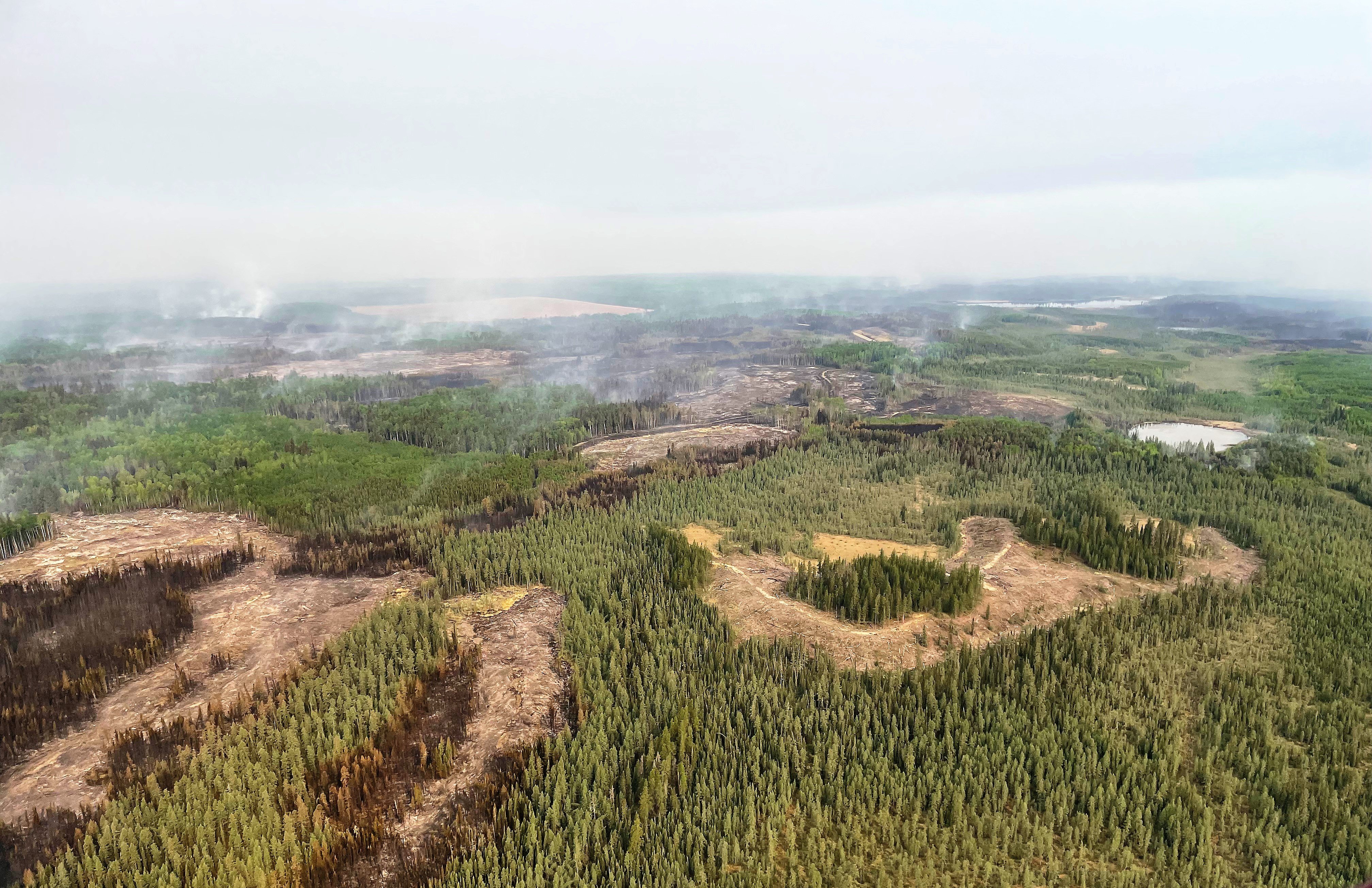
The fire did get across Twp Rd 560 in a small section and continued to burn towards the south in a J shaped form. The fire did not burn the forest in a continuous pattern, it hopped and skipped, mostly through spruce stands which are very flammable, especially in these weather conditions. In this area, the fire is burning easily through conifer (spruce) stands but slows down when it reaches deciduous (poplar/aspen) stands, or low, wet and swampy stands (see the photo below). Fortunately, the wildfire slows down when it reaches a cut block, having no fuel to burn with great fire behaviour.
Heavy equipment was busy putting in containment line ahead of the fire to the south yesterday but had to retreat and re-establish in a new location. Firefighters are looking to move the containment line further south, using existing roads to stop the spread of the fire.
EWF035 will be supported by helicopter buckets today. Airtankers will assist if they are available to support, many wildfires in Alberta require them during these exceptional times. We ask that you stay out of these areas, if aircraft see members of the public near burning areas, they cannot do their job effectively. You may be unintentionally impeding our operations, please give our firefighters the room and time they need to complete their tasks.
New map is available below. You can also use the NASA Link, which can be a useful tool. Be aware that the system may project ahead of itself, making the wildfire look larger then it is.
Wildland firefighters expect some growth to occur on the south-southeast of the fire perimeter of EWF035 again tomorrow until the winds change direction.
Aircraft will continue to report heightened wildfire activity areas to the ground and resources will work on priority areas.
Yellowhead County has reported that structural protection crews have been initiating their system over the last several days and are now prepared to action approximately 100 homes. Special flagging of different colours marked ‘SPU’ are set up on these properties to help firefighters identify operations for that property. This is to identify the placement of pumps and structural protection sprinklers. Please do not remove the flagging. Woodlands County and the Whitecourt Fire Department have also installed sprinkler protection on houses in the immediate area of EWF035 and will continue to monitor the situation as it continues. Woodlands County has strategically placed staff for night watch on EWF-035 to monitor for fire activity after dark. Alberta Wildfire is assisting Yellowhead County and Woodlands County with this wildfire.
The Deep Creek Complex has a total of 44 firefighters plus 19 incident management firefighters working with 27 pieces of heavy equipment on this complex. Additionally, eight helicopters are assisting the wildfire with aerial assessments and performing bucket operations on the complex.
By: Caroline Charbonneau
If you have any questions or concerns about the DEEP CREEK COMPLEX please call the Wildfire Information Officer - Caroline Charbonneau at 780-740-1341.
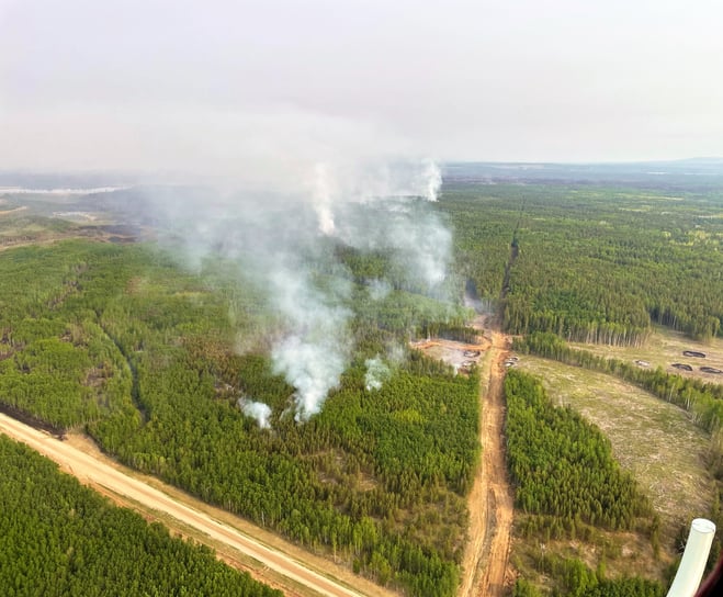
 EWF035 is burning in patchy locations this morning south of Twp Rd 560. Taken from the SE of the fire, looking north (May 18, 2023)
From Twp 560 looking north towards Twp 570. A dozer line was established this week and firefighters will remove the fuel away from the line to reinforce the line (May 18, 2023)
WILD HAY WILDFIRE COMPLEX - EWF037 and EWF040
There are multiple wildfires located south of the Little Smoky River, north of the Wild Hay River and east of Hwy 40 north. These also include the areas near the Willow Haul road and the Jack Wright Road north of Hinton. These wildfires were formerly reported as five separate fires, but due to more accurate GPS measuring, have been determined to be two larger fires. EWF037 is out of control at 578 ha and EWF040 is out of control at 684 ha.
There was les fire activity observed on the complex yesterday which allowed crews to focus on extinguishing hotspots. Shifting, gusty winds may increase fire behavior today.
Crews have successfully completed the containment line around EWF-037 and will move on to fire EWF-040 today. Some wet ground conditions may make it challenging for heavy equipment to access parts of this wildfire. Crews are monitoring EWF-040 for changing winds with a focus on the south boundary of the fire.
There are 3 helicopters, 6 pieces of heavy equipment and 4 wildfire personnel working on this complex today.
PUBLIC WILDFIRE MAPS
Edson Forest Area Overview Map - May 17, 2023 - public map - Click here.
Deep Creek Wildfire Complex (EWF-035, WCU002 and WCU001) May 17, 2023 - public map - Click here.
EWF035 Wildfire May 17, 2023 - public map - Click here.
(NEW MAP IN PM UPDATE) Pembina Wildfire Complex (EWF031, EWF039, RWF034, RWF040) May 17, 2023 - public map - Click here.
EWF031 Wildfire May 17, 2023 - public map - Click here.
Note: The wildfire perimeter map is an estimate based on measurements such as GPS, aerial scanning and satellite imagery. This estimated perimeter can change as more accurate measurements become available. Areas within the fire perimeter may not have been affected by wildfire.
WILDFIRE LINKS AND TOOLS
Visit our Wildfire Dashboard to view active wildfires and their stats on the wildfire dashboard.
There are multiple EVACUATION ORDERS & ALERTS in the Province. Please visit Alberta Emergency Alerts or your community webpage for more information.
For road closure information, please visit: https://511.alberta.ca/#:Alerts
The NASA FIRMS Fire Information website is a great resource to give an idea of the location of wildfires in the area, but it should be noted that this data is based on interpolation and often can make a wildfire appear larger than it actually is.
Wildfire smoke is a tool used for the location of smoke firesmoke.ca
PROVINCIAL STATE OF EMERGENCY
Hot, dry conditions continue in most areas of the province resulting in numerous wildfires. A provincial state of emergency has been declared. Albertans who require assistance can call 310-4455 for wildfire related information - Click here.
DO NOT FLY DRONES NEAR WILDFIRES!
The use of recreational drones over wildfires in Alberta is dangerous, illegal and could result in a fine of up to $15,000* for putting aircraft and people at risk. Please give Alberta firefighters the space they need to do their jobs safely.
*Transport Canada

VOLUNTEER INFORMATION
Volunteers, equipment owners/operators or firefighters looking to assist with these wildfires or any of the wildfires within the province, please contact EmergencySupportOffers@gov.ab.ca. Please do not contact Edson Forest Area logistics directly, as they are extremely busy supporting the wildfire situation in the area. Thank you.
COMMUNITY EMERGENCY INFORMATION | EVACUATIONS
A MESSAGE FROM THE MUNICIPALITIES
If you are evacuating, gather important documents, medication, and enough food and water to be away from home for at least 3 days. Take pets with you.
For updates from Yellowhead County and Town of Edson, please visit their Facebook page: https://www.facebook.com/yellowheadcounty or www.yhcounty.ca for updates. Evacuees can call 1-833-334-4630 for more information.
For updates from Parkland County, please visit their Facebook page: https://www.facebook.com/ParklandCountyAB. Residents in the affected areas can contact the Emergency Information Line at 1-780-968-8888.
For residents with health concerns related to smoke you can find the air quality map here: https://www.alberta.ca/about-the-air-quality-health-index.aspx. If you have smoke related health concerns, please contact AB 811 and click here for more information.


WE URGE RESIDENTS AND RECREATIONALISTS TO USE EXTRA CAUTION
Due to the current dry grass, warm weather and possible windy conditions, there is an increased risk of wildfires in the Edson Forest Area. We urge residents and visitors to exercise caution and take the following precautions:
- Do not start any fires or use open flames in areas that are susceptible to catching fire, such as near dry vegetation like grass or wooded areas.
- Dispose of cigarettes and other smoking materials properly, do not throw them on the ground.
- If you see a wildfire, immediately call 310-FIRE (3473) and report the location of the fire.
- Avoid using equipment that could generate sparks, friction or flames, such as power tools or lawn mowers, in areas with dry vegetation.
- Ensure grinders and welders are properly maintained and used in areas that are free from dry vegetation. Have sufficient water and tools on hand. Always keep watch of your surroundings and look around at regular intervals for smoke or flames that may have been accidently ignited.
We encourage everyone to stay informed about the current wildfire risk and to follow any guidance or orders from emergency personnel. By working together and taking proactive steps, we can help reduce the risk of wildfires in our community.
WILDFIRE PREVENTION TIPS
Albertans are always asked to use caution when working or recreating in the outdoors:
- Before you burn it, get your fire permit. Fire permits in Alberta.
- Clear debris from hot spots on your off-highway vehicle.
- Ensure your campfire is out - soak it, stir it, soak it again.
- Before you head out this weekend, check out the albertafirebans.ca website or download the app to stay informed.
ALBERTA WILDFIRE INFORMATION
- Subscribe to the Edson Forest Area wildfire update to receive an email when new information is posted.
- Download the Alberta Wildfire App for Apple and Android device.
- Join the conversation on Facebook, Twitter or Instagram.
For more information, please contact: