

A Fire Advisory remains in effect for the High Level Forest Area. Use caution within the Forest Protection Area. To report a wildfire, call 310-FIRE (3473). The Jackpot Creek fire is Under Control (UC).
HIGH LEVEL FOREST AREA UPDATE | JULY 24, 2019 AT 11:00 A.M.There are currently 20 active wildfires in the High Level Area. Of these fires: 6 are Out of Control (OC), 6 are Being Held (BH) and 8 are Under Control (UC). Click here for a map of all fire locations and their status within the High Level Forest Area. (See below for details on the Chuckegg Creek wildfire).
Wildfires note:
- Fire (HWF143) is located 53 km to the Southeast of South Tall Cree and is classified as Out of Control (OC) at an estimated size of 7 hectares. There are 9 firefighters and 2 helicopters working on this fire. There is no threat to the community at this time.
- Fire (HWF141) is located 47 km east of North Tall Cree and is classified as Out of Control (OC) at an estimated size of 6 hectares. There are 9 firefighters and 3 helicopters working on this fire. There is no threat to the community at this time.
- Fire (HWF140) is located 45 km to the southeast of South Tall Cree and is classified as Out of Control (OC) at an estimated size of 253 hectares. There are 39 firefighters and 5 helicopters working on this fire. There is no threat to the community at this time.
- Fire (HWF127) is located 26 km west of Garden River and is classified as Under Control (UC) at an estimated 60 hectares. There are 32 firefighters and 1 helicopter working on this fire. There is no threat to any communities at this time.
- Fire (HWF126) is located 20 km northwest of Zama City and is classified as Under Control (UC) at an estimated size of 45 hectares. There are 33 firefighters and 3 helicopters working on this fire. There is no threat to any communities at this time.
- Fire (HWF-113) is located 62 km southeast of the Town of Rainbow Lake and is Being Held (BH) at 185 hectares. There are 32 firefighters and 4 helicopters working on this fire. There is no risk to communities at this time.
- The Jackpot Creek wildfire (HWF-066) is located north of Lutose and is Under Control (UC) at 74,331 hectares. There are 22 firefighters, 4 helicopters and heavy equipment working on this fire.
NOTE: Unless conditions change, the next update will be at 8:00 p.m. on July 24, 2019.
Firefighters, helicopters, airtankers and heavy equipment are positioned throughout the High Level Forest Area to respond to any new wildfire starts.
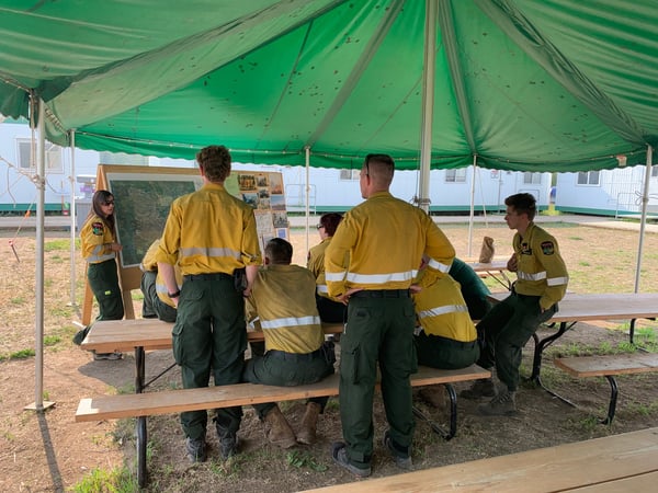
Firefighters getting briefed on the current situation - July 23, 2019
CHUCKEGG CREEK WILDFIRE UPDATE | JULY 24, 2019 AT 11:00 A.M.
- Last recorded size: 351,856.08 hectares
- Fire perimeter: 628.97 km
- There are 743 firefighters and support staff, 48 helicopters and 50 pieces of heavy equipment fighting this wildfire.
*Fire size and perimeter are subject to change based on clearer visibility for high-altitude scanning.
Heavy smoke and fire activity may occur along Highway 35 south and Highway 58 east of High Level. Please use caution as you're traveling through these areas and consider slowing down as you pass through.
If you have any health concerns related to smoke activity, please contact Alberta Health Services for assistance or call 811.
A mandatory evacuation remains for a small number of residents near Devil Lake. For more information, visit the Mackenzie County Facebook page.
Fire activity is anticipated to reduce slightly as cooler temperatures and higher relative humidity levels is expected for today. That should provide firefighters, helicopters and heavy equipment to continue making progress on priority areas, specifically in areas around Devil Lake and Surette Lake.
The planned controlled ignition operations in the horseshoe west of the Peace River will not likely happen today, but ignition specialists will assess the landscape throughout the day and determine a strategy for what the next couple days look like. Please follow the Mackenzie County Facebook page for any developments surrounding those operations.
Weather should cool off slightly with temperatures reaching 22 degrees and a relative humidity of 50%. Winds will shift early in the morning and will be coming from northeast at 25 km/hr., with wind gusts reaching 45 km/hr. Mixed with the relative humidity levels, this change in wind direction should help suppression efforts as the fire spread should be pushed back into itself.
Even with the reduced fire activity, areas of the fire will still remain active. Please remain vigilant and aware of your surroundings while traveling near the fire.
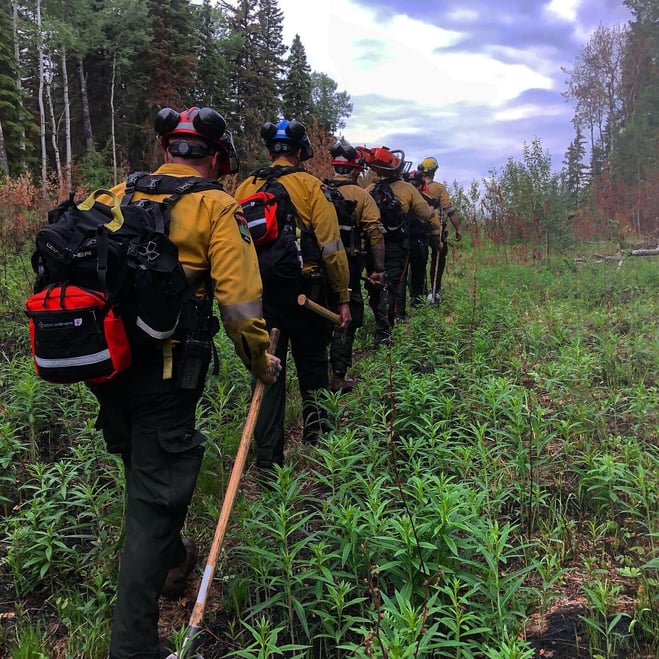
Alberta rappel crew walking the line for their next assignment
-----
Did you know?
Planned controlled ignition operations have many conditions that go into initiating a successful burn. Conditions like the right wind speed, wind direction, relative humidity levels, the type of fuel or landscape that’s being burned, and the support resources to contain the burn (firefighters, helicopters and heavy equipment). If one of those conditions are not met, the burn will not happen. We are very calculated in our approach to planned controlled ignition burning and take this operation very seriously.
Although the Chuckegg Creek wildfire has not completely burned the entire interior of the fire, the current perimeter is over 610 km around - that's like driving from Edmonton to Calgary, and back!
-----
The Chuckegg Creek wildfire will continue to be an active wildfire situation. As a result, smoke may be present along nearby highways and communities. Please use caution as you travel through these areas to ensure the safety of firefighters and community residents.


FIRE ADVISORY REMAINS IN EFFECT FOR THE HIGH LEVEL FOREST AREA
A Fire Advisory remains in effect due to the hotter temperatures, no significant rainfall and the ongoing wildfire activity within the High Level Forest Area.
Current short term permits will not be renewed and all permit holders with root rows/root piles need to ensure all piles are extinguished prior to the expiry of their permit.
- Safe campfires are currently allowed
- Current seasonal permits issued until October 31, 2019 will remain valid
- New permits will only be issued for smudges and burn barrels
To get a fire permit please call 780-926-5407 and leave a detailed message including your home address, burn location and what you plan to burn. A patrolman will contact you to arrange a site visit.
Visit albertafirebans.ca for more information or download the new Alberta Fire Bans mobile app.
ALERTS AND EVACUATIONS | BE PREPARED, STAY INFORMED
Download the Alberta Emergency Alert app or visit their website by clicking here. You can also check with the county, the town or your local community to see if new alerts or evacuation orders have been issued.
ROAD CLOSURE INFORMATION
To stay informed on all road closure information visit the Alberta Transportation website or download the mobile app.
SMOKE ISSUES
Smoke from wildfires in northern Alberta has caused poor air quality and reducing visibility at times. Winds will continue to shift bringing smoky conditions. For health related smoke issues, please visit Alberta Health Services.
PUBLIC SAFETY - WILDFIRE OPERATIONS
During an active wildfire, the highest priority is the safety of the public and wildfire personnel. Please refrain from entering areas of active wildfire suppression. If you encounter aircraft or helicopter bucketing operations on a water body please move your boat to shore.
The airspace around a wildfire is restricted via NOTAM in a radius of 9 kilometres to an altitude of 3,000 feet above ground level. It is illegal to operate any aircraft not associated with wildfire suppression within the restricted area, including drones. Do not fly drones or UAVs near or within the perimeter of an active wildfire. When a drone is near a wildfire it endangers firefighting personnel and important aerial firefighting operations will be grounded. Those caught in violation can be subject to an automatic court appearance and a fine of up to $100,000.

Victoria Ostendorf | Wildfire Information Officer
High Level Forest Area
Phone: 780-841-9387
1-866-FYI-FIRE
Matt Bell | Wildfire Information Officer (Chuckegg Creek wildfire)
Phone: 587-986-4985
1-866-FYI-FIRE
RELATED INFORMATION