

The fire danger in the Fort McMurray Forest Area is overall VERY HIGH.
Please use caution if you are spending time in forested areas. If you see smoke or fire in the forest call 310-FIRE (3473).
The majority of the fire activity on wildfire MWF031 was on the western perimeter today and very little growth was observed on the south.

A fire advisory is in effect for the portion of the Fort McMurray Forest Area located north of Lake Athabasca and east of Wood Buffalo National Park.
Under this advisory:
All existing fire permits are suspended and no new permits will be issued.
Prohibited:
Any burning without a valid fire permit, other than a campfire, is prohibited.
Allowed:
Safe wood campfires *
Backyard fire pits
Portable propane fire pits
Gas or propane stoves and barbecues
Catalytic or infrared-style heaters
*Safe wood campfires should be within a metal, brick, or rock fire ring. They are required to:
a) be on rock, gravel, sand, or another non-combustible surface that extends at least one metre around the fire;
b) have a responsible person in attendance to keep fire under control at all times and extinguish before leaving;
c) have on hand enough water on site to extinguish the fire.
Safe wood campfires on private lands include private land campgrounds and private land recreation areas. Municipalities, parks and protected areas may have additional fire safety requirements.
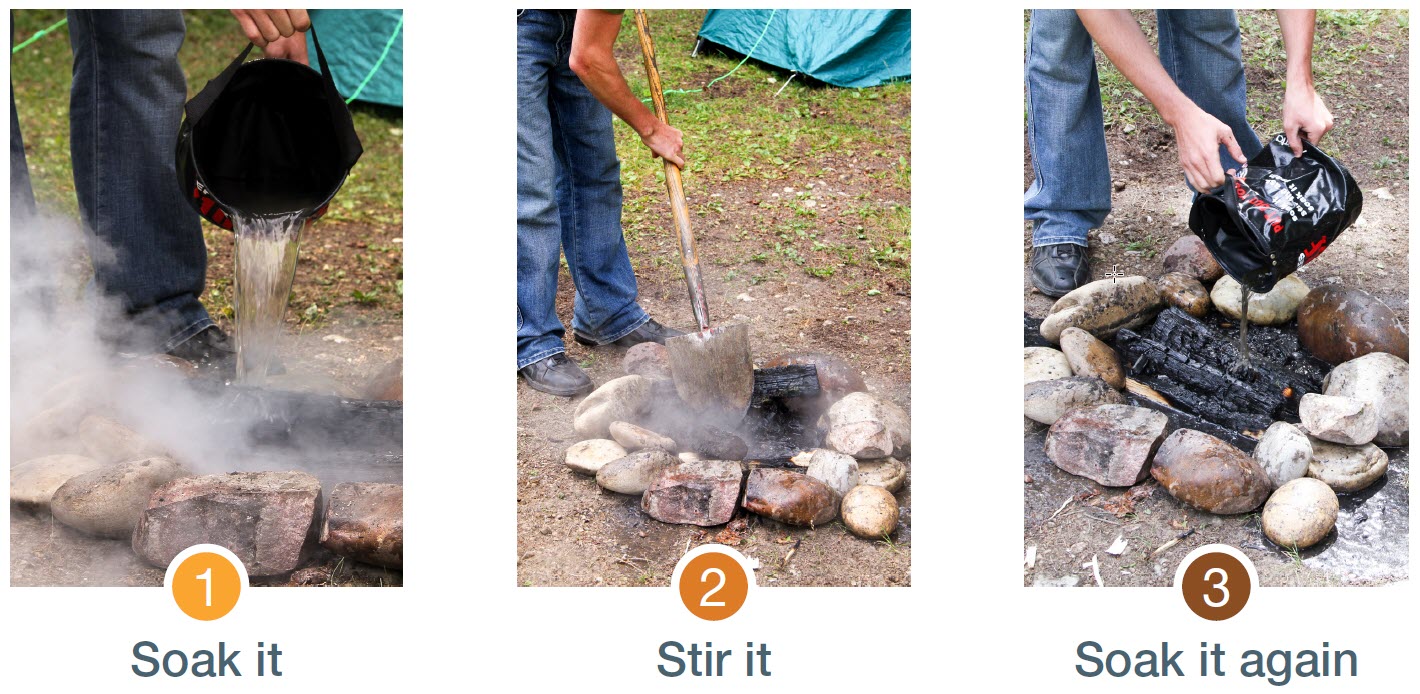
Never leave a campfire unattended. Soak it, stir it and soak it again until cool to the touch to ensure it is extinguished. If you see a wildfire, report it immediately by calling 310-FIRE.
The fire advisory will remain in effect until conditions improve. To view the area on a map, visit albertafirebans.ca.
FORT MCMURRAY WILDFIRE UPDATE
Since January 1, 2022, there have been 33 wildfires in the Fort McMurray Forest Area burning a total of 15,404 hectares (ha).
MWF015 was detected on June 12 and is located 24 km southeast of Fort Fitzgerald, 49 km southeast of Fort Smith and 115 km north of Fort Chipewyan. It is currently estimated to be 1,399 ha in size and classified as being held.
MWF018 was detected on June 13 and is located 28 km south southeast of Fort Fitzgerald, 50 km southeast of Fort Smith and 90 km north of Fort Chipewyan. It is currently estimated to be 2,810 ha in size and classified as being held.
MWF022 was detected on June 13 and is located 65 km southeast of Fort Fitzgerald and 62 km north northeast of Fort Chipewyan. It is currently estimated to be 8,160 ha in size and classified as being held.
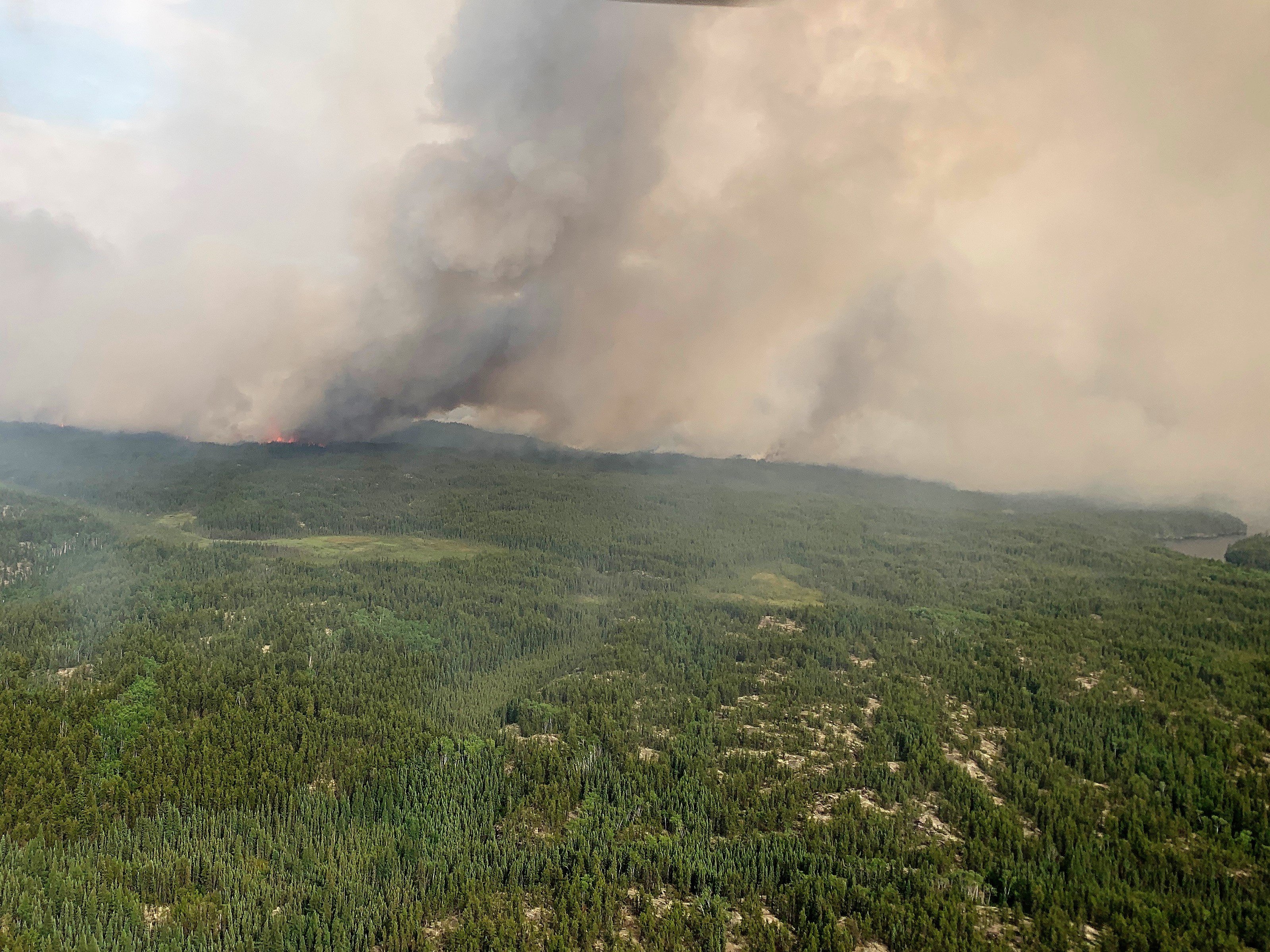
MWF031 was detected on June 25 and is located 24 km north of Fort Chipewyan and 1.5 km from Flett Lake. The wildfire was resurveyed today and is now estimated to be 2,900 ha in size and is classified as being held. The head of the wildfire was on the western perimeter today where firefighters observed moderate to high fire behaviour. The remainder of the perimeter was fairly quiet and mostly smoldering, with occasional flames. There was little to no growth towards the south thanks to the smoke column that shaded the wildfire from the sun and helped decrease the fire behaviour.
Firefighters expect some growth on this wildfire in the coming days, however forecasted variable winds could help prevent the wildfire from spreading, as it may burn onto itself. This wildfire will be actively monitored by firefighters on a daily basis but is not threatening any communities at this time.
Firefighters are currently assessing the wildfire and closely monitoring its progress. Ignition specialists will be assessing potential areas where they can tie the wildfire to natural fuel breaks like lakes and rivers.
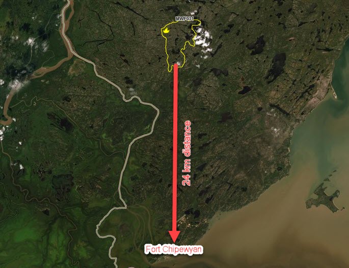
MWF031 is located 24 km north of Fort Chipewyan. To view wildfires on an interactive map, visit our new wildfire dashboard by clicking here. Be sure to select all the various layers and options the program has to offer.
Since these wildfires are located in remote areas where they do not threaten communities or resources, we allow the wildfires to play out their natural role onto the landscape under the watchful eye of experienced fire managers. Using this wildfire management strategy has many benefits. It re-introduces fire onto the landscape, creates a break in the continuous fuels, reduces the intensity of the fire, provides safety zones for our firefighting crews to work from and reduces the cost of fighting these wildfires.
All of the above mentioned wildfires were caused by lightning. To learn more about the classification of wildfires, please click here.
To view the wildfires on a map, check out the new wildfire dashboard. It provides up-to-date wildfire information at the click of a button. This interactive tool displays important statistics on the number of active wildfires in the province, sizes, locations, suspected causes and more.
SPECIAL AIR QUALITY STATEMENT IN EFFECT
A special air quality statement is in effect for many parts of the Fort McMurray Forest Area. You can view the statement by clicking here. To view the affected area, visit the interactive map by clicking here.
If you have smoke related concerns, we recommend that you visit the Alberta Health FAQs on wildfire smoke by clicking here. You can also visit firesmoke.ca to view current and forecasted smoke in your area.
A MESSAGE FROM THE REGIONAL MUNICIPALITY OF WOOD BUFFALO
There are currently no threats to any communities at this time. In the event of an evacuation alert or order within the Regional Municipality of Wood Buffalo, we recommend that you download Alertable - Emergency Notifications.
To learn more about how you can protect your property from wildfire, visit the Regional Municipality of Wood Buffalo FireSmart website:https://www.rmwb.ca/en/fire-and-emergency-services/firesmart.aspx
Managing emergencies is all about planning for them in advance. Once a year, a review of the REMP and CEMPs is done to ensure they reflect all the needs of our region. To learn more about the Regional Emergency Management Plan, click here.
PROVINCIAL WILDFIRE UPDATE
Since January 1, 2022 in the Forest Protection Area, there have been 492 wildfires burning a total of 28,309 ha.
FIRESMART
Using FireSmart principles is becoming a way of life for many communities in North America. With so many neighborhoods threatened by wildfire each year, residents are taking action and reducing the risk to their homes, cabins and properties.
Being FireSmart doesn't have to be complicated and there are many resources to help you get started. You can check out some easy tasks by visiting firesmartcanada.ca, click here to watch a video or you can take the FireSmart Canada FREE one-hour course by clicking here.
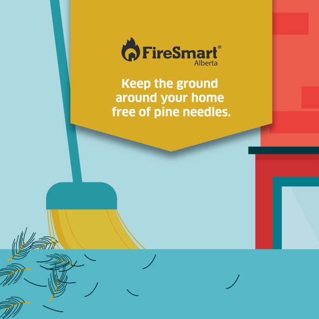
Removing combustible debris like pine needles, dead vegetation and branches around your home and outbuildings can help protect your property from wildfire.
CAMPFIRE SAFETY
With the long weekend approaching, many Albertans are preparing to spend time recreating and possibly having a campfire. We would like to share some important reminders to help keep our forests safe:
BUILD IN A SAFE LOCATION
A campfire should be built on level ground near water and should be sheltered from the wind. If water is not nearby, keep a large pail already filled with water within reach. Under the right conditions, wind can pick up sparks or embers and ignite a wildfire.
NEVER LEAVE YOUR CAMPFIRE UNATTENDED
Whether you are going to bed, going out for a short hike or heading home, your campfire must be fully extinguished before you leave.
PROPERLY EXTINGUISH YOUR CAMPFIRE
You must soak the ashes with water, stir it with a shovel or large stick and soak the ashes again. Continue to do this until the ashes are cool to the touch. Your campfire can re-ignite if not properly extinguished, especially if there is wind, and could start a wildfire.
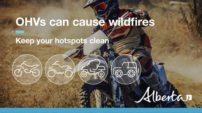
OHV SAFETY
Before you ride, clean any debris that has built up near the exhaust and muffler, under the seat, in wheel wells and around the engine. During your ride, stop regularly to clean your hotspots. Dry grass and vegetation that accumulate near the exhaust, ignite and cause a wildfire when it falls to the ground. Always carry a small fire extinguisher, a collapsible shovel and water. These tools can help extinguish a wildfire and safely dispose of hot debris.
REQUEST A FIRE PERMIT
Wildfire season in Alberta is from March 1 until October 31. During wildfire season, you are required to have a fire permit if you plan on burning in the Forest Protection Area, with the exception of a campfire.
To request a free fire permit online, visit the new portal. You will need a MyAlberta Digital ID to access the portal. Please note that you can still request your permit from the Fort McMurray forest office by calling 780-743-7125.
For more information regarding fire permits, you can view our video by clicking here.
For more information, please contact:
RELATED INFORMATION
Websites:
- Alberta Wildfire
- Alberta Fire Bans
- FireSmart in Alberta
- Alberta Emergency Alerts
- Air Quality Health Index
- Wildfire Smoke and Your Health
- 511 Road Reports
- Emergency Preparation
Social Media: