

The fire danger in the Fort McMurray Forest Area is overall VERY HIGH.
Please use caution when working or recreating in the outdoors. Always ensure you fully extinguish your campfire and if you see smoke or flame in the forest, call 310-FIRE (3473).
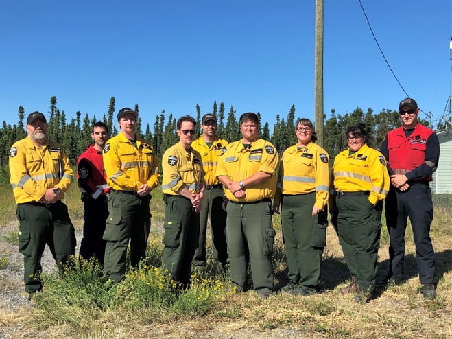
The incident management team is now established in Fort Chipewyan. Other firefighters arrived this evening to assist with wildfire operations. July 4, 2022
FORT MCMURRAY WILDFIRE UPDATE
Since January 1, 2022, there have been 36 wildfires in the Fort McMurray Forest Area burning a total of 26,049 hectares (ha).
MWF015 was detected on June 12 and is located 24 km southeast of Fort Fitzgerald, 49 km southeast of Fort Smith and 115 km north of Fort Chipewyan. It is currently estimated to be 1,399 ha in size and classified as being held.
MWF018 was detected on June 13 and is located 28 km southeast of Fort Fitzgerald, 50 km southeast of Fort Smith and 90 km north of Fort Chipewyan. It is currently estimated to be 2,810 ha in size and classified as being held.
MWF022 was detected on June 13 and is located 65 km southeast of Fort Fitzgerald and 62 km north northeast of Fort Chipewyan. It is currently estimated to be 8,160 ha in size and classified as being held.
Since these wildfires are located in remote areas where they do not threaten communities or resources, we allow the wildfires to play out their natural role onto the landscape under the watchful eye of experienced fire managers. Using this wildfire management strategy has many benefits. It re-introduces fire onto the landscape, creates a break in the continuous fuels, reduces the intensity of the fire, provides safety zones for our firefighting crews to work from and reduces the cost of fighting these wildfires.
MWF031 was detected on June 25 and is located 21 km north of Fort Chipewyan and is now on the edge of Flett Lake. The wildfire was re-surveyed again today and is now estimated to be 10,453 ha in size. No new growth was reported on the south boundary. It remains classified as being held. **the new wildfire perimeter map may not be available today but will be by tomorrow morning.
Today firefighters observed moderate to high fire behaviour. The fire grew mostly towards the west and very little growth was recorded on the south boundary. The fire has not reached Powder Creek today but could potentially reach it by tomorrow evening. Firefighters were assisted by helicopter bucket operations throughout the day. They also cleaned some areas for ignition in strategic locations on the southwest boundary of the fire. Firefighters were successful at achieving their goal of tying the wildfire to natural fuel breaks in an attempt to prevent the wildfire from moving south.
Starting tomorrow and into Thursday, winds are forecasted to be up to 15 km/h and pushing the wildfire towards the west and northwest, away from the community of Fort Chipewyan. Tomorrow, firefighters expect similar growth on the wildfire as what was observed today.
Three structure protection specialists have begun assessing the area and building a plan for the community of Fort Chipewyan and surrounding area, in the event that the wildfire does approach or a new one ignites. Six other members of the structure protection team are scheduled to arrive this week.
This wildfire is actively monitored by firefighters on a daily basis and is not threatening any communities at this time. There are currently four firefighters based in Fort Chipewyan and ready to respond to new wildfires. An additional 20 firefighters arrived this evening. The wildfire incident management team is also in Fort Chipewyan. Five helicopters are assigned to this wildfire. Eight firefighters are also stationed in Fort Smith.
Local aircraft operators, please be advised that a “notice to airmen” NOTAM is in effect for the area surrounding wildfire MWF031.
All of the above mentioned wildfires were caused by lightning. To learn more about the classification of wildfires, please click here.
To view the wildfires on a map, check out the new wildfire dashboard. It provides up-to-date wildfire information at the click of a button. This interactive tool displays important statistics on the number of active wildfires in the province, sizes, locations, suspected causes and more.
SPECIAL AIR QUALITY STATEMENT IN EFFECT
A special air quality statement is in effect for many parts of the Fort McMurray Forest Area. You can view the statement by clicking here. To view the affected area, visit the interactive map by clicking here.
If you have smoke related concerns, we recommend that you visit the Alberta Health FAQs on wildfire smoke by clicking here. You can also visit firesmoke.ca to view current and forecasted smoke in your area.
A MESSAGE FROM THE REGIONAL MUNICIPALITY OF WOOD BUFFALO
There are currently no threats to any communities at this time. In the event of an evacuation alert or order within the Regional Municipality of Wood Buffalo, we recommend that you download Alertable - Emergency Notifications.
To learn more about how you can protect your property from wildfire, visit the Regional Municipality of Wood Buffalo FireSmart website:https://www.rmwb.ca/en/fire-and-emergency-services/firesmart.aspx
Managing emergencies is all about planning for them in advance. Once a year, a review of the REMP and CEMPs is done to ensure they reflect all the needs of our region. To learn more about the Regional Emergency Management Plan, click here.
PROVINCIAL WILDFIRE UPDATE
Since January 1, 2022 in the Forest Protection Area, there have been 530 wildfires burning a total of 38,968 ha.
FIRESMART
Using FireSmart principles is becoming a way of life for many communities in North America. With so many neighborhoods threatened by wildfire each year, residents are taking action and reducing the risk to their homes, cabins and properties.
Being FireSmart doesn't have to be complicated and there are many resources to help you get started. You can check out some easy tasks by visiting firesmartcanada.ca, click here to watch a video or you can take the FireSmart Canada FREE one-hour course by clicking here.
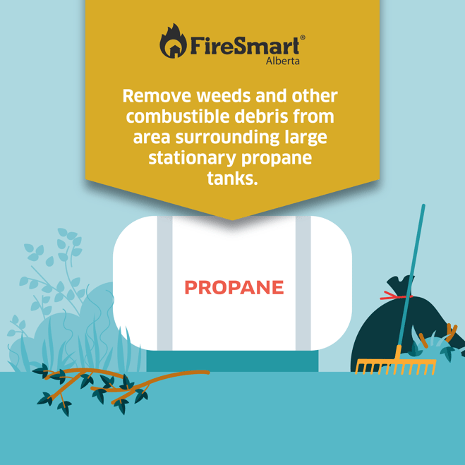
It's always best to keep your propane tank safe by removing combustible debris surrounding the area. It's also good practice to store your gasoline and other flammables away from embers that could be carried on the wind or flame from a possible wildfire.
CAMPFIRE SAFETY
With the long weekend approaching, many Albertans are preparing to spend time recreating and possibly having a campfire. We would like to share some important reminders to help keep our forests safe:
BUILD IN A SAFE LOCATION
A campfire should be built on level ground near water and should be sheltered from the wind. If water is not nearby, keep a large pail already filled with water within reach. Under the right conditions, wind can pick up sparks or embers and ignite a wildfire.
NEVER LEAVE YOUR CAMPFIRE UNATTENDED
Whether you are going to bed, going out for a short hike or heading home, your campfire must be fully extinguished before you leave.
PROPERLY EXTINGUISH YOUR CAMPFIRE
You must soak the ashes with water, stir it with a shovel or large stick and soak the ashes again. Continue to do this until the ashes are cool to the touch. Your campfire can re-ignite if not properly extinguished, especially if there is wind, and could start a wildfire.
OHV SAFETY
Before you ride, clean any debris that has built up near the exhaust and muffler, under the seat, in wheel wells and around the engine. During your ride, stop regularly to clean your hotspots. Dry grass and vegetation that accumulate near the exhaust, ignite and cause a wildfire when it falls to the ground. Always carry a small fire extinguisher, a collapsible shovel and water. These tools can help extinguish a wildfire and safely dispose of hot debris.
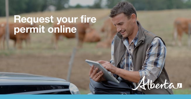
REQUEST A FIRE PERMIT
Wildfire season in Alberta is from March 1 until October 31. During wildfire season, you are required to have a fire permit if you plan on burning in the Forest Protection Area, with the exception of a campfire.
To request a free fire permit online, visit the new portal. You will need a MyAlberta Digital ID to access the portal. Please note that you can still request your permit from the Fort McMurray forest office by calling 780-743-7125.
For more information regarding fire permits, you can view our video by clicking here.
For more information, please contact:
RELATED INFORMATION
Websites:
- Alberta Wildfire
- Alberta Fire Bans
- FireSmart in Alberta
- Alberta Emergency Alerts
- Air Quality Health Index
- Wildfire Smoke and Your Health
- 511 Road Reports
- Emergency Preparation
Social Media: