

The fire danger in the Fort McMurray Forest Area is overall HIGH, with the exception of the area north of Lake Athabasca, which is VERY HIGH.
Please use caution when working or recreating in the outdoors. Always ensure you fully extinguish your campfire and if you see smoke or flame in the forest, call 310-FIRE (3473).
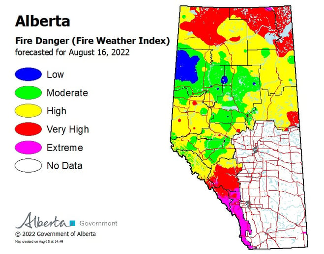
Tomorrow's forecasted map of the fire danger throughout Alberta (August 15, 2022).
FORT MCMURRAY WILDFIRE UPDATE
Since January 1, 2022, there have been 73 wildfires in the Fort McMurray Forest Area, burning a total of 88,937.6 hectares (ha).
MWF015 was detected on June 12 and located 24 km southeast of Fort Fitzgerald, 45 km southeast of Fort Smith and 115 km north of Fort Chipewyan. It is currently estimated to be 3,162 ha in size and classified as being held. This wildfire was caused by lightning.
MWF018 was detected on June 13 and is located 28 km southeast of Fort Fitzgerald, 43 km southeast of Fort Smith and 90 km north of Fort Chipewyan. It is currently estimated to be 2,942 ha in size and classified as being held. This wildfire was caused by lightning.
MWF022 was detected on June 13 and is located 58 km southeast of Fort Fitzgerald and 62 km northeast of Fort Chipewyan. It is currently estimated to be 24,920 ha in size and classified as being held. This wildfire was caused by lightning.
MWF025 was detected on June 14 and is located 30 kilometers east of Fort McMurray. It is currently estimated to be 1,554 ha in size and is classified as being held. The wildfire is moving east and away from the city of Fort McMurray. This wildfire was caused by lightning.
MWF031 was detected on June 25 and is located 21 km north of Fort Chipewyan. The wildfire is estimated to be 45,280 ha in size and was caused by lightning. The south end of the fire from the Roche River past the east side of Flett Lake is now controlled from ongoing suppression efforts. Although still classified as being held, this wildfire is not anticipated to threaten any community or surrounding cabins from this point forward.
MWF032 was detected on June 26 and is located nine kilometers east of Gypsy Lake. It is currently estimated to be 6,476 ha in size and is classified as being held. This wildfire was caused by lightning.
MWF033 was detected on June 30 and is located 30 km southwest of Fort Fitzgerald and 110 km north of Fort Chipewyan. It is currently estimated to be 1,863 ha in size and classified as being held. The fire has reached the west side of Leland Lake. This wildfire was caused by lightning.
MWF034 was detected on June 30 and is located 50 km southeast of Fort Fitzgerald and 90 km north of Fort Chipewyan. It is currently estimated to be 1,301 ha in size and classified as being held. This wildfire was caused by lightning.
Since these wildfires are located in remote areas where they do not threaten communities or resources, we allow the wildfires to play out their natural role onto the landscape under the watchful eye of experienced fire managers. Using this wildfire management strategy has many benefits. It re-introduces fire onto the landscape, creates a break in the continuous fuels, reduces the intensity of the fire, provides safety zones for our firefighting crews to work from and reduces the cost of fighting these wildfires.
These wildfires are actively monitored by firefighters on a regular basis and do not threaten any communities at this time.
To learn more about the classification of wildfires, please click here.
To view a map of all the wildfires in the area north of Lake Athabasca, click here.
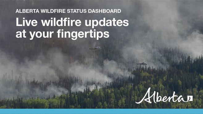
To view the wildfires on a map, check out the wildfire dashboard. It provides up-to-date wildfire information at the click of a button. This interactive tool displays important statistics on the number of active wildfires in the province, sizes, locations, suspected causes and more.
PROVINCIAL WILDFIRE UPDATE
Since January 1, 2022 in the Forest Protection Area, there have been 822 wildfires burning a total of 107,518 ha.
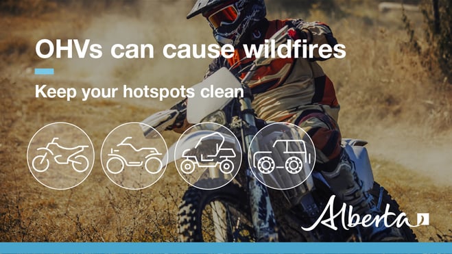
OHV SAFETY
Off-highway vehicles (OHVs) include:
-all-terrain vehicles
-quads
-trikes
-other vehicles designed for travelling off public roads and on unpaved trails and rough terrain
Debris falling from these vehicles have been known to cause wildfires.
How OHVs can start wildfires
-Exhaust systems heat up to temperatures in excess of 204 degrees Celsius; hot enough to fry an egg and start a wildfire.
-At these temperatures, built up materials and debris on your machine (such as grass, muskeg, moss, or other debris) can heat up, smoulder and ignite.
-The smouldering debris can drop to the ground as you’re riding, starting a wildfire.
Help reduce the risk
You can reduce the risk of your vehicle causing a wildfire by following these simple steps:
-Before you ride, clean out hot spots and remove debris from your machine.
-After riding through muskeg or tall grass, stop and remove any build-up from your machine.
-Carry firefighting equipment such as a small shovel, collapsible pail or fire extinguisher.
-Wash your quad, trike or bike and keep it clean; do not wash in streams and creeks.
-Make sure your muffler and spark arrestor are working properly.
-Stop frequently. Take the time to knock debris from your machine’s hot spots. If the debris is smouldering, soak it, stir it, and soak it again to make sure it’s out.
REQUEST A FIRE PERMIT
Wildfire season in Alberta is from March 1 until October 31. During wildfire season, you are required to have a fire permit if you plan on burning in the Forest Protection Area, with the exception of a campfire.
To request a free fire permit online, visit the new portal. You will need a MyAlberta Digital ID to access the portal. Please note that you can still request your permit from the Fort McMurray forest office by calling 780-743-7125.
For more information regarding fire permits, you can view our video by clicking here.
CONTACT
RELATED INFORMATION
Websites:
-Wildfire Smoke and Your Health
Apps: