

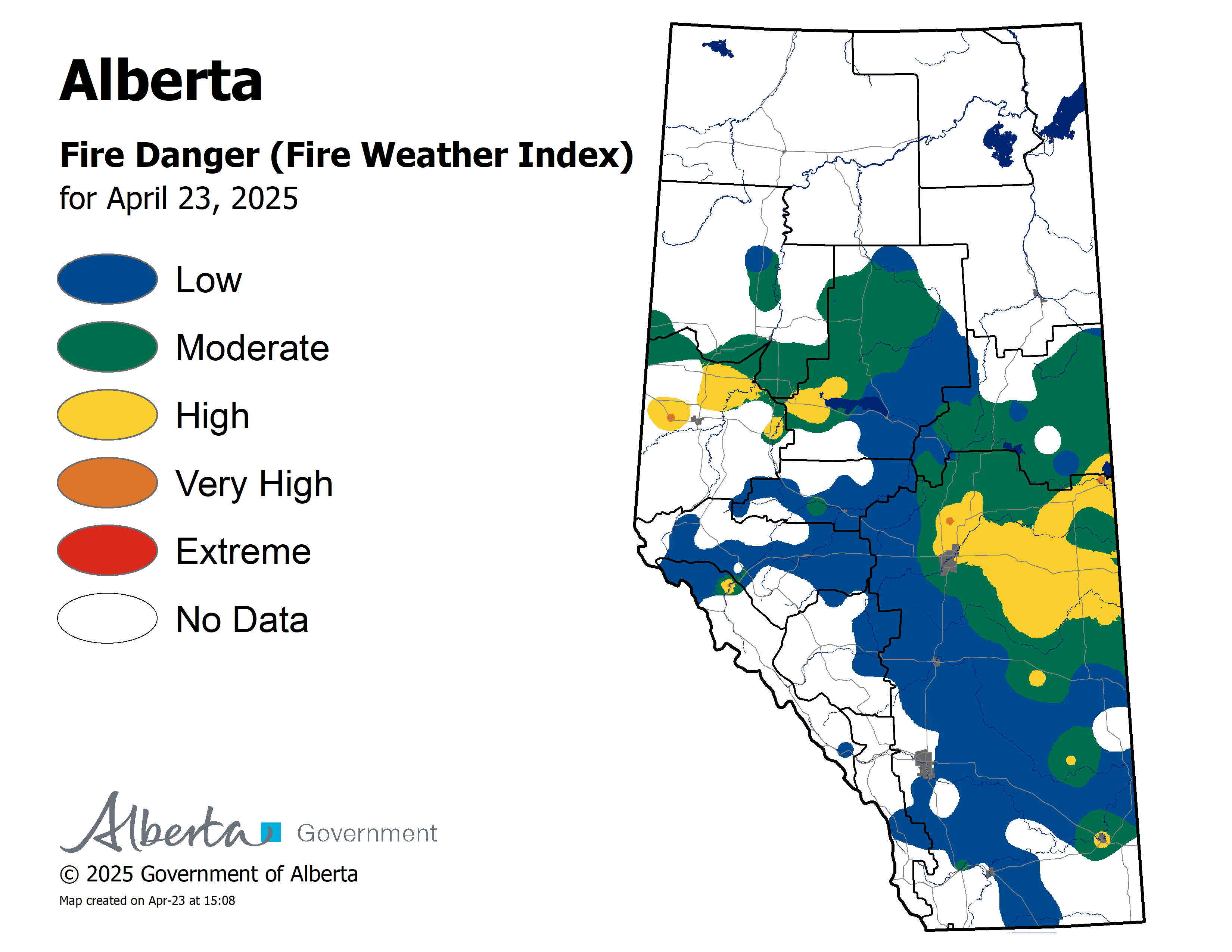
Wildfire danger
A small amount of rain was recorded for areas north of Lesser Slave Lake this afternoon.
The wildfire danger remains High to Extreme for areas north of Lesser Slave Lake. Click here to view the wildfire danger map for today.
Rain is in the forecast however it will take a significant amount to improve the dry conditions.
At this time, the Fire Ban/OHV Restriction remains in effect for the entire Slave Lake Forest Area and other parts of Alberta.
We are constantly monitoring the weather and will adjust when conditions improve. Stay tuned to www.albertafirebans.ca for the latest information.
To view a fact sheet on the OHV restriction click here.
To view a fact sheet on the fire ban click here.
Firefighters are urging everyone to use caution and report wildfires immediately by calling 310-FIRE or #FIRE on your cell phone.
Alberta Emergency Alert/Road Conditions
Keep up to date by downloading the Alberta Emergency Alert App or visit www.emergencyalert.alberta.ca
For road conditions visit www.511.alberta.ca
Smoky conditions are expected to continue
Over the next several days wildfire smoke will continue to drift into the Slave Lake Forest Area.
If you experience respiratory difficulties, visit Alberta Health Link or dial 811. Visit www.firesmoke.ca to view the most current smoke forecast.
Click here for Alberta Health Services Information about Wildfire Smoke.
New Wildfire Starts
There was one new wildfire start today. It is being held at 0.3 hectares.
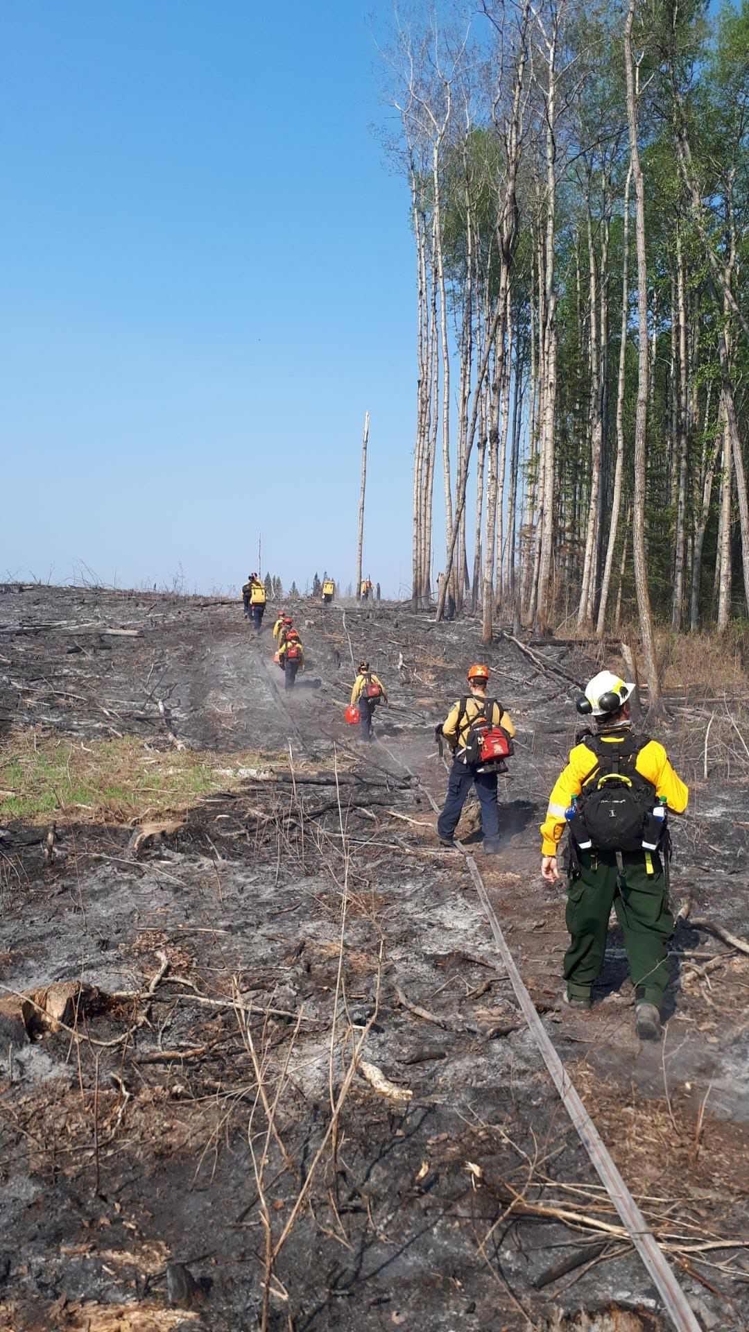
Firefighters have extinguished nine of the wildfires which started on June 2nd. Eight firefighters and three helicopters continue to fight SWF-093 which is located 11 kilometres south of Chipewyan Lakes. It is classified as out of control and is 150 hectares.
Since the start of the wildfire season on March 1st, there have been 97 wildfires and 299,489 hectares burned in the Slave Lake Forest Area.
For information on the wildfire situation across the province of Alberta click here.
McMillan Wildfire Complex
The south end of the fire received 2.6 millimeters of rain while the north end received 1.2 millimeters of rain. This helped to reduce fire behavior across a majority of the fire. Harvested areas in the perimeter did experience higher fire behavior. Minimal perimeter growth was experienced today.
The rain on the south end of the fire allowed heavy equipment to continue to build dozer lines along this section of the fire. Firefighters are mopping up ignition lines on the southeast end of the fire along the power line this will strengthen control lines. Fire crews are extinguishing hot spots 100 feet in the fire perimeter on the Marten Lake Road. Helicopters were bucketing to reduce fire behavior on SWF-090.
Structure protection is complete at Trout Lake, Wabasca and Marten Beach.
The wildfires are:
- 5.8 and 3.7 kilometres west of Wabasca No. 166B and 166D
- 26.5 kilometres northeast of Marten Beach
- 32.8 kilometres northeast of Slave Lake
- 9.3 kilometres southeast of Trout Lake
SWF-049 is 238,254 hectares and is classified as out of control.
SWF-078 is 162 hectares and is classified as out of control.
SWF-079 is 355 hectares and is classified as out of control.
SWF-090 is 183 hectares and is classified as out of control.
There are 347 firefighters and support staff, 35 helicopters and 35 pieces of heavy equipment fighting this wildfire.
Click here to view a map of the McMillan Wildfire Complex.
Click here to view a map of the wildfires burning in Alberta.
Alberta Wildfire Information booths are set up in the following location;
- Calling Lake Evacuation Centre
- Slave Lake Canadian Tire Parking Lot 10:00 am - 1:00 pm
Weather
For Tuesday the temperature will be 16 degrees and winds will be from the southwest/west 20 kilometres per hour gusting up to 40. The forecast is calling for a chance of rain.
On high alert
Fire lookouts are on high alert constantly watching for smoke and firefighters in helicopters, various pieces of heavy equipment and airtankers are ready to respond to any new wildfires that may start.

FIRE BAN AND OFF-HIGHWAY VEHICLE RESTRICTION IN EFFECT
A fire ban and off-highway vehicle restriction is in effect for the entire Slave Lake Forest Area and other parts of Alberta.
The Town of Slave Lake, Big Lakes County and Town of High Prairie have issued a fire ban and OHV restriction.
To view a map of the fire ban/OHV restriction area visit www.albertafirebans.ca
To view a fact sheet on the OHV restriction click here.
To view a fact sheet on the fire ban click here.
Prohibited
If you have any questions please contact:
Leah Lovequist
Wildfire Information Officer
Mobile: 780-849-0945
Email:leah.lovequist@gov.ab.ca
Keep up to date on the wildfire situation by subscribing to the Slave Lake Forest Area Wildfire Update or download the free Alberta Wildfire app for Apple or Android devices.


