

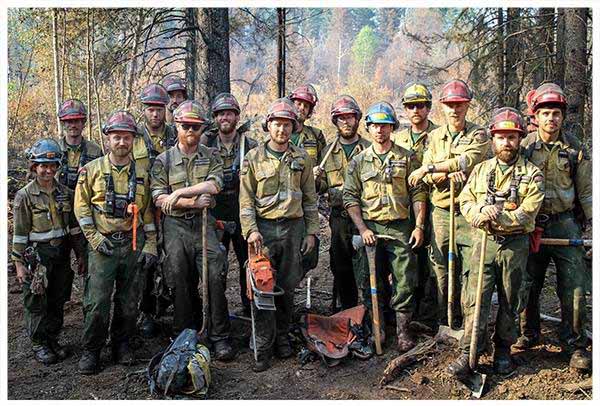
One of the Peace River based unit crews has returned from their time helping out with the wildfires in the High Level area and will be heading out to work on the remaining out of control fire in the Notikewin complex tomorrow.
Wildfire Hazard
The wildfire hazard for the Peace River Wildfire Management Area is now HIGH. Temperatures are expected to be in the low twenties tomorrow with moderate relative humidities and strong winds gusting up to 40 km/hr.
Scattered thunderstorms are expected to continue, resulting in an increased risk of lightning started wildfires. Please report wildfires by calling 310-FIRE (3473). Despite the recent rainfall, the surface vegetation and trees remain flammable.
Wildfire Danger Notice
Campfires
Safe campfires are permitted in campgrounds and back country or random camping areas.
Fire Permits
Fire permits are not suspended at this time, but may be in the future if the wildfire hazard continues to climb. Fire permits will be issued on a site-by-site basis and may be refused until conditions are more favorable.
Visit www.albertafirebans.ca for the latest fire ban information across the province.
Concerned About Smoke?
Anyone with health concerns regarding the smoke should check the Alberta Health Services website or call 811 for 24/7 health advice from Alberta Health Link.
For a smoke forecast map, please visit Wildfire Smoke Forecasts for Western Canada.
Local Wildfires
There have been 148 wildfires in the Peace River Wildfire Management Area this fire season, all but 9 of which have been extinguished.
Active wildfires in the area current as of 8 pm on July 14 (changes have been italicized):
- PWF 052 is under control at 1202.00 hectares in the Hotchkiss area.
- PWF 116 is under control at 5.40 hectares northeast of the Notikewin Provincial Park.
- PWF 130 is under control at 1.0 hectare in size in the Hawk Hills area.
- PWF 134 is under control at 0.5 hectares in size west of the Clearhills area.
- PWF 135 is under control at 6.0 hectares in size west of the Clearhills area.
- PWF 137 is being held at 3.40 hectares north of the Hines Creek area.
- PWF 145 has been extinguished at 0.30 hectares in size north of Cadotte Lake.
- PWF 146 has been extinguished at 0.01 hectares in the Clearhills area.
- PWF 147 has been extinguished at 0.01 hectares in the Weberville area.
NOTIKEWIN COMPLEX
Please continue to respect the restrictions to access that have been put in place for your safety and the safety of our fire fighters.
- PWF 129 is being held at 538 hectares in the Notikewin area (approximately 15 kms northwest of Sulphur lake). A dozer guard has been completed around the entire perimeter of the fire. There were a few hotspots that were smoking today and crews and helicopters worked to extinguish them today and will continue to work towards getting this fire under control tomorrow.
- PWF 131 is 3,006 hectares in size and remains out of control. This fire is located approximately 10 kms west of Sulphur Lake and 15 kms northwest of Stony Lake. Firefighters, heavy equipment and helicopters continued their work towards containing this wildfire today and will continue to do so tomorrow. After a quiet morning, the fire behavior worsened this afternoon and the fire crossed over the dozer guard. Efforts are being made to contain this area this evening.
- *In order to ensure the safety of the public and our firefighters, access onto the Notikewin Tower Road, the Canfor Road, the DMI P2 200 and the Silver Creek Road will be limited to necessary personnel only until further notice. Please do NOT go into the area for any reason without first calling 780-618-6215.*
- NOTIKEWIN COMPLEX MAP UPDATED JULY 12
PBZ002 (FONTAS FIRE):
- PBZ002 - This wildfire started in British Columbia and has made its way over the Alberta/British Columbia border in the Fontas area. Approximately 2926 hectares of this fire are now burning within Alberta. The fire was very quiet again today as crews continued to patrol this fire and actioned hotspots along the transmission line in the area.
- PBZ002 MAP UPDATED JULY 10
Provincial Wildfires
There are 97 wildfires currently burning in the province, 15 of which remain out of control as of 8 pm on July 14.
The 2015 fire season has been busier than average for the province with 1,421 fires and 482,626 hectares burned thus far.
Please visit our wildfire status map on our website at www.wildfire.alberta.ca or download the Alberta Wildfire App for more information on what is happening throughout the province.
Fire Permits
BEFORE YOU BURN IT, GET YOUR PERMIT
Albertans in the forested areas need to get a fire permit for any burning, excluding campfires.
- Fire permits are free and you can get more information or request a fire permit by calling our Peace River office at 780-624-6190.
- Please call a week in advance of when you would like to burn in order to give our staff time to make arrangements to come out to your site and issue your permit.
- In order to further ease the process, please have your site ready according to the burning site guidelines. before staff arrive.
- All permits must be completely extinguished before they expire, so if you need an extention, please make sure to call in for one well before your permit expires.
Wildfire Prevention
Please click on the links below for more information on how YOU can prevent wildfires.
- get a fire permit before you burn
- ensure that your campfire is COMPLETELY extinguished before you leave your site
- check your ATV for dry debris that may be heating up on the hot parts of your machine.
For More Information
- Visit us on Facebook or Twitter or download our Alberta Wildfire App for android and apple products
- Up-to-date information fire restrictions and fire bans is available by calling 1-866-FYI-FIRE (1-866-394-3473).
- Current wildfire information
- Fire ban information
- Fire ban system
Remember to help us action wildfires quickly by calling 310-FIRE to report a wildfire.
CRYSTAL BURROWS - Information Officer
c: 780.618.6215 o: 780.624.7142
crystal.burrows@gov.ab.ca