

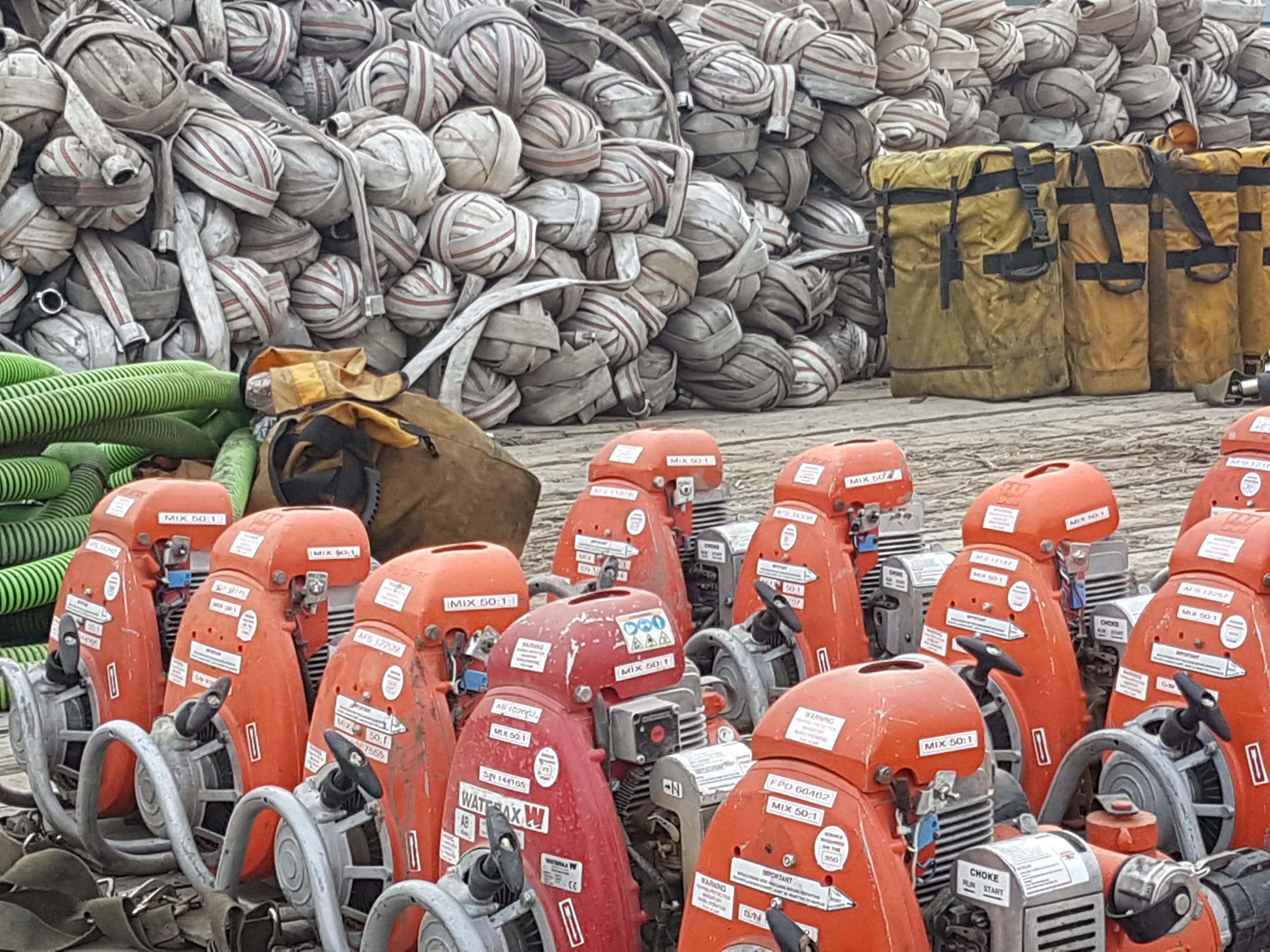
 Firefighting equipment ready to be deployed on Battle complex
FIRE BAN IN EFFECT
 Due to extreme wildfire danger from dry grass and weather indicators, a Fire Ban and OHV Restriction is now in effect for the Peace River Forest Area and most of northern Alberta.
Existing fire permits are suspended until further notice.
Prohibited
- All open fires including campfires in campgrounds, backcountry and random camping areas and backyard fire pits.
- Charcoal briquettes, turkey fryers and tiki torches.
- Fireworks and exploding targets.
- The use of off-highway vehicles for recreational use on all public lands.
Allowed
- Portable propane fire pits that are CSA approved or UL certified.
- Gas or propane stoves and barbecues that are CSA approved or UL certified and are designed for cooking or heating.
- Catalytic or infrared-style heaters.
- OHVs for industrial use, agricultural use, and traditional use by Indigenous peoples, as well as use on private lands.
The Fire Ban and Off-Highway Vehicle Restriction will remain in effect until conditions improve.
Many nearby municipalities have advisories, restrictions or firebans in place. Please check www.albertafirebans.ca for more information and to view a map of the fireban/OHV restriction boundaries.
WILDFIRE UPDATE (current as of May 30, 2019 at 10 pm)
There have been no new starts in the Peace River Forest Area yet today, allowing firefighters to focus their full efforts on patrols and the fires we already have burning in the area.
Numerous resources including crews, aircraft and heavy equipment groups have been placed throughout the area on standby and at the ready to quickly action any new wildfire starts.
There have been 70 wildfires in the Peace River Forest Area this fire season, and each of these wildfires has now been extinguished with the exception of three:
WILDFIRES OF NOTE:
Battle Complex:
PCX-001 (formerly PWF 052 and 054) remains out of control at 52,322 hectares in size Manning/Notikewin area
Cooler temperatures, higher humidity and heavy smoke helped to reduce fire activity today. However, the smoke also meant aircraft were unable to fly throughout the day.Today, many of the crews and heavy equipment assigned to this fire focussed on the creation of a significant guard on the east side of the fire. This guard is intended to help reduce the likelihood that the fire will move toward the town of Manning and rural properties in the area. To ensure the guard is built as quickly as possible and while the wind and weather are in our favour, a contingent of both ground crews and heavy equipment will continue to work on this guard throughout the night.
Structure protection specialists continue to assess properties and deploy sprinkler units within the County of Northern Lights’ evacuation area.
Nearly 400 personnel, 22 helicopters, heavy equipment and air tankers continue to work on this fire today.
The Battle complex fire is now estimated to be 52,607 hectares. (PWF-054 is now within PWF-052’s perimeter and they have been renamed PCX-001).
PWF 070 is still being held at 251 hectares in size west of Keg River. Numerous firefighters and helicopters continued to work towards containing this fire today. The fire has been completely surrounded by dozer guard and the guard held today.
HWF 042 (Chuckegg Creek Fire)
This fire spread down into the Peace River Forest Area yesterday, specifically in the Paddle Prairie area. For updates on this fire, please visit
http://srd.web.alberta.ca/high-level-area-update
OTHER WILDFIRES IN THE AREA:
- PWF 066 has been turned over to the landowner at 10.50 hectares in size in the Three Creeks area.
For your safety and the safety of the numerous firefighters working to contain these wildfires, please stay obey the access restrictions and stay out of the area if you do not need to be there.
For information on the wildfire situation across the province of Alberta, visit: wildfire.alberta.ca.
FIRE WEATHER
The red flag weather warning remains in the fire area because of low humidity and high temperatures.
Increased temperatures with a high in the mid 20s are expected tomorrow. The humidity will increase slightly to 25-30% and the winds will come from the S/SW at 15 to 20 km/hr.
SAFETY NOTICES
EVACUATIONS
County of Northern Lights:
Area north of Manning:
Residents in the Evacuation area must evacuate immediately. Residents must report to the Reception Centre located at the County of Northern Lights Main Office Building, at 600, 7th Ave. NW, Manning. If you are physically unable to evacuate on your own call 780 836 3348 and together, we will make a plan. Use extreme caution while driving as visibility may be poor.
Keg River and Carcajou:
If you are physically unable to evacuate on your own accord and require assistance, call the County Office at 780.836.3348 and together, they will make a plan with you.
The evacuation route is Highway 35 south. Please use extreme caution while driving as visibility is poor due to smoke.
All evacuees are requested to report at the Registration Centre located at the County of Northern Lights Main Office building at #600-7th Ave NW Manning. If you are planning to stay with friends or family, you are still asked to report at the registration centre.
Registering helps the County of Northern Lights to keep you informed throughout this situation and for re-entry into your community.
Further instructions and additional information will be given at the registration centre concerning possible destinations. Please listen to the local radio station or visit the County of Northern Lights website: www.countyofnorthernlights.com or the County’s facebook page www.facebook.com/countyofnorthernlights
- northward from township road 910 (North Star Road)
- Southward of township road 922 (Notikewin Road)
- everyone west of range road 231
Temporary Access Pass Information-Friday, May 31st
The County of Northern Lights wants to ensure the security of the Evacuation Zone. To achieve this, they must limit the frequency and the reason for entry into the Evacuation Zone. The following rules will be implemented for Friday, May 31, 2019.
- No entry to the Evacuation Zone will be permitted until the County has received approval from Forestry Wildfire Base (notification will not be given prior to 0900 hours)
- Only residents tending to Farm Livestock will be allowed entry
- Only one entry will be permitted per day
- Daily registration at the County office and hourly check-in is still required
For more information on evacuation alerts, visit Alberta Emergency Alert or download the free Alberta Emergency Alert app.
ROAD CLOSURES
For information on road closures and other access related hazards, visit Alberta 511 or download the free Alberta 511 app.
SMOKE
Smoke may be drifting into the area for the foreseeable future. Anyone with health concerns should check with Alberta Health Services or call 811 for 24/7 health advice from Alberta Health Link. For a smoke forecast map, visit Wildfire Smoke Forecasts for Western Canada.
FIRE PERMITS SUSPENDED
All fire permits have been suspended, effective on May 16 at 6 pm. No fire permits will be issued until the fire danger conditions improve.
Please call the Peace River Forest Area office at 780-624-6190 if you have any questions about fire permits.
DO YOUR PART TO PREVENT WILDFIRES
Please continue to respect the fire ban and quad restriction currently in effect.
FIRESMART
You can protect your home from wildfire
Protecting your home from wildfire starts with simple actions. Whether you are doing regular yard maintenance or making large scale changes during renovations or landscaping, you can make choices that will help protect your home from wildfire.
Learn more at firesmartcanada.ca.
FOR MORE INFORMATION

- Bookmark the Peace River Wildfire Update and check for updates anytime or subscribe to have it emailed to you
- Download our app, available for Apple and Android devices.
- You can also find us on Facebook,Twitter, Youtube
- or visit www.wildfire.alberta.ca
Or contact:
Crystal Burrows
Wildfire Information Officer
(780) 618-6215
crystal.burrows@gov.ab.ca
Report Wildfires 310-FIRE (3743)