
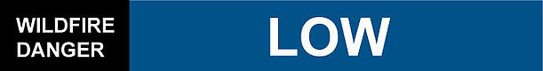
The wildfire hazard is expected to be LOW for the next several days.
A cold front is forecast to cross the area tomorrow as it makes its way out of Alberta. Cooler temperatures in the mid-teens, high humidity, widespread precipitation,strong and gusty winds and high lightning potential are expected tomorrow. The wildfire hazard will remain HIGH until the cold front crosses the area.
We didn't have any new wildfires today. We have crews, helicopters and the airtankers on hand to action any new wildfires tomorrow. We exported one crew to the Calgary area to help out there. The airtankers helped with a wildfire in the Slave Lake area today.
Remember that it's not safe to burn when winds exceed 15 km/hr. The last few days have seen winds substantially stronger than that, and tomorrow's winds are expected to be between 25-45 km/hr. Please respect the conditions on the back of your fire permits, and don't burn when the conditions are not safe.
Thanks for doing your part to prevent wildfire.
For more information, please contact:
Leslie Lozinski
780-623-9758
Area Information Co-ordinator