

A Fire Advisory remains in effect for the High Level Forest Area:
Use caution within the Forest Protection Area.
To report a wildfire, call 310-FIRE (3473)
HIGH LEVEL FOREST AREA UPDATE | JULY 7, 2019 AT 7:00 P.M.
There are currently 6 active wildfires in the High Level Area. Of these fires, 2 are Out of Control (OC), 1 is Being Held (BH) and 3 are Under Control (UC). (See below for details on the Chuckegg Creek wildfire).
Click here for a map of all fire locations and their status within the High Level Forest Area.
Wildfires of note:
- Fire number HWF-066 (Jackpot Creek) is classified as Being Held (BH), is located north of Lutose. The fire is approximately 74,331 hectares in size. There are 216 firefighters and support staff, 10 helicopters and 2 pieces of heavy equipment working on this wildfire.
- Fire number HWF-088, is classified as Under Control (UC) and is located 10 km northwest of Hutch Lake. This fire is 216 hectares in size. There are 25 firefighters, 2 helicopters and heavy equipment working on this fire.
NOTE: The next update will be by 11:00 a.m. tomorrow, or if conditions warrant.
Firefighters, helicopters, airtankers and heavy equipment are positioned throughout the High Level Forest Area to respond to any new wildfire starts.
CHUCKEGG CREEK WILDFIRE UPDATE | JULY 7, 2019 AT 7:00 P.M.
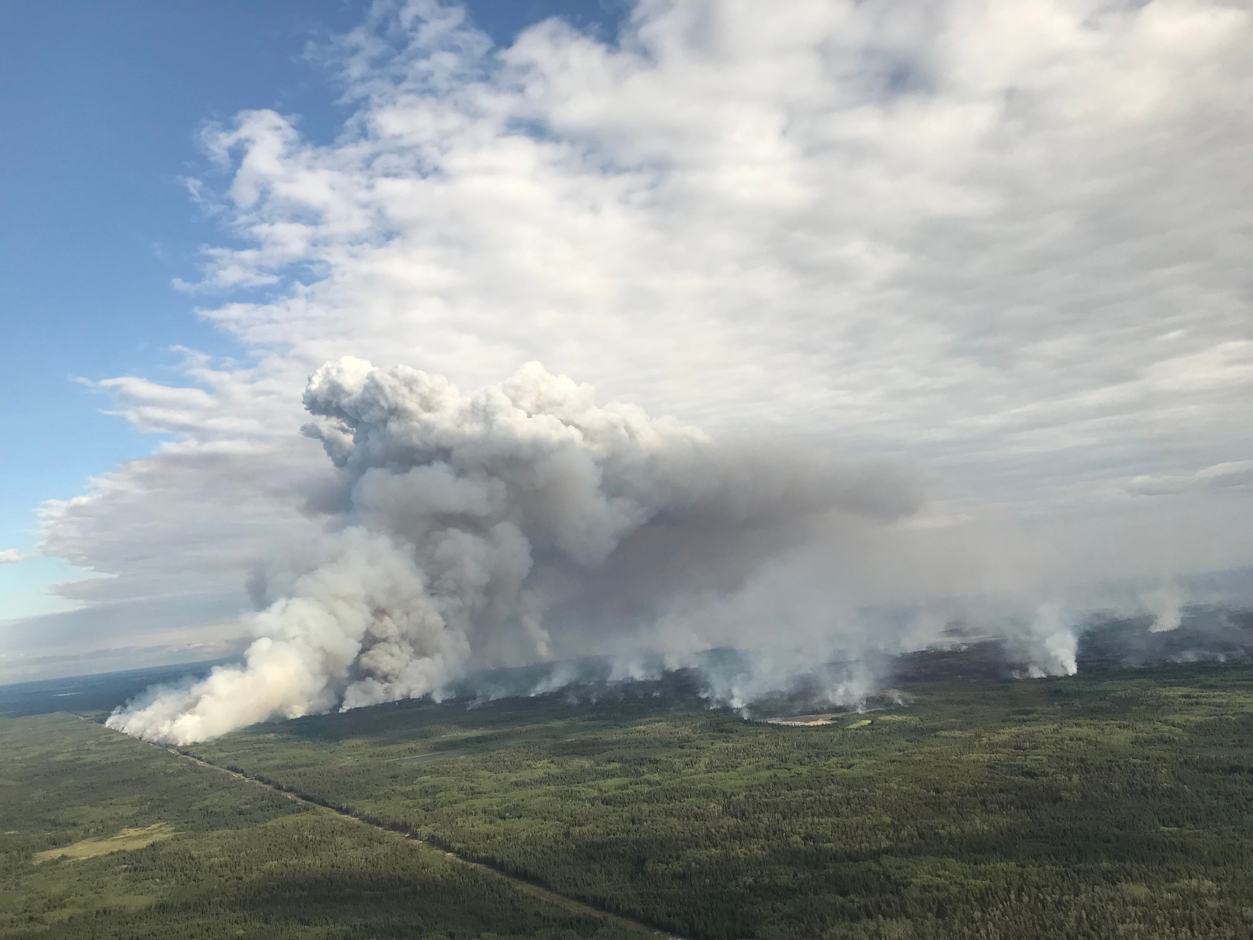
Aerial Ignition Operations - July 7
This afternoon weather conditions have allowed firefighters to conduct the planned ignition operation on the east side of the fire, west of La Crete. This tactic is used by firefighters to create containment along the fire perimeter and minimizes the potential for the fire to spread in an uncontrolled way as well as improves firefighters safety. Firefighters will also be continuing to look for the opportunity to do the ignition operation to the northeast of the Boyer River Cell Tower if conditions allow.
On the east side of the fire, west of La Crete, areas of the fire continue to burn in very deep areas of peat moss which has created some challenges for firefighters. Firefighters along with heavy equipment continued to make progress in establishing guard in this area. Helicopters also continue to aid firefighting efforts by dropping retardant and water on the fire perimeter in priority areas to limit fire spread. Due to the warmer temperatures and windy conditions the fire has been active this afternoon.
Firefighters worked today to establish a water delivery system using large water tanks, water reservoirs (750, 000 gallons), pumps, sprinklers and hose line. Once this is complete, this system will help support firefighters directly attack the fire perimeter and assist in flooding areas where the fire is burning in peat moss.
Progress continues to be made by firefighters on the north, west, south, and southeast side. In Tompkins Landing the fire has seen some activity due to the fact there are pockets of unburned areas inside the fire perimeter that did not burn initially. Infrared scanning from helicopters will continue. This process identifies thermal infrared radiation from areas that are still smoldering which are also known as hot spots. This process helps firefighters to ensure that these areas are cold and no fire continues to burn. Some of the areas to be scanned are close to residential areas and helicopters may be in the area early in the mornings.
On the west side, firefighters continue with direct attack extinguishing hot spots and mopping-up 100 feet inward, south of Highway 58. This area did experience some activity inside the fire perimeter and smoke could be seen by people driving along highway 58, west of High level. In the southwest, hose lay, mop-up and extinguishing hot spots is ongoing.
In the southern end of the wildfire, infrared scanning has identified some hot spots in the Paddle Prairie area and firefighters continue to extinguish hot spots in priority areas.
The last recorded size is 332,057 hectares. There are 1,225 wildland firefighters and support staff, 46 helicopters and 158 pieces of heavy equipment fighting this wildfire.- The last recorded size is 331,988 hectares.
- There are 1,225 wildland firefighters and support staff, 46 helicopters and 158 pieces of heavy equipment fighting this wildfire.


FIRE ADVISORY IN EFFECT FOR THE HIGH LEVEL FOREST AREA
A Fire Advisory remains in effect due to ongoing wildfire activity within the High Level Forest Area.
- Safe Campfires are currently allowed
- Current seasonal permits issued until October 31, 2019 remain valid
- New permits will only be issued for:
- smudges
- burn barrels
- light yard debris
- root piles/rows
To get a fire permit please call 780-926-5407 and leave a detailed message including your home address, burn location and what you plan to burn. A patrolman will contact you to arrange a site visit.
Visit albertafirebans.ca for more information or download the new Alberta Fire Bans mobile app.
PROVINCIAL SUMMARY (JULY 7)
There are currently 14 wildfires in the Forest Protection Area: 1 is Out of Control, 2 are Being Held, 8 are Under Control and 3 have been Turned Over to the responsible parties.
Since March 1, 2019, Alberta has recorded 702 wildfires in the Forest Protection Area of Alberta that have burned a total of 805,814 hectares. Forest Protection Area.
ALERTS AND EVACUATIONS | BE PREPARED, STAY INFORMED
Download the Alberta Emergency Alert App or visit their website by Clicking Here. You can also check with the County, the Town or your local community to see if new alerts or evacuation orders have been issued.
ROAD CLOSURE INFORMATION
To stay informed on all road closure info visit the Alberta Transportation website or download the mobile app.
SMOKE ISSUES
Smoke from wildfires in northern Alberta has caused poor air quality and reducing visibility at times. Winds will continue to shift bringing smoky conditions. For health related smoke issues, please visit Alberta Health Services.
PUBLIC SAFETY - WILDFIRE OPERATIONS
During an active wildfire, the highest priority is the safety of the public and wildfire personnel. Please refrain from entering areas of active wildfire suppression. If you encounter aircraft or helicopter bucketing operations on a water body please move your boat to shore.
The airspace around a wildfire is restricted via NOTAM in a radius of 9 kilometres to an altitude of 3,000 feet above ground level. It is illegal to operate any aircraft not associated with wildfire suppression within the restricted area, including drones. Do not fly drones or UAVs near or within the perimeter of an active wildfire. When a drone is near a wildfire it endangers firefighting personnel and important aerial firefighting operations will be grounded. Those caught in violation can be subject to an automatic court appearance and a fine of up to $100,000.

Matthew Anderson | Wildfire Information Officer | High Level Forest Area
1-866-FYI-FIRE
Victoria Ostendorf | Wildfire Information Officer | Chuckegg Creek Wildfire
Phone: 780-841-9387
1-866-FYI-FIRE
RELATED INFORMATION
- Alberta Wildfire Status
- Alberta Fire Bans
- Air Quality Health Index
- Alberta Emergency Alerts
- 511 Road Reports
- Emergency Preparation